
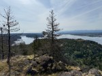
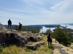
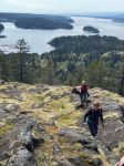
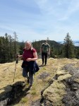
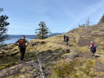
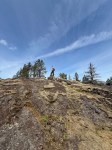
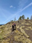
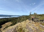
On a gorgeous sunny spring day, five hikers set out from the Copperhead Road parking area to hike around Blindman’s Bluff. There were only a few fallen trees on the trail, so it was in fair shape. There had been no other hikers on the trail since last fall, so it was easy to lose the path because of the new grass growth and trees across it. We had to rely on an old GPS track in a couple of places as we went around the Bluff counterclockwise. We stopped at a couple of open bluff areas to admire the mountains on Vancouver Island. Victoria Peak was especially prominent. As we came across the south side above Gowlland Harbour log sort we decided to go south down the rocky open area and explore a bit. This is a beautiful mossy area and we found many deer bones as well as a full skull where possibly a cougar had feasted. We then returned back to the main trail, continued on around Blindman Bluff Trail, and headed for Eagle Ridge.
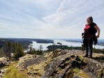
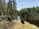
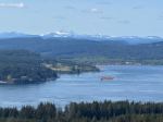
We stopped by the large beaver pond to have lunch, admire the lily pads that were starting to grow and vegetation around the lake. We then preceded up the ridge to the highpoint, looking over Seymour Narrows toward Menzies Bay. This is also a great viewpoint with a large swampy area below you, then the ocean and looking again to the mountains in Strathcona Park. There were two tugs moving a log boom from Menzies Bay around Race Point. You could see the current moving the center of the boom out as they tried to get it going straight again, and finally did. After a short rest we headed back to the vehicles to call it a day. (6.8 km and about four hours)
Les
Thanks to Carrie and Les for the photos.

-
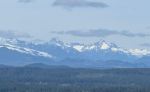
- Vancouver Island Mtns
-
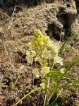
- Death Camas
-
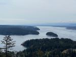
- View south down Discovery Passage

-
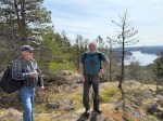
- Blindman’s Bluff
-
- Lunch break
-
- Eagle Ridge
-
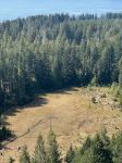
- Wetlands
-
- Victoria Peak beyond Menziese Bay
-
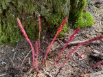
- Emerging coralroot
-
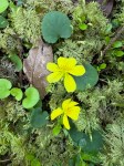
- Yellow violets
