
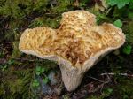
We began the hike in the early afternoon after a few morning showers. The trail roughly follows the Elk River through varied forest with some old growth trees, interesting fungi and lichen, many creeks and waterfalls. And there were also wasps for about a kilometer after Elkhorn. The sign at the trailhead said “turn back now”. Fortunately we did not encounter the wasps in either direction, but many parties did.
We arrived at the second campsite, which is 9 kilometers from the trailhead on the gravel bar just before Landslide Lake, in under 4 hours. We camped there with only two other small parties. Sunday morning dawned completely clear, so we were up early and off to Landslide Lake, about 2 kilometers further on. Mt. Colonel Foster and the Lake were both very lovely and the evidence of the 1946 earthquake and landslide very interesting.
Backpacking Landslide Lake – Elk River Trail 24-25 Aug 2013

-
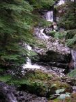
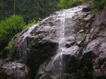
- Butterwort Creek
-
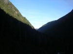
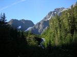
- Elk River valley
-
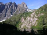
- Mt. Colonel Foster and landslide scar
-

- where the landslide came from
-
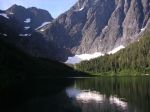
- Landslide Lake
-
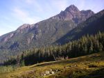
- Kings Peak and Elkhorn Mtn

-

- Fireweed
click to enlarge

I like your images that go with your report and now I have a better idea of when I can go and do it. Thanks for posting.