
As the end of summer’s good weather was approaching, we took an exploratory adventure to check out a possible new trip for the Club. Mt. Beadnell on Rodger’s Ridge is nearby and was said to have excellent views. True, it’s nearby, you can see it from Quadra, but the access is on logging roads which vary from wide, flat and dusty, to narrow, rocky, and steep. And with unmarked junctions. That was an adventure, but now we know the way.
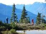
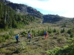
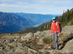
The trail itself varies from a well-worn foot path to no path and little flagging. It starts out steep and in forest, but it quickly emerges onto the ridge with fantastic views to the mountains beyond Buttle Lake and the mainland including Mt. Waddington. The trail is a steady climb (made slower by excellent blueberries and huckleberries) all the way to the flat, wide-open Mt. Beadnell summit. And the summit does indeed have amazing views all around. The Ridge provides the opportunity for relatively easy further exploration. This would be a good day-hike or backpack when the flowers are in bloom. 9.5km; 580m elevation gain; and 6 hours, without the drive.
Norris
Thanks to Norris and Diana for the photos
(click on photos to enlarge)
-
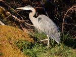
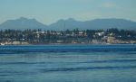
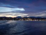
- Great Blue Heron at the ferry terminal
-
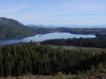
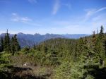
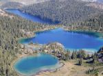
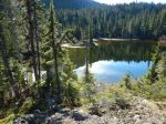
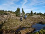
- Upper Quinsam Lake
-
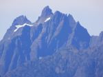
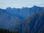
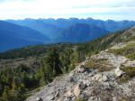
- Rambler Peak
-
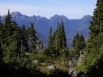
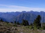
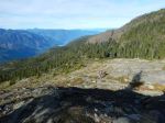
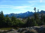
- Looking northwest
-
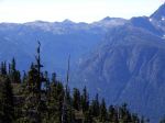
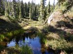
- Marble Meadows
-
- Looking west
-
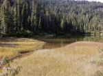
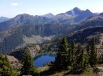
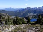
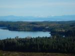
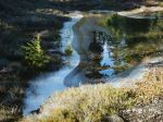
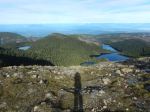
- Beadnell and smaller lakes
-
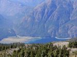
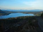
- Buttle Lake
-
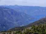
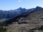
- Mt. Victoria, Crown Mtn & Campbell Lake
-
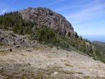
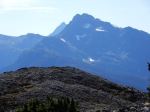
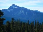
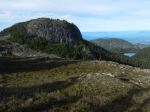
- Mt. Beadnell
-
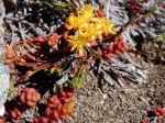
- Sedum
-
- Mt. Alexandra
-
- View toward Mt. Washington
-
- Mt. Alexandra & Mt. Adrian
-
- Mt. McBride with Golden Hinde beyond
-
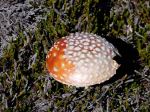
- Amanita
-
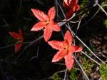
- Fall colour
Update for the reconnaissance report: We had hoped to have a scheduled trip to Mt. Beadnell, but that never happened. At the last minute, we went on an impulsive outing on November 1. The weather was very similar to the previous trip, but the drive up was altogether different. The upper logging road had been ditched in the last year so the last 9 km took us an hour to drive even in high clearance, 4-wheel-drive vehicles. That was more than absolutely necessary, since we got out and looked at most of the ditches on the way up. The drive down took 38 minutes.
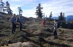
But Roger’s Ridge was every bit as special as before. The quick access from the logging road to the sub-alpine, the ponds and tarns along the way, the easy walking on a good trail and open rock, the spectacular views in all directions make this an amazing trip. With the slow drive and early sunset we didn’t have time for the Mt. Beadnell summit or other exploring, but the Ridge was fabulous. 8.5km; 530m elevation gain; and 5 hours, without the drive.
-
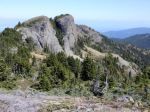
- Roger’s Ridge on the right-hand skyline
-
- Uppler Quinsam Lake
-
- Mt. McBride
-
- Mt. Albert Edward, Alexandra and Adrian
-
- Mt. Beadnell
-
- Beadnell & other lakes

-
- Upper Quinsam Lake
-
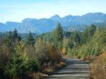
- Roger’s Ridge on the way home

Beautiful photos of a beautiful day hiking!