
Four of us parked at the official end of Leishmans Rd and continued along it as a forestry road. After only a very short distance, we turned off onto a flagged path. The first point of interest is a pair of huge rocks, or one gigantic rock split into two with a narrow walkway between them. Continuing along the flagged path cleared through salal, we ended up at a splendid viewpoint of Discovery Passage facing south. And it was a warm, sunny day. From here we went north, sometimes following deer trails and sometimes walking on the rocky shore (tide dependent). This whole section has good viewpoints and interesting cairns. Finally as the grassy meadows that we had been walking through started to turn into forest, we had lunch and then headed up hill. We climbed the grassy slopes and skirted the occasional rock band. Once on top of the ridge, we could follow it back down to the south, keeping to open understory. The east side of this ridge is quite a big cliff, bit it gradually diminishes and it’s easy to rejoin the original logging road. We stopped to admire the big Douglas fir. 3.1 km; 3 hours
(click on photos to enlarge)
-
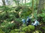
- Into the forest by the rocks
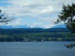
-
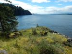
- South viewpoint
-

- Carin
-

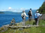
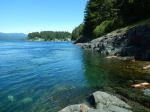
- Rocky shore walking
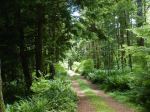
-
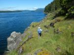
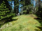
- Grassy meadow walking
-
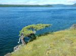
- Wind-sculpted fir
-
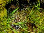
- Water on spider web
-

- Higher bluffs
-
- View toward Vancouver Island
-
- The logging road
-
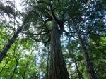
- Big Douglas fir
-
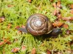
- Snail
-
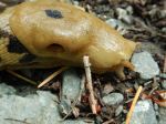
- Slug head (about 3 cm)
-
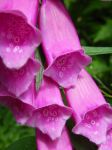
- Foxglove
