
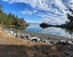
What originally was planned as a kayak trip to Jedediah Island morphed into a trip to Texada Island, mostly to hike. Four of us took three ferries the day after Labour Day to reach Shingle Beach on a beautiful afternoon. We settled in to the spacious campsites at the Forestry Recreation Site and enjoyed walking and relaxing on the beach. The beach walk south lead to an old homestead and a cabin in ruins. (3.2 km; 1¼ hours) We watched the sunset from the bluffs.
(click to enlarge photos)
-
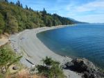
- Shingle Beach
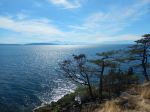

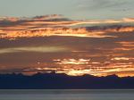
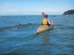
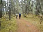
On Wednesday morning we kayaked south from Shingle Beach in steadily increasing southeast wind. We had no fixed destination and returned to the beach as the white caps pushed us home. (5.7 km; 1½ hours) In the afternoon, we drove to Shelter Point and walked the gentle Kay Garner nature walk. This trail loops first along a shore bluff on Mouat Bay and then through the forest. The ocean views and old growth were excellent. (3.8 km; 1 hour) After dinner we again enjoyed the sunset from bluffs at the campground.
-
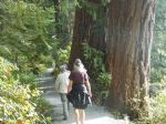
- Shelter Point Nature Trail
-
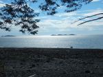
- Mouat Bay
-
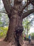
- Trinity Tree
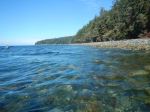
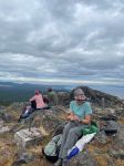
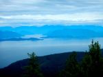
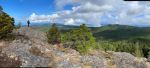
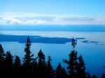
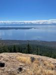
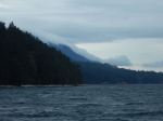
After some night rain, Thursday was mostly overcast. We hiked up to the Mt. Pocahontas summit at 462m, which was the site of Canada’s first fire lookout in 1924. This fairly short hike is rewarded with excellent views of Malaspina Inlet and mainland mountains to the east, and Lesqueti, Georgia Strait and Vancouver Island to the west. Part of the group continued on to other nearby viewpoints (7.9 km; 3¼ hours) while others went to Emily Lake to look for turtles, which are common on Texada. Everyone browsed through Van Anda and some stopped at beaches on Gillies and Davie Bays on the way back to the campsite. Just above the Shingle Beach campsite, we hiked the short, rambling Colossus Grove trail with an exceptional old growth cedar tree (0.9km).
-

- Mt. Pocahontas
-
- View toward Jervis Inlet
-
- Davie Bay
-
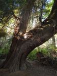
- Cedar tree on Colossus Trail
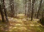
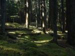
On Friday, we drove uphill on good-condition logging roads to Bob’s Lake, another Forestry Recreation site with camping. The lake was beautiful, quiet and very inviting as a camping destination. Nearby, we hiked up to Mt. Davies with the summit at 609m. This hike was even shorter than the Mt. Pocahontas hike and mostly through a beautiful, mossy forest with completely open understory. After enjoying the 360° views during lunch, we hiked on looking for the viewpoint from Mt. Blood. We underestimated the number of routes flagged with identical flagging tape in the area and some ended up elsewhere, but all had great views. Some of us swam in Bob’s Lake before returning to the campground for dinner. (5.5km; 3¼ hours)
-
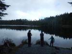
- Bob’s Lake
-
- Mt. Davies
-
- View of Lesqueti Island
-
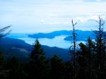
- View of Jedediah Island
-
- View of Georgia Strait
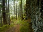
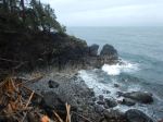
Three of us were able to linger for a hike on Saturday before returning home. It was quite windy and lightly raining. We headed to the north end of Texada and hiked in the Eagle Cove Trail system. We made a loop which included a gnome village, some hard walking on rocky, mossy terrain along circuitous trails, dramatic bluffs above wetlands and really impressive bluffs along the Malaspina Inlet shore.
-
- Changing weather at Shingle Beach
-
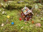
- Gnome home
-

- Edge Trail
-

- Arbutus
We enjoyed Texada much more than we expected with its amazing variety and beauty, and felt we could have spent much longer exploring trails, lakes, beaches and logging roads. We hope to go back.
Debbie
Thanks to Norris and Vikki for the photos
