This trip was rescheduled from August in hopes that Desolation Sound would be less busy in September. It probably is, but still busy enough in this exceptional pandemic summer, especially at the Curme Islets campsites. Compared with our usual paddling destinations, there were a large number of young people (well, young being anyone under 40…), many of them in rental kayaks, and some in more unusual craft. Notable sightings (of creatures human and otherwise) are described below.
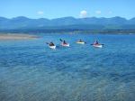
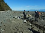
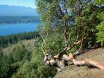
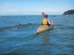
Day 1 – Tuesday: Four of us launched from Squirrel Cove on Cortes Island about 11 a.m. on Sunday, having lined up around 8 a.m. to catch the 9:05 ferry from Heriot Bay. The weather was calm and sunny for our crossing to the Martin Islands where we stopped for lunch. From the Martins, we headed to the north end of Mink Island and around the top to the Curmes. We had a little wind and chop on the crossing. We were somewhat taken aback to find two of the three campsite locations full by early afternoon. Fortunately, we were able to nab three of four remaining tent pads on East Curme. All the sites in Desolation Sound Marine Park have designated tent pads, an outhouse, picnic tables and/or benches, and (on the mainland sites, bear caches). Access in the Curmes is awkward in most spots on most tides. After setting up camp, some of us went swimming in the warm – slightly soupy – water, and all made an early night. One of the consequences of the younger demographic was a certain amount of partying, although with darkness by 8:30 and no campfires, things settled down about 9:30 or 10 (which is quite late on kayaking days!). The stars were absolutely dazzling. 13.7 km; 4 hours.
Notable sighting: A group consisting of two senior lady paddlers and two couples in doubles came looking for a tentpad about 5 p.m. and spent some time paddling about before the two singles took the last site on East Curme and the others disappeared to seek their fortune elsewhere. Like us, they hadn’t expected the crowds….
(click to enlarge photos)
-
-
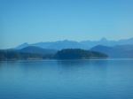
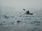
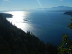
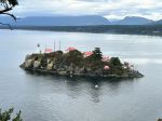
View from the ferry
-
-
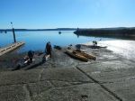
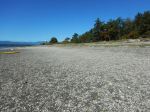
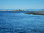
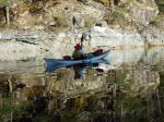
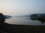
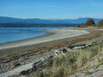
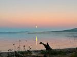
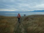
View from Squirrel Cove
-
-
-
-
-
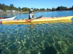
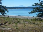
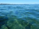
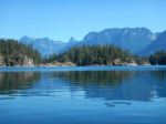
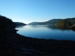
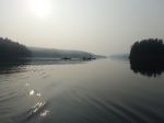
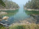
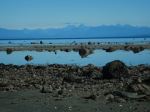
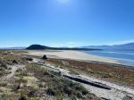
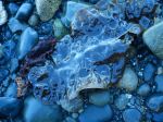
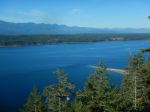
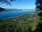
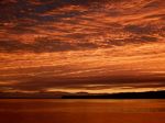
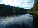
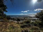
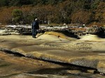
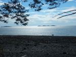
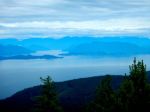
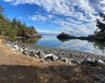
Desolation Sound
-
-
-
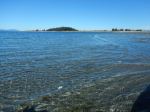
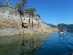
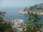
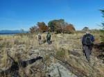
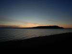
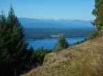
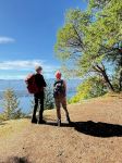
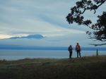
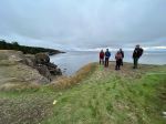
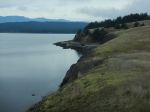
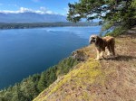
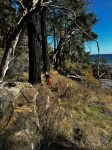
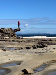
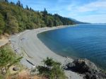
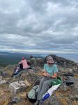
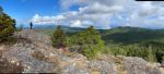
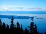
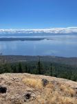
View from East Curme Bluff
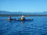
Day 2 – Wednesday: We headed out about 9:30 for a day trip to Prideaux Haven and beyond. Exceptionally calm, almost glassy conditions, and hot (although not the hottest yet). Very pleasant paddling through the islets, with a break at Laura Cove (where we were serenaded by a boat owner playing his violin). Then on to a rocky outcropping just beyond Price Point for lunch, and back home (taking the route outside Eveleigh Island and back though the gap between Otter Island and the mainland). More swimming, dinner, and planning for the next few days. By this point we had decided to order a water taxi to return us from the north tip of Malaspina Peninsula to Squirrel Cove, as three of us needed to be back fairly early, and it looked like a longish slog through open water. This later proved to be an inspired decision. 20.0 km; 6 hours.
Notable sighting: Half an hour before dark, a young couple paddled up in an inflatable double (about as wide as it was long), accompanied by their cat. Fortunately, some parties had moved off West Curme, and they were able to find a tent pad.
-
-
-
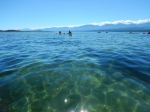
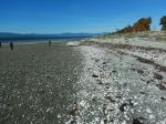
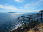
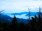
View from Prideaux Haven
-

-
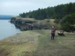
Channels among the islets
-
-
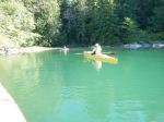
Laura Cove
-
-
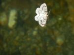
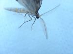
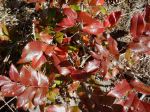
Phantom Hemlock Looper
-

-
Sea Gull
-

-
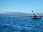
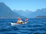
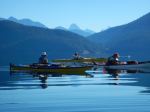
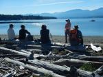
Lunch in Homfray Channel
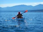
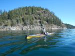
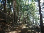
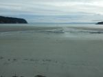
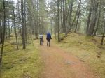
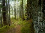
Day 3 – Thursday: Off about 9:00 a.m. to Hare Point on the northeast shore of Malaspina Inlet, about 2 kilometres from Zephine Head. Another hot still day. Quite a bit of room at the campsite, with a fairly decent beach, although the canoe/kayak run is only wide enough for one boat at low tide. The tent pads are located on either side of the cove, with outhouse/bear cache/picnic table for each group. The westerly, more scenic area is up a fairly steep trail – we defaulted to the lower group of tent pads – still a bit of a scramble up the rocks. The afternoon was very hot – we spent much of it looking for shade. Two of us practised self-rescue (and have the bruises to show for it). This activity generated quite a bit of amusement for other kayakers: “Oh gosh, there she goes, right over the other side.” Much quieter location than the Curmes. Early night. 9.6 km; 2 hours.
Notable sighting: Ultra light aircraft on pontoons flew over us en route to Hare Point. Took a while to figure out what it was.
-
-
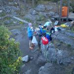
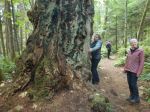
Breakfast on E Curme Island
-
-
-
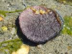
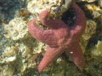
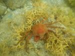
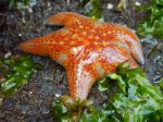
Sea star
-
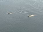
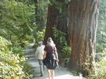
Day 4 – Friday: Off about 9:30 toward Grace Harbour for a day trip. Not such a warm day, with the smoke beginning to move in. Grace Harbour is a popular anchorage, although not very busy when we were there. Only 2 or 3 tent pads; probably not too much privacy in summer with boaters marching through toward Black Lake. There is a creek at the head of the bay, east of the campsite. We walked up to the lake through a pleasant cedar forest, with the remnants of logging operations in a few places. About 15 minutes walk each way. There is a small cleared area for swimming access but slippery on the rocks. After lunch, we paddled back to the campsite and passed on the way a colony of Steller (and possibly also California) sea lions. We had seen Stellers fishing in the cove, and occasionally popping up rather close to our kayaks. Back about 4 p.m. More rescue practice – more bruises…. 16.0 km; 5¼ hours.
Notable sighting: A young couple on standup paddleboards with gear strapped fore and aft arrived at the campsite about 5:30. The operation looked slow and a bit hazardous, but they apparently like it.
-
-
Phantom Hemlock Looper
-
-
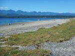
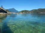
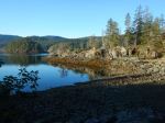
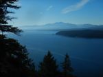
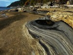
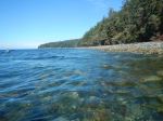
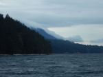
Malaspina Inlet
-
-
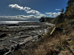
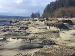
The bay at Hare Point
-
-
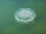
Moon jellyfish
-
-
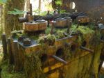
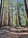
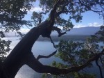
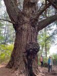
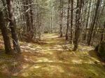
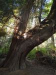
Logging relic
-
-
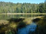
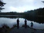
Black Lake
-
-
Grace Harbour
-
-
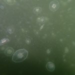
Abundance of moon jellyfish
-
-
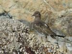
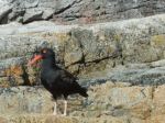
Oyster Catcher
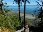
Day 5 – Saturday: Away at 9 a.m. In order to have time to visit the Copeland Islands and still be picked up Sunday morning by the water taxi, we upped stakes at Hare Point, and nabbed tent platforms at Feather Cove (about 45 minutes paddle). Feather Cove has a decent landing beach, although exposed to waves and wash. Another 2-part campsite, with tent pads on the hill, and back among the trees down by the beach. This site is on the Sunshine Coast trail, so is used by both hikers and paddlers. In very thick smoke, we paddled to Sarah Point, down the peninsula toward Bliss Landing, and across to the most northerly of the Copeland Islands. For the first time on the trip, we had some significant wind (in our face, of course). There are at least two and possibly three campsites in the Islands. We entered North Copeland Island through a small gap into a shallow bay with easy landing. At this large site, there are three sets of tent pads; the most westerly grouping is very scenic but with what looks like trickier access. Quite a few empty pads. After lunch, we paddled by the next island with tent pads, and around a larger island with several small notches and coves for anchorage. After darting across Thulin Passage between cruising and fishing boats, we headed north again, with a stop at a lovely sandy beach just north of Bliss Landing. An old homestead with some remnants of buildings, the site has a very productive collection of old fruit trees. Some of the apple trees were about 40 feet high. Unfortunately, it was very obvious that this is a place beloved by bears, whose reach is about the same as ours. Back to camp about 5:30, having enjoyed the following wind and a bit of a favourable current. 22.9 km ; 7¼ hours.
Notable sighting: A young couple in rented kayaks showed up about 6 p.m. with an astonishing amount of gear tied to the decks of their boats, including a five gallon water container (full). As they were leaving to find a campsite at Hare Point, one of us was unable to resist suggesting to them that the location of the water container was not the best of ideas…. Not sure how this advice was received, but one has to try. Notable non-sighting: About 2 o’clock in the morning, distant shouting and banging were followed by splashing and loud snorting. The bear (as we assume it was…) did not arrive in our locale. Judging by the trail of water leading from the beach up the hill behind our tents, we concluded that the bear had been chased off the hillside tent area, ran down to the water, splashed across, and took off heading south.
-
-
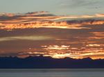
Smoke at Malaspina Inlet
-
-
-
Spider crab
-
-
Leather sea star
-
-
-
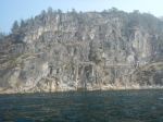
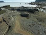
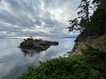
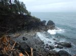
Cliffs in Thulin Passage
-
-
Views from North Copeland Island
-
-
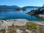
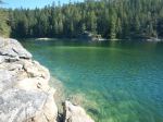
Bay at North Copeland Island
-
-

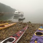
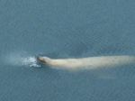
Day 6 – Sunday: Up early to be ready for the water taxi to arrive at 9. Very, very smoky. We were relieved not to have to make a 3+ hour trip in near zero visibility. Duncan Pollen from Lund delivered us safely to Squirrel Cove, and helped carry the kayaks up a very steep ramp. We reached Whaletown shortly after 11, and one of us was lucky enough to be shoehorned aboard the 11:50 ferry. The others left on the 1:50 sailing. Everyone home by mid-afternoon. Notable sighting: While we were waiting on the beach, a Steller sea lion showed us how to catch fish. Grab the salmon, shake it violently, and gulp it down head first. Worked for him (or her).
-
-
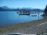
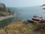
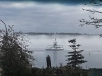
Water taxi at Feather Cove
As mentioned above, this trip was quite different from our more usual paddles to less accessible and popular locations. It was mostly more relaxed, with shorter distances. The scenery is lovely, of course, the water is warm and having some basic services at the campsites is convenient. Almost certainly, COVID is responsible for the large number of paddlers, some of whom appeared to be out for the first time. Fortunately, the weather was very calm, and presumably there were no problems with overloaded boats or less-than-seaworthy conveyances encountering challenging conditions. We did hear from the skipper of the water taxi that there had been more than the usual number of kayakers in trouble this summer. We enjoyed our time together as always.
Darcy
A couple of useful links for trip planning:
http://bcparks.ca/explore/parkpgs/desolation/camping.html
https://www.bcmarinetrails.org
Thanks to Norris and Val for the photos!
Multi-day kayaking – Desolation Sound – 8-13 Sept 2020


 .
.