When the kayak trip to Bligh Island unraveled, the remnants of that trip booked into the Ralph River campground at the last minute. This was not a carefully scripted trip; we mostly made it up as we went along.
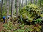
Day 1 – After a late start and a ferry overload wait, we arrived at 3:00 at the campground, set up the tent amongst the amazing old growth trees in the Ralph River campground, and left to begin hiking at 4:00. Given the time available, we explored some of the trailheads in that area: the Auger Point Traverse (steep), Shepherd Creek route (impressive canyon), Flower Ridge, and Price Creek (river views, then follows an old level road for a while).
(click to enlarge photos)
-

-
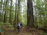
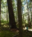
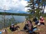
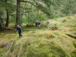
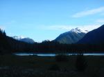
Ralph River campsite
-

-
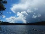
Rain in the valley
-

-
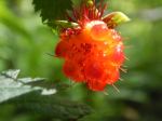
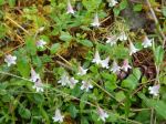
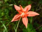
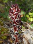
Candy Stick (Allotropa)
-
-
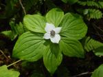
Bunchberry
-
-
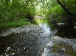
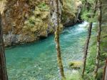
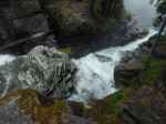
Shepherd Creek Canyon
-
-
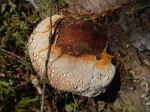
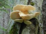
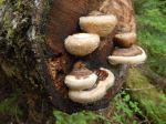
Oyster mushroom
-
-
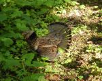
Rugffled Grouse
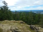
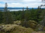
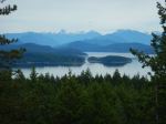
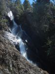
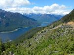
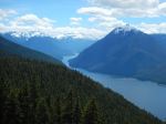
Day 2 – We hiked up the Buttle Bluffs and Park Main logging roads from the Western Mine road. These are steep, gated roads surrounded by clear-cuts, but they provide excellent views and a rapid approach to higher elevation destinations. The spring flowers were still quite good, the geology was fascinating, and there is an excellent water falls at 5 km. The views of the Buttle Lake valley are really exceptional. We continued about 7.5 km and 840 meters elevation gain, until we crossed a high point in the road and could see into the next valley surrounded by high mountains.
-
-
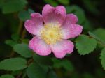
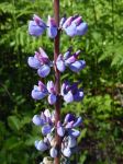
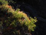
Lupin
-
-
Indian Paint Brush
-
-
5 Km Falls
-
-
-
Buttle Lake looking south
-
-
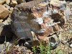
Quartz intrusions
-
-
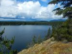
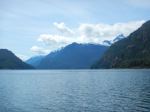
Buttle Lake looking north
-
-
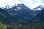
Alexandra Peak
-
-
Buttle Lake & Mt. Phillips
-
-
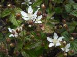
Trailing blackberry
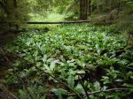
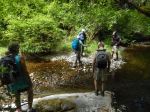
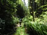
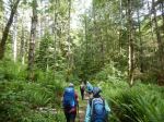
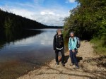
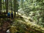
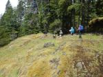
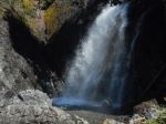
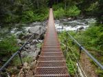
Day 3 – We planned to kayak on Jim Mitchell Lake, but that didn’t work out because the condition of the Jim Mitchell Road changes from 2-wheel drive to 4-wheel drive at the Bedwell trailhead. We didn’t have the right vehicles, so we walked up the road to see the Lake. We returned part way down the road and then followed the Bedwell Trail out through a beautiful old forest to Thelwood Creek and the suspension bridge for lunch. After lunch we drove just a bit further and walked the short approach to Lower Myra Falls. This is always a beautiful falls, with great rock ledges and pools. There was lots of water coming through the falls with the spring run-off. The final short hike of the day was the Shepherd Creek loop, which leaves from the Ralph River bridge. This short trail has a lot of variety with the river, some big trees, a mossy bluff, a wetland, and interesting saprophytes and fungus. We still had time to explore the campground which is nestled in a beautiful forest between the Ralph River and Buttle Lake with lots of shoreline and views. There were other folks from Quadra so the evenings were very social.
-
-
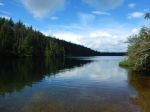
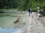
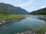
South end of Buttle Lake
-
-
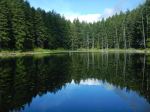
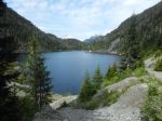
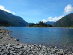
Jim Mitchell Lake
-
-
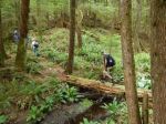
Bridge over Thelwood Creek
-

-
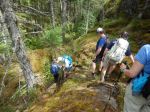
On the Bedwell Trail
-
-
Bracket fungus
-
-
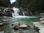
Lower Myra Falls
-
-
Lower Myra Falls
-
-
-
Candy Stick (Allotropa)
-

-
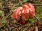
Monotropa saprophyte
-
-
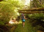
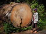
Fallen old-growth danger tree
-
-
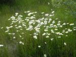
Daisies on the shore
-
-
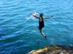
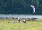
Neville’s kite
-
-
Mt. Myra at evening
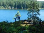
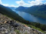
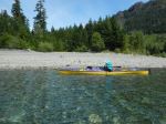
Day 4 – We packed up the camping gear and drove to the Buttle Lake boat launch to kayak on the Lake. We crossed to Rainbow Island in a freshening breeze. At the moment it’s not an island because the water level in Buttle Lake is quite low. We paddled to the south, sheltered side, explored a bit and had lunch. There was a racing shell boat practicing in the lake. After lunch we poked around some cliffs and an island to the south before returning to the boat launch. Further exploration would be great, but more water and less wind would have been ideal.
-
-
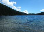
Buttle Lake
-

-
-
Looking south in Buttle Lake
-
This is an exceptionally beautiful area with access to amazing hiking at the Lake level or in the surrounding mountains. The combination of the fjord-like lakes, the mature forests and the numerous mountains makes this a wonderful base for hiking and boating.
Debbie