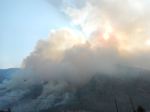
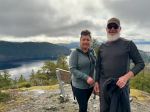
In order to encourage more participants and because of the dates of the club’s kayak trip, this trip’s goal was changed, to focus on the Malaspina Peninsula, and was delayed by one week. Being well into September there was some concern about the good weather holding. Although we did leave with this year’s southern fire smoke in the air, the timing regarding weather was perfect, as the first daytime rain followed immediately after reaching the end of our trek. It turned out to also be auspicious timing regarding dates, as we only encountered 4 other back packers, and only shared a campsite on the first night.
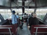
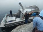
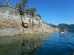
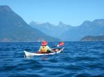
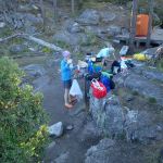
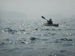
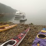
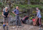
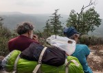
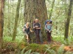
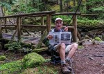
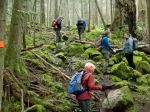
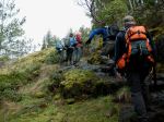
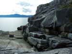
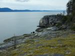
Day 1 – Tuesday: Leaving the ferry behind at 10:15, we left one vehicle at a friend’s house near Mowat Bay, near the end of our walk, and drove on to Lund with our other vehicle, catching the Lund water taxi at 2 pm, destination: Sarah Point. The taxi dropped us off in hazy conditions on a dry rock shelf, from which, after the “before” photos, we donned our lightweight backpacks and started the walk through arbutus and manzanita groves to Feather Cove, our first campsite. We shared this site, looking east towards Malaspina Inlet, with a young kayaking couple, and were visited frequently by a curious sea lion as we set up camp. At this point, one is in Malaspina Provincial Park, and the campsite is outfitted with an outhouse, food cache and picnic table. This was truly roughing it. This is where one of our group revealed their secret weapon, a backpacking chair, and quest for seating began!
(click to enlarge photos)
Day 2 – Wednesday: Wanting to gradually add to each day’s mileage considering the placement of campsites along the route, we rose around 7 am, stretched as all conscientious aged packers do, and were on the trail by 9. Our goal was a 9.2 km hike to Wednesday Lake. At Hinder Lake outflow we were able to fill up with water.
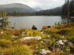
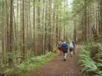
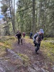
The route took us through a green mossy forested landscape, with the first two thirds including some pleasant forested walking trail. This disappeared the last kilometer and a half before Wednesday Lake, as we had 2 successive uphill grunts up root filled inclines, until finally gaining site of Wednesday Lake. The old, non-parks standard outhouse was in stark contrast to our cushy appointment at Feather Cove, and the first camp clearing was rudimentary and a poor prospect for clean drinking water. Luckily, a short distance around the lake shore brought us to the real campsite, with adequate flat space for our 3 tents on a rock bluff, and good access to water and a swim! We walked about 6 hours that day, and being our first day of real backpacking, we were very ready to lose our loads here. We were humbled later in the early evening when a young speed backpacker dropped in, after leaving Sarah Point only 3½ hours earlier that day. Her plan was to hike the entire Sunshine Coast Trail, some 150 km, in 4½ days. We gave her all the experienced hiking tips we could offer in about 10 seconds, and bid her good evening.
Entertainment that evening was shared between stealing a backpacking chair, and watching three seasoned backpackers comically hone their technique of launching a rock-weighted line over a tree limb, to provide a food cache; entitled: Quest for Rocks. Nominations for the Darwin Awards have been submitted!
-

-
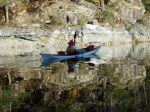
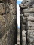
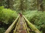
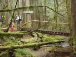
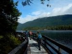
Departing Feather Cove
-

-
-
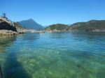
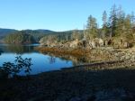
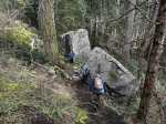
Feather Cove
-
-

-

-
-
-
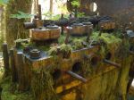
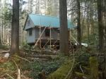
Bliss Portage Hut under construction
-
-
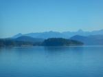
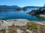
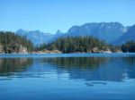
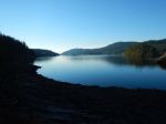
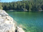
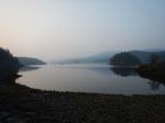
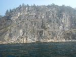
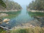
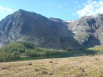
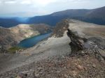
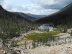
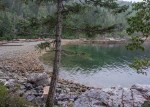
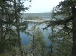
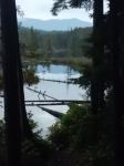
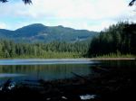
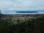
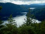
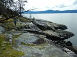
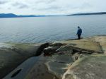
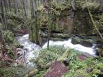
View of Malaspina Inlet
-
-
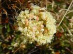
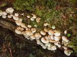
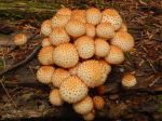
Oyster mushroom
-
-
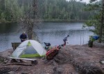
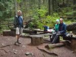
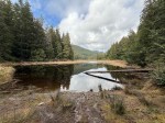
Camp at Wednesday Lake
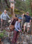
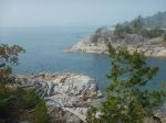
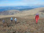
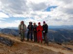
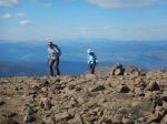
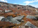
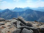
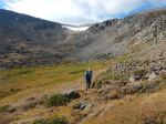
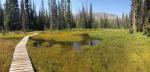
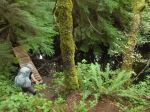
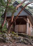
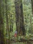
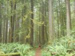
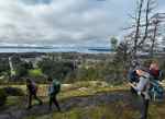
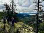
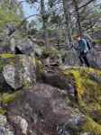
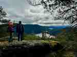
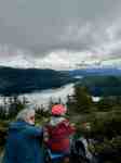
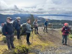
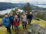
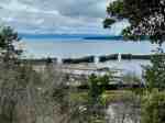
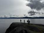
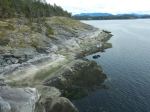
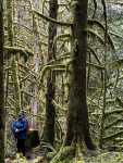
Day 3 – Thursday: Again we were back on our route by 9 am. We had to climb out of Wednesday Lake but the trail had some pleasant forested walking before our accent to the Gwendoline Hills. The walk along this ridge was fairly flat, but again we climbed as we neared McPherson Hill, after leaving Malaspina Park behind. After a walk through lovely old growth, we reached Manzanita Bluff, where a beautiful mountain hut awaited, and an expansive view of the Salish Sea would have been our reward, if it hadn’t been obscured by alternating smoke and fog. Unfortunately, we could barely see the darker mass of Hernando Island in the distance. Nevertheless, it was a beautiful lunch spot with picnic tales. We now descended through commercial forest lands, containing some lovely old trees, where the forest companies have allowed a right of way for the trail. Later, we came to Emil’s Bench, dedicated to Emil Kormpocker, a veteran logging contractor who had the foresight to save a stand of old growth trees in this area. Unfortunately, the younger forest around us obscured views of the saved old growth. Here you also have a view of Okeover Inlet below. Eventually, through some older forest, we crossed over Malaspina Road, and continued on to our next campsite, Fern Gully Creek. Here we had one of our darkest campsites, thanks to some old growth giants, There was adequate space for tents here and a rustic table. Although we had water, the pools may be drier at the end of a hotter summer. And we could find no outhouse.
-
-
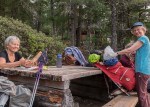
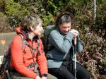
Lunch at Manzanita Hut
-
-
-
-
Manzanita Hut
-

-
-
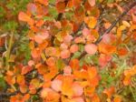
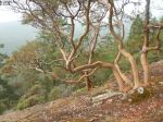
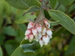
Arbutus
-
-
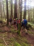
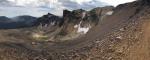
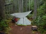
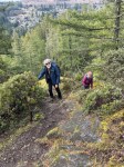
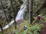
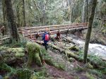
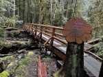
Day 4 – Friday: We were back on the trial this day around 9 am knowing that we would add the first real increase to our daily distance, covering 13 km. The first part of this day had us climbing up the Thunder Ridge Trail.. After the Plummer Creek Road we were treated to an old forested rail grade, which lead us to a rest spot at Plummer Creek Bridge. Below, a 5 minute walk leads to the Plummer Creek campsite, near the bottom of Toquenatch Creek. After our break, about an hour later, we arrived at Toquenatch Falls, where water still cascaded over rocks, although nowhere the force that would exist after a rainy fall. The trail continued up the creek valley, sometimes using old rail grade, and eventually comes to a newer logging area where we had another reminder that we were out of the park, as we could hear a logging truck close by, lumbering up a grade. Eventually, the trail took us to a road system, and the Homestead Forest Recreation site. This was accessible by vehicle, and after a quick lunch held no real interest for us. Here, we met, Nick, a young fellow from Victoria, who had passed us the previous evening at Fern Gully, but was now lying on the ground, in some obvious discomfort, nursing a nerve injury from long bouts of car driving. We could only offer ibuprofen and encouragement, but Nick seemed to be familiar with the condition and was weighing his options. The afternoon then brought us up a climb to Rievely Pond with its lovely hut in an open spot above the pond. Water was not the best here, but we enjoyed a rest and continued to our intended goal, the Appleton Creek Bridge Campsite, a lovely open site amongst several old growth giants, next to a very good running water source. Above the campsite is a trail leading up to a bathing pool in the creek. We had benches at camp for cooking and sitting, and an outhouse, although its location was hidden to us until the next morning.
Because of the weather forecast, we set up two tarps to be prepared for the next morning. Two trail walker/runners passed by, who were doing the peninsula trail in one day, They were only carrying fanny packs and intended to continue through to Powell River with just 2 hours left. We did celebrate our last camp on this Friday evening by sharing some extra food and having a small campfire.
-
-
Fern Gully old growth
-
-
-
-
Puff balls
-
-
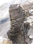
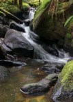
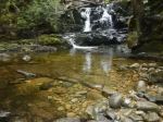
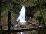
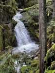
Toquenatch Falls
-
-
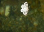
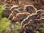
Turkey tail fungus
-
-

-
Trinkets on Trinket Trail
-
-
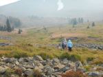
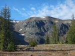
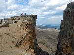
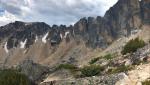
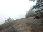
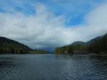
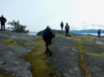
View? from Gibraltar Bluff
-
-
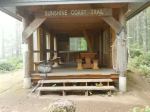
Rievely Hut
-
-
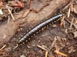
Yellow-spotted Millipede
-

-
Tiny, tiny red mushroom
-
-
Swimming hole at Appleton Creek
-

-
Amanita
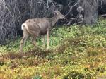
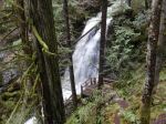
Day 5 – Saturday: This morning, the darkness of the forest and the night’s rain had us up a little later, but we were on the trail a little after 9. We had another 15 km to reach the end of our route. The descent down Appleton Creek was a mossy forest trail with several stops for small cascades and the larger Gorge Falls. Further along we entered lands given by the Sliammon people to allow the trail to continue to Sliammon Lake and Little Sliammon Lake, with its picnic pavilion, boat wharf and road access. The trail around the lakes is an up and down workout around bluffs and roots, but only for a portion of the days hike. From Little Sliammon we mostly followed old forest roads down to Sunset Park, and increasingly saw bear scat, and many friendly day hikers as we approached the suburb of Wildwood. At Sunset Park, we dropped our packs and congratulated ourselves. Two of us continued along streets to the bridge at Powell Lake outlet, and then again picked up the Sunshine Coast Trail to Mowat Bay, just down the road from where we had left our parked car. The timing was perfect, as we encountered our first daytime rain just before we reached Mowat Bay.
-
-
-
Breakfast at Appleton Creek
-
-

-
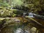
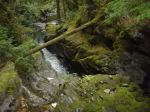
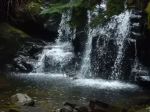
Falls on Appleton Creek
-
-
-
-
-
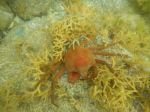
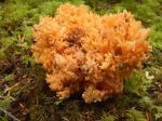
Coral mushroom
-
-
-
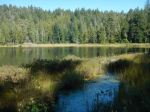
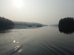
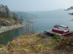
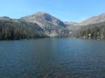
Theyeth Lake
-

-

-
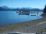
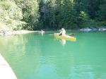
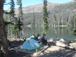
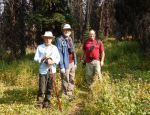
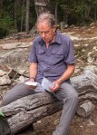
Lunch at Little Sliammon Lake
-
-
Old roads near Powell River
This trail is obviously not a walk in the park, carrying loaded packs for 5 days. But, after our plan to gradually build up each days distance, we not only found it manageable, but enjoyable and well worth the effort. It offered a great deal of variety within the coastal forest setting, including views, water courses, a variety of forests, and some excellent camping. This part of September proved to be a good choice, as there was little traffic on the trail, and offered many opportunities for solitude. The group turned to have excellent dynamics and the common love of the outdoors, plus an ample dose of good humour, allowed us to get beyond familiarity. A very positive journey!
Brent
Thanks to Brent, Norris, and Diana for the photos
Multi-day hiking – Sunshine Coast Trail – 15-20 Sept 2020


 .
.