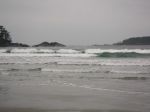
After arriving at the vacation rental in Ucluelet around noon, we had lots of time on Monday to walk to Florencia and Half Moon Bay at the south end of Pacific Rim National Park. The hike took us through beautiful old forest, along boardwalk, and down stairs to the long sandy beach at Florencia and then up and down again to the more intimate beach at Half Moon Bay. (9.7 km)
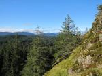
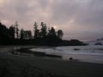
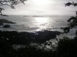
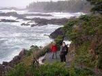
On Tuesday, we hiked the Lighthouse loop on the Wild Pacific Trail in Ucluelet in the morning (3.0 km) and after lunch we hiked from Big Beach to the Cedar Grove and back. (8.5 km) This is a beautiful, rocky coast, which contrasts well with beaches in the Tofino area. The lighthouse, islets, surge channels and wonderful trees are incredibly scenic.
On the last day, we spent about an hour exploring Tofino and then walked the length of Chesterman’s Beach before heading home. In all three days we never had more than a brief bit of drizzle, and sometimes we had sunny breaks.
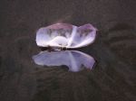
We also had fun in the evening at the house we rented on the Ucluelet Inlet. We had a wonderful seafood feast on Monday with mulled wine, Oysters Rockefeller, BBQed salmon, roast vegetables, salad and chocolate cake. On Tuesday, we had lasagna with homemade noodles, with all the trimmings. The house had an exceptional woodstove and book collection. The nearly full moon lighted the inlet each night.
-

-
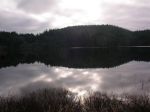
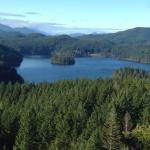
Florencia Bay
-

-

-

-
Florencia Bay
-
-
-

-
-
-
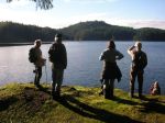
Half Moon Bay
-
-

-
Lighthouse Loop
-

-
-

-
-

-
Wild Pacific Trail
-

-
-
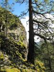
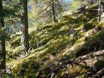
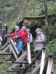
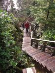
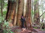
in the ancient cedar grove
-

-
in the ancient cedar grove
-

-

-

-
-
Chesterman’s Beach
(click on photos to view larger)
Hiking Ucluelet – 2-4 February 2015