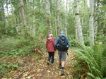
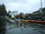
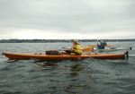
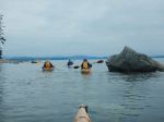
With just a few days remaining of summer ’22, seven kayaks set out from Quathiaski Cove to complete a “Round the Cape” adventure. With the help of non-paddling spouses, we managed the shuttling of vehicles between Q-Cove and the Shore Access at the end of Smiths Road that made it possible to do this trip.
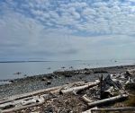
By 8:50 we were on the water just as the ferry was docking – one less thing to worry about. Weather, tides and currents were all in our favour as we rounded Whiskey Point and headed south to Cape Mudge. We passed by the Village and the campground and then rounded the Cape. The often turbulent waters were very calm, due to our timing, and we headed into the boulder strewn shallows of the south shoreline. By this time we were looking for a reasonable place to pull out for a “rest” and stretch. A cobbly beach was the best we could do.
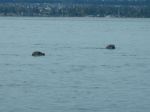
We were treated to a good showing of sea birds throughout the trip and numerous seals and sea lions and/or dolphins quite a ways offshore. No doubt they were after salmon which were seen jumping near our kayaks.
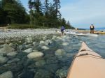
The rest stop ended up being a little longer and some snacked enough that we put off our lunch stop until the takeout. Back on the water and the sun appeared, warming things up even more as we cruised northward from Francisco Pt to our destination at Smiths Road. Once ashore, lunch and beverages were enjoyed on the beach.
List of bird sightings – at least two dozen Common Loons (very vocal), many Harlequin ducks, Common Mergansers, Bonaparte’s, Glaucous-winged, and Mew Gulls, Cormorants, Great Blue Heron, geese, Bald Eagles, Vultures, Horned Grebes,
About 3.5 hours of paddling; Distance – 15.3 km
Vic Gladish
Thanks to Jan and Norris for the photos
(click on photos to enlarge)
-
-
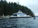
Launching at QCove
-
-
The Powell River Queen
-
-
-
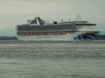
Other boats in Discovery Passage
-
-
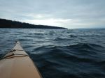
Along the west shore
-
-
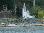
Church at the Village
-
-

-
Cape Mudge lighthouse
-
-
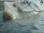
Petroglyphs in the tide
-
-
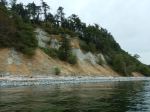
Cape Mudge bluffs
-

-
The long snack break
-
-
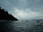
Curious Harbour Seals
-
-

-
Along the east shore
-
-
-
Arriving at Smiths Rd
Kayaking – QCove to Smiths Rd – 15 Sept 2022