Below is a link to an interview by Cortes Currents about the Quadra Island Outdoor Club. Click “continue reading” to see the full transcript.
Peeking into the world of the Quadra Island Outdoor Club

Below is a link to an interview by Cortes Currents about the Quadra Island Outdoor Club. Click “continue reading” to see the full transcript.
Peeking into the world of the Quadra Island Outdoor Club
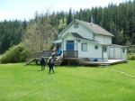
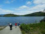
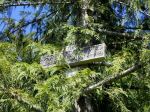
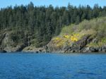
After we returned to the cars, doing a bit more trail work along the way, we drove to the old Bold Point trestle, where the Union Steamship used to dock. The planking is seriously deteriorating, but it’s a beautiful vista onto Hoskyn Channel.
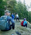
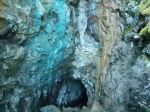
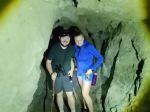
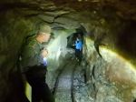
Thanks for all the community support for our hike out to the mine. The mine trail was 3.3 km; 2¼ hours.
(click on photos to enlarge)


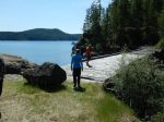

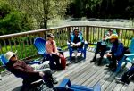
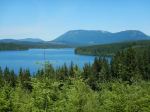
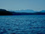
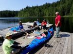
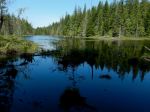
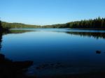
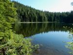
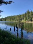
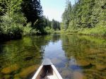
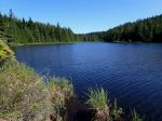
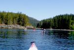
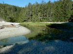
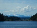
Tuesday: There were seven of us on this camping, kayaking and hiking trip, with flexible arrival and departure times. Les went out early and stayed Monday night at Morton Lake Provincial Park. The rest of us arrived on Tuesday morning and set up our campsites right away. After a picnic lunch at the Mohun Lake boat launch in the sun, we launched and paddled south into Mohun Lake with a light northwest breeze following us and fabulous views of Strathcona Park ahead. We checked out two campsites on the way and then got out at the Pacific Yew Rec Site to stretch our legs before heading back. The Lake and campgrounds were very quiet and we only saw two canoes all day. The water levels were high everywhere, sometimes making it tricky to get ashore. After returning to the Provincial Park, most of us took a short walk along Morton Lake to a rocky outcropping along the shore where people had made many, many cairns. We enjoyed a great happy hour at Les’ campsite with much too much yummy food, before a restful evening at our campsites.
(click to enlarge photos)
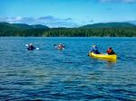

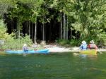
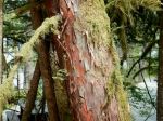
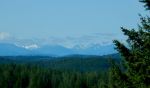
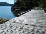
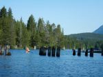
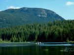
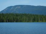
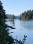
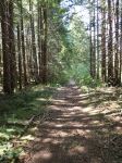
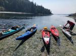
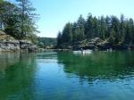
Wednesday: We were on the water shortly after 9:30 on a clear day with a light northwest breeze. We headed north through the old trestles into Goose Lake, with the Menzies Massif high above the Lake. We made leisurely progress checking out the campsites on the shore and getting out at G6 and G7 for closer inspection. We continued north to Seagull Bay and hauled out there. After lunch on the dock, most of us walked the portage trail connecting to Twin Lakes. The forest walk was lovely with dappled light in a good forest and the trail often following a creek. There was a guided group of students at the north end with four canoes, just about to launch. We returned to the boats and headed south, enjoying the many islands and islets, before turning into the lagoon to explore. We paddled the very shallow waters over to the campsite at Loon Bay, which had a great location and set-up. We headed back to the campsite and again had great appies at Stephen and Carrie’s campsite before another quiet evening.


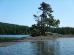
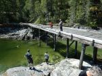
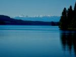
Thursday: Terry had to head home and Les departed at check-out time. The remaining five of us first walked the loop trail north of the campground leading to Andrew Lake and then back. Next, we walked the old railroad line out to the trestles at the narrows between Mohun and Goose Lakes. There were flowers and lake views along the way. We went a bit further through the forest to open shore by an islet, with a spectacular view of Mohun and the mountains beyond it. After returning to the campground, Bonnie, Norris and Debbie departed, with Stephen and Carrie remaining another night. They explored Morton Lake by kayak and poked into Mohun Creek.
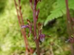

Friday: Stephen and Carrie took a trail south of Morton Lake to a lovely lake perhaps named Oglarama, if you can believe the sign on the tree.
This is a beautiful area book-ended by Menzies on the north and Strathcona Park on the south. This was the perfect time to visit with excellent weather and very few people on the Lakes and in the campsites.
Debbie
Thanks to Carrie, Bonnie and Norris for the photos
Multi-day kayaking and camping – Morton Lake Provincial Park – 23-25 May 2023
| Activity | Hiking |
| Destination | Heron Pt and Mt. Sweat loop |
| Date | 14 June, Wednesday |
| Trip Coordinator | Debbie Quigg |
| Contact Info | dmquigg@gmail.com or 3710 Please contact the coordinator by Monday night. |
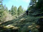
| Description | This is a short hike starting on Kolker Main. We will briefly follow a logging road, a short connector and a mossy bluff to Heron Point for great views of Hyacinthe Bay and the Chinese Mtn area. From there we will take a cairned route through forest trails and rocky bluffs to Mt. Sweat. We descend to Kolker Main through open, forested slope and return to the vehicles on the logging road. This is a view hike and will not be done in poor weather. About 4 km; 2½ hours. |
| Meeting Place | Heriot Bay store parking lot. We will drive out in a group. |
| Departure Time | 10:00 or earlier if it’s hot |
| Difficulty |
Mostly easy, but some interesting places on Mt. Sweat. |
| Costs | None |
| Trip limits | 10 |
| Dogs? | No, some of this will be on private property. |
| Notes: | Some of this trip is on private property and we thank Heather Kellerhals for allowing our visit to Chauntaluf Farm. Bring gear appropriate for the weather and trail conditions, as well as lunch. |
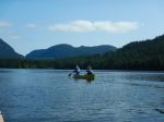
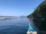
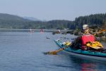
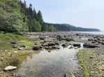
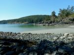
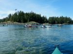
Five paddlers put in at Whalebone Cove and set off by 0900 on glassy seas, with bright sunshine, and warming temperatures. A beautiful summer day in the spring! And finally, after many attempts to undertake this trip, we were doing it.
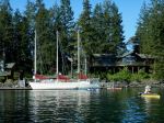
Working with and against the ebbing current we made our way northward, close to shore and observing the life below. An hour’s paddling brought us to the fish farm near Maud Island and then we decided that our early lunch stop would be at the entrance to the saltwater lagoon which was at this point not navigable.
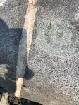
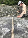
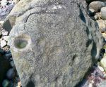
We then headed for “Kawston”, the ancient village site and its petroglyphs at the mouth of Morte Creek just east of Maud Island. Locating the flat-topped large rock with the quartz line was easy and on it was a fairly obvious petroglyph as indicated in Inglis’s little guide book. Over the next 45 minutes or so we searched for further examples and came up empty handed. However the many canoe pull outs were quite evident as we walked across the top of the beach.
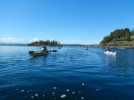
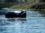
As we paddled back, southward, with an increasingly strong flood current, we stayed close to shore and were passed by a solitary cetacean (porpoise?), spotted an otter, and a sea lion. We rode the fast current for several minutes, got pushed around by boils and whirlpools, and then cruised back into Whalebone Cove. 6½ hours and 17 km covered.
A fabulous outing!!
Vic
Thanks to Vic and Tak for the photos
(click on photos to enlarge)
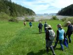
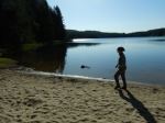
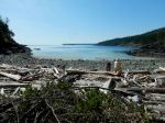
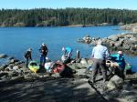
Five hardy club members started early Monday morning, May 15, braving the unseasonal extreme heat to show our community pride by participating in Quadra’s Beach Clean-Up. We began at Big Beach in Open Bay where Les and Neil hauled two heavy piles of already collected debris from the beach-side trailhead back up the steep trail to our large collection bag. This pile turned out to be the most garbage we would see for the entire clean-up. The three beaches (Big, Redonda, and Valdes beaches) have obviously been well cleaned in the last few weeks, by other Island teams and/or the geology students from VIU.
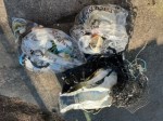
Kudos to Debbie and Norris who made a valiant effort at Big Beach to remove the tires/styrofoam/wood remains of an old dock. Too heavy and bulky to wangle up the steep hill, it was finally, regretfully, left at the beach above the high tide line.
Small amounts of debris were found at Redonda and Valdes beaches, dutifully packed into the big white bag for later disposal at the Beach Clean-Up event on May 27.
The heat on the exposed beaches precluded any socializing afterwards, so we all headed back to find our cool spots at home. (about 2.5 hours; about 27° C)
(click on photos to enlarge)
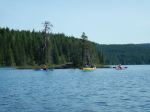
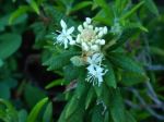
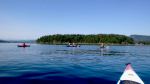
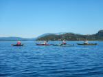
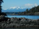
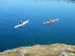
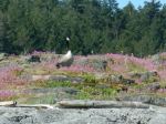
Ten kayakers met at Gowlland Harbour resort for our spring wildflower paddle. It was a beautiful sunny summer day with only light wind. Gowlland Harbour Resort was very gracious and allowed us to launch from their beautiful Resort. Les had hurt his shoulder earlier in the week, so was not able to join the group on the water. He showed up to help everyone get launched, but Debbie shepherded the group on the water.
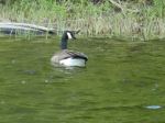
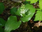
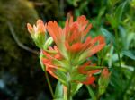
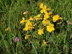
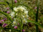
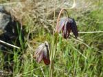
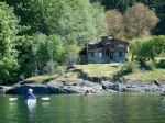
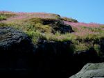
After launching we paddled over to Vigilant Island, where about half the group went ashore to explore the wildflowers. There were Sea Blush, Monkeyflowers, Death Camas, tiny Blue Eyed Marys, and Chocolate Lilies, so it was a great show. From there we crossed the channel to Steep Island and chatted with the couple on the three-masted sailboat before crossing the Gowlland Harbour entrance. We skirted the outside of May Island and got a glimpse of the submerged wreck, which was less than a metre under the water. We headed east across North Gowlland Harbour checking out the old stone house and glimpsing large anemones around the islets. The cliffs along the Quadra shore were a perfect rock garden in places, with sedum and Monkeyflowers on dripping walls. We dipped into the bay and chatted with Jill and Vibeke before paddling east around the islets in Gowlland Harbour where the Harbour Seals were basking on the rocks in the sun. Passing by two large sailboats at anchor, we continued on by Fawn, Stag and Doe Islands with the Sea Blush coming out and the Canadian Geese nesting. As we landed at Les’ place, there were Geese with goslings making their way along the shore.
Les fixed appetizers for the group. We had Nan bread with cheese, ham and turkey, as well as rice crackers with cream cheese and crab, a mixed vegetable platter and cookies. After that the group paddle back to Gowlland Resort. Les met them there to load up. (11.2 km; 5 hours with all breaks)
Les and Debbie
(click on photos to enlarge)


| Activity | Hiking |
| Destination | Santana Mine |
| Date | 29 May 2023, Monday |
| Trip Coordinator | Norris Weimer |
| Contact Info | norris.weimer@ualberta.ca or 3710. Please contact the coordinator by Saturday night. |
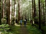
| Description | We will hike to the historic Santana Mine from the Bold Point area. The access routes are not maintained and range from old logging roads to trails up to the mine. This outing combines a walk through a good forest and a mine with a horizontal shaft. The history of the mine is quite interesting. Here is a link to the claim information: https://minfile.gov.bc.ca/summary.aspx?minfilno=092K%20%20013 |
| Meeting Place | Heriot Bay Store |
| Departure Time | 9:00 |
| Difficulty |
Moderate |
| Costs | None |
| Trip limits | 10 |
| Dogs? | |
| Notes: | Bring a flashlight. Bring gear for the weather and lunch. |
| Activity | Multi-day kayaking, camping and hiking |
| Destination | Main Lake Provincial Park |
| Date | 6-8 June 2023, Tuesday to Thursday |
| Trip Coordinator | Vic Gladish |
| Contact Info | vicgladish@gmail.com; 250-285-2111; text 250-287-0459 |
| Description | We will set up camp at Main Lake and spend three days exploring by hiking and paddling. Destinations can vary with the group’s interests. |
| Meeting Place | Mine Lake boat launch |
| Departure Time | On the water at 1030 hr. |
| Difficulty | Easy to moderate if windy |
| Cost | https://bcparks.ca/main-lake-park/ |
| Trip limits | 8 |
| Dogs? | No. |
| Notes: | This multi-day trip is relatively easy on a local lake, but requires good paddling and camping gear. Bring footwear suitable for hiking (easy).
Ask coordinator about joining for just 1 or 2 days if you have a schedule conflict. |
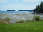
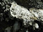
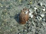
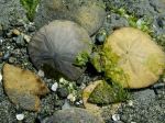
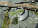
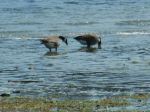
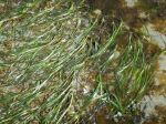
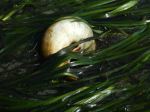
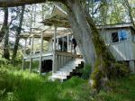
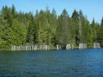
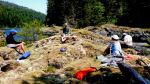
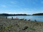
On a beautiful spring day, eight of us enjoyed exploring Hyacinthe Bay on a 0.5 metre tide which revealed some history and intertidal life. After arriving at Chauntaluf Farm, we sat on the deck of the Schoolhouse and talked about the history and ecology of the Bay. About 25 years ago, the Kellerhals family noticed stakes in the stream channel at low tide. These turned out to be the remnants of Indigenous fish traps which are several hundred years old. We also talked about the nearly complete loss of eel grass in Hyacinthe Bay in the last 50 years. This may be the result of a wasting disease, but it has immense consequences for the creatures who used to live there.
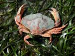
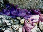
We wandered down to the tidal flats and almost immediately found many of the old stakes. Although we couldn’t always see the pattern of how the trap would have worked, we were impressed with the resilience of the wood. We found lots of oyster and clam shells, and further out there were sand dollars, mostly dead, but a few still black. There were also many moon snail egg cases. At the very edge of the water there was eel grass, some crabs and sea stars. There was plenty of diversity .
As the tide began to flood, we climbed ashore and visited a property which had recently been donated to the Regional District. The cabin is still in quite good condition. From there we followed a short trail leading back to the Farm. We took the lovely, wide, grassy Maple Bay Road back to the vehicles. This was a very easy relaxed day, giving us the time to enjoy the beautiful day and fascinating things on the shore. (2.7 km; 2 hours)
Thanks so much for the invitation from Heather Kellerhals and all the help from Robyn.
Debbie