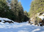
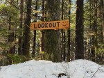
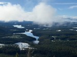
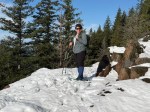
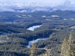
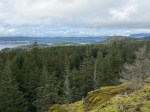
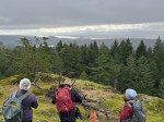
This snowshoe trip was rescheduled from the original date due to no snow in the mountains. It looked bad for the new date too, but then we had a huge snowstorm. We weren’t sure if chains were required on the Mt. Washington road or if their snowshoe trails would be broken for us, so we opted for Mt. Menzies first lookout instead. It was a good decision. Mt. Washington was a zoo, with the resort trying to deal with snow removal and grooming. There was a lack of parking space for the demand. On Menzies, we had fresh snow, no crowds and a beautiful spring day. We made it to the first lookout, enjoyed the view, then decided to do just a bit more before heading back down. 6.4 km, 340m, 3.75 hours.
We will follow some of the Mt. Washington snowshoe trails leaving from Raven Lodge. On Friday there are only two snowshoe trails open, but the area is expected to receive significant snowfall over the weekend, increasing the snow base and reducing wet areas. This may mean the trails are not packed down. We will adapt to conditions.
Meeting Place
Quathiaski Cove Ferry terminal
Departure Time
8:30 ferry
Difficulty
Moderate
Costs
Ferry, fuel and day pass (full, weekday, snowshoe pass is $14)
Trip limits
10
Dogs?
No
Notes:
Bring lunch, well-functioning snowshoes, and gear appropriate for the weather.
norris.weimer@ualberta.ca or 3710. Please contact the coordinator in advance by phone or email.
Description
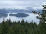
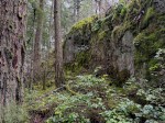
We will start out on the trail to Maud Island, but turn off onto an old logging road to Plumper Point. However, we divert from that in order to walk the beach at a low tide. When the beach runs out we will go up on mossy bluffs and continue to the Point. We will return through the forest on the old logging road. About 6.5 km, 3 to 4 hours.
Meeting Place
Community Centre parking lot; we will convoy in our cars from there.
Departure Time
10:00
Difficulty
Moderate, but varied: easy trail, beach walking, routes on old, unmaintained logging roads, a few steepish ascents on bluffs
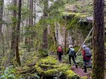
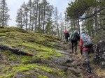
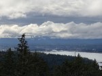
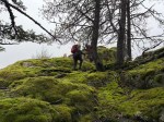
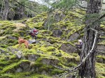
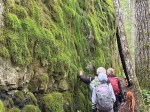
Four of us had a leisurely ramble on the south Heriot Ridge bluffs on a gentle, partly sunny winter day. We started at the Hopespring trailhead and climbed to the two principal Heriot Ridge viewpoints, one facing east and one facing west. We turned off the main trail and made our way to the communication tower, through some salal, wet places and undulating rock. We used the handy platform as a place to stop for lunch. We descended the sometimes steep, mossy bluffs until we reached the forest and the trail to the High Bluff. After enjoying that view and returning to the trail, we found that the trail down to the North Gowlland trail was so wet that it was not appealing, so we climbed back up to the south-facing, open, mossy bluffs for more views. In places there are paths, but often the route was quite steep up and down. We rambled west back to the Hopespring trail and returned to the vehicles. (4.1 km, 3.5 hours)
This is partially an experiment in early season camping, hence the short stay and accessible destination. Not all of the participants need to camp, however. Final decisions about activities will be made closer to the time of travel. Activities will include park beach and trail walking, observing wildlife during the herring season, trips to Englishman River Falls, Little Qualicum River and Rosewell Creek Falls. These are not very challenging objectives, but more could be available in the greater Nanaimo area. if the group were interested.
Meeting Place
Rathtrevor Beach Provincial Park
Arrival Time
TBD
Difficulty
Easy
Cost
Ferries, fuel, camping
Trip limits
10
Dogs?
Notes:
Please let the coordinator know if you are interested in this trip. More information is available about camping and specific activities on request.
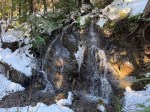
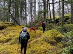
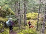
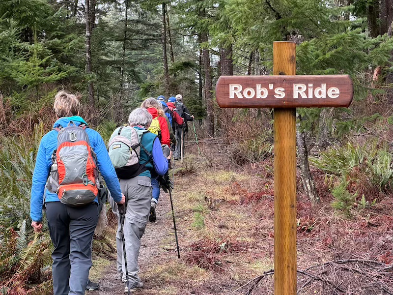
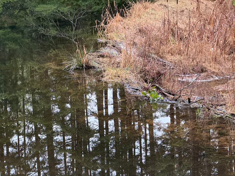
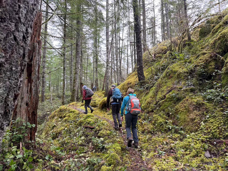
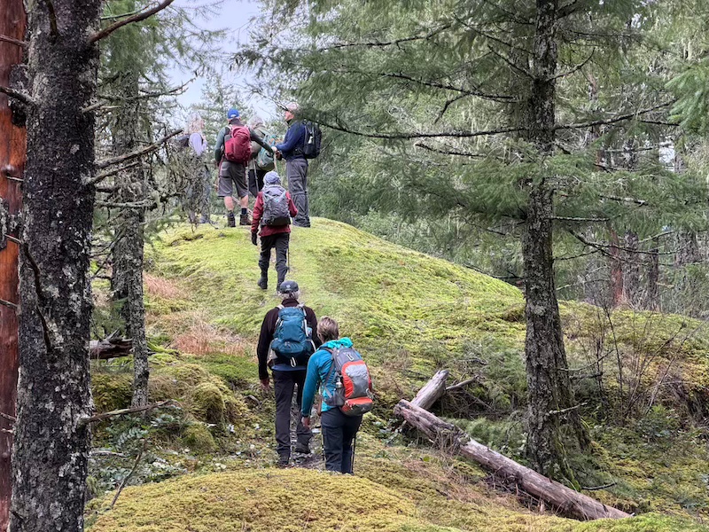
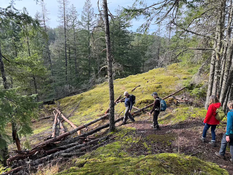
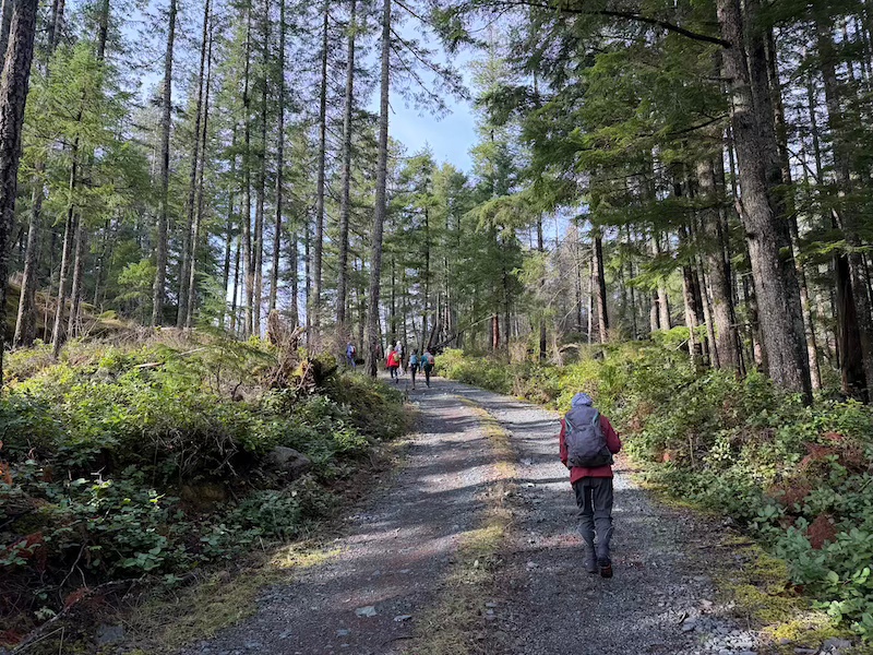
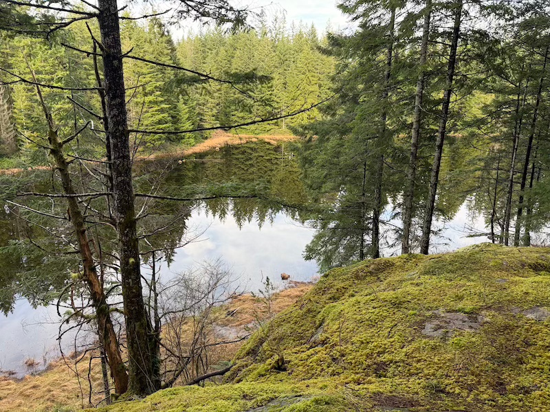
We got a lucky break in the weather for the long planned jaunt around the bike trails south of Walcan Road. Our final count was eleven hikers and one furry companion enjoying a dry, mostly overcast, and mild winter day. Most carpooled from the Community Centre, met up at the yellow gate off Upper Gowlland Harbour Road, then drove the short gravel stretch up to Rob Ride’s trailhead. We checked out the beaver dam at the outlet of Nighthawk Lake but it isn’t currently maintained. There were no obvious signs of recent beaver activity. We backtracked to Dick’s Ride to start our excursion through the maze of trails interlacing the hilly terrain west of the Lake. We followed Dicks Ride to the intersection with Cash Only, turning right onto Cash Only. Cash Only came out onto a logging road, which we crossed to pick up Back Door on the other side. We had lunch on a grassy knoll facing north-west with some views. Quite quickly we intersected with Silk Stocking and followed it to Copperhead Road. We turned off the road onto Straight as a Dime which intersected with the north end of Rob’s Ride. It was heart-warming to see the daffodils coming up around the beautifully carved sign designating Rob’s Ride, honouring much missed Club members Rob, and his wife, Diana. With some relief, we followed the easy trail along the creek and were soon at the head of Nighthawk Lake. All of the trails had had some wet sections, there were two beautiful waterfalls coming down the slopes on the west side of Rob’s Ride. Some ducks were spotted on Nighthawk, but no Swans. About 4.5 hours and 9 km later we were back at our cars. Altogether a lovely hike on what was more like a day in spring than mid-winter.
NOTE All of the trails had been recently maintained and were in good condition. Other than Rob’s Ride, none of these trails are signposted. There are occasional yellow tapes around trees, but these are no longer legible. Any hikers who do not already know these trails well must have reliable GPS maps. There was cell reception throughout the hike. As this is a long hike consider taking battery backup for your cellphone, especially if you are also taking photos.
Many thanks to Debbie, Norris, Carrie and Stephen for providing GPS consultation and backup. We were pleased to meet Greg Ross at the start of the hike and John Barclay just as we finished, both equipped with various clippers and pruners. These two, and other members of the Trail Committee. are instrumental in keeping these trails in great condition so we can enjoy them year-round. As always, big thanks to Norris for photos .
dmquigg@gmail.com, land 3710, cell 250-850-9848. Please contact the coordinator prior to the trip departure.
Description
We will hike the Hopespring Trail, make a quick stop at the Heriot Ridge viewpoint, continue to the communication tower, descend and then climb up to the High Bluff viewpoint. We will descend from there to the North Gowlland trail, perhaps visit the Aisle of 19 before climbing back up the Hopespring Trail to the vehicles. We will be using maintained trails, less maintained trails and routes. There will be wet places. The forecast is not perfect.
Meeting Place
Hopespring trailhead, because this is off a paved road.
Departure Time
10:30
Difficulty
Quite short but there will be steep, possibly slippery sections, and little maintained trails and routes
Costs
None
Trip limits
10
Dogs?
Notes:
Poles may be helpful if you use them. Bring a lunch/snack and gear for the weather.