| Activity | Quadra Island Wild Mushroom Festival |
| Location | Opening presentation (Heriot Bay Inn), collecting trips (various spots), Identification workshop (Quadra Community Centre) |
| Date | 13-15 October 2017, Friday to Sunday |
| Event Coordinator | Darcy Mitchell with Marian McMeekin |
| Contact Info | mitchelldarcy51@gmail.com, telephone: 778-716-7124 |
| Description | The Festival consists of 2 parts:
Part 1 – Opening presentation – Friday evening, October 13 at the Heriot Bay Inn. “Tales of the Chanterelle: A Mushroom’s Life in the Woods” by Dr. Shannon Berch, accompanied by delicious mushrooms appies. Seating 6:30 in Herons Dining Room. Cost for Part 1 – $25.00 Part 2 – Collecting forays and identification workshop Collecting forays – Saturday, October 14, departing from the Quadra Community Centre at 9:30 a.m. returning to the QCC no later than 3:00 p.m. Guided field trips to find the greatest possible variety of mushrooms and other fungi. Identification Workshop by Dr. Shannon Berch – Sunday, October 15, Quadra Community Centre, 9:30 a.m. to 12:30 p.m. with optional Question and Answer session from 1:00 to 2:00 p.m. Note: if you wish to stay for the Q&A session, bring a lunch or snack as there will be a half hour break. To register for one or both parts of the Festival, call the Heriot Bay Inn at 250.285.3322. Additional information (i.e. what to bring for the collecting forays) will be provided upon registration. Note: all participants in Part 2 (forays and workshop) will be required to sign the Quadra Island Outdoor Club waiver if not already members of the Club. |
Author Archives: qioutdoorclub
Trip Report – Savary Island – 7-9 Aug 2017
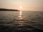
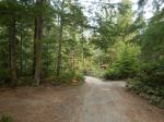
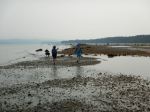
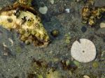
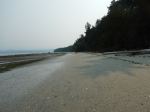
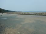
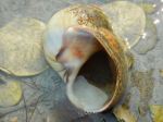
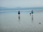
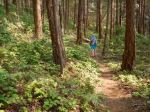
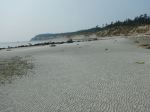
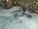
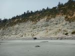
We took advantage of Cyndy’s generous offer to visit Savary Island. Getting there can be a challenge, but there are many ways to do it. We came by boat and anchored off Indian Point at the west end of the island. On Tuesday we walked along the beach taking advantage of a very low tide in the middle of the day. The heat of the day was reduced by the smoky haze clouding the coastal skies from inland BC fires. Savary is famous for its sandy beaches and shallow shoreline. Starting at Indian Point, we walked east appreciating the interesting intertidal life. We stopped at the spring, the mermaid rock, admired the burrowing anemone, sand dollars, crabs, snails and shells. After lunch on the beach, we crossed the island on trails in the undeveloped central lands. We passed by the disused airstrip and continued on to the south shore with sand dunes and high bluffs. We met Jen, whose family has had property on Savary since 1930. We made a side trip to the spirit tree before continuing along the shore where some families were enjoying the beach. After checking out an antique store, we returned to Indian Point on the Sunset Trail. Cyndy’s local knowledge made a huge difference in exploring Savary. 16.6 km; 6½ hours.
Debbie
- Sunset in a smoky sky
- Major road
- North shore
- Moon snail
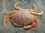
- Small Dungeness crab
- Old airstrip
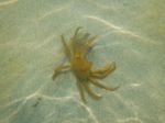
- Spider crab
- South shore
- Western Terrestrial Garter Snake
- Jen’s family house from the 1930s
- Our track on Savary Island
(click on photos to view larger)
Trip Report – Open Bay to Breton Island – 9 Aug 2017
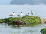
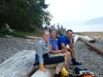
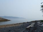
Four members enjoyed an unusually calm and peaceful paddle from Len Road Beach to Open Bay. We paddled past Seal Rock at the mouth of Hyacinthe Bay to check out the seal colony then stopped briefly at Big Beach in Open Bay, where we observed a few tents at the high tide line. Enjoying the foreshore and intertidal exposed by the very low tide, we explored the caves and outcroppings of Open Bay, the extreme infolding and convolutions of the unique geological formations of this area were clearly visible. We continued over to the Breton islets, lazily watched by the seal colony draped over the exposed rocks, and a few curious Bonaparte Gulls. We were pleased to see so many sea-stars back again, and carpets of sea urchins in the more active waters between the islets. After a short lunch stop on the south Breton, we paddled back to Len Beach across the glass-still ocean, concluding the calmest paddle I have ever enjoyed on Quadra.
Valerie van Veen, Trip Coordinator
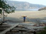
Note: In the last photo, Len, our newest member, demonstrates the new membership requirement for carrying kayaks. Existing members are grand-fathered/mothered from this requirement. 😃 lol
(click on photos to view larger)
- Bonaparte Gulls chilling
- Lunch on Breton Island
- Coast Range hidden in smoke
- Seal sun tanning on driftwood
- How to carry a kayak
Backpacking – Arnica Lake and Phillips Ridge – 21 – 24 August 2017
This trip may be postponed due to heat, visibility, air quality as well as forest fire danger.
| Activity | Backpacking |
| Destination | Arnica Lake and Phillips Ridge |
| Date | 21 – 24 August 2017, Monday to Thursday |
| Trip Coordinator | Debbie Quigg |
| Contact Info | debbie.quigg@ualberta.ca or 3710. Please contact the trip coordinator by August 14th. |
| Description | Either three or four days hiking and camping in Strathcona Park. Backpack from the Phillips Ridge trailhead up on a gradual trail with many switchbacks to Arnica Lake to camp (about 12 km; 845m elevation gain). Day trip(s) up Phillips Ridge for views. |
| Meeting Place | Ferry terminal to Campbell River |
| Departure Time | 07:05 ferry |
| Difficulty | Strenuous |
| Costs | Shared fuel and ferry costs, $10/person/night for back country camping |
| Trip limits | Three tents maximum |
| Dogs? | no |
| Notes: | The first day will be very long with the ferry, the drive and a long up-hill day. It’s possible that we could camp at Ralph River the night before. |
Kayaking – Open Bay to Breton Island – 9 Aug 2017
| Activity | Kayaking |
| Destination | Open Bay to Breton Island |
| Date | 9 August 2017, Wednesday |
| Trip Coordinator | Valerie |
| Contact Info | vvv@qisland.ca, or 250 285 2329; must contact coordinator 24hrs before to confirm |
| Description | A casual half-day paddle to Open Bay and islets. |
| Meeting Place | Len Road launch |
| Departure Time | Arrive in time for 10:00 departure |
| Difficulty |
moderate |
| Costs | none |
| Trip limits | none |
| Dogs? | no |
| Notes: | No lake or recreational kayaks. Kayaks must be ocean-worthy wilth all safety equipment. Bring snack, water, appropriate clothing for a half day paddle. Cancelled if winds greater than 20 knots. |
Trip Report – Kanish Bay & Darkwater Lake – 1 Aug 2017
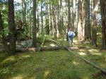
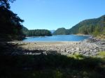
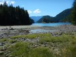
The hike to Mt. Becher was postponed due to super hot weather, poor visibility from BC forest fires, and ferry overloads. Instead we opted for a cooler, local hike to Kanish Bay and Darkwater Lake. After a long drive over rough logging roads, with a few stops for lake views and wildflowers, we parked and walked to Kanish Bay along a somewhat overgrown old logging road. It was pleasant and cool in the forest and there were still more wildflowers. Views of Kanish Bay don’t come easily, but we bushwhacked down to a gravel beach for lunch, views and a breeze.
We walked back to the vehicle and drove toward Darkwater Lake. The walk is very short, through open understory forest, to the mossy peninsula. We sat on the rocks by the lake and Julie swam in the cool water. 4.0 for Kanish Bay; 1.4 km to Darkwater; 2½ hours total without the driving.
– Norris
(click on photos to view larger)
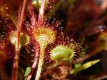
- Sundew
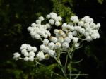
- Pearly Everlasting
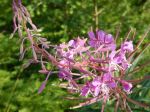
- Fireweed
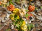
- Hop clover
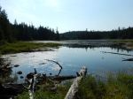
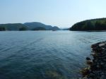
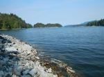
- Kanish Bay looking NE
- Kanish Bay looking NW
- Canada Geese
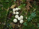
- Puff balls
- Darkwater Lake
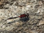
- Dragonfly
Trip Report – Newton Lake and Beyond – 26 July 2017
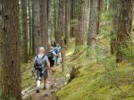
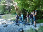
Seven hikers trekked from the Newton Lake trail parking lot to the Lake, where several people swam and we had a quick lunch, accompanied by the intermittent serenade of loons. We then headed down the trail to Small Inlet, and over to Waiatt Bay. We returned through the ‘portage’ branch, which skirts a rather mysterious bubbling spring, then along the beach and back to the main trail. There was a bit of puffing and panting up the rather steep climb back to Newton Lake, where swimmers again enjoyed a cool break. It was a lovely day, sunny and not too warm. We met several other parties on the trail (busy for Quadra!). Except for the steep bit on the return from Small Inlet to Newton Lake, the trail is good throughout, although there is a fair amount of loose rock between the parking lot and the Lake, which makes for tricky footing in parts. 14.8 km; 6¼ hours.
Darcy
(click on photos to view larger)
- Emerging chanterelle
- Newton Lake
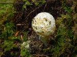
- Amanita ?
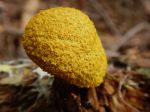
- Dog Vomit Slime Mold
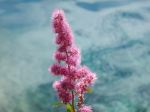
- Douglas’ Spiraea
- Small Inlet
- Waiatt Bay
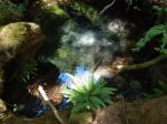
- Bubbling spring
- Small Inlet
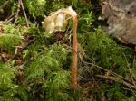
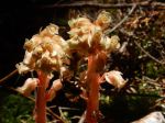
- Pinesap
- Pinesap
- Newton Lake
Hiking – Mine Lake Bluff – 5 Sept 2017
This trip has been postponed or cancelled.
| Activity | Hiking |
| Destination | Mine Lake Bluff |
| Date | 5 September 2017, Tuesday |
| Trip Coordinator | Julie Mellanby |
| Contact Info | phone 3978. Please contact the coordinator in advance. |
| Description | We will leave from the parking area on the road near the Mine Lake access and walk to Camp Homewood. From there the route ascends steeply the rocky bluff to the north of Mine Lake with great views (weather permitting). A loop will be made by a trail which descends to the north and circles back to the trail just before Camp Homewood. The route up the bluff can feel a bit exposed. On the return, there will be the opportunity for a swim in Mine Lake. |
| Meeting Place | Heriot Bay Tru Value parking lot |
| Departure Time | 9:30 |
| Difficulty | moderate, and challenging if not comfortable with exposure |
| Costs | none |
| Trip limits | none |
| Dogs? | |
| Notes: | Bring lunch and swimming gear if you wish. |
Hike – Nugedzi Lakes and Views – 16 August 2017
| Activity | Hiking |
| Destination | Nugedzi Lakes and Views |
| Date | 16 July 2017, Wednesday |
| Trip Coordinator | Julie Mellanby |
| Contact Info | 3978; please contact the coordinator in advance of the trip. |
| Description | Hike up a steep, old logging road and meander through open forest to the lovely Nugedzi Lakes. If the group wants more, there are side trips to viewpoints looking northeast, southeast and west. Nugedzi Lake is a good swimming spot. |
| Meeting Place | Heriot Bay Store for car pooling |
| Departure Time | 9:30 |
| Difficulty | moderate |
| Costs | none |
| Trip limits | none |
| Dogs? | okay |
| Notes: | Bring lunch |
Hiking – Forbidden Plateau plus Nymph Falls – 1 Aug 2017
Postponed
| Activity | Hiking |
| Destination | Mt. Becher |
| Date | |
| Trip Coordinator | Debbie Quigg |
| Contact Info | Please RSVP to qioutdoorclub@gmail.com or 3710 if interested; please contact the coordinator by Sunday in order to assure car pooling |
| Description | The plan is to go to Mt Becher which is on the SE corner of Forbidden Plateau. The trail goes from theold Plateau Ski Lodge up to the sub-alpine summit (1390 m). There is a view down to Boston Lake and views over Forbidden Plateau, Comox Lake, Georgia Strait and the norther Gulf Islands from the top. On the return, we plan to stop at Nymph Falls to admire the Puntledge River and swim (for those that want to). |
| Meeting Place | Q Cove Ferry parking area |
| Departure Time | Early enough for the 8:00 ferry |
| Difficulty |
Moderate to strenuous; about 13.5 km return, 580 m elevation gain, about 7 hours |
| Costs | Shared gas and ferry fee |
| Trip limits | None |
| Dogs? | Dogs would need to be on leash in Strathcona Park |
| Notes: | Bring lunch, gear for changes in weather, poles if you use them. If you plan to swim at Nymph Falls, bring that gear too. |