Trip Report – Quathiaski Cove – 9 Aug 2024

Ten members of the Club gathered at the Quathiaski Cove boat launch at 1830 on a beautiful summer evening. Eight paddlers launched their kayaks and we left two onshore as they had no paddles!

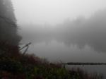
On calm seas we set out on a flood tide for the green blinker by the seal rocks near Grouse Island. As the currents and very light wind presented no concerns we paddled out of the Cove and along the length of Grouse Is. and then across the gap to the north shore of Q Cove. The Discovery Passage currents were pretty benign so we continued on to the cliff to view the now deserted Guillemot (a small jet-black seabird) colony and its “whitewashed” rockface. As we turned to the south, we could feel the tide carrying us in that direction and we headed back into the Cove, over a boulder field, under the watchful eye of the local eagles.

With the sun getting lower in the smoky skies, the golden hour was upon us as we rounded the corner into Unkak Cove and paddled its very shallow waters. The many crabs and small fishes (sculpins?) scurrying along the bottom were just a foot or two below us. The rising tide allowed us to get very close to the end of the cove where we turned 180 and headed south once again.

We left Unkak Cove and paddled past the numerous docks and buildings adjacent to the old ferry landing and then crossed back over to Grouse Island amidst the raucous screeching of an eagle family with recently fledged eaglets. After viewing the all but abandoned residence and its dilapidated sign it was time to head to the take out. With the red ball of sun at our backs and a beautifully lit Cove ahead we cruised in to the boat launch mere minutes before a stunning sunset. (2.9 NM, 1.75 hours)

This idyllic summer evening paddle ended with a social hour with snacks and beverages and friendly conversation around a propane campfire at the Gladish residence.

Wildlife: Eagles, Oystercatchers, Kingfisher, Great Blue Heron, Crows, Harlequin Ducks, Harbour Seals

Vic

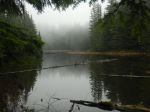
Thanks to Vic and Norris for the photos.

(Click on photos to enlarge)

Social Paddle – Quathiaski Cove – 9 Aug 2024

Trip Report – Thomspon-Hopespring Trail Loop – 7 Aug 2024

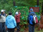
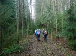
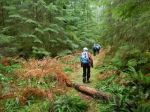
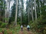
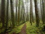
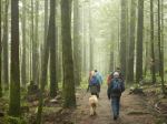
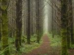
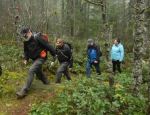
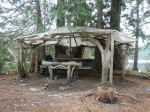
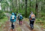
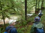
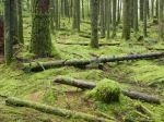
Eleven hikers, including five guests, started on a morning hike from the end of Thompson Road. It was a beautiful sunny day although warm and a bit smoky already. We continued on past the Gowlland Harbour Trail and turned onto the small trail down into the creek valley with the group of old growth trees. This is a stunning area with some very beautiful majestic, old growth-trees. We then went back to the Hopespring trail and onward to the Three Sisters which are some of the largest old-growth Douglas firs on Quadra. A little way down the trail we turned off again to view another group of nineteen old growth trees. Back on the trail we climbed up to the Heriot Ridge Trail and proceeded to the bench to have lunch and enjoy the view. Afterwards we hiked down to the end of Hopespring and walked the road back to our vehicles. (6.1km, 3 hours).

Les
 
Thanks to Les, Chris and Norris for the photos
 
(click on photos to enlarge)
 

Hiking – Thompson-Hopespring Trail Loop – 7 Aug 2024

Hiking – Deadfish-Tripod Loop – 26 Aug 2024

This hike has been re-scheduled to August 28, Wednesday!

Activity Hiking
Destination Deadfish-Tripod Loop
Date 28 August, Wednesday  26 August, Monday
Trip Coordinator Nicole and Louise
Contact Info Nicole: email quadranick@gmail.com or Louise: text 306-539-3813
Description The hike will start at Morte Lake parking lot,  making a big loop on biking/hiking trails south of Morte Lake.  We will ascend Morning Beer and Nirvana trails, then west along south Morte Lake.  Turning back on Tripod, Ridge trail and Lost Rider, we return by Deadfish to the parking lot.  Duration should be about 2 hours (3 hours max).
Meeting Place Meet at the Morte Lake trail head
Departure Time 10:00
Difficulty
Moderate
Costs none
Trip limits 10
Dogs? No
Notes

Trip Report – Eagle Crag Loop – 31 July 2024

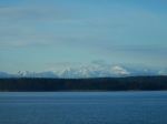
Five of us hiked the trail to Eagle Crag, then the steep path to the top of the bluff.  Here we rested, had a bite to eat, and enjoyed the fantastic view.  There were clouds over the Vancouver Island mountains, but other than that the visibility was very good, especially considering how much fire smoke there is elsewhere.  We enjoyed the perfect temperature, the sunshine, and the gentle breeze for quite a while.  We were visited by a hummingbird and a grouse.

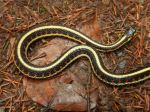
After that, we continued up an old path, originally for climbing access to a higher bluff, surprising a garter snake.  At the top of this path, we again sat and enjoyed the beautiful day.  Then we took the trail down from Beech’s Mountain, back to the vehicles.  (4.9 km; 3.5 hours)

Norris

(Click to enlarge)

Hiking – Eagle Crag Loop – 31 July 2024

Trip Report – Newton Lake, Small Inlet and Waiatt Bay – 24 July 2024

A large group of 11 hikers (including 1 guest and 1 new member) undertook our “annual” midsummer trek to Newton Lake, Small Inlet, and Waiatt Bay. It was a cooler day after some rainy days, but a swim was still happily anticipated by some. After regrouping and adjusting the pace at the Small Inlet Park Boundary, we had a soggy go through the thick patches of salal, thanks to recent rain, and then arrived at Newton Lake for a short rest.
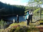
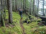
Our long line of hikers became longer as we descended the switchbacks down the steep slope to Small Inlet. We walked out onto the mudflat and shortly realized that we were in one of the inlet’s many clam gardens. The tide seemed exceptionally low and revealed the long arc of piled boulders that enclosed the clam bed.

A few minutes later we crossed the mudflat to the Waiatt Bay trail head, stopped to marvel at the freshwater spring a few strides later and then made the short hop to Waiatt Bay. By this point we had only met up with a few pairs of hikers coming from the anchorage. At the bay on Quadra’s east coast, dozens of “yachts” were visible. Perhaps the very big tide flat was discouraging them from coming ashore?

After a leisurely lunch the group was again on the move and ready to tackle the uphill leg back to Newton Lake. We ascended slowly, and with it being a cooler, overcast day, everyone arrived at the top in good shape. Arriving at the lake with a light rain shower starting made a dip in Newton Lake’s inviting waters even less appealing. So, after a brief rest, we tackled the final leg of this classic hike. (12.8 km; 5 hours 48 min)

Vic

Thanks to Carl and Norris for the photos

(Click to enlarge)

Hiking – Newton Lake-Small Inlet-Waiatt Bay – 24 July 2024

Trip Report – Century Sam Lake – 13 July 2024

Five of us hiked to the picture postcard called Century Sam Lake.  It’s named after a character that Sid Williams played.  Must have been quite a character to have a lake like this named after him.  We wanted to hike to it when it was in full sunshine, to show off the deep blue-green.  The trade off was that it was very hot.  But the crowd that was there was fully into swimming and diving off cliffs, so it was perfect weather – cloudless, a bit of breeze.  The Lake is located below the Comox Glacier.  This contributes to the other attraction of this hike which is the ice cave.  It wasn’t as good as on a previous trip, maybe too early in the season, but still very interesting.  And the wildflowers were excellent.

The Lake is in Strathcona Park, but the approach is not.  Trail maintenance is ambiguous, but someone had just clipped the aggressive brush, including Devil’s Club, so that was good.  The route is rough everywhere and steep in the headwall up to the Lake.  The access to this trail is on a logging road through Mosaic lands and the gate is only unlocked on weekends and only when Mosaic is not logging and the fire danger is low.  We timed it well, so all was good.  (11.3 km; 7.5 hours; 423 m elevation gain)

Norris 

Thanks to Louise, Jim and Norris for the photos

(click on photos to view larger)

Hiking -Century Sam Lake – 13 July 2024

Trip Report – Gowlland Harbour – 10 July 2024

Ten people gathered on a beautiful, calm, sunny day for a paddle and social. The Stuart’s place is a bit difficult to launch from as there is a steep driveway with a switch back and only one vehicle can come down at a time. Then you have to pack the kayak around the pond. This was made easier by the fact that I live here, two members paddled over from their place, and another member brought his kayak in by boat to the dock. All in all it worked out well and we managed to leave a little ahead of schedule. We paddled south around the south end of Gowlland Harbour to start. After passing the old sunken barge, we stopped where the two abandoned boats have sunk to talk about how bad the government is managing abandoned boats on our coastline. We then paddled on flat water up the east side of Gowlland Island and stopped to stretch our legs on the north end. As we proceeded toward Gowlland Resort there was a colony of seals on some of the small islets. At Seascape Resort, now called Jade Resort, we stopped to look and discuss the falling apart of the old barge hotel. This is a total disaster of waste and garbage being emptied into our beautiful harbour because of the inability of government and courts to deal with a problem.
We then had an easy paddle back to our entry point. Here we had a great social on the deck, complete with chips and salsa, smoked oysters and meats with cheese and crackers, veggie platter, and Smokies and buns from the barbecue.  Plus drinks and desserts.  (7 km; 2 hour paddle)

Les

(click on photos to enlarge)

Kayaking – Gowlland Harbour – 10 July 2024

Hiking – Thompson Trail-Hopespring Loop – 7 Aug 2024

Activity Hiking
Destination Thompson Trail-Hopespring Loop
Date 7 Aug 2024, Wednesday
Trip Coordinator Les Hand
Contact Info lhquadra@gmail.com or 285-2029
Description We will start at the end of Thompson Road and do the circle counter clockwise. Bring a snack or small lunch and we will stop at the top of Heriot Ridge before we come down to Hopespring Road.
Meeting Place End of Thompson Road
Departure Time 9:00
Difficulty
Easy
Costs None
Trip limits 10
Dogs? Okay, but under control
Notes: We are starting earlier than normal to beat some of the heat. Bring hiking poles if you’d like to use them.

Trip Report – Mt. Kitchener – 3 July 2024

Quite a few people wanted to go on the Mt. Kitchener hike then couldn’t make it for a wide variety of reasons.  So at the last moment, the trip went ahead with only three.  We can report that the road up does not have waterbars, so any vehicles with four-wheel drive, good clearance, and good tires should be able to make it.  On the way up we had a special treat of seeing a herd of elk, seven with three young ones and another, smaller group higher up.  The trail is in good condition, although there is a section of large windfall to go around at the start.

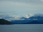
There was some morning cloud, especially in the north, and we parked just above the clouds, which went away as the day warmed up.  After the first steep ascent on to the ridge, we  hiked along the ridge to the Mt. Kitchener summit, where the communication infrastructure had been removed since our last visit.  We had excellent views all around, looking over Johnstone Strait and up Loughborough Inlet to Mt. Waddington.  We stopped for lunch before descending and then made the short climb to Mt. McCreight, with more views to the south.  We had excellent weather and took our time to enjoy the hike.  (4.3 km; 4.25 hours; 475 m elevation gain)

Norris 

(click on photos to view larger)

Hiking – Mt. Kitchener – 3 July 2024

Trip Report – Kay Dubois Loop – 19 June 2024

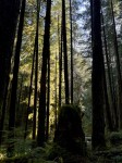
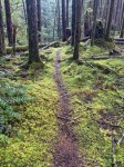
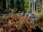
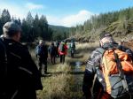
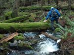
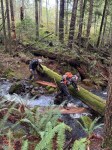
Our hike on the Kay Dubois trail was a lovely, cool forest-bathing-ish treat on a warm summer morning.  We started at the Fox Road entrance and walked on the woodlot road to the trail head at the end of Sutil Road.  When we got to the bottom of the hill, we made a few beach-viewing stops to enjoy the view. The understory growth was phenomenal from all the rain we have had.  We continued on to the giant witchy spruce tree, headed up the hill on the Hansel and Gretel walk and made it back to our starting point with no nibbled body parts.  (5.7 km; 1¾ hours)

Kathy
 
 
Click on photos to enlarge