| Activity | Kayaking and social |
| Destination | Gowlland Harbour |
| Date: | 10 July 2024, Wednesday |
| Trip Coordinator | Les Hand |
| Contact Info | lhquadra@gmail.com or 250-285-2029 |
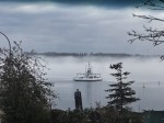
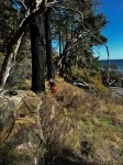
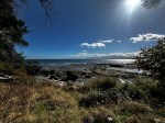
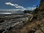
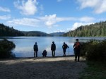
| Description | This will only be a one and a half to two hour paddle followed by a social hour on the deck at my house. I will provide appetizers. Depending on current and weather we may go around Gowland Island otherwise we will just stay around the southern part of Gowland Harbor. Because of this please bring a spray skirt and all necessary equipment mandated by the Coast Guard. If it is more than showers the date will be changed. |
| Meeting Place | 1157 West Rd |
| Departure Time | Meet at 10:00; Leave at 10:30 |
| Difficulty |
Moderate |
| Costs | None |
| Trip limits | 12 |
| Dogs? | No |
| Notes: | Only one vehicle at a time can come down the hill so be on time. I have permission to park vehicles at the landlords house. From there it is a steep concrete driveway with a switch back involved. You will need to be able to back up with your mirrors to get down close to the water. Otherwise you will park up above and we will use two people to carry the kayaks down. When you sign up I will explain more as it will not be that hard. |
Category Archives: day-trip
Trip Report – Surge Narrows Trail – 5 June 2024
Eight of us and a dog car-pooled out to the very full parking lot at the end of the Surge Narrows road. We had a quick look at the dock and offered assistance to two locals but it appeared the outer islanders are very independent. We then headed back up the steep hill to start our hike north.
At our first stop we watched the flood tide push through the narrows and saw a kayaker successfully navigate the rapids. We continued on the unmaintained route a little further north and had a relaxing lunch. We watched the tide come in a little with more spectacular views of the rapids and a brief viewing of the intertidal life, mostly sea stars. Then it was time to head back and enjoy the great hiking weather and get back to the parking lot. Some over ripe oyster mushrooms along the trail and a hint of huckleberry season is coming.
The trail is well kept with evidence of some bridge repair but one bridge is definitely on the watch list but easily traversed. Wild life was at a minimum except for one eagle diving for fish. A short hike but a very enjoyable hike. (4.3 km; 2¾ hours)
Neil
- The boat launch
- Surge Narrows dock
- The recent bridge
- The viewpoint on the Narrows
- Green sea urchin
- Ochre sea stars
- Ochre sea star
- Moon snail cases
- Rapids on the flood
- Farah cooling off
- Sea cucmber and leather star
- Back through the cedars
Hiking – Mt. Kitchener – 3 July 2024
Due to some issues around this trip, please stay in touch with the coordinator.
| Activity | Hiking |
| Destination | Mt. Kitchener |
| Date | 3 July 2024, Wednesday |
| Trip Coordinator | Norris Weimer |
| Contact Info | 285-3710 or norris.weimer@ualberta.ca. Please contact the coordinator by Monday evening. |
| Description | Mt. Kitchener is located northeast of Campbell River and south of Sayward in the Prince of Wales Range. The summit is 1,457m, but fortunately the first 1,000 m can be driven up, leaving about 500 m elevation gain. The trail begins steeply through the forest and after a short scramble emerges onto a sub-alpine ridge. As the the ridge gains height, the views appear on all directions. We will visit Mt. McCreight (1,419 m) with some remembrances of the military plane crash from 1950. We will continue on to Mt. Kitchener, but not visit the crash site. |
| Meeting Place | Q Cove Ferry terminal. |
| Departure Time | 8:00 ferry. If the weather is very hot, we may go earlier. |
| Difficulty |
Challenging, but not very long |
| Costs | Shared ferry and fuel costs |
| Trip limits | 10 |
| Dogs? | No |
| Notes: | This trip will require 4-wheel drive vehicles with some clearance. We will not do this trip in poor weather. Bring lunch and water. |
Hiking – Kay Dubois Loop – 19 June 2024
| Activity | Hiking |
| Destination | Kay Dubois Loop |
| Date | 19 June, Wednesday |
| Trip Coordinator | Kathy Sales |
| Contact Info | lilsuzyh@hotmail.com, 250-285-3693 or 250-314-4055 |
| Description | We will start at the end of Fox road and head down into the woodlot, turning at the “Hansel and Gretel” trail down to the beach. We will continue on the Kay Dubois trail up to the end of Sutil Road, then return to Fox on the woodlot road. |
| Meeting Place | End of Fox Rd |
| Departure Time | 10:00 |
| Difficulty |
Easy, with a few steeper parts |
| Costs | None |
| Trip limits | |
| Dogs | |
| Notes: |
Trip Report – Ripple Rock Trail – 29 May 2024
Three of us caught the 9:00 am ferry to Campbell River and when we reached the parking lot at the trailhead only one other car was there.The weather was typical west coast Spring with patchy clouds, sunshine and rain in the distance.
On the way to Seymour Narrows there are several viewpoints with excellent views of Menzies Bay with log booms and other watercraft. With the recent rain all the new growth was spectacular with thimbleberries in bloom, salmonberries ripening and all the variety of ferns and other plants we are learning to identify. There are several bridges over rushing creeks with many wire covered wooden structures over wet areas. The trail overall is easy walking with some uphill stretches that require careful stepping due to rock outcroppings. One set of stairs had a broken step, which hopefully will get repaired soon, as we did meet a maintenance crew trimming the new growth along sides of the trail.
The view at Seymour Narrows overlooking where Ripple Rock was blasted is striking as you can see up and down the Narrows for quite a distance with good views of Quadra Island. At the bluff viewpoint a large group of school age kids where just finishing their lunches before heading back on the trail before us. On the return hike it started to sprinkle so jackets went back on. With the rain and the group ahead of us the trail seemed more muddy from when we came out. By the time we reached the parking lot the sun came out with blue skies as we headed back and caught the 3:00 pm boat to Quadra. All and all a very enjoyable hike. (8.8 km 4 hours with lunch stop)
(click on photos to enlarge)
- The big Spruce
- Menzies Bay
- Penstemon
- Wild Rose
- Arnica
- South through Seymour Narrows
- Low tide
- Horsetail and fern
Trip Report – Manson’s Lagoon Loop – 22 May 2024
Eight of us gathered at Heriot Bay on a brilliant sunny day in May and carpooled to Manson’s Lagoon. Here a perfect low tide accommodated our trek across the sand to explore a couple of flower strewn islets in the middle of the lagoon where we sat and ate taking in the spectacular view surrounding us. After lunch we continued along a shoreline pathway and through the forest to the beautiful white sands of Hague Lake where the sun took it’s cue to warm us up enough to go wading in the clear, tepid water. Along the beach and through a forest to a roadway that curved uphill toward Manson’s Landing Coop Store. Here we took advantage of an opportunity to check out lovely local crafts, a great little book store, bakery, coffee shop and organic local grocery outlet. After coffee and yummy local chocolate we continued past Manson’s Community Centre, soccer field, Fire Hall, Museum, Senior’s Home & through the school yard onto a pathway leading through a delightful old growth forest hugging the west facing shoreline which eventually returned us to the Manson’s Dock, white sandy beach, carvings, Manson’s Spit and our vehicle.
Great day and memories.
Cyndy
Thanks to Cyndy for the photos.
(click on photos to view larger)
- Manson’s Lagoon at low tide
Hiking – Surge Narrows Trail – 5 June 2024
| Activity | Hiking |
| Destination | Surge Narrows Trail |
| Date | 5 June 2024, Wednesday |
| Trip Coordinator | Neil Unwin |
| Contact Info | neilunwin08@gmail.com; 604 202 4762 |
| Description | This undulating trail makes its way north from near the end of the Surge Narrows Road, traversing slopes which descend to the shoreline. We will come out onto rocky bluffs overlooking Surge Narrows. We can then continue on an unmaintained route which leads to Raven Bay. Activities will depend on the height of the tide. |
| Meeting Place | Heriot Bay store parking lot |
| Departure Time | 10:00 |
| Difficulty | Fairly short, with some steep sections |
| Costs | None |
| Trip limits | 12 |
| Dogs? | Yes if under control and not running through the group |
| Notes | The tide will be flooding while we are hiking, but will not reach its maximum current of 9.7 knots until after 13:00 |
Trip Report – Gowlland Harbour – 15 May 2024
The paddling trip that almost wasn’t actually worked out really well for the three of us that showed up at Gowlland Harbour Resort. One health concern or another, and switching from one launch to another, played havoc with the plans and commitments for this outing.
We got on the water a little ahead of schedule and set off for a counterclockwise circumnavigation of Gowlland Harbour. Warm temperatures, nearly flat calm seas and friendly currents set the scene for a very enjoyable trip. Otters, seals, and a sea lion shared the harbour with us, the only humans on the water during our time out. We took our lengthy lunch break on the gravelly beach on the west side of Gowlland Island in view of a string of Private Property signs!
Many thanks to Gowlland Harbour Resort for allowing us to launch from their property.
Total distance: approx 10 km
Total time: 4 hrs with a nearly 1 hr lunch stop
Vic
(click on photos to enlarge)
- Lunch break
- The sunken lodge
Trip Report – Maud Island – 6 May 2024
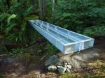
The weather was as unsettled as promised, a short, violent hailstorm as I left home almost convinced me to change our destination. However, the weather seemed to improve as the morning wore on so we opted to chance it, with the caveat that, if the predicted thunderstorms did materialize while on the trail, we would immediately abort the hike. Indeed, after a few unexpected delays, as eight hikers finally began our excursion at 12:20, the sun began to burst through, highlighting the luxuriant spring green moss and groundcover. This is a pretty trail, most of it on gently sloping old logging roads leading to the border with the Conservation area. At the junction of the old road with the trail proper we came across a quartet of abandoned bikes. We met their owners a few minutes later, a young Island family, returning from their trek out to Maud. We lost our weather gamble just as we hiked the final slope to the viewpoint, fortunately just heavy rain, no thunderstorms! With our planned later start time (thanks Les!) we arrived at the viewpoint at 2:20, just 30 minutes after the predicted 14 knot full flood. A zodiac gave its boatload of tourists a thrill as it rode the currents and rip tides at the south end of Seymour Narrows. A small cruiser was getting a free ride downstream, backwards! Not sure if that was the planned route. As the rain settled in with a vengeance, we had a hasty lunch under the trees, not like our usual summer sojourns in this very scenic spot. We were back at our cars just before 4 pm.
NOTE: the logging roads accessing the trailhead have been extensively built up since I hiked Maud Island last fall. It appears that there have been washouts, many stretches of formerly soft roadbed are now built up with rough rocks … sturdy vehicles such as pick-up trucks are recommended. Also, the junction with the logging road off Walcan Road has been widened so the Trail sign is no longer there. All further trail signs are still in place. And just at the crest of the final bluff there is now a new path that turns left, cutting through the forest to the viewpoint, bypassing the moss covered rocks that are slippery when wet!
Valerie van Veen
Thanks to Valerie for the photos.
- Long abandoned car
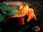
- Slug with a mushroom
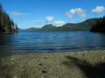
- View of Seymour Narrows
Hiking – Manson’s Landing Loop, Cortes – 22 May 2024
| Activity | Hiking |
| Destination | Manson’s Landing Loop Cortes |
| Date | 22 May, Wednesday |
| Trip Coordinator | Cyndy Chidley |
| Contact Info | 250-285-3575 or kasoltan@gmail.com |
| Description | After crossing on the ferry, we will drive to Manson’s Landing Lagoon and take advantage of the low mid-day tide to explore the lagoon and islands. We will then take a trail along the lagoon and through the forest to Hague Lake. We will follow the beach and roads to the Coop, where we will likely stop for lunch. After exploring the Manson’s Landing Community Hall and museum, we will take the trail back to the lagoon through the forest. There will likely be enough time to visit Smelt Bay and walk on the beach there. |
| Meeting Place | Heriot Bay ferry terminal to Cortes. |
| Departure Time | 9:05 ferry; come very early, shortly after 8:00, to avoid the overload. |
| Difficulty |
Easy |
| Costs | Ferry costs; bring your ferry card. Shared fuel. |
| Trip limits | 10 |
| Dogs? | Okay |
| Notes: | Bring shoes or sandals that can get wet for the lagoon exploration. Bring lunch and snacks, although food is available at the coop. We expect to return on the 3:50 ferry. |