| Activity | Hiking |
| Destination | Thompson Trail-Hopespring Loop |
| Date | 7 Aug 2024, Wednesday |
| Trip Coordinator | Les Hand |
| Contact Info | lhquadra@gmail.com or 285-2029 |
| Description | We will start at the end of Thompson Road and do the circle counter clockwise. Bring a snack or small lunch and we will stop at the top of Heriot Ridge before we come down to Hopespring Road. |
| Meeting Place | End of Thompson Road |
| Departure Time | 9:00 |
| Difficulty |
Easy |
| Costs | None |
| Trip limits | 10 |
| Dogs? | Okay, but under control |
| Notes: | We are starting earlier than normal to beat some of the heat. Bring hiking poles if you’d like to use them. |
Category Archives: day-trip
Trip Report – Mt. Kitchener – 3 July 2024
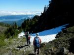
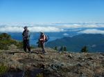
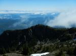
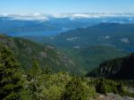
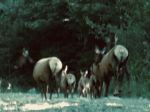
Quite a few people wanted to go on the Mt. Kitchener hike then couldn’t make it for a wide variety of reasons. So at the last moment, the trip went ahead with only three. We can report that the road up does not have waterbars, so any vehicles with four-wheel drive, good clearance, and good tires should be able to make it. On the way up we had a special treat of seeing a herd of elk, seven with three young ones and another, smaller group higher up. The trail is in good condition, although there is a section of large windfall to go around at the start.
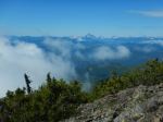
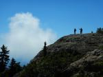
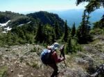
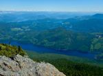
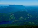
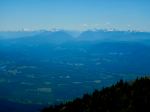
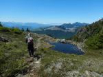
There was some morning cloud, especially in the north, and we parked just above the clouds, which went away as the day warmed up. After the first steep ascent on to the ridge, we hiked along the ridge to the Mt. Kitchener summit, where the communication infrastructure had been removed since our last visit. We had excellent views all around, looking over Johnstone Strait and up Loughborough Inlet to Mt. Waddington. We stopped for lunch before descending and then made the short climb to Mt. McCreight, with more views to the south. We had excellent weather and took our time to enjoy the hike. (4.3 km; 4.25 hours; 475 m elevation gain)
Norris
(click on photos to view larger)
- Roosevelt Elk
- Victoria Peak
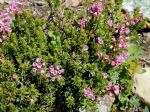
- Heather
- At the Mt. Kitchener summit
- View toward Nodales Channel
- Mt. Waddington
- Mt. McCreight
- View toward Mt. Menzies
- View toward Strathcona Park
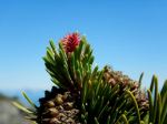
- Lodgepole pinecone and needles
Trip Report – Kay Dubois Loop – 19 June 2024
Our hike on the Kay Dubois trail was a lovely, cool forest-bathing-ish treat on a warm summer morning. We started at the Fox Road entrance and walked on the woodlot road to the trail head at the end of Sutil Road. When we got to the bottom of the hill, we made a few beach-viewing stops to enjoy the view. The understory growth was phenomenal from all the rain we have had. We continued on to the giant witchy spruce tree, headed up the hill on the Hansel and Gretel walk and made it back to our starting point with no nibbled body parts. (5.7 km; 1¾ hours)
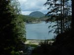
- View of Sutil Channel
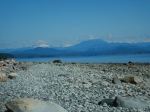
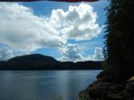
- View toward mainland mountains
- Horsetail
- Low tide
- The wtichy spruce tree
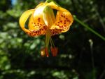
- Columbia lily
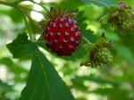
- Salmonberry
Hiking – Eagle Crag Loop – 31 July 2024
The meeting location has changed! The “Difficulty” has been updated.
| Activity | Hiking |
| Destination | Eagle Crag Loop |
| Date | 31 July 2024, Wednesday |
| Trip Coordinator | Norris Weimer |
| Contact Info | norris.weimer@ualberta.ca; 3710 |
| Description | Starting at the Chinese Mtn parking lot, we will follow the south side trails and then the climbing access trails to Eagle Crag. This ascends quite steeply and has amazing views. From there, we will follow a flagged route which connects with the Beech’s Mtn trail, bringing us back to the parking lot. |
| Meeting Place | Meet at the coordinator’s driveway |
| Departure Time | 10:00; we will start earlier if it is hot |
| Difficulty | Challenging for a few sections of scrambling. This is not very long and not a lot of elevation gain, but the trail is rough and the route involves steep places and no path. |
| Costs | None |
| Trip limits | 10 |
| Dogs? | No |
| Notes: | We will not do this trip in poor weather |
Hiking – Century Sam – 13 July 2024
Updated!
| Activity | Hiking |
| Destination | Century Sam Lake |
| Date | 13 July Saturday; this date is still somewhat tentative for weather and for Mosaic’s announcement on Thursday about the gate opening. |
| Trip Coordinator | Norris Weimer |
| Contact Info | norris.weimer@ualberta.ca; 250-285-3710. Please let the coordinator know if you are interested by Wednesday, 10 July. |
| Description | This trip is hard to schedule because it needs good weather and the access is through a gate which is only unlocked for 12 hours on Saturday and on Sunday. Once passed the gate, the access is via a logging road which eventually has water bars. The hike itself is on a heavily used, but not really maintained trail. The creek crossings are on logs. To the lake is about 8.3 km (return) and 400m elevation gain; to the ice caves is about 13.6 km (return) and 570m elevation gain. The hiking time may be about 7 hours. The trail will likely be very busy. |
| Meeting Place | QCove ferry terminal |
| Departure Time | 7:00 am ferry |
| Difficulty |
Challenging for the length of the day, elevation and altitude gain. |
| Costs | Ferry, shared fuel costs. |
| Trip limits | Limits may depend on the vehicles going. |
| Dogs? | No |
| Notes: | We will not do this trip in poor weather. This is a long day. Come prepared for mountain conditions. |
Kayaking – Gowlland Harbour – 10 July 2024
| Activity | Kayaking and social |
| Destination | Gowlland Harbour |
| Date: | 10 July 2024, Wednesday |
| Trip Coordinator | Les Hand |
| Contact Info | lhquadra@gmail.com or 250-285-2029 |
| Description | This will only be a one and a half to two hour paddle followed by a social hour on the deck at my house. I will provide appetizers. Depending on current and weather we may go around Gowland Island otherwise we will just stay around the southern part of Gowland Harbor. Because of this please bring a spray skirt and all necessary equipment mandated by the Coast Guard. If it is more than showers the date will be changed. |
| Meeting Place | 1157 West Rd |
| Departure Time | Meet at 10:00; Leave at 10:30 |
| Difficulty |
Moderate |
| Costs | None |
| Trip limits | 12 |
| Dogs? | No |
| Notes: | Only one vehicle at a time can come down the hill so be on time. I have permission to park vehicles at the landlords house. From there it is a steep concrete driveway with a switch back involved. You will need to be able to back up with your mirrors to get down close to the water. Otherwise you will park up above and we will use two people to carry the kayaks down. When you sign up I will explain more as it will not be that hard. |
Trip Report – Surge Narrows Trail – 5 June 2024
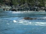
Eight of us and a dog car-pooled out to the very full parking lot at the end of the Surge Narrows road. We had a quick look at the dock and offered assistance to two locals but it appeared the outer islanders are very independent. We then headed back up the steep hill to start our hike north.
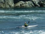
At our first stop we watched the flood tide push through the narrows and saw a kayaker successfully navigate the rapids. We continued on the unmaintained route a little further north and had a relaxing lunch. We watched the tide come in a little with more spectacular views of the rapids and a brief viewing of the intertidal life, mostly sea stars. Then it was time to head back and enjoy the great hiking weather and get back to the parking lot. Some over ripe oyster mushrooms along the trail and a hint of huckleberry season is coming.
The trail is well kept with evidence of some bridge repair but one bridge is definitely on the watch list but easily traversed. Wild life was at a minimum except for one eagle diving for fish. A short hike but a very enjoyable hike. (4.3 km; 2¾ hours)
Neil
- The boat launch
- Surge Narrows dock
- The recent bridge
- The viewpoint on the Narrows
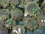
- Green sea urchin
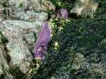
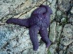
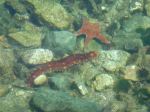
- Ochre sea stars
- Ochre sea star
- Moon snail cases
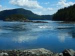
- Rapids on the flood
- Farah cooling off
- Sea cucmber and leather star
- Back through the cedars
Hiking – Mt. Kitchener – 3 July 2024
Due to some issues around this trip, please stay in touch with the coordinator.
| Activity | Hiking |
| Destination | Mt. Kitchener |
| Date | 3 July 2024, Wednesday |
| Trip Coordinator | Norris Weimer |
| Contact Info | 285-3710 or norris.weimer@ualberta.ca. Please contact the coordinator by Monday evening. |
| Description | Mt. Kitchener is located northeast of Campbell River and south of Sayward in the Prince of Wales Range. The summit is 1,457m, but fortunately the first 1,000 m can be driven up, leaving about 500 m elevation gain. The trail begins steeply through the forest and after a short scramble emerges onto a sub-alpine ridge. As the the ridge gains height, the views appear on all directions. We will visit Mt. McCreight (1,419 m) with some remembrances of the military plane crash from 1950. We will continue on to Mt. Kitchener, but not visit the crash site. |
| Meeting Place | Q Cove Ferry terminal. |
| Departure Time | 8:00 ferry. If the weather is very hot, we may go earlier. |
| Difficulty |
Challenging, but not very long |
| Costs | Shared ferry and fuel costs |
| Trip limits | 10 |
| Dogs? | No |
| Notes: | This trip will require 4-wheel drive vehicles with some clearance. We will not do this trip in poor weather. Bring lunch and water. |
Hiking – Kay Dubois Loop – 19 June 2024
| Activity | Hiking |
| Destination | Kay Dubois Loop |
| Date | 19 June, Wednesday |
| Trip Coordinator | Kathy Sales |
| Contact Info | lilsuzyh@hotmail.com, 250-285-3693 or 250-314-4055 |
| Description | We will start at the end of Fox road and head down into the woodlot, turning at the “Hansel and Gretel” trail down to the beach. We will continue on the Kay Dubois trail up to the end of Sutil Road, then return to Fox on the woodlot road. |
| Meeting Place | End of Fox Rd |
| Departure Time | 10:00 |
| Difficulty |
Easy, with a few steeper parts |
| Costs | None |
| Trip limits | |
| Dogs | |
| Notes: |
Trip Report – Ripple Rock Trail – 29 May 2024
Three of us caught the 9:00 am ferry to Campbell River and when we reached the parking lot at the trailhead only one other car was there.The weather was typical west coast Spring with patchy clouds, sunshine and rain in the distance.
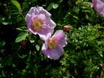
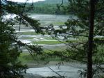
On the way to Seymour Narrows there are several viewpoints with excellent views of Menzies Bay with log booms and other watercraft. With the recent rain all the new growth was spectacular with thimbleberries in bloom, salmonberries ripening and all the variety of ferns and other plants we are learning to identify. There are several bridges over rushing creeks with many wire covered wooden structures over wet areas. The trail overall is easy walking with some uphill stretches that require careful stepping due to rock outcroppings. One set of stairs had a broken step, which hopefully will get repaired soon, as we did meet a maintenance crew trimming the new growth along sides of the trail.
The view at Seymour Narrows overlooking where Ripple Rock was blasted is striking as you can see up and down the Narrows for quite a distance with good views of Quadra Island. At the bluff viewpoint a large group of school age kids where just finishing their lunches before heading back on the trail before us. On the return hike it started to sprinkle so jackets went back on. With the rain and the group ahead of us the trail seemed more muddy from when we came out. By the time we reached the parking lot the sun came out with blue skies as we headed back and caught the 3:00 pm boat to Quadra. All and all a very enjoyable hike. (8.8 km 4 hours with lunch stop)
(click on photos to enlarge)
- The big Spruce
- Menzies Bay
- Penstemon
- Wild Rose
- Arnica
- South through Seymour Narrows
- Low tide
- Horsetail and fern