| Activity | Kayaking |
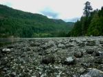
| Destination | Open Bay to Village Bay |
| Date | 10 July, Monday |
| Trip Coordinator | Valerie Van Veen |
| Contact Info | 250 285 2329 vvv@qisland.ca 778 242 5774 |
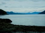
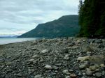
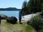
| Description | July 10 is the perfect day to launch from the Open Bay area with a higher tide throughout the day. This will be a gentle paddle to explore the Bretons, go through Moulds Bay and the Pass with the high tide allowing us passage, then on to Village Bay. We can go further afield if the group wishes, to Bold Island and possibly over to Dunsterville and surrounding islets. We have seen Humpbacks out in the Channel so we may be lucky on this trip. |
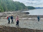
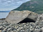
| Meeting Place | Launch will be from the low gravel beach at a member’s home close to Valdes Beach. Meeting point address and instructions will be given to Club members when they sign up for this trip. |
| Departure Time | Meet at 9:30 am, on water by 10:00 |
| Difficulty |
Moderate |
| Costs | None |
| Trip limits | None |
| Dogs | |
| Notes: | Must have ocean kayaks with all Transport Canada required safety equipment. Trip is weather and wind dependent. Only signed-up participants will be contacted of any changes in plans. MUST sign up by Saturday evening, July 8. Bring lunch, water. |
Kayaking – Open Bay to Village Bay – 10 July 2023
1