Trip Report – Morte Lake Loop – 9 June 2021

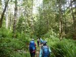
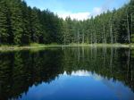
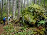
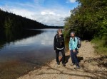
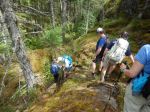
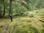
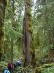
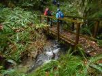
The hike around Morte Lake is a familiar classic to many of us. There have been lots of changes in the past two years so this hike gave us an opportunity to experience some of those changes. Volunteers have been busy creating alternatives to trail sections that were wet or seriously eroded.

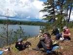
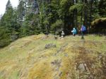
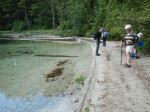
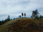
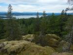
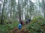
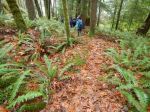
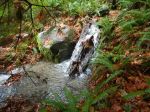
In spite of grizzly bear sightings and a rainy weather forecast, seven of us met at the Morte Lake parking lot and set off under sunny skies. We hiked counter clockwise, stopping for a snack on a bluff overlooking the lake. It started to rain lightly as we ate our lunch at the sandy beach on the south end. We returned to the parking via lower Deadfish Trail. It was a great to spend the day hiking and chatting with new people after so many months of isolation.

4 hours total (with snack & lunch stops) 9.5 km

Diana
 
Thanks to Diana and Norris for the photos
 

(click on photos to enlarge)


Hiking – Morte Lake Loop – 9 June 2021


Summer Planning Meeting – 20 June 2021

Activity Summer Planning Meeting
Date 20 June 2021, Sunday
Coordinator Debbie Quigg
Contact Info qioutdoorclub@gmail.com for inquiries
Description The planning meeting we normally have inside the Community Centre, will be held outside.  We will review the recent Club experiences, likely future scenarios for the summer, but primarily we will be working to construct a summer schedule.
Bring your own chair and gear for weather.
Meeting Place Community Centre Ball Park
Meeting Time 3:00

Trip Report – South Heriot Ridge Loop – 2 June 2021

This  was the first Club outing since Dr. Bonnie Henry re-opened adult outdoor sports in British Columbia.  It was great to go out with a group again.  The six of us first talked a bit about work that has been done documenting the geology, plants, animals and Indigenous history in this area.  We started out on the Homewood Camp trails leading to the first and most easterly bluff with views to the south and east.  We descended and continued on to Homewood Bluff for more views.  After a brief section off-trail we followed a forest trail leading to a short, steep ascent and High Bluff.  We stopped for lunch, then descended and made our way westerly across open mossy bluffs below the Citadel.  We climbed up a line to the plateau on the Citadel and visited the emergency communications tower with entirely different views to the northeast.  It was quite warm and humid, so we vegged out a bit on the helipad before continuing along the ridge and joining the Hopespring trail.  This trail led us to North Gowland Trail and then the Isle of 19 old growth Douglas firs.  We admired these survivors of the 1925 fire before crossing the small bridge, and again out onto mossy bluffs.  We followed a good line down to a forested logging road, where a Barred Owl sang to us, and a then short trail section leading back to North Gowlland Trail.  From there we walked east back to the vehicles.  7.7 km; 4¼ hours.

Debbie
 

(click on photos to enlarge)

Hiking – Homewood and N Gowlland Trails – 2 June 2021


Hiking – Morte Lake Loop – 9 June 2021

Activity Hiking
Destination Morte Lake Loop
Date 9 June 2021, Wednesday
Trip Coordinator Diana McKerracher
Contact Info diana@gicable.com  285 3204.  Please contact coordinator by Monday June 7
Description An easy 9 km hike on established trail all the way around Morte Lake. 4-5 hours with breaks and a possible swim.
Meeting Place Morte Lake parking lot; (allow 15 minutes to drive from Heriot Bay store)
Departure Time 10:00
Difficulty
Easy to moderate.
Costs None
Trip limits 10 participants
Dogs? Okay, if under control at all times
Notes: Bring lunch and swim gear.
Covid protocol in effect.

Hiking – Homewood and North Gowlland Trails – 2 June 2021

Change of meeting location!

Activity Hiking
Destination Homewood and North Gowlland Trails
Date 2 June 2021, Wednesday
Trip Coordinator Debbie Quigg
Contact Info 285-3710 or debbie.quigg@ualberta.ca.  Please contact the coordinator by Monday.
Description We will hike to three bluffs off of Homewood trails before climbing up to the telecommunications tower on Heriot Ridge.  From there we will descend to North Gowlland trail to visit some old trees and open bluffs.
Meeting Place Community Centre parking lot
Departure Time 10:00
Difficulty
Moderate.  Some steep sections, wet sections.  We will follow maintained trails, unmaintained trails and routes.  About 8 km; 4.5 hours with lunch.
Costs None
Trip limits 10 participants.  If you RSVP for this trip, please commit to coming as others may be excluded by the cap on trip participants.
Dogs?
Notes: Bring lunch and gear for weather. COVID protocol in effect.

Trip Report – Shellaligan Pass Loop – 18 Nov 2020

In damp, cloudy weather, eight hikers enjoyed our first “Hot Chocolate” hike of the season, perambulating the beautiful Shellaligan inland loop clockwise. We set off from the first parking lot from the turn off from Valdes Road, a good decision in retrospect as the logging road was blocked further on by downed trees from the previous day’s windstorm. The first part of this loop is on good logging roads, watch for signage for the turn-offs. Soon we turned right off a wide logging road, onto the trail, this turn easily missed so now marked with extra orange flagging tape. We followed this lovely, easy trail through a veritable sea of green, alongside a very full creek, to the shore. Here we admired the “neurotic sapsucker tree” and noted the collected marine debris awaiting pick-up. Soon reaching the trail sign a bit inland, we headed back on the “shortcut to parking lot” to the “middle” parking lot, turning right onto the logging road back to our cars. Just under 2 hours, good exercise, good company, home by the fire by early afternoon, a great first “Hot Chocolate” hike. 4.9 km; 1½ hours.

Thank you to Norris for the photos!

 
Valerie van Veen
 

(click on photos to enlarge)

Hiking – Shellaligan Pass Loop – 18 Nov 2020


Hiking – Shellaligan Pass Trail – 18 Nov 2020

Activity Hiking
Destination Shellaligan Pass Trail – Land Loop
Date 18 Nov, Wednesday
Trip Coordinator Valerie van Veen
Contact Info 250 285 2329; vvv@qisland.ca
Description This is a “Hot Chocolate” Hike:
South end hikers … meet at Heriot Bay store at 10 AM if carpooling or want to convoy together.  Otherwise meet co-ordinator at turn off to logging road (trail access road) on Valdes Road at 10:20 am. We will drive to the first parking lot (on the left, marked with a trail sign). We will follow the land loop around to the second parking lot, walk back on the logging road to our cars.
Meeting Place Heriot Bay Store at 10:00 or Valdes Road at 10:20.  See trip description.
Departure Time See trip description
Difficulty
Easy
Costs None
Trip limits 10, following Club Covid protocols
Dogs? Must be in full control, or on leash.
Notes: This is a Hot Chocolate hike; we may stop briefly for a Snack break or continue on. About 2 hours. If rain, sections could be a bit muddy.

Kayaking – Maud Island – 25 Nov 2020

This trip has been suspended due to additional COVID restrictions

Activity Kayaking
Destination Maud Island
Date 25 Nov, Wednesday
Trip Coordinator Vic Gladish
Contact Info 250-285-2111; cell 250-287-0459
Description We will put in at 1000 at the Leishman Road shore access just north of Copper Cliffs. There is parking for a few cars and a rocky beach. Staying close to shore, the plan is to paddle north to Maude Island and/or the Saltwater Lagoon. The trip is about 8 km each way (16 km round trip). The lagoon entrance is passable at certain tide levels so will be an on the spot decision whether to explore or not.
Meeting Place Shore Access Copper Cliffs – Leishman Road
Departure Time 1000 on the water
Difficulty
Moderate – distance, currents, weather
Costs None
Trip limits 6
Dogs? no
Notes: The tide will be against us but it is a time of neap tides so currents shouldn’t be so strong. Participants should be open to trip revision once the forecast for that week is more relevant – i.e. lets be open to a Monday, Tuesday or Thursday with better weather.
All participants must be equipped for ocean paddling in November – required equipment as per club guidelines (https://qioutdoorclub.org/wp-content/uploads/2018/07/paddling-guidelines-aug2018.pdf) and appropriate clothing.
Bring lunch, hot drinks, extra warm layers and something to sit on.

Trip Report – Kw’as Park, Cortes – 11 Nov 2020

We were a group of four on the Remembrance Day hike to Cortes Island.  The ferry was uncrowded and the crossing calm.  We began the hike at the trailhead near the Cortes Island Motel and walked through this beautiful rainforest.  We ascended up toward the Summit and then along the Millennium Trail undulating over rocky bluffs through some old growth trees.  We had views of Hague Lake before we reached the Swim Rock, where we stopped for lunch.  The water and the weather were calm, and we chatted with a local woman who was fishing from her kayak.
 
We continued on the trail high along the shore with great views and descended the ladder along the Rock Face.  We made a short side trip to visit the Survivor Fir, which we measured as 7.9m in circumference.  We crossed the bridge across the narrow waterway between Hague and Gunflint Lakes and walked the loop to the south, including Pierre de Trail and the Cedar Ridge.  We also enjoyed the large Douglas fir at the junction, which we measured as 8.35m in circumference.  We returned over the bridge and walked the trail along the west shore of Gunflint Lake, with great views along the way and the steam donkey remains.  We continued on through the Spruce Grove and returned to the vehicles.  
 
It was a great hike with lots of variety and highlights.  The trail was very quiet at this time of year.  After the hike we stopped at the Cortes Coop for delicious refreshments before taking the ferry home.  8.9 km, 4½ hours.
 
Debbie
 

(click on photos to enlarge)

Hiking – Kw’as Park, Cortes – 11 Nov 2020

Reconnaissance Report – Snowden Forest – 6 Nov 2020

Having now hiked the Lost Lake area three times, I was really keen to check out the trails further west,  particularly “Lookout Loop” and “Enchanted Forest”.  Armed with an old Ministry of Forests “Forest Recreation” map and the more recent coloured map, I headed out with my daughter and her dog on a lovely crisp fall day. We passed the Lost Lake parking lot, and the Riley Lake parking turn-off shortly after, and using the Ministry map (the coloured map has a logo right over the relevant section) we found the turn-off to the Elmer Lake parking lot, as marked on both maps. However, though marked as an almost straight north logging road, this quickly became a network of logging roads, with no signage anywhere. The northerly route eventually turned into a narrow, unmaintained quagmire, unnavigable if we hadn’t been in my daughter’s Honda Ridgeline. Obviously, this access route would be impossible for club members. We tried a few more logging roads that quickly opened out into recent clear-cuts with signs of active logging. Most regretfully, we turned around and headed back into more familiar territory.

We turned off at the sign to the Riley Lake parking lot, a bit further west of the more popular Lost Lake parking lot. Finally on foot, we headed up the Riley Lake trail. We soon came to a map which outlined the very area that we had been trying to access, now off-limits as active road construction and logging is presently underway there. So that explained the lack of any signage. To avoid the logging, the northern stretch of Riley Lake trail is being redeveloped, it is wide and with a good dirt base, easy walking. Eventually as Riley Lake trail turned west then SW, it became a narrow trail off the developed pathway, (not signed, used our compass and common sense). We followed the narrower trail to Pepper Spray (signed) to a T-junction with Cheshire Cat. Here the signage was very confusing. The right hand branch was signed “Out” but this would lead, eventually, to the very parking lot we had tried to find earlier, and would be in the closed area. Ignoring the “Out” sign, we went SE on Cheshire Cat, which came down to a clearing off the main road. We decided to follow Cheshire Cat back north, then took Oggies right back to our truck. Altogether about 2.5 hrs without a rest stop, easy to moderate hiking through beautiful woods. The short drive to the Riley Lake parking lot is a little rough, I think the Trimac trail links the Riley Lake trail to the Lost Lake parking lot, which would be more convenient. Definitely another hike to do in the beautiful Snowden Forest.

Valerie