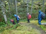
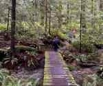
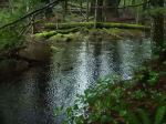
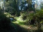
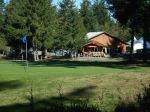
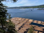
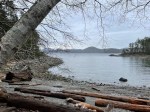
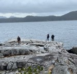
There had been no rain for three days so nine hikers, including a new member, and one furry friend, had all of the Shellaligan trail system open to us. We opted to park at the first lot as the logging road deteriorates further on. We walked down this road, paved with huge fallen broadleaf maple leaves, to reach the beach trailhead. This small corner of Quadra is mixed deciduous though most of northern Quadra is coniferous forest. We took time to enjoy the ocean views from the various bluffs, stopping for lunch where the trail comes down to the beach. The oyster farm is active again, we hailed the two fellows harvesting the farm. Bird sightings included a large flock of Goldeneyes and a few Grebes. At the Haiku Corner we enjoyed the written contributions of hikers more inspired than us. This is also the junction with the short or long circuits; two of our hikers opted to go back via the short route. The rest of the group continued on the long route, which can euphemistically be described as “undulating”, following the creek uphill through the beautiful mixed forest.
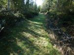
Shellaligan trails had been closed earlier in the year due to logging. We encountered the new clear cut near the end of the route. Logging in this area over the years has made trail-finding on the long route somewhat challenging as old landmarks are erased. For future hikes on the long route, going counter clockwise…when the forest trail first meets a logging road turn left, and left again at the T junction with the next logging road. There is a signpost high up in the trees for those going in the clockwise direction. Follow this road uphill and look for the trail marker on the right, follow this trail past the clearcut (as of November 2025) to the logging road. Turn left and it is a short walk back to the first parking lot. (7.5 km, 3¾ hours)
Valerie van Veen
Thanks to Les and Norris for the photos
(click on photos to enlarge)
-

-
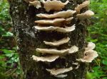
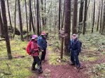
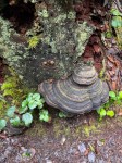
Giant, rotten tree
-

-
-
-
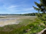
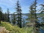
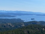
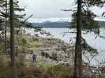
Looking south to Sutil Channel
-
-
-
-
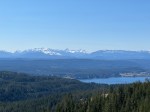
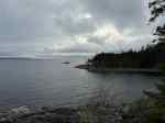
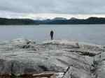
Hoskyn Channel
-

-
-

-
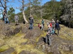
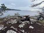
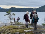
Reading some Haiku
-

-
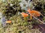
Vermillion waxcap
-

-
-
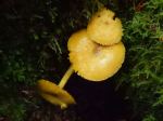
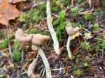
Elfin Saddle
-

Hiking – Shellaligan Loop – 19 Nov 2025