Trip Report – Plumper Bay – 22 July 2020

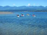
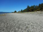
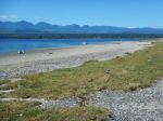
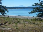
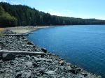
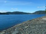
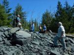
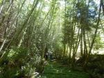
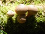
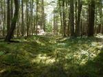
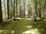
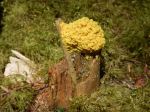
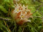
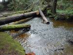
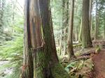
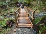
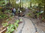
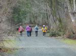
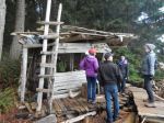
Seven of us and one dog hiked to Plumper Bay.  The day was clear and sunny.  We hiked through the forest, with just the right amount of shade.  In the first part of the route follows the Maud Island Trail, where the forest ground cover is beautiful moss.  The second part of the route is an old road, possibly built for the Seymour Narrows blasting in 1958, as well as for logging.  The road bed is still in great condition, although littered with dead branches.  The lunch stop is where that road comes out in Plumper Bay, on the north shore.  We sat by the water in the shade with a gentle breeze.  After picking up some garbage, we headed back.  The group was up for a little adventure, so we took an old logging road which had reverted to wonderful deep moss.  We made our way through the forest back to the Maud Island Trail and the cars.  7.0 km, 3¼ hours.

– Norris

Thanks to Norris and Les for the photos

(click on photos to enlarge)

Hiking – Plumper Bay – 22 July 2020

Hiking – Plumper Bay – 22 July 2020

Activity Hiking
Destination Plumper Bay
Date 22 July, Wednesday
Trip Coordinator Norris Weimer
Contact Info norris.weimer@ualberta.ca or 3710.  Please contact the coordinator in advance.
Description A relatively flat and easy hike on old logging roads. The first part is the same as for going to Maud Island, then instead of turning left, we turn right. This part of the trail has not been maintained, yet it is in quite good shape. There is no bushwacking, not even any major deadfall. However, the trail does have some tripping hazard from small branches that have fallen across the trail. 6 km roundtrip, about 2.5 hours including lunch. The destination is a nice grassy meadow on the waterfront of Plumper Bay (the first large bay north of Seymour Narrows). Bring lunch. Bring family radios if you have them (FRS); no problem if you don’t. This is not a narrow trail, we will easily be able to space ourselves to keep covid-safe.
Meeting Place Heriot Bay Tru Value parking lot; we will convoy in our cars from there.
Departure Time 10:00
Difficulty Easy, but part of the route is unmaintained
Costs none
Trip limits Maximum twelve participants, in pods of three or four.  The number of cars is a concern as well as group size.
Dogs?
Notes: Bring lunch.

Trip Report – Drew Creek and Harbour – 26 Feb 2020

Nine of us took a stroll around the new Drew Creek loop on the We Wai Kai reserve starting at the stream renovation done by the Salmon Enhancement Society, then on to the new foot bridge put in by John Barclay and other volunteers.  We continued through the campground, which is quiet in February, and on to the memorial and beachwood shack at Paddy’s Lagoon.  There were lots of interesting things to explore along the way.  We walked back along the shore and stopped to admire Alex Witcombe’s driftwood Sasquatch sculpture. 

Five of the group continued into Rebecca Spit Marine Park, stopped for a snack and walked the trail to the end of the Spit.  It was a cold, dark day with a bit of southeast breeze, but the rain held off.  11.1 km, 3½ hours.

– Norris

(click on photos to enlarge)

Hiking – Drew Creek and Harbour – 26 Feb 2020

Hiking – Drew Creek and Harbour – 26 Feb 2020

Activity Hiking
Destination Drew Creek and Harbour
Date 26 Feb 2020, Wednesday
Trip Coordinator Norris Weimer
Contact Info norris.weimer@ualberta.ca or 3710.
Please contact the coordinator in advance.
Description A short easy walk.
Meeting Place Heriot Bay Tru Value parking lot
Departure Time 10:00
Difficulty Easy
Costs None
Trip limits None
Dogs? Okay, if they do not run through the group.
Notes:

Trip Report – Surge Narrows Logging Roads – 29 Jan 2020

Changeable weather at its best.  Leave home in winter wind and rain, and arrive at the trailhead in sunny spring.  We did delay the hike by a few minutes, to allow the weather to get over it, by visiting the old Union Steamship dock at Bold Point.  The steamships stopped running in 1953.  The dock was built sometime after 1901.  The dock itself is gone except for the concrete part.  The bridge is still there.

Six of us hiked an old logging road from the Bold Point Rd over to the Surge Narrows Rd.  The route rolls gently through some fine forest.  Then we had lunch at Mine Lake (very high water level!).  We walked the Surge Narrows Rd south to join another logging road back to the Bold Point Rd and make a loop.  This last section took us by a sunny knoll and a wetland meadow with a pond and a bufflehead duck.  7.1 km, 2½ hours.

– Norris

(click on photos to enlarge)

Hiking – Surge Narrow Logging Roads – 29 Jan 2020

Hiking – Surge Narrows logging roads – 29 Jan 2020

Activity Hiking
Destination Forested area east of Mine Lake
Date 29 Jan 2020, Wednesday
Trip Coordinator Norris Weimer
Contact Info norris.weimer@ualberta.ca or 3710.
Please contact the coordinator in advance.  With the winter weather, stay in touch with the coordinator.
Description We will leave from near the Mine Lake access and walk logging roads through a woodlot.  The roads are relatively flat.  There may be wet areas.
Meeting Place Heriot Bay Tru Value parking lot
Departure Time 10:00
Difficulty Easy
Costs None
Trip limits None
Dogs? Okay, if they do not run through the group. This is wolf habitat.
Notes: Bring lunch and gear for the weather.

Trip Report – Open Bay Trails – 1 Jan 2020
Instead of a New Year’s paddle (postponed due to weather forecast) seven hikers got together on the first day of 2020 to explore the trails and roads of Open Bay with a local guide – Val – followed by lunch and socializing at the Van Veen residence.

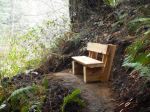
The day started out with outstanding weather – calm, dry and sunny breaks – and we took great advantage of it with nearly a three hour walk, some on the road and several legs through the beautifully sunlit forests that rim Open Bay. We stopped briefly at the beach access at the end of Valdez Rd where we enviously watched a lone kayaker crossing the mouth of Open Bay on the glassy calm water. We again accessed the water at the other end of the bay with a hike down the forested switchbacks to Big Bay and the We Wai Kai Reserve #8. None of us took a polar bear dip into the chuck and the tide was too high to walk the beach back to Valerie’s so we made our way back up to the road and to our indoor lunch spot complete with fabulous view and fresh hot coffee! We had a great vantage point to watch the weather deteriorate quickly into another winter storm. Thank you to our hosts.

And our day wasn’t over yet! We made a stop along Valdez Road and walked less than 100 m off the road into a spectacular grove of old growth Douglas Firs. Another hidden gem on Quadra Island.  8.5 km, 2¾ hours.

Vic

(click on photos to enlarge)

Hiking – Open Bay Trails – 1 Jan 2020

Hiking – Open Bay Trails – 1 Jan 2020

Activity Hiking
Destination Open Bay Trails
Date 1 Jan 2020, Wednesday
Trip Coordinator Vic Gladish and Valerie Van Veen
Contact Info vicgladish@gmail.com or 2111
Description A New Year’s day social walk in the Open Bay area, including Big Beach.  After walking we will go to Valerie’s house to socialize and eat our lunches out of the rain.
Meeting Place Heriot Bay store parking lot to carpool. Parking is limited
Departure Time 10:00 am
Difficulty
Easy
Costs none
Trip limits 12
Dogs? No
Notes:


Trip Report – Lighthouse Trails – 11 Dec 2019

Plan B was substituted due to weather.  Eight of us spent a couple of hours hiking the trails from Cape Mudge lighthouse, first to the north along Discovery Passage and then along the Cape Mudge shoreline with a loop into the forest and back to Tsa-Kwa-Luten.  We had lunch back at Julie and Randy’s house.  We didn’t get wet, just a bit blown around on the Cape Mudge bluffs.  7.5 km, 2 hours.

Julie

Thanks to Norris and Cyndy for the photos

(click on photos to enlarge)


Trip Report – Haskin’s Farm & Environs – 20 Nov 2019

On a sunny, cold morning 13 hikers and 3 dogs set out on the very familiar (to most) Haskin’s Farm trail. After quickly arriving at the beach and enjoying the mid-fall sunshine it was decided that we would visit the big trees along the beach trail, ascend to the top of the bluff and then explore the new trails. We forest bathed under the big Douglas firs then back-tracked to the switchbacks, regrouped and headed along the new trail that skirts the bluff, checked out the man made pond that is part of the new Golf Club development, walked the new trail through the future subdivision and eventually sat down for lunch at the clubhouse picnic tables and basked in the sunshine. Several hikers headed back to their cars and several headed around the golf course, bushwacked for 10 minutes, regained the Haskin’s Farm logging road close to the Todd’s Trail sign, and finished off our 3 hour outing. The new trails are a welcome addition to this classic Quadra hike. 8.5 km, 3 hours.

Vic

(click on photos to enlarge)

Hiking – Haskin’s Farm Loop – 20 Nov 2019