| Activity | Naturalist outing |
| Destination | Quadra’s Karst formations |
| Date | 21 March 2015, Saturday |
| Trip Coordinator | Richard Leicester |
| Contact Info | 285-2663; please contact the coordinator by Thursday if you are interested in going |
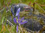
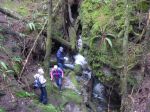
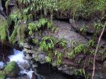
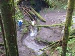
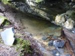
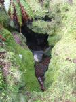
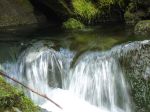
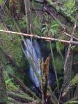
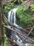
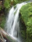
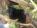
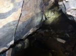
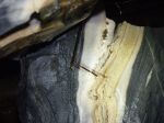
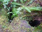
| Description | Visit some of Quadra’s Quatsino limestone formations, an area which contains karst sinkholes, intakes, resurgences and underground streams. We will visit two or three areas, which involves a bit of driving on logging roads and bush walking. We will not be walking in caves. |
| Meeting Place | Heriot Bay store parking lot for car pooling. High clearance vehicles will be preferable. |
| Departure Time | TBA |
| Difficulty |
Easy to moderate |
| Costs | none |
| Trip limits | none |
| Dogs? | no |
| Notes: | Bring lunch and gear appropriate for the weather. Also, bring a flashlight to see into these geological formations. |
Category Archives: easy
Trip Report – New Thompson Trail Loop 30 Dec 2014
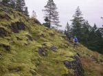
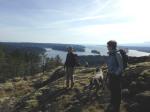
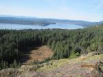
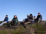
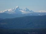
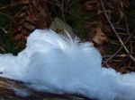
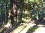
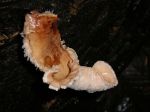
The group of eight met up on a beautiful, cold day to hike a loop consisting of official and unofficial trails, new and old logging roads. We hiked in from the Thompson trailhead to the recently renovated B&B trail. We took this briefly until it is crossed by a new logging road which we followed as it passed by some great mossy bluffs and occasional views. After a few junctions we took a left-hand turn onto an old logging road and then turned left again on the Gowlland Harbour trail. A few in the group took a side-trip down a mountain bike trail, but we all met up for lunch on Rousseau Ridge. The sun and the views were great. We continued on the Gowlland Harbour trail making a side-trip to the old growth grove, which is always impressive. We returned to the Thompson trail making our way back to the cars. 9 km, about 3 hours.
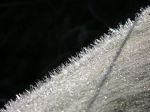
- Frost
- Briar
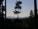
- Mt. Victoria
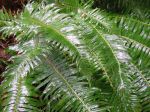
- Angle Hair
- Old growth fir
(click on photos to view larger)
Trip Report – Kay Dubois Loop – 17 Dec 2014
At the last minute, the destination was changed for the convenience of the participants. The forecast called for rain, but it held off until later in the day, though the forest was definitely saturated. We started at the entrance to the woodlot on Cape Mudge Rd and walked logging roads until we met up with the trail to the beach. We continued on the trail north along the shore and then up hill at the big sitka spruce tree. We returned to the cars following logging roads. Two hours.
- mushroom
- Sutil Channel and islands
- fast-moving water
(click on photos to view larger)
Trip Report – Shellaligan Loop 29 Nov 2014
Six people and a dog hiked the bigger Shellaligan Loop, beginning at the parking closest to the water, counter-clockwise. It was a beautiful, cold, clear day with a bit of north wind. This hike took us over rocky bluffs with great views and then undulated through forest with some old growth and lovely creeks. 7 km, about three hours.
- Mt. Doogie Dowler
- Mt Doogie Dowler
- Village Bay
(click on photos to view larger)
Hike Rousseau Ridge – 10 Sept 2014
NOTE: last minute change of destination and start time!
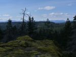
The trip is now going to The Bluff Above Camp Homewood on Mine Lake.
| Activity | Hiking |
| Destination | |
| Date | 10 Sept 2014, Wednesday |
| Trip Coordinator | Norris Weimer |
| Contact Info | 285-3710; please contact the coordinator in advance of the trip |
| Description | There is a trail from Camp Homewood on Mine Lake to the top of the hill behind the camp. It has a great view. We will start from the Mine Lake boat launch. |
| Meeting Place | Heriot Bay Tru Value parking lot to carpool |
| Departure Time | |
| Difficulty | Mostly easy |
| Costs | none |
| Trip limits | none |
| Dogs? | |
| Notes: | Bring lunch. Three to four hours. |
Trip Report – Newton Lake 13 August 2014
The group was undaunted by a few drops of rain at the beginning of the hike into Newton Lake and was rewarded with clearing skies. We had this beautiful and serene lake all to ourselves, but no one went swimming. It was a bit cool and some leeches kept cruising by. After a leisurely lunch and a bit of exploring beyond the second swimming rock, we returned as many others headed up to the lake. 8.9 km; 3 3/4 hours.
- NE swimming rock
- leech
- swimming ledge
- waterfall at the bridge
(click on photos to view larger)
Trip Report – Heriot Ridge Route – 29 June 2014
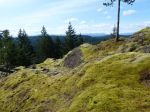
We had eight people on this short hike on short notice. Starting at the end of Hope Spring Road, we hiked up to the east and west viewpoints of Heriot Ridge on a warm, mostly sunny day. We continued north on the flagged route, which undulates through open forest and mossy bluffs. The most unusual naturalist event of the hike was a dragonfly with a bee in its mouth that landed on the trip coordinator’s shirt. The dragonfly did not leave until the bee was completely consumed, even during walking or close-up photography. The meal lasted at least 15 minutes. We returned by the Thompson Trail, with about half the group visiting the northern viewpoint over Hyacinthe Bay, and then following the road back to the cars.
- Heriot Ridge viewpoint
- Dragonfly eating a bee
- scramble up the northern viewpoint
- Hyacinthe Bay
(click on photos to view larger)
Hike Newton Lake – 13 August 2014
(postponed from 19 July 2014)
| Activity | Hiking |
| Destination | Newton Lake |
| Date | |
| Trip Coordinator | Syd Lapan |
| Contact Info | Syd 285-2999 or comoxsyd@gmail.com |
| Description | Lovely hike through the woods to a clear, sometimes cold, lake at the north end of the island |
| Meeting Place | Heriot Bay Store for car pooling |
| Departure Time | 9:00 |
| Difficulty | easy to moderate |
| Costs | none |
| Trip limits | none |
| Dogs? | no |
| Notes: | Bring lunch and snacks. Might want to bring a bathing suit. Small, extra walk could eliminate the need for that. |
Hike Heriot Ridge Route – 29 June 2014
| Activity | Hiking |
| Destination | Heriot Ridge Route |
| Date | 29 June 2014, Sunday |
| Trip Coordinator | Debbie Quigg |
| Contact Info | 285-3710; Please contact the coordinator prior to the trip |
| Description | This hike is a loop following the Heriot Ridge. It first follows the Heriot Ridge trail up to the ridge where there are excellent views to the east and west. The hike then continues on the ridge on a well-used flagged route, not a maintained trail, for about a third of the distance. The route undulates through open forest and bluffs until it joins the Thompson Trail and descends to Thompson Rd. About 2 hours. |
| Meeting Place | Heriot Bay Store for possible car pooling |
| Departure Time | 1:00 |
| Difficulty | easy |
| Costs | none |
| Trip limits | none |
| Dogs? | |
| Notes: |
Trip Report – Wood Duck Lake – 19 June 2014
Despite the forecast for rain and gale force winds later in the day, the group of eight proceeded with this hike to an area not familiar to most of the participants. Taking the second logging road on the right after turning onto North Gowlland road, we parked about a half a kilometre down the road, just past a recently harvested area. The mountain bike trail known as Yellow Mud branched to the left and led to a series of meadows and to Wood Duck Lake. The beaver dam, which had failed a few years ago causing some down-stream damage, was in good repair. There were Mergansers with babies on the lake. We continued on and then up on Play Thing trail to an old copper mining site. Finding the Back Door trail we followed this through open forest until we reached a bluff with views of the Chinese Mountain – Beech’s Mountain ridge. We returned via Dick’s Ride trail, making a small loop. 7 kilometres. The rain and wind held off until we got home.
- beaver dam
- Wood Duck lake
- beaver dam
- Rolf
- track in Google Earth
(click on photos to view larger)