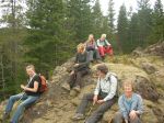
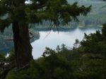
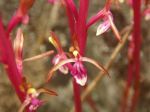
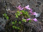
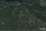
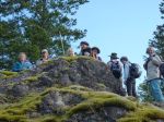
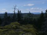
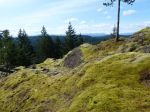
Hiking – Ripple Rock- 26 May 2015

Activity Hiking
Destination Ripple Rock
Date 26 May 2015, Wednesday
Trip Coordinator Julie Mellanby
Contact Info 285-3978; please contact the coordinator in advance of the trip
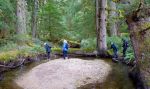
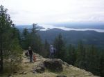
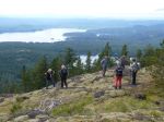
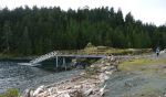
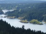
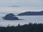
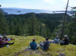
Description We will take the 9:00 ferry and drive north of Campbell River to the trailhead.  The trail has been much improved in recent years.  The Club has not done this walk since the suspension bridge has been replaced.  This is a lovely walk through forest and along the shore, climbing at the end to the western bluff of Seymour Narrows.  There are great views.   About 4 hours.
Meeting Place Q Cove ferry terminal; car pools will be arranged in advance
Departure Time 9:00 ferry; if you are driving, come early as this is a busy ferry
Difficulty
moderate
Costs ferry
Trip limits none
Dogs?
Notes: Bring lunch.


Hiking – Newton Lake, Small Inlet & Waiatt Bay – 17 May 2015

Activity Hiking
Destination Newton Lake, Small Inlet and Waiatt Bay
Date 17 May 2015, Sunday
Trip Coordinator Les Hand
Contact Info 285-2029; please contact the coordinator in advance of the trip
Description First we will drive to Granite Bay and the trail head. The road in to the trailhead is much better due to logging activity. We will hike to Newton Lake and then descend down to Small Inlet. This is the new Heart of Quadra Park area. We will use the portage trail to cross to Waiatt Bay and return via the same route.
Meeting Place Heriot Bay Store for car pooling
Departure Time 9:30
Difficulty
First part easy and second moderate
Costs none
Trip limits none
Dogs? Yes, as long as they will stay by you
Note: Bring a lunch.
Parts of the trail can be wet this time of year.
About 12 km at an easy pace;  about 4-5 hours including driving.


Trip Report – Maud Island – 29 April 2015

The weather forecasts varied wildly, but in the end we had a good day for the hike to Maud Island. The nine of us hiked through the mossy forest and along the old logging road leading to the foot of Mt. Lolo. Even with some cloud, the views were good. We descended the trail down the south bluff, continued through the forest and along the coastal trail to the area north of the causeway where Canoe Pass Tidal Energy Corp. has recently built a dock and rearranged the rocks. The work leading to constructing tidal turbines was not as far advanced as we had expected.

http://www.newenergycorp.ca/Portals/0/documents/case_studies/Canoe%20Pass.pdf

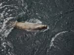
We hiked to the overlook on Maud Island for lunch and were rewarded with sightings of sea lions and a whale (humpback?)  in Seymour Narrows. We returned via the saltwater lagoon. About 4 hours, 10.2 km.

(click on photos to view larger)

Hiking Maud Island 29 April 2015

Trip Report – Mt. Sweat – 22 April 2015

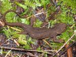
This trip was postponed to the raincheck date, which turned out to be a lovely day. Rolf and Heather welcomed the dozen hikers at their property, and Rolf had lots of information about the history and natural history of the area.   He has the 1890 survey of the property and there are fruit trees from the same period. The group hiked past the Kellerhals’ garden and up through a series of mossy bluffs and intermittent forest to several great 270° viewpoints, extending from the Vancouver Island mountains across the Strait of Georgia (Salish Sea) to the mainland mountains. We had lunch at the Mt. Sweat summit and then descended by the same route until we turned off to the pond/reservoir. Along the way we saw the Sequoia trees in their experimental forest, their garden, beautiful spring deciduous trees, some old growth fir, a hummingbird, sapsucker, tree frog, a newt swimming in the pond, and an unusual worm case. Many thanks to Rolf and Heather for showing us this great area.

(click on photos to view larger)

Hiking Mt Sweat 21 April 2015

Hiking – Noel’s Pizza Peak – 13 May 2015

Activity Hiking
Destination Noel’s Pizza Peak
Date 13 May 2015, Wednesday
Trip Coordinator Norris Weimer
Contact Info 285-3710 or norris.weimer@ualberta.ca; please contact the coordinator in advance of the trip
Description Noel’s Pizza is the informal name for the west ridge of Beech’s Mountain.  It is a great viewpoint overlooking Morte Lake.  It is a flagged route, not an official trail.  There are several different approaches that we can use and a loop is possible.  About 4 hours.
Meeting Place Heriot Bay Store for car pooling
Departure Time 10:00
Difficulty
moderate
Costs none
Trip limits none
Dogs? no
Notes: Bring lunch.  If you use poles, bring them.


Trip Report – Carrington Bay, Cortes – 15 April 2015

Imagine a forest in trust to the children of Cortes Island.

On Wednesday, April 15th, 13 walkers plus one black dog experienced a part of this forest. We took the 9:05 a.m. ferry to Cortes and were met by Andy and Andrew who hosted this walk on behalf of ‘Forest Trust’. Andy Ellingsen began by giving us an overview of the walk in the woods. These forest lands, at the heartland of Cortes Island, are ecologically significant and contain wetland, herbaceous plants, woodland and old growth. We followed the old logging road and onto well marked paths.  Andy took us to the site of an old settlement, the old fruit trees in full bloom. We continued onto Carrington Lagoon, a narrow channel through which the tides flows. We sat and had our lunch in this beautiful area with a number of lovely campsites. From here we continued onto ‘Grandmothers Grove’, a beautiful old growth stand of trees, along side James Creek watershed that supports cutthroat trout & spawning salmon. Andy fed us all so much information on identifying trees and what to look for in trees. His father was a logger in Van Donop region and gave Andy a wealth of knowledge.

We then continued onto the parking area filled with the memory of a small part of northern Cortes Island.

We thank our hosts Andy, Andrew & Christine Robinson for organizing this hike.

(click on photos to view larger)

Hike Carrington Bay – 15 April 2015

Trip Report – Stramberg Old Growth – 1 April 2015

The weather cooperated this time and gave us a nice day for a lovely walk in the woods.  The first leg of this trip heads west along Vic’s Marsh, after that it turns north and heads into  Main Lake Provincial Park.  The trees are plastered with lichens and moss making it an enchanted forest.  There are very impressive trees scattered along the whole walk, including a gigantic white pine, and there are some huge stumps from before this area became a park.  The destination, the old growth grove, has some big trees!  We didn’t think of it, but we should have taken a tape measure so we could say how big they are. We would also like to know how tall they are and how old they are.

The trail and trail flagging is in good condition, other than all the fallen trees that you have to climb under or over or go around, and except for the little loop that goes through the grove.   13.4 km round trip, 5½ hours.  12 hikers.

(click on photos to view larger)

Stramberg Old Growth – 1 April 2015
Hiking Mt Sweat 21 April 2015
 This trip will take place on April 22!

Activity Hiking
Destination Mt. Sweat
Date 21 April 2015, Tuesday or 22 April if visibility is poor on Tuesday
Trip Coordinator Rolf and Heather Kellerhals
Contact Info 285-3570. Please call to confirm and for driving directions.
Description The trip involves some steep sections and some scrambling over rock, but no actual rock climbing, with some good views over the island and mountains.  Three to four hours depending on the route.
Meeting Place the Kellerhals’ farm
Departure Time 10:00
Difficulty
moderate
Costs none
Trip limits none
Dogs? no
Notes: Bring lunch.


Hiking Maud Island 29 April 2015
Activity Hiking
Destination Maud Island
Date 29 April 2015, Wednesday
Trip Coordinator Debbie Quigg
Contact Info 285-3710 or debbie.quigg@ualberta.ca; please contact the coordinator in advance of the trip
Description Hike to Maud Island through varied forest over level and undulating trails.  We hope to have views from Mt. Lolo and from the Narrows.  We will also see the state of construction of the tidal turbines at the Canoe Pass causeway.  The current through the Narrows will not be very impressive on this day.  About four hours or more.
Meeting Place Heriot Bay Store for car pooling
Departure Time 10:00
Difficulty
Easy to moderate
Costs none
Trip limits none
Dogs? no
Notes: Bring lunch.


Trip Report – Karst Formations 21 Mar 2015
Clouds in the early morning gave way to perfect sunny weather for the Karst Hike on Saturday March 21st, 2015. The previous day’s rain provided plenty of water in the streams, creating ideal conditions in which to really appreciate this distinctive topography.

Karst landscape is largely shaped by dissolving action of water on carbonate bedrock (usually limestone, dolomite, or marble). This geological process, occurring over many thousands of years, results in unusual surface and subsurface features ranging from sinkholes, vertical shafts, disappearing streams, and springs, to complex underground drainage systems and caves.

A narrow band of Quatsino Limestone on Quadra Island extends north from Open Bay and terminates near Luoma Creek. The most significant area north of Canyon Creek contains the most number of caves and karst features. Although the cave sizes are very small, the impressive size of some of the karst features makes this an interesting area for recreational exploration and interpretation.

The Quadra Island Trails Committee has applied to Recreation Sites & Trails BC for two Forest Interpretative Sites to help protect some of finest surface karst features on Quadra Island.

Richard Leicester.

(click on photos to view larger)

Karst Formations – 21 March 2015