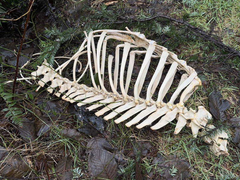
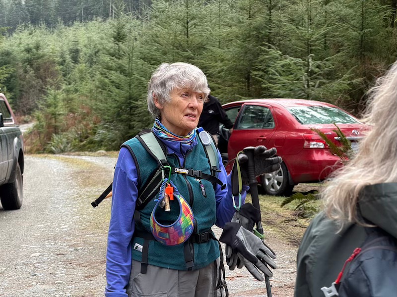
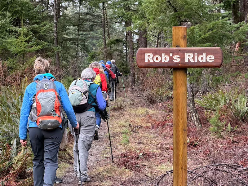
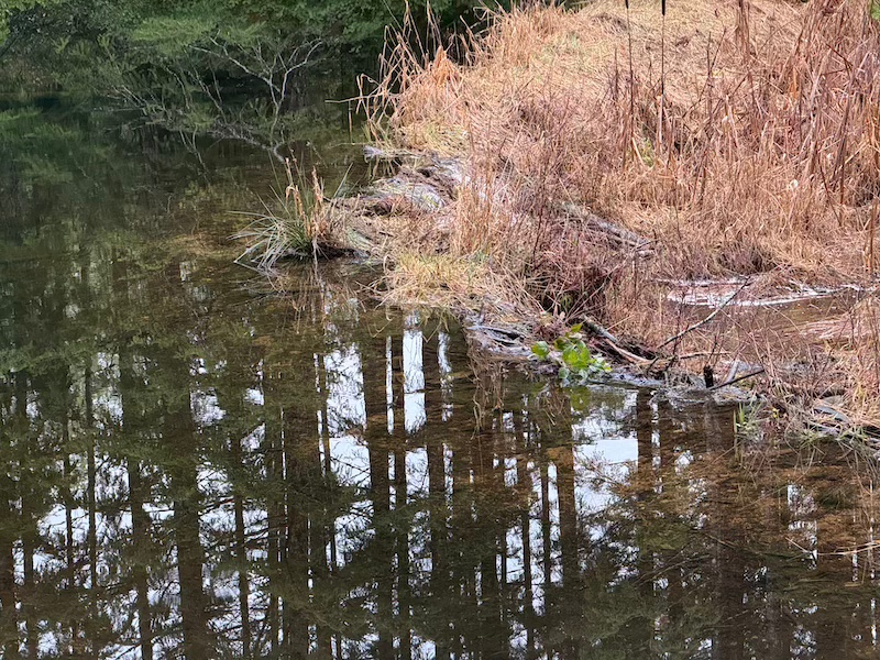
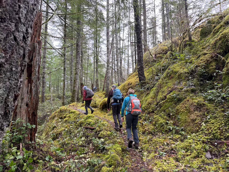
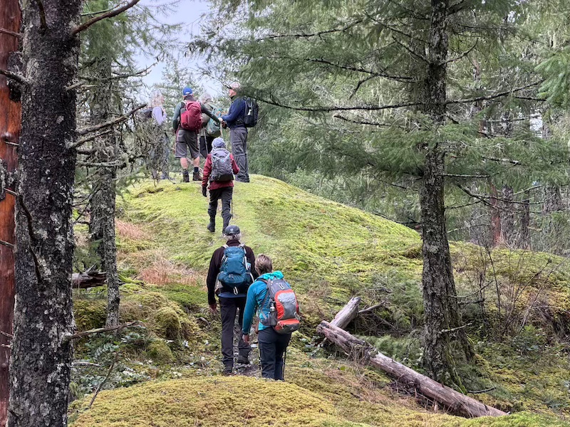
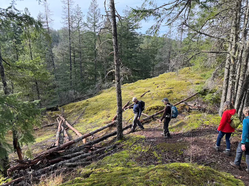
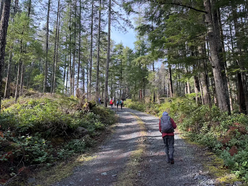
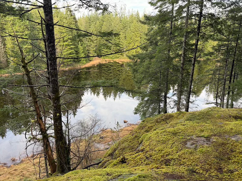
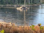
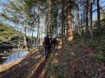
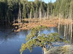
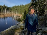
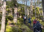
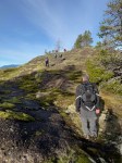
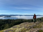
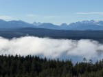
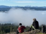
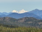
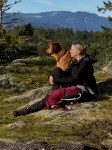
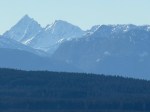
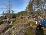
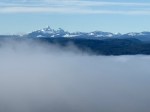
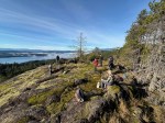
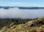
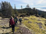
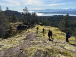
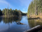
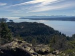
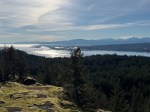
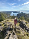
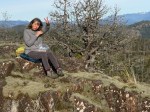
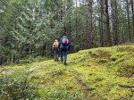
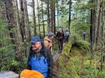
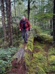
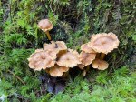
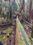
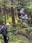
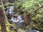
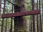
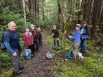
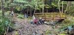
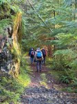
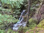
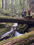
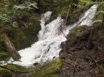
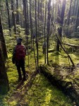
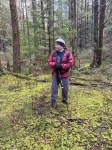
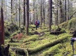
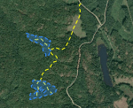
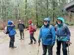
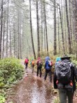
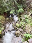
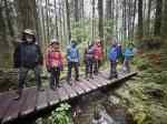
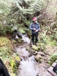
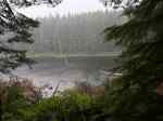
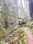
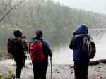
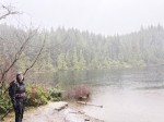
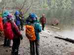
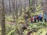
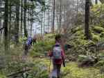
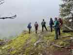
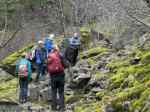
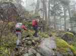
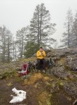
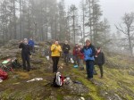
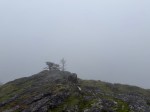
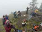
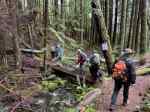
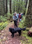
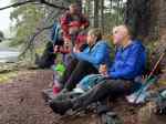
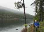
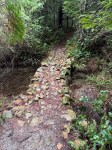
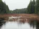
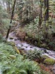
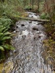
| Activity | Hiking |
| Destination | Thompson Trail – Hopespring Loop |
| Date | 10 Dec, Wednesday |
| Trip Coordinator | Allan Liimatta |
| Contact Info | allanliimatta@gmail.com or 250-416-9338 |
| Description | Hike up Thompson Trail and on to Gowlland Trail and the Three Sisters which are some of the largest Old Growth on Quadra Island, then picking up the Hopespring Trail and back to the parking area on Thompson Rd. Bring a lunch. Trip length 6-7 km. approx. 3.5 hrs. |
| Meeting Place | Parking place at end of Thompson road |
| Departure Time | 10:00 |
| Difficulty |
Moderate |
| Costs | None |
| Trip limits | 10 |
| Dogs? | Yes, but must be on leash |
| Notes: |
Category Archives: moderate
Hiking – Maud Island – 26 Nov 2025
| Activity | Hiking |
| Destination | Maud Island |
| Date | 6 May 2024, Wednesday |
| Trip Coordinator | Debbie Quigg |
| Contact info | dmquigg@gmail.com or 3710 |
| Description | We will use the trailhead from the Walcan and active logging roads and hike along very old logging roads and then up onto the Mt. Lolo bluffs for views over Discovery Passage. After descending and heading west, we will follow the shoreline, then cross the causeway to Maud Island. We will have lunch at the viewpoint over Seymour Narrows. The currents will not be particularly strong. We will return by the Saltwater Lagoon. If there is a group of three or more who don’t want to go by Mt. Lolo, they could go out and back by Saltwater Lagoon. Approximately 10 km and four hours. |
| Meeting Place | Community Centre parking lot |
| Departure Time | 10:00 |
| Difficulty | Moderate |
| Costs | None |
| Trip limits | 10 |
| Dogs? | No |
| Notes | We will not do this trip in poor weather. |
Hiking – Shellaligan Loop – 19 Nov 2025
| Activity | Hiking |
| Destination | Shellaligan Loop |
| Date | 19 Nov, Wednesday |
| Trip Coordinator | Valerie van Veen |
| Contact Info | Vvv@qisland.ca, 250 285 2329, 778 242 5774( cell) |
| Description | We will hike the circular route, in a clockwise direction, allowing us to take the coast trail option if weather permits. Otherwise we will stay inland to complete the loop. We will start at the first parking lot, hike the route, and walk back to our cars on the logging road. Bring lunch, dress for the weather. Trip cancelled if heavy rain and/or strong winds. Only registered hikers will be advised of any changes in plans. |
| Meeting Place | Community Centre parking lot OR Shellaligan logging road turn off on Valdes Road |
| Departure Time | 10:00 |
| Difficulty |
Moderate |
| Costs | None |
| Trip limits | 10 |
| Dogs? | Under control, must stay with owner at front or back of group. |
| Notes: | Must register by Monday evening, Nov 17. South end hikers will meet at the CC parking lot. I will let registered hikers know who else is coming and I will be available by cell phone if needed Wednesday morning. I will meet the group at the turn off to the logging road on Valdes Road. Please contact me if unsure of these directions. |
Trip Report – Beaver Lake and Open Bay Creek – 30 Oct 2025
We had a small but enthusiastic group for a hike on a lovely autumn day. We started from Hyacinthe Bay Road and followed a flagged route down to Beaver Lake. The fungi were amazing. We crossed the outflow creek without any problem and paused on the bluff above Beaver Lake before heading east on the open logging road and then into the forest and down the path following the creek to Open Bay Creek. The water was flowing well and when we reached the falls we always visit, we noticed that there were falls higher up, so we bushwhacked to see these other cascades. There were two sets which were more impressive than the falls by the trail. After lunch on an open, mossy bluff, we bushwhacked back to the trail and down to Open Bay Creek. From there we meandered upstream along the creek, mostly on high bank, but sometimes at the creek level. There were no salmon in the creek, but the forest and the views were lovely. (5.9 km and 3 hours)
(click on photos to enlarge)
- Beaver Lake
- Open Bay Creek
Hiking – Elk Falls Loop – 6 Nov 2025
This hike has been cancelled due to weather.
| Activity | Hiking |
| Destination | Elk Falls – Canyon View trails |
| Date | 6 Nov, Thursday |
| Trip Coordinator | Vic Gladish |
| Contact Info | 250-287-0459; vicgladish@gmail.com |
| Description | This is a well developed, popular trail that follows the Campbell River along the north shore and into Elk Falls Park and to the Suspension Bridge. We will have lunch at Elk Falls, and return on the River Trail. We will start from the parking lot on the north side of the river across the “log” bridge before the Quinsam Campground. TURN RIGHT off of Hwy 28. Anyone not wanting the full, 4 hr hike, could loop back to the starting point when we get to the bridge. |
| Meeting Place | Q Cove Ferry terminal |
| Departure Time | 9:30 ferry |
| Difficulty | Moderate |
| Costs | Ferry costs |
| Trip limits | None |
| Dogs? | On leash; warning.. the ramps and bridge at Elk Falls are made of metal grids that are hard on dogs’ feet |
| Notes: | Bring lunch. We will hike at a leisurely pace to really enjoy this beautiful area. (fall colours?) Unless extreme weather, we will at least do the Canyon View Trail. About 2 – 4 hours, 5 – 10 km depending on route. Carpooling from the ferry parking lot will be attempted. Drivers should arrive to be in line for the 0930.Elk Falls Park/Trails Map here: https://nrs.objectstore.gov.bc.ca/kuwyyf/elk_falls_parking_trails_map_68efc975fd.pdf |
Hiking – Beaver Lake to Open Bay Creek – 30 Oct 2025
| Activity | Hiking |
| Destination | Beaver Lake to Open Bay Creek |
| Date | 30 Oct 2025, Thursday |
| Trip Coordinator | Debbie Quigg |
| Contact Info | dmquigg@gmail.com or 3710 |
| Description | We will leave from Hyacinthe Bay Road and follow a flagged trail down to Beaver Lake. After crossing the outflow creek, we will continue on to Open Bay Creek mostly following the creek with some sections of steep descent. The path along Open Bay Creek is undulating, but mostly flat. This involves a car shuffle. |
| Meeting Place | Community Centre parking lot |
| Departure Time | 10:00 |
| Difficulty |
Moderate |
| Costs | none |
| Trip limits | 10 |
| Dogs? | |
| Notes | Bring a lunch or snack and dress for the weather. |
Trip Report – Big Trees and Clear Lake – 22 Oct 2025
(click on photos to enlarge)
Trip Report – Denman & Hornby Islands – 5-8 Oct 2025
Sunday: Seven of us went straight from the 10:00 ferry from Buckley Bay to the Morning Beach trailhead to take advantage of the relatively low tide, and walk to Tree Island (aka Sandy Island). We descended the stairs on the east side of Longbeak Point and walked north along the shore and then across the sandy flats to Tree Island. It was a perfect, sunny day. We walked across the wooded area for the view north before heading back. We hurried a bit, not wanting to be too late with the turn of the tide, but there was no problem and we could have taken more time. We had lunch once we returned to Longbeak Point on Denman and then continued to the trailhead. (7.5 km, 3h) We went to Fillongley Provincial Park and set up our campsites in this popular park on Lambert Channel. Several people explored Denman a bit more and visited Chickadee Lake looking for the best swimming spot. (2.25 km, 45m). The evening was cool and the group gathered around a fire for happy hour and later for dessert. The moon was nearly full as it rose over the Salish Sea.
(click on photos to view larger)
- Morning Beach
- Looking east
- Arriving at Tree Island
- Looking south to Denman
- The beach on Baynes Sound
- Oregon Grape
- Lunch break
- Seaweed
- Moon rise
Monday – The weather was again perfect. We took the 9:40 ferry to Hornby and positioned the vehicles for a car shuffle. Starting from Mount Road, we hiked up Middle Bench in the Mt. Geoffrey Escarpment Provincial Park and almost immediately had wonderful views to the west, over Lambert Channel and Denman Island. The gradual climb continued on Outer Ridge up to the summit of Mt. Geoffrey at 330m. But the views are not at the summit, they are along the embankment with the unusual conglomerate geology. We continued on the Cliff Trail in Mt. Geoffrey Regional Park, with views that included the Hornby farmlands and the scenery to the north. We descended the dirt stairs down to Lea Smith Road and took the ferry back to Denman Island for the evening at Fillongley. The trail was very quiet and we encountered only one group of mountain bikers all day. (9.2 km, 3¾ hours, about 300m ascent) Once again the campfire was the social centre and the truly full moon rose over Hornby Island.
- Sunrise
- View from Middle Bench
- Shingle Spit & Lambert Channel
- A gradual trail
- Looking toward Vavncouver Island
- Unusual arbutus tree
- Looking southwest
- Looking northwest
- Moon rise
- Campfire social
Tuesday – We had a spectacular sunrise, which was followed by significant cloud cover until late in the afternoon. We again returned to Hornby Island on the 9:40 ferry and went to Helliwell Provincial Park to walk the south-facing bluffs. The views are great and the cliff formations from conglomerate are fascinating. We walked north to the park boundary and then followed the trail loop counterclockwise. There were sea lions swimming below the cliffs and in a colony on nearby Flora Island. (5.4 km, 1¾ hours). After visiting the Hornby Coop Store, which is an amazing source of anything that you might need, we continued on to Tribune Bay for lunch and to enjoy the fine sand and the scenery. After a quick visit to Little Tribune Bay, there were a variety of short explorations before returning to Denman for the evening. Regrettably, we did not have time or tide to explore the rock formations at Heron Rock and elsewhere. Back on Denman, a few in the group went to explore the Lindsay Dickson Nature Reserve and Graham Lake, which were both worth the visit. (2.9 km, 1h)
- Sunrise from Denman
- The end of the sunrise
- K’ómoks Guardian Pole
- Bluffs at Helliwell Prov Park
- Sea Lion
- Tribune Bay
- Sandstone at Little Tribune Bay
- Lindsay Dickson Nature Reserve
- Graham Lake
Wednesday: For most of us, this was a short and cloudy day. A group hiked the eastern shore in Boyle Point Provincial Park to see Eagle Rock and the view of the Chrome Island lighthouse. This was a gentle walk through a fine forest. (2.9 km, 1h)
- Chrome Island lighthouse
We then headed home after a great trip with an amazing variety of hikes and scenery.
Debbie
Thanks to Jim, Louise, and Norris for the photos
Hiking – Big Trees and Clear Lake – 22 Oct 2025
| Activity | Hiking |
| Destination | Big Trees and Clear Lake |
| Date | 22 Oct, Wednesday |
| Trip Coordinator | Debbie Quigg |
| Contact Info | dmquigg@gmail.com or 3710; please contact the coordinator in advance of the trip |
| Description | The destination for this trip is one of the biggest Douglas fir on Quadra. We will hike up a logging road and into Main Lake Park. There is no trail and part of the route is quite steep, but the distance is not long. We can visit several big trees in this valley. Expect to climb over deadfall. We will continue on to the south end of Clear Lake. To reach the beach may be very wet. |
| Meeting Place | Quadra Community Centre parking lot |
| Departure Time | 10:00 |
| Difficulty |
Moderate for some steep parts and mostly no trail |
| Costs | None |
| Trip limits | 10 |
| Dogs? | |
| Notes: | Bring lunch; hiking poles if you use them. Wear good boots. The approach involves a logging road, so we will need vehicles for that. |
Multi-day Hiking – Hornby & Denman Islands – 5-8 Oct 2025
| Activity | Multi-day Hiking |
| Destination | Hornby and Denman Islands, staying at Fillongley Prov Park campground |
| Date | 5-8 Oct 2025, Sunday to Wednesday |
| Trip Coordinator | Debbie Quigg |
| Contact Info | 3710 or dmquigg@gmail.com; please contact the coordinator well in advance of the trip |
| Description | We will have two half-days and two full days to explore the two islands. There is lots to do: on Hornby Island, by ferry: Mt. Geoffrey Regional Park (a significant walk on a bluff with good views if the weather cooperates), Tribune Bay Prov Park (a walk on the beach), Helliwell Provincial Park (a rocky, coastal walk), Heron Rock (sculpted rock beach walk) on Denman Island: Boyle Point Prov Park (short, easy walk to a view of the Chrome Island Lighthouse), possibly a walk to or toward Tree Island (Sandy Island Marine Park if the tide is right; this is long and flat) We will decide as we go, what we will do each day. Each person or group will need to make their own arrangements to stay at Fillongley Provincial Park campground or elsewhere. The cost is half-price for seniors. |
| Meeting Place | QCove ferry |
| Departure Time | 8:30 ferry to Campbell River for the 10:00 ferry from Buckley Bay to Denman Island. This is weather dependent and will be confirmed later. |
| Difficulty | Moderate and varied |
| Cost | The ferries, fuel and camping |
| Trip limits | 8 |
| Dogs? | No |
| Notes: | The season is changing. Bring a variety of gear. |


