| Activity | Hiking |
| Destination | Hopespring – Thompson Trail Loop |
| Date | 13 Nov, Monday |
| Trip Coordinator | Louise Squire |
| Contact Info | lsquire@sasktel.net |
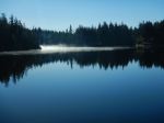
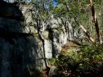
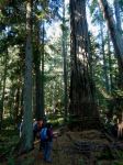
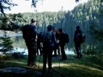
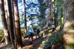
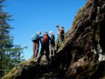
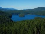
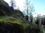
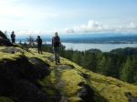
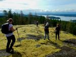
| Description | We will meet at Hopespring Rd trail head and circle Heriot Ridge ending up on Thompson Rd and walking back to the trailhead. There will be 2 or 3 short side trips to check out Heriot Ridge viewpoints, some old growth and perhaps to the old homestead. Depending on weather and time, we will stop at Rousseau Rock for lunch (with a view), or stop at a grassy nook for a short lunch break and comradery.Fund Fact – Comradery is a spirit of friendship and community between two people or a group of people. The members of the group are comfortable around each other and support each other. |
| Meeting Place | Hope Spring Rd Trail Head |
| Departure Time | 10:30 |
| Difficulty |
Moderately easy |
| Costs | None |
| Trip limits | 10 |
| Dogs? | Under control or on leash |
| Notes: | Bring a lunch, clothes for the weather, a seating pad and poles are recommended. |
Category Archives: moderate
Hiking – Eagle Ridge Loop – 20 Nov 2023
| Activity | Hiking |
| Destination | Eagle Ridge Loop |
| Date | 20 Nov 2023, Monday |
| Trip Coordinator | Norris Weimer |
| Contact Info | norris.weimer@ualberta.ca or 3710 |
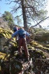
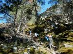
| Description | This hike will include the official trail to Eagle Ridge and an unmarked route descending the ridge and continuing on to the higher ridge to the north. From there we will descend to the logging road and return to the vehicles. The descent from Eagle Ridge is briefly very steep on mossy rocks. There is no trail. Three to four hours hiking. |
| Meeting Place | Heriot Bay store parking lot |
| Departure Time | 10:00 |
| Difficulty |
The section up to Eagle Ridge is a maintained trail of moderate difficulty. The descent from Eagle Ridge is briefly tricky. The segment to the next ridge and down to the logging road is on an unmarked route through mostly open forest. |
| Costs | none |
| Trip limits | 10 |
| Dogs? | No |
| Notes: | Bring lunch, poles if you use them, and gear for weather. |
Trip Report – Kw’as Park, Cortes – 30 Oct 2023
(click on photos to enlarge)
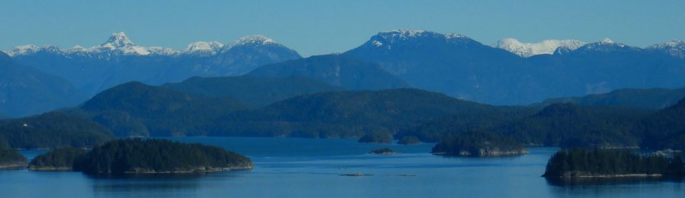
- View toward Mainland mountains
- Heriot Bay
- Rebecca Spit
- Frosty morning
- Lunch stop at Hague Lake
- Hague Lake
- Descent by ladder
- The Survivor Fir
- Viewpoint on Gunflint Lake
- The steam donkey
- Gunflint Lake
- Whaletown
- View southwest toward Quadra
Hiking – Kw’as Regional Park, Cortes – 30 Oct 2023
| Activity | Hiking |
| Destination | Kw’as Regional Park, Cortes |
| Date | 30 Oct 2023, Monday |
| Trip Coordinator | Debbie Quigg |
| Contact Info | 285-3710 or dmquigg@gmail.com. Please contact the coordinator by Monday. |
| Description | We will hike through this lovely park, situated between Gunflint and Hague Lakes on Cortes Island. Along with great views, there is fine old growth, interesting geology and history, and a good variety of trails. We hope to include a bit of everything in the day’s hike. We will return on the 1:50 or 3:50 ferry. |
| Meeting Place | Heriot Bay ferry terminal to Cortes. Drivers will need to be early enough to be on the ferry. |
| Departure Time | 9:05 ferry |
| Difficulty |
Moderate. A few steep and undulating places, but mostly reasonable walking on good trails. The possible loops vary, but we may hike about 10 km. |
| Costs | Ferry costs; bring your ferry card. |
| Trip limits | 10 |
| Dogs? | |
| Notes: | Bring lunch and gear for weather. |
Work Party – Chinese Mtn – 25 Oct 2023
| Activity | Work party |
| Destination | Chinese Mountain |
| Date | 25 Oct, Wednesday |
| Trip Coordinator | Norris Weimer |
| Contact Info | norris.weimer@ualberta.ca or 3710; please contact the coordinator in advance of the outing. |
| Description | The Chinese Mountain system is not in bad condition, but there is some deadfall that needs to be chainsawed and the annual brush cut is due. If there is time and energy, we may work on the trail to Beech’s Overlook. The Trail Committee provides tools. Bring your own gloves, and your own tools if you prefer them. We will have lunch at a scenic location. |
| Meeting Place | Heriot Bay store parking lot to organize tools and carpool to the trailhead |
| Departure Time | 10:00 |
| Difficulty |
Moderate work |
| Costs | None |
| Trip limits | 10 |
| Dogs? | No |
| Notes: | Bring lunch. |
Trip Report – Amor and Nearby Lakes – 29-30 Sept 2023
This trip used the road-accessible Rec Site on Amor Lake for greatest flexibility. Of the six people who participated, some stayed three nights, two nights, one night or just one day. It certainly isn’t the best campsite on Amor Lake, but it has some conveniences. We were incredibly lucky with the beautiful autumn weather, since the trip was planned long in advance.
Friday: Two came out on Thursday and set up camp. Three others arrived on Friday morning and all launched as soon as possible. We headed out to the south end of Amor and hauled out at the Mr. Canoehead campsite. We navigated the short portage to Surprise Lake with the assistance of borrowed wheels for the kayaks and paddled across Surprise Lake as if we were doing the canoe circuit. We left the boats at the south end of Surprise Lake and walked the 2.2 km portage to Brewster Lake through a lovely forest. We had lunch at the launch site into Brewster Lake before retracing our steps and paddled back to the campsite by mid-afternoon. We walked down the Blackwater Main logging road to visit the Rec Site on Blackwater Lake, which was sunny and scenic. After relaxing on the shore, we headed back for dinner and enjoyed a great campfire, as the ban had just been lifted during the week and the evenings were cool. The full moon was a bonus. (paddling 5.2 km, 1¼ hr; walking 8.3 km, 2½ hr)
(click to enlarge photos)
- Launch at Surprise Lake
- Portage trail to Brewster Lake
- Launch site at Brewster Lake
- Walking back to Surprise Lake
- Amanita muscaria
- Campsite at Blackwater Lake
- Campfire at Amor
Saturday: We were joined by one more person on Saturday morning and were quickly away, heading north and across Amor Lake to the portage to Twin Lakes. The launch site was quite muddy, but we managed awkwardly to get to the trail and walk up the undulating path to Twin Lake. The campsite there, which is accessible by road, was very busy on this long weekend with great weather. We briefly followed a trail up the north side of Twin Lake to a swim rock before heading back. After returning to Amor Lake, we stopped for lunch at the first campsite we passed, which was on the north shore and had a beautiful sandy beach and lots of sunshine. Continuing on, we came out of the east arm of the Lake and headed to the campsite at the north end, which has significant infrastructure. We admired the dock with the picnic table as well as the covered shelter, but especially the sandy beach, sun-facing direction and great view. We headed south along the western shore exploring the many campsites and sandy beaches along the way. On our return to the campsite, two of the group packed up and left, leaving four others to enjoy another relaxed evening around the campfire. (paddling 13.1 km, 3¼ hr; walking 2.5 km, ¾ hr)
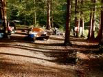
- Amor Lake campsite
- Twin Lake
- Twin Lake swim rock
- The lunch beach
- Arriving at the north Rec Site
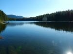
- Looking south down Amor Lake
- The shelter
- The floating picnic table
We saw four of the Sayward canoe circuit lakes on this brief two-day paddle. It was an easy and relaxed exploration. We only encountered four other boats on Amor. This was a fitting end to the season, having begun in May with an outing to Morton Lake Provincial Park and paddling on two other Sayward canoe circuit lakes – Mohun and Goose. We had beautiful weather for both trips and enjoyed the relative quiet of the shoulder season.
Debbie
Multi-day kayaking and camping – Amor Lake – 29-30 Sept. 2023
Trip Report – Mine Lake Bluff – 20 Sept 2023
Six of us were fortunate to have a truly beautiful autumn day for this highly varied hike. The group decided to do the hike as a loop, which is more challenging than out-and-back. We walked along the Mine Lake shore to Homewood’s Woodsman Camp and then steeply up the trail to the foot of the bluff. The exposed section of the route was fairly dry in spite of the previous day’s rain. Views of Mine Lake, the Quadra high plateau, and the Vancouver Island skyline made it all worthwhile. We explored much of the bluff perimeter, with impressive cliffs on the east and west sides, before settling down for lunch at a sunny viewpoint. We picked up the trail down the north side and under the impressive cliffs we had just been standing on. After visiting some of the periphery of the camp we followed the path out to the first campsite, at the corner of Mine Lake and the narrows. One person swam before we headed back along the lake to the vehicles. We enjoyed this leisurely hike to so many beautiful spots on a wonderful fall day. (6.6 km; 4 hours)
- Mine Lake
- Puff balls
- View of Mine Lake
- View of Main Lake
- Along the cliff bottom
- At the narrows
Trip Report – Rousseau Ridge Loop – 13 Sept 2023
Six of us hiked this loop starting from North Gowlland Road. The recent welcome rain made the bushes wet and the day humid. We hiked North Gowlland Trail up to Rousseau Ridge with a short break for elevenses and to enjoy the view.. From there we descended the mossy bluffs toward Gowlland Harbour Rd, with a few short steep sections into the forest and back up on the ridge. Each ridge has great views of Discovery Passage and the Vancouver Island mountains, which were in cloud for us. We stopped for a leisurely lunch on the third and lowest bluff. We continued our descent to a logging road heading east and then picked up a route over lower, but still open bluffs taking us back to North Gowlland Trail. We enjoyed the three very old Douglas firs, the Three Sisters, on the way back to make our loop. Since we did this loop about 15 months ago, the flags have been removed, making the route finding trickier. 6.8 km; 3¼ hours.
(click on photos to enlarge)
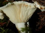
- Lobster mushroom
- Ascending Rousseau Ridge
- View from Rousseau Ridge
- The middle ridge
- After lunch
- Impaled bracket fungus
- The route back
Hiking – Mine Lake Bluff – 20 Sept 2023
| Activity | Hiking |
| Destination | Mine Lake Bluff |
| Date | 20 Sept 2023, Wednesday |
| Trip Coordinator | Debbie Quigg |
| Contact Info | dmquigg@gmail.com or 3710; please contact the coordinator by Monday night. |
| Description | We will hike through the Camp Homewood site on Mine Lake and then through the forest to the scenic bluff. We can decide as a group whether we want to do this as a loop or out-and-back. |
| Meeting Place | Heriot Bay store parking lot |
| Departure Time | 9:30 |
| Difficulty |
Moderate if we do out-and-back. Some challenging spots with exposure if we do the loop. |
| Costs | none |
| Trip limits | 10 |
| Dogs? | no |
| Notes | We will not do this trip in wet weather and maybe not even in poor visibility. |
Trip Report – Paddle around Cape Mudge – 6 Sept 2023
Almost exactly one year to the day since our first Round the Cape paddle trip, four club members set out from Q-Cove to repeat the adventure. This report will therefore sound a lot like the one written last year (cut and paste…) The necessary shuttle was pretty simple with just four participants, one volunteer spouse and a two-car paddling couple! Two paddlers got to the put-in without motorized transport!
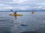
By 10:10 we were on the water just as the ferry was loading – two ferries to watch out for this time. Weather, (overcast and threatening drizzle, but no wind) tides and currents were all in our favour as we rounded Whiskey Point and headed south to Cape Mudge. We passed closely by the Village (accompanied briefly by a pair of harbour porpoises on our starboard), and then the lighthouse, working against the counter currents while the main tide continued to flood, and then rounded the Cape. One petroglyph barely revealed itself here, but one sharp-eyed paddler spotted it. These often treacherous waters were very calm, due to our timing, and we headed into the boulder strewn shallows of the south shoreline. It was interesting to be at the base of the sandy cliffs that we had hiked to the edge of last week for a view of the shoal at very low tide.
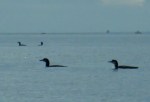
As we glided along a flock of a dozen or so Common Loons struck up a conversation about kayaking intruders, Harlequins scurried along the water’s edge to put distance between us, and the migrating coho were leaping about. Large schools of herring or sardines were seen in the shallow waters of Wilby Shoals.
By this time we were looking for a reasonable place to pull out for a “rest” and stretch, but, once again a cobbly beach was the best we could do. As it was time for lunch, our rest stop lasted nearly an hour. Back on the water and heading for our final “turn around the corner”, a nice beach was spotted and perhaps will be remembered for next year’s lunch stop! We rounded Francisco Point and headed north on a somewhat brighter and milder afternoon without notable resistance from the ebbing tide. With our destination in sight for most of the 5 km, it did feel like a long stretch as we avoided rocks and watched for whales. (15.0 km; 4¼ hours.)
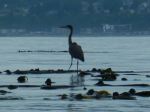
List of bird sightings – at least a dozen Common Loons (very vocal), many Harlequin ducks, a Common Merganser, numerous Bonaparte’s, Glaucous-winged, and Mew Gulls, Cormorants, a Great Blue Heron, Bald Eagles
Vic
Thanks to Vic and Norris for the photos
(click on photos to enlarge)
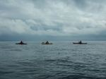
- South in Discovery Passage
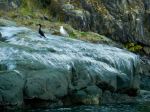
- Bird rock with Gull and Cormorant
- Great Blue Heron
- At the Cape Mudge lighthouse
- Petroglyph in the tide
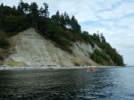
- Bluff at Cape Mudge
- Common Loons
- Approaching Francisco Point
- Arriving at Smiths Rd beach