Trip Report – Amor and Nearby Lakes – 29-30 Sept 2023

This trip used the road-accessible Rec Site on Amor Lake for greatest flexibility.  Of the six people who participated, some stayed three nights, two nights, one night or just one day.  It certainly isn’t the best campsite on Amor Lake, but it has some conveniences. We were incredibly lucky with the beautiful autumn weather, since the trip was planned long in advance.

Friday:  Two came out on Thursday and set up camp.  Three others arrived on Friday morning and all launched as soon as possible.  We headed out to the south end of Amor and hauled out at the Mr. Canoehead campsite.  We navigated the short portage to Surprise Lake with the assistance of borrowed wheels for the kayaks and paddled across Surprise Lake as if we were doing the canoe circuit.  We left the boats at the south end of Surprise Lake and walked the 2.2 km portage to Brewster Lake through a lovely forest.  We had lunch at the launch site into Brewster Lake before retracing our steps and paddled back to the campsite by mid-afternoon.  We walked down the Blackwater Main logging road to visit the Rec Site on Blackwater Lake, which was sunny and scenic.  After relaxing on the shore, we headed back for dinner and enjoyed a great campfire, as the ban had just been lifted during the week and the evenings were cool.  The full moon was a bonus. (paddling 5.2 km, 1¼ hr; walking 8.3 km, 2½ hr)

(click to enlarge photos)

Saturday: We were joined by one more person on Saturday morning and were quickly away, heading north and across Amor Lake to the portage to Twin Lakes.  The launch site was quite muddy, but we managed awkwardly to get to the trail and walk up the undulating path to Twin Lake.  The campsite there, which is accessible by road, was very busy on this long weekend with great weather.  We briefly followed a trail up the north side of Twin Lake to a swim rock before heading back.  After returning to Amor Lake, we stopped for lunch at the first campsite we passed, which was on the north shore and had a beautiful sandy beach and lots of sunshine.  Continuing on, we came out of the east arm of the Lake and headed to the campsite at the north end, which has significant infrastructure.  We admired the dock with the picnic table as well as the covered shelter, but especially the sandy beach, sun-facing direction and great view.  We headed south along the western shore exploring the many campsites and sandy beaches along the way.  On our return to the campsite, two of the group packed up and left, leaving four others to enjoy another relaxed evening around the campfire.  (paddling 13.1 km, 3¼ hr; walking 2.5 km, ¾ hr)

We saw four of the Sayward canoe circuit lakes on this brief two-day paddle.  It was an easy and relaxed exploration.  We only encountered four other boats on Amor.  This was a fitting end to the season, having begun in May with an outing to Morton Lake Provincial Park and paddling on two other Sayward canoe circuit lakes – Mohun and Goose.  We had beautiful weather for both trips and enjoyed the relative quiet of the shoulder season.

Debbie

Multi-day kayaking and camping – Amor Lake – 29-30 Sept. 2023

Day or Multi-day Paddling – Amor Lake – 29-30 Sept 2023

Activity Day or Multi-day Paddling
Destination Amor Lake
Date 29-30 Sept 2023, Friday – Saturday
Trip Coordinator Debbie Quigg
Contact Info dmquigg@gmail.com or 3710; please contact the coordinator well in advance of the trip
Description We will try to make this a very flexible outing.  Kayaks or canoes are welcome with good gear and experience.  Participants may come for one day or for both.  The base for our activities will be the small Rec Site on the west side of the lake with five campsites.  This is a free Rec Site accessible by logging road.  The boat launch is modest.  Amor Lake has lovely beaches and islets with much to explore.  It is on the Sayward Canoe Circuit and we can walk the portages.
Meeting Place QCove ferry terminal or Amor Lake
Departure Time 9:00 ferry to Campbell River or by individual arrangement
Difficulty Easy to moderate.
Cost Ferry
Trip limits 10
Dogs? No
Notes: Here is information about the Rec Site and Amor Lake:  http://www.sitesandtrailsbc.ca/search/search-result.aspx?type=Site&site=REC0174
There is currently an advisory for an aggressive cougar, but I believe that is quite old.

Trip Report – Paddle around Cape Mudge – 6 Sept 2023

Almost exactly one year to the day since our first Round the Cape paddle trip, four club members set out from Q-Cove to repeat the adventure. This report will therefore sound a lot like the one written last year (cut and paste…) The necessary shuttle was pretty simple with just four participants, one volunteer spouse and a two-car paddling couple! Two paddlers got to the put-in without motorized transport!

By 10:10 we were on the water just as the ferry was loading – two ferries to watch out for this time. Weather, (overcast and threatening drizzle, but no wind) tides and currents were all in our favour as we rounded Whiskey Point and headed south to Cape Mudge. We passed closely by the Village (accompanied briefly by a pair of harbour porpoises on our starboard), and then the lighthouse, working against the counter currents while the main tide continued to flood, and then rounded the Cape. One petroglyph barely revealed itself here, but one sharp-eyed paddler spotted it. These often treacherous waters were very calm, due to our timing, and we headed into the boulder strewn shallows of the south shoreline. It was interesting to be at the base of the sandy cliffs that we had hiked to the edge of last week for a view of the shoal at very low tide.

As we glided along a flock of a dozen or so Common Loons struck up a conversation about kayaking intruders, Harlequins scurried along the water’s edge to put distance between us, and the migrating coho were leaping about. Large schools of herring or sardines were seen in the shallow waters of Wilby Shoals.

By this time we were looking for a reasonable place to pull out for a “rest” and stretch, but, once again a cobbly beach was the best we could do. As it was time for lunch, our rest stop lasted nearly an hour. Back on the water and heading for our final “turn around the corner”, a nice beach was spotted and perhaps will be remembered for next year’s lunch stop! We rounded Francisco Point and headed north on a somewhat brighter and milder afternoon without notable resistance from the ebbing tide. With our destination in sight for most of the 5 km, it did feel like a long stretch as we avoided rocks and watched for whales.  (15.0 km; 4¼ hours.)

List of bird sightings – at least a dozen Common Loons (very vocal), many Harlequin ducks, a Common Merganser, numerous Bonaparte’s, Glaucous-winged, and Mew Gulls, Cormorants, a Great Blue Heron, Bald Eagles

Vic 

Thanks to Vic and Norris for the photos

(click on photos to enlarge)

Kayaking -Paddle around Cape  Mudge – 6 Sept 2023

Trip Report – Kanish Bay Paddle – 22 Aug 2023

Four paddlers were treated to a very nice day of paddling on Kanish Bay. We started out early at Granite Bay to take advantage of the tides and headed off by 0900 on a cool morning. Last year CCW, this year we took the CW (clockwise) route around the bay. With little wind and an ebbing tide, we arrived at the tidal flats tucked in between Bodega Pt and an unnamed island. A short break here allowed us time to cross the beach and take in the view of upper Discovery Passage. Back on the water and passing between the last two islands of the Chained Islets, we headed across the western end of Kanish Bay with our sights set on Granite Point, 3.2 km away. At the point, the waters were calm and the sun much warmer so we just kept going until 15 minutes later we had a bit of a view down Okisollo Channel! Time to turn back… we meandered down the northern shore of the bay, visited the pictographs cliff and then stopped for lunch at Ashlar Creek, a rather rocky and difficult landing spot, but sunny and warm with a big view of the Passage and Vancouver Is.

The tide aided our afternoon efforts by starting to flood, and with the Chum jumping here and there we were soon at Orchard Bay and once again fantasizing about a couple of nights of camping in this very nice part of the area. (This was to have been today’s goal, but too few signed up for the planned camping trip). A family of Loons and a lone Red-necked Grebe were spotted on the bay. We explored for a few minutes and then headed back to Granite Bay and our take out. (17.8 km; 5½ hours.)

Vic 

(click on photos to enlarge)

Kayaking – Kanish Bay – 22 Aug 2023

Kayaking – QCove to Smiths Rd- 5 Sept 2023

Postponed to Sept. 6th, Wednesday

Activity Kayaking
Destination QCove to Smiths Road Shore Access
Date 5 6 Sept, Tuesday
Trip Coordinator Vic Gladish
Contact Info vicgladish@gmail.com; 250-287-0459 text; or phone 250-285-2111.
Description This paddle trip involves either a shuttle or a drop off/pick up.
We will put in at the boat launch or nearby beach and paddle south to the bottom end of Quadra Island (Cape Mudge) and then up the eastern shore to the shore access at Smiths Rd.
Meeting Place QCove boat launch at 1000
Departure Time On the water by 1030
Difficulty
Moderate due to possible wind and strong currents. The paddle could take 4 hrs including short breaks.
Costs Parking and/ or boat launch – $4
Trip limits 8
Dogs? No
Notes: This outing requires that each paddler arrange to be dropped off at the put in and picked up at the take out. Alternatively, a shuttle could be worked out to reconnect drivers and cars.
Ocean going kayaks that meet club and coast guard safety standards are required.

Reconnaissance Report – Woss Lake Provincial Park – 12-14 July 2023

We had talked about this trip for over a year, but it came together at the very last minute. There is little information available about Woss Lake Provincial Park and much of it is unhelpful or actually incorrect. Historically this was an important trade route for the Namgis and Mowachaht, but today it is not much visited. There are some reasons why this beautiful place is quite inaccessible and little known.

Six of us in two kayaks and two canoes set out on a beautiful summer day to explore this area hoping to find the campsite and the Grease Trail. We launched at 11:30 in calm water from the Woss Community Cabin, which is about 8 kilometres down Woss Rd. The views on this in-land fjord are wonderful with Rugged Mountain and the glacier at the southwest end of the Lake. By 13:00 the diurnal wind from the south began to build and continued to increase to about 20 knots until after sunset, but the wind didn’t die completely until midnight. We spent several hours pulled out on the shore waiting for the wind to abate. Magically, a large Namgis cedar dugout canoe came quickly down-wind while we were on shore.

The campsite was not where we expected because the trail location on Backroads map is incorrect. The campsite is in much better condition than we expected since the BC parks says there are no facilities, and other sites simply repeat that there are a “few tent pads.” The campsite was built and the trail re-established as an initiative by the Namgis between 2001 and 2005. Lindsay Elms’ information in Beyond Nootka is the most complete. While some of the tent platforms have rotten wood, the general facilities and location are excellent for rustic camping.

The following day we planned to hike up to the pass on the Grease trail, which would descend to Tahsis on the far, south side. The trail was in better condition than we expected, since BC Parks are certainly not maintaining this. It seems likely that the Namgis are working on it. It was well flagged and most of the creeks were bridged for the first 3 kilometres. Then there was lots of flagging in different colours, but no convincing trail and no logical continuity. Because Backroads maps shows the trail on the wrong side of the creek and Lindsay Elms says that the grant was to develop 3 kilometres of trail, our expectations were that this would be a short steep hike. That was not the case and we had not allowed sufficient time to continue to the pass. We returned to the campsite through this excellent forest with many streams. The diurnal wind started earlier and persisted longer than the previous day.

The last day we paddled out following the west-side shore with interesting geology and small bays. Starting earlier in the day, we arrived at our launch site by noon and encountered virtually no wind at all. We learned a lot about this area on the trip, but definitely not everything and hope to return.

Debbie

(click on photos to enlarge)

Multi-day Kayaking, Camping – Granite & Kanish Bays, Small Inlet – 22-24 Aug 2023

This is now a day trip on August 22, Tuesday.

Activity Multi-day kayaking, camping and hiking
Destination Granite and Kanish Bays, Small Inlet
Date 22-24 Aug 2023, Tuesday to Thursday
Trip Coordinator Vic Gladish
Contact Info vicgladish@gmail.com; 250-285-2111; text 250-287-0459
Description This will be a two night multi-day paddling trip out of Granite Bay. We will set up a base camp at Orchard Bay and explore the familiar haunts of Small Inlet and Kanish Bay. As well as doing lots of paddling we will do the hikes to Waiatt Bay and Newton Lake.
Day 1: paddle to Chained Islets and Bodega Pt and finish at Orchard Bay on a rising tide.
Day 2: paddle to east end of Small Inlet and hike to Waiatt Bay and/or Newton Lake (not a lot of tidal change on this day); camp at Orchard Bay
Day 3: paddle to Granite Pt., Nixon Is, Ashlar Creek and return to Granite Bay and take out on a rising tide.
WEATHER/WINDS will determine the final trip plan and itinerary. We will be very flexible.
Meeting Place Granite Bay boat launch at 0830
Departure Time 0900
Difficulty Distances, winds, and tides make this a moderately difficult multi day trip.
Cost Parking and launch about $15 to $20. Carpooling means fewer cars in the lot and lower costs.
Trip limits 8
Dogs? No.
Notes: Must have ocean kayaks with sealed hatches and sprayskirt with all Transport Canada required safety equipment. PLEASE REVIEW OUR PADDLING GUIDELINES. You will not put in unless fully equipped. (https://qioutdoorclub.org/wp-content/uploads/2023/07/paddling-guidelines-july2023.pdf ) Trip is weather and wind dependent. Only signed-up participants will be contacted of any changes in plans. MUST sign up by Sunday evening, August 20.
You need drinking water for 3 days, your own camping gear and food. Be aware of the weather forecast when prepping your gear and clothing. There are no food caches or outhouses. We will hang our food and have a designated “outhouse” area.

Trip Report – Open Bay to Village Bay – 10 July 2023

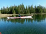
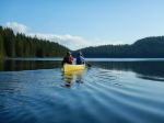
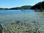
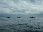
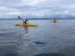
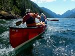
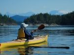
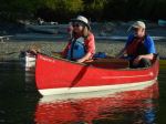
Six Club members and one guest enjoyed an (almost) idyllic summer day on the Salish Sea on our July 10 paddle from Open Bay to Village Bay and beyond.

Before embarking, we reviewed  our Club’s Paddling Guidelines and discussed the proposed route, predicted weather, tide and currents . Two paddlers volunteered to take the going and returning sweep positions.

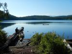
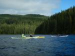
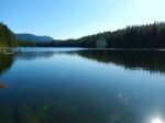
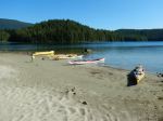
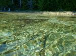
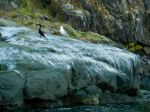
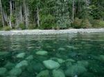
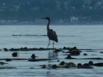
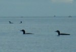
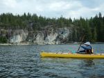
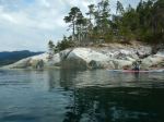
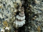
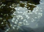
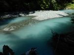
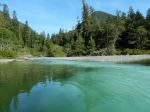
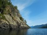
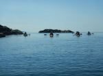
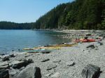
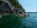
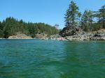
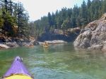
We enjoyed the easy launch from Open Bay using the beach property of a Club member and were soon perusing the islets around the Bretons. The calm, almost benign conditions encouraged us to take the outside route around the Bretons up Hoskyn Channel. We saw seals and many seabirds, including Mergansers, Oyster Catchers, Harlequins, Guillemots, and, most notably, Arctic Terns, possibly attracted by the large shoals of herring visible around the rocky reefs. Even though there were several boats apparently watching the whales who were audibly breaching and blowing south of us, disappointingly we did not see any whales during our paddle.

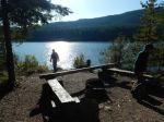
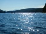
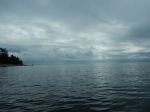
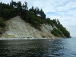
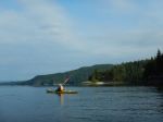
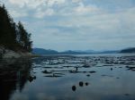
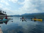
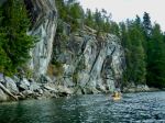
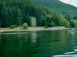
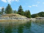
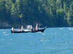
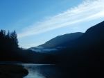
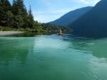
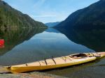
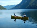
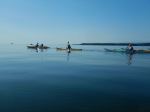
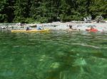
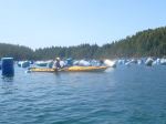
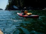
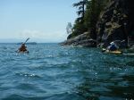
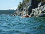
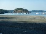
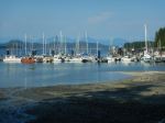
We arrived at Village Bay in time for a leisurely lunch, enjoying the warm sun and social time. As predicted, the wind began to rise just after 12:00, creating some visible chop. Still feeling energetic, we decided to proceed further north to paddle around Bold Island and visit the oyster and mussel farm. The aquaculture-farm was in full operation as we paddled leisurely by, to the envy of the workers. As expected, the conditions changed from benign to more challenging as we left the protection of Bold Point and came out into Hoskyn Channel. Given the wind/wave conditions we opted to head directly across to the entrance to Shellaligan Pass. The pass was a peaceful respite before the even more challenging conditions in Open Bay. A short, invigorating paddle through the rocky reef brought us back to the protected, calm waters of our launch site.  (15.1 km; 5 hours with lunch)

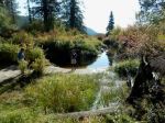
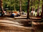
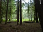
Once our kayaks and gear were loaded, we very much enjoyed a social hour on our Club member’s shaded and tranquil deck. We were also well entertained by the hummingbirds and swallows attracted to the many feeders, and nesting boxes on this lovely property.

With many thanks to the two volunteers who acted as sweeps on this trip, and especially to the Club member who offered us the use of their beach access, and then a social hour on their lovely deck afterwards.

Valerie van Veen

Thanks to Valerie and Norris for the photos.


(click on photos to enlarge)

Kayaking – Open Bay to Village Bay – 10 July 2023

Trip Report – Heriot Bay – 7 July 2023

Eight paddlers launched at the Esplanade Park beach and headed off at 1900 for a meander along and around the islands between Heriot Bay and Hyacinthe Bay into the bright evening sun. It was a perfect summer evening, with favourable tides, a convivial group, and very light breeze.   We paddled between Heriot and Quadra Islands, and up into Hyacinthe Bay, turning around Turtle Island and heading back toward our launch site.

Unfortunately all was not perfect and a number of circumstances resulted in two of the eight paddlers becoming separated from the group.  This was a good heads-up to review the paddling guidelines and tighten up our Club practices.

With all eight paddlers back on the beach we quickly loaded up our gear, debriefed somewhat, and regrouped at the Heriot Bay Inn for cold beverages and very congenial conversation.  (About 5 km)

Debbie and Vic

(click on photos to view larger)

Happy Hour Paddle – Heriot Bay – 7 July 2023

Kayaking – Open Bay to Village Bay – 10 July 2023

Activity Kayaking
Destination Open Bay to Village Bay
Date 10 July, Monday
Trip Coordinator Valerie Van Veen
Contact Info 250 285 2329 vvv@qisland.ca 778 242 5774
Description July 10 is the perfect day to launch from the Open Bay area with a higher tide throughout the day. This will be a gentle paddle to explore the Bretons, go through Moulds Bay and the Pass with the high tide allowing us passage, then on to Village Bay. We can go further afield if the group wishes, to Bold Island and possibly over to Dunsterville and surrounding islets. We have seen Humpbacks out in the Channel so we may be lucky on this trip.
Meeting Place Launch will be from the low gravel beach at a member’s home close to Valdes Beach.  Meeting point address and instructions will be given to Club members when they sign up for this trip.
Departure Time Meet at 9:30 am, on water by 10:00
Difficulty
Moderate
Costs None
Trip limits None
Dogs
Notes: Must have ocean kayaks with all Transport Canada required safety equipment. Trip is weather and wind dependent. Only signed-up participants will be contacted of any changes in plans. MUST sign up by Saturday evening, July 8. Bring lunch, water.