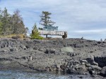
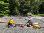
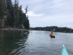
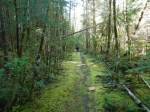
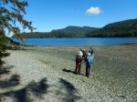
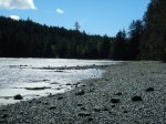
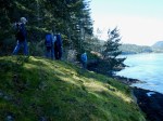
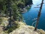
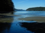
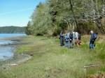
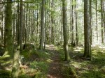
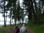
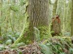
The weather was as unsettled as promised, a short, violent hailstorm as I left home almost convinced me to change our destination. However, the weather seemed to improve as the morning wore on so we opted to chance it, with the caveat that, if the predicted thunderstorms did materialize while on the trail, we would immediately abort the hike. Indeed, after a few unexpected delays, as eight hikers finally began our excursion at 12:20, the sun began to burst through, highlighting the luxuriant spring green moss and groundcover. This is a pretty trail, most of it on gently sloping old logging roads leading to the border with the Conservation area. At the junction of the old road with the trail proper we came across a quartet of abandoned bikes. We met their owners a few minutes later, a young Island family, returning from their trek out to Maud. We lost our weather gamble just as we hiked the final slope to the viewpoint, fortunately just heavy rain, no thunderstorms! With our planned later start time (thanks Les!) we arrived at the viewpoint at 2:20, just 30 minutes after the predicted 14 knot full flood. A zodiac gave its boatload of tourists a thrill as it rode the currents and rip tides at the south end of Seymour Narrows. A small cruiser was getting a free ride downstream, backwards! Not sure if that was the planned route. As the rain settled in with a vengeance, we had a hasty lunch under the trees, not like our usual summer sojourns in this very scenic spot. We were back at our cars just before 4 pm.
NOTE: the logging roads accessing the trailhead have been extensively built up since I hiked Maud Island last fall. It appears that there have been washouts, many stretches of formerly soft roadbed are now built up with rough rocks … sturdy vehicles such as pick-up trucks are recommended. Also, the junction with the logging road off Walcan Road has been widened so the Trail sign is no longer there. All further trail signs are still in place. And just at the crest of the final bluff there is now a new path that turns left, cutting through the forest to the viewpoint, bypassing the moss covered rocks that are slippery when wet!
Valerie van Veen
Thanks to Valerie for the photos.
Click on photos to enlarge
-
-
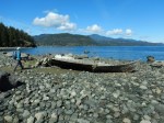
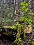
Long abandoned car
-
-
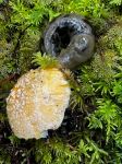
Slug with a mushroom
-
-
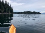
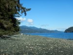
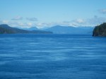
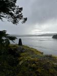
View of Seymour Narrows
-

Hiking – Maud Island – 6 May 2024