| Activity | Kayak training |
| Destination | Mine Lake |
| Date | 12 Aug 2020, Wednesday |
| Trip Coordinator | Brent Henry |
| Contact Info | brenthenrys@gmail.com or 250-205-1106 (phone or text). Contact the coordinator in advance |
| Description | This will start with a short session on outfitting a kayak for safety. We’ll do a short paddle with some rescue and skills practice, for 2 or 3 hours. |
| Meeting Place | Mine Lake parking lot |
| Departure Time | Meet at 9:00; launch at 9:30 |
| Difficulty | Easy |
| Costs | none |
| Trip limits | 6 |
| Dogs? | No |
| Notes: | All safety equipment required. Bring a lunch. This is not a formal instruction session. We will all share our knowledge. |
Category Archives: Quadra Island
Hiking – Chauntaluf Farm – 2 Sept 2020
| Activity | Hiking |
| Destination | Chauntaluf Farm |
| Date | 2 Sept 2020, Wednesday |
| Trip Coordinator | Debbie Quigg |
| Contact Info | debbie.quigg@ualberta.ca or 3710 |
| Description | Heather Kellerhals has generously invited us to hike at the family property. There are many options, but we will probably hike out to Hyacinthe Point and on to the Coast Mountain Lookout, if the group is up for it. The invitation includes swimming in the Pond. We will not do this trip if the weather isn’t reasonable for views. |
| Meeting Place | Heriot Bay Store parking lot to convoy to the property |
| Departure Time | 10:00 |
| Difficulty |
Moderate |
| Costs | None |
| Trip limits | 10. We may hike in pods. |
| Dogs? | No – not allowed on the farm |
| Notes: | Bring lunch and poles if you use them. If you want to swim, bring what you need. COVID-19 protocols will be in effect. |
Trip Report – Open Bay – 5 Aug 2020
Five paddlers left Len Road launch on a bright sunny day with flat water. We went south between the small islands and Quadra. Then we traveled over to Seal Rock where there were about 50 seals and pups. We stayed well away so as not to disturb the pups. As we paddled past the entrance to Open Bay we were treated to an aerial show by two eagles.
After unloading anything that we did not want to get wet the group practiced a few different paddling techniques, edging/bracing and such. Two paddlers practiced self rescue. The water was surprisingly warm. We then dried off and had lunch on the beach.
The wind came up a bit on the return but was welcomed in the heat. 4 NM in total and 3 1/2 hours including the practice.
Les
Kayaking – Open Bay – 5 Aug 2020
| Activity | Kayaking |
| Destination | Open Bay |
| Date | 5 August 2020; Wednesday |
| Trip Coordinator | Les Hand |
| Contact Info | 285-2029 or leshand@gicable.com Please contact the coordinator in advance of the trip. |
| Description | This will be a casual paddle around Hyacinthe and over to the beach at Open Bay. There we will do some paddle practice and self rescue for those that wish to. Assisted rescue only for those that have someone within their bubble available. The choice will be up to you. After we will have a lunch on the beach and paddle back to Len Road. |
| Meeting Place | Len Road |
| Departure Time | Meet at 9:30, launch at 10:00 |
| Difficulty | Easy |
| Costs | None |
| Trip limits | 8 |
| Dogs? | |
| Notes: | All safety equipment required. Bring a lunch. I am not an instructor so what we do will be dictated by the group. |
Trip Report – Plumper Bay – 22 July 2020
Seven of us and one dog hiked to Plumper Bay. The day was clear and sunny. We hiked through the forest, with just the right amount of shade. In the first part of the route follows the Maud Island Trail, where the forest ground cover is beautiful moss. The second part of the route is an old road, possibly built for the Seymour Narrows blasting in 1958, as well as for logging. The road bed is still in great condition, although littered with dead branches. The lunch stop is where that road comes out in Plumper Bay, on the north shore. We sat by the water in the shade with a gentle breeze. After picking up some garbage, we headed back. The group was up for a little adventure, so we took an old logging road which had reverted to wonderful deep moss. We made our way through the forest back to the Maud Island Trail and the cars. 7.0 km, 3¼ hours.
– Norris
Thanks to Norris and Les for the photos
(click on photos to enlarge)
- Plumper Bay main
- Plumper Bay
- View to Discovery Passage
- Inchworm
- Sea urchin
- Puff Balls
- Old moos-covered logging road
- Dog vomit slime mold
- Gnome plant
Hiking – Newton Lake-Small Inlet-Waiatt Bay – 19 Aug 2020
| Activity | Hiking with swimming |
| Destination | Newton Lake, Small Inlet and Waiatt Bay |
| Date | 19 Aug 2020, Wednesday |
| Trip Coordinator | Vic Gladish |
| Contact Info | vicgladish@gmail.com; 250-285-2111; (cell 250-287-0459) |
| Description | We will hike up to Newton Lake, down to the portage between Small Inlet and Waiatt Bay and back to the Newton Lake parking lot. Distance about 15 kilometres – will take approximately 6-7 hours (including lunch and short swim stops at Newton Lake) |
| Meeting Place | Newton Lake trail head (off Granite Bay Rd) |
| Departure Time | 9:00 |
| Difficulty |
Moderate for distance and steep grades |
| Costs | none |
| Trip limits | 10 with pandemic protocols |
| Dogs? | okay |
| Notes: | Bring plenty of water, lunch and snacks, and swimming stuff if you want to swim. |
Trip Report – Open Bay/Sutil Channel/Octopus Islands – 12-15 July 2020
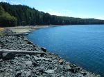
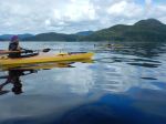
Day 1. Six paddlers launched from the end of Valdes Road on a fairly high tide, leaving the beach about 10:45 toward the Penn Islets. The weather was sunny with some overcast and the occasional rain squall, winds light. With a favourable current, we made excellent time, arriving at the campsite on North Penn Islet in just under 3 1/2 hours paddling time. A lovely classic cruiser was anchored in the nook south of the campsite, but very few other boats seen. The campsite is beautiful, with great views from the bluff, and some good forest sites also. Distance covered – 16.6 km in 3 hours and 20 minutes.
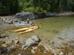
Day 2. As the day was sunny with light winds forecast, we made a side trip to the entrance of Von Donop Inlet and stopped for a break at the campsite in Robertson Cove. While the location has several tent sites, and a trail to Robertson Lake, it seemed dark and is exposed to the west. Easy landing. We then paddled toward South Rendezvous Island, our planned stop for the night. Unlike other years, this large and very attractive site was empty. The summer has been disastrous for local outfitters, but it has meant that more camping options are available than usual. Easy access from the north, several tent sites, and a small creek. One or two tent sites also available on the tidal island in front of the main site. Hot afternoon. Distance covered 16.2 km in 4 hours and 10 minutes.
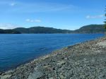
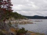
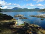
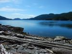
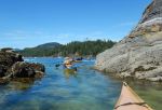
Day 3. We launched about 9:45 to be in good time for slack at Surge Narrows. Paddling up the west side of the Rendezvous Islands to the south tip of North Rendezvous, we crossed to Mayes Point at the entrance to White Rock Passage against a fairly lively adverse current. After a short stop on the south shore of the Passage (just before the campsite noted on the Marine Trails website), we paddled through the Settlers Group in good time. As the weather was very calm, we paddled a straight course up Okisollo Channel to the Octopus Islands to benefit from the favourable ebb tide. Several other parties of kayakers spotted, and the usual population of pleasure boats in the park. We camped on the shore of a very “clammy” cove on the south shore of Waiatt Bay. There is a good creek draining an unnamed lake. The grassy site is good for 2 and possibly 3 tents; others uncomfortably close to the high tide line. Another hot day. Distance covered 21 km in 5 hours 10 minutes.
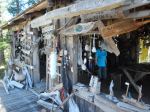
Day 4. Heading home, we made a short stop at the ‘museum cabin’ on the more southerly of the private islands adjacent to the park. Many boaters (often for successive years) have left mementoes of their visits in the cabin. We then took a short swing through the islets and headed to Yeatman Bay for lunch and to wait for slack in Surge Narrows. We slipped easily through the rocks between Quadra and Peck Island on the last of the flood, and with increasing following winds and a fair current, landed in Open Bay less than half an hour after high tide, for an easy landing and a short carry. Distance covered 23.9 km in 5 hours and 23 minutes.
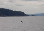
The weather throughout the trip was great and the first two campsites excellent. We didn’t see much wildlife apart from a few harbour porpoise, some seals, and sea birds, apart from one fledgling eagle that we hoped would be rescued by a parent as it looked very forlorn on its rock. Total trip distance – 77.7 kilometres for an average speed of 4.3 km per hour.
Darcy
(click on photos to view larger)
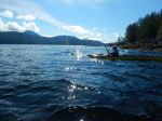
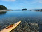
- Departing from Valdes
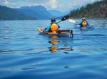
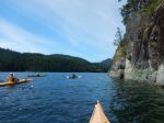
- Crossing south of Read Island
- Arriving at Penn Islets
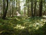
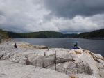
- Campsite at Penn Islets
- Days 2: Sutil Channel
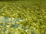
- Oyster shells in shallow water
- Sutil Channel
- Arriving at S Rendezvous Island
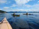
- Day 3: Entering Okisollo Channel
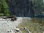
- Lunch break on Maurelle Island
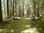
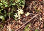
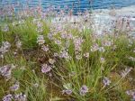
- Onion grass at Waiatt Bay
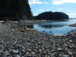
- Day 4: Waiatt Bay & Octopus Islands
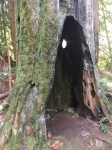
- The museum cabin
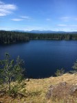
- View south to Okisollo Channel
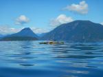
- Octopus Islets
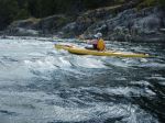
- Hoskyn Channel in rising wind
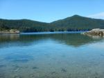
- Haul out at Valdes
Trip Report – Morte Lake Loop – 15 July 2020
It was a beautiful day and our hike began on the Deadfish trail where we enjoyed lush ferns as we followed the creek bed listening to the sounds of water flowing. At the first bridge we went over to the Morte Lake loop trail and stayed right to do a counterclockwise loop around Mort Lake. We took the new trail until we went left to the lookout where we stopped and took in the spectacular view of the lake below and the majestic mountains. From the lookout, in order to avoid water covering the main trail further along we followed the orange markers on the trees along the bluff which led us under a fallen tree where we saw a gnome and back to main trail and to the sandy beach where we enjoyed lunch before continuing on the remainder of the loop and back to the parking lot. We had the trail to ourselves and didn’t encounter another hiker until shortly after lunch, and it wasn’t until we were on the last leg of our hike before we encountered 3 more hikers. It was very pleasant and everyone maintained social distancing.
Vikki
Thanks to Vikki for the photos
(click on photos to enlarge)
Trip Report – Shellaligan Pass Loop – 8 July 2020
Six QIOC club members and one dog were heralded back onto Quadra trails with a two flipper salute and several large blows from a pair of humpbacks cruising down Hoskyn Channel in front of Shellaligan Beach. Their welcoming slaps set the tone for a very pleasant hike on the “long” Shellaligan loop, luckily sandwiched in between the seemingly never-ending rainstorms of late. Surprisingly, the rock bluffs along the seashore were dry, despite the early morning rain. We took advantage of the good weather to take an early lunch break on the granitic bluffs, even enjoying a few rays of sunshine. The trail was in good condition, branches and deadfall have been cleared in the forest section and bridges are in good repair. Some beach debris (mostly fish- and shellfish -farming debris) has been piled at the beach access points, hopefully to be removed by a boater (or very enthusiastic hiker) soon. Along the trail we saw several outcroppings of Indian Pipe, and one bright spot of “Dog’s Vomit” slime mold (or, more elegantly, “Scrambled Egg” Slime). The “Neurotic Sapsucker” tree amused those who had not done this section of the trail before. We also saw several fresh wolf scats on Boletus Road and Village Bay Main. As we hiked, and stopped for breaks, we had no problems in adhering to our Club’s new distancing and talking protocols. Altogether, a great start to our “Covid” hiking season. Time: 3 hours including a 20 minute lunch break
Valerie
Thanks to Valerie and Diana for the photos
(click on photos to enlarge)
- Humpback waving
- Dog Vomit slime mould
- Scots Thistle
- Bluff at lunch break
- Coral fungus
- Wolf Scat
- Indian Pipes
Hiking – Beech’s Mtn Loop – 29 July 2020
Please note change of start time to 9:00
| Activity | Hiking |
| Destination | Beech’s Mountain Loop |
| Date | 29 July 2020, Wednesday |
| Trip Coordinator | Brent Henry |
| Contact Info | brenthenrys@gmail.com or 250-205-1106 (phone or text). Contact the coordinator in advance |
| Description | Starting at the Chinese Mountains trailhead, we follow the South Chinese Trail to its juncture with Beech’s Mountain Trail. Along this trail we ascend many steep rock bluffs with spectacular views to the east, west and south from the open bluffs. At the top of Beech’s Mountain, we make a steep descent through the forest to an old rough logging road. Eventually the route veers away from the road onto mossy bluffs with convoluted route-finding using flagging tape. The route connects with the North Chinese Mountain Trail (essentially a steep rubbly old logging road) which we descend to the parking lot. |
| Meeting Place | Chinese Mountain parking lot |
| Departure Time | 9:00 |
| Difficulty | Moderate to difficult (many steep and potentially slippery bluffs to negotiate, as well as steep rocky logging roads) |
| Costs | none |
| Trip limits | 8 participants in 2 pods |
| Dogs? | OK if not running and under control. Owner must have leash available. |
| Notes: | Sturdy hiking shoes/boots required. Coordinator will have 2 family walkie talkies. Hiking poles may be helpful. Bring a lunch or snack and sufficient water. Estimated time 4 hours. |


