| Activity | Hiking |
| Destination | Morte Lake Loop |
| Date | 6 July 2016, Wednesday |
| Trip Coordinator | Julie Mellanby |
| Contact Info | 285-3978. Please contact the trip coordinator prior to the trip. |
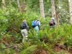
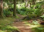
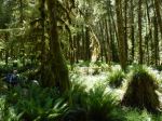
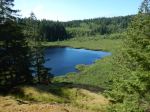
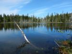
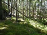
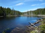
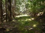
| Description | We will hike the classic loop on maintained trails. This is a lovely walk through open forest around the lake on bluffs, old logging roads and trails. If the weather is good, there will be time for swimming. |
| Meeting Place | Heriot Bay store parking lot, to arrange carpools |
| Departure Time | 09:00 |
| Difficulty |
moderate |
| Costs | none |
| Trip limits | none |
| Dogs? | yes |
| Notes: | Bring lunch and water. |
Category Archives: Quadra Island
Hiking – Mine Lake Bluff – 15 June 2016
| Activity | Hiking |
| Destination | Mine Lake Bluff |
| Date | 15 June 2016, Wednesday |
| Trip Coordinator | Debbie Quigg |
| Contact Info | phone 3710 or debbie.quigg@ualberta.ca. Please contact the coordinator in advance. |
| Description | We will leave from the parking area on the road near the Mine Lake access and walk to Camp Homewood. From there the route ascends the bluff to the north of Mine Lake with great views (weather permitting). A loop will be made by a trail which descends to the north and circles back to the trail just before Camp Homewood. The route up the bluff can feel a bit exposed. If the weather is nice, there will be time for swimming. If the weather is awful, we will hike somewhere else. |
| Meeting Place | Heriot Bay Tru Value parking lot |
| Departure Time | 10:00 |
| Difficulty | moderate, tricky in places |
| Costs | none |
| Trip limits | none |
| Dogs? | no |
| Notes: | Bring lunch. |
Trip Report – Open Bay – 6 June 2016
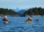
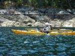
Our paddle on Monday, June 6, started from a new launch site for most of us, the end of Breton Road in Open Bay; a short downhill, a short walk avoiding the nettles, a few logs and the inevitable rocks though not as big nor as steep as at the more commonly used Valdez beach launch site. Five of us were on the water by 10:30 am. The overcast soon dissipated and the weather quickly turned from warm to hot, northwest winds gusted to about 20 knots throughout the day.
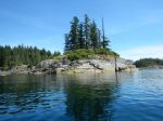
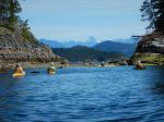
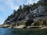
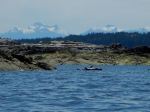
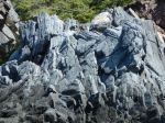
We paddled east along Open Bay shores, admiring the contorted and dramatic geology, peered into one cave, then turned north into Moulds’ Bay. The rapidly dropping tide prevented us from taking the shortcuts so we paddled through Shellaligan Pass into Hoskyn Channel, past the north Breton, then into Village Bay. The snow-dappled peaks of the Coast and Vancouver Island mountain ranges provided dramatic backdrops to the north and west.
Our lunch stop, after one and a half hours of paddling was Village Bay beach where we noted the new signage posted by the We Wai Kai nation, as this is Reserve land. The very low tide revealed eel grass and its many inhabitants and the rich marine life in the intertidal zone.
After a short lunch break we were boosted on our return by a following sea pushed by the north-west winds and the flooding tide. We stayed in Hoskyn due to the very low tide, and turned west to Open Bay on the north side of the southernmost Breton. Here we stopped to admire the seals laying on their backs on rocks just above the tideline, apparently sunning their bellies. We also saw many oystercatchers and a flock of wood ducks as well as several herons, gulls, and eagles.
As we came into Breton Beach we could see sea urchins, pencil stars and bat stars on the rocks below. The very low tide meant a long haul up the rocky beach, the usual challenge of launching from Open Bay. We were off the water by about 2:45 pm after a hot but very pleasant paddle.
Valerie
- Open Bay geology
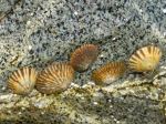
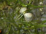
- Limpets
- In Shellaligan Pass
- Lunch stop at Village Bay
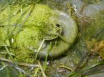
- Moon Snail egg case
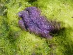
- Sea Star
- Seal sun bathing
- Breton Road launch site
(click on photos to view larger)
Trip Report – Surge Narrows Trail – 1 June 2016
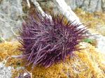
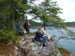
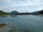
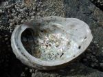
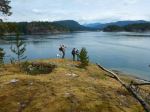
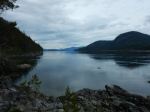
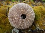
Six of us enjoyed our hike along the Surge Narrows trail. We stopped at the first viewpoint to watch the tidal rapids (8.8 knot flood tide at 11:00), then walked the route trail and shoreline through Raven Bay. We had good views of starfish and urchins. After lunch on the rocky point the tide was still low enough to go to a small island for views up Okisollo Channel.
Julie
- Foxglove
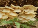
- Oyster mushroom
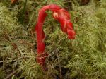
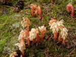
- Pinesap
- Pinesap
- Sea Urchin
- Flooding though Surge Narrows
- Foxglove
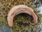
- Abalone shell
- Dead sea urchin shell
- Chiton
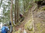
- Steep place on the route
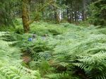
- the bracken forest
(click on photos to view larger)
Trip Report – Stramberg Old Growth – 25 May 2016
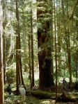
Four hikers and one dog enjoyed a lovely spring hike, beginning at the south end of Vic’s marsh where we were fortified by ripe salmonberries. We stopped for a look at the old barn built by Vic Balatti. The building is still sturdy but several square-timbered floor and ceiling joists have been removed. The trail winds along the marsh through open Douglas fir forest with occasional old growth fir. Past the end of the marsh the trail passes through stands of moss-covered alder, hemlock and back into mature fir. Several old growth cedar are lying on the ground where they were cut sometime in the past and left for some reason. One large solitary Western white pine was noted along the trail. We stopped for lunch in a grove of old growth fir, then proceeded on a short distance to the main stand of old fir trees. One giant clearly stood out in the crowd, a massive, stovepipe-straight beauty that was worth the hike all by itself.
The north half of the trail is less used but well-marked with flagging tape. Sections of the trail at this end could be improved by a chainsaw and clippers where downed trees make going slow. On the way back, we stopped off for a snack at the bluff overlooking the lake at the north end of the marsh. By mid-afternoon, the day was warming up so a cool Northwest breeze was welcome. Hiking time was a bit more than 5 hours moving at a good pace, and including lunch and a snack break (13.2 km). Highlights were the old fir trees, of course, but also the wide variety of plant communities we hiked through.
Janis
- Salmonberry
- Vic’s Marsh
- Emerging Pinesap
- Lake at Vic’s Marsh
(click on photos to view larger)
Trip Report – Around Mt. Seymour – 13 May 2016
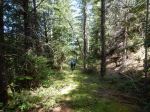
Five of us hiked from the Nugedzi trail head, up the old logging road north of Beech’s Mountain, along the old logging road that runs on the west side of the Nugedzi plateau, up a trail to a viewpoint of Nugedzi Lake, then down along a flagged route and trail to connect up with another old logging road which continues below the west and north sides of Mount Seymour and then descends, ending in a recently logged area just south of the gravel pit. The old logging roads can be very nice for walking, covered by a carpet of moss when they are level. The steep ones can be rough walking though.
The west side of the Nugedzi plateau features a number of small lakes or ponds. The north side of Seymour features some nice views to the north.
The trip was 14.4 km and took 5.5 hours, not including the car shuffle.
Norris
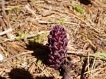
- Pinesap
- Vancouver gound cone
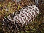
- White pine cone
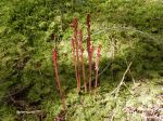
- Spotted coral root
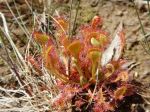
- Round leaf sundew
- View north
- View northeast
- Penstemon
(click on photos to view larger)
Kayaking Training – Mine Lake – 29 June 2016
| Activity | Kayak training and refresher course |
| Destination | Mine Lake |
| Date | 29 June 2016, Wednesday |
| Trip Coordinator | Darcy Mitchell and Valerie van Veen |
| Contact Info | vvv@qisland.ca. |
| Description | Doug Taylor, Paddle Canada kayak skills instructor, will provide training (or skills review) in assisted rescue, self-rescue and bracing (techniques to avoid kayak capsize). Depending on the number of registrants and their background and experience, we may have one session for those without prior training, and one for those with training in these skills. Assignment of individuals to particular sessions will take place once registration is complete; if most people are looking only for skills review, we may not be able to offer basic training in this session. Contact Val van Veen at the email address given above to be sent a registration form that will include requested information about your current skills level and completed training. |
| Meeting Place | Mine Lake boat launch/ beach access, 2 km beyond Village Bay Lake |
| Departure Time | Session 1 – 8:30 am; Session 2 – 12:30 pm |
| Difficulty |
NA |
| Costs | $55 per person |
| Trip limits | 10 (5 per session) |
| Dogs? | no |
| Notes: | Space is very limited and participants will be registered on a first-come, first served basis. Deadline for mailing the registration form with payment is 8 June. |
Hiking – Open Bay – Big Beach Creek forests – 22 June 2016
| Activity | Hiking |
| Destination | Open Bay – Big Beach Creek forests |
| Date | 22 June 2016, Wednesday |
| Trip Coordinator | Valerie |
| Contact Info | 285-2329 or vvv@qisland.ca. Please contact the trip coordinator prior to the trip. |
| Description | North Island people can meet at intersection of Hyacinthe Bay Rd and Granite Bay Rd. We will make the loop that was identified in a few explorations this winter/spring, using trails, routes, and logging roads. Be prepared for some bushwhacking. About 3-4 hours of hiking. Bring snack/lunch. Alternative may be arranged if raining. |
| Meeting Place | Heriot Bay Parking Lot at 10 am; Granite Bay Rd. intersection at 10:15 |
| Departure Time | 10:00 |
| Difficulty |
moderate |
| Costs | none |
| Trip limits | none |
| Dogs? | Must be under control at all times |
| Notes: |
Kayaking – Open Bay – 6 June 2016
| Activity | Kayaking |
| Destination | Open Bay |
| Date | 6 June 2016, Monday |
| Trip Coordinator | Valerie |
| Contact Info | 250-285-2329 or vvv@qisland.ca. Please contact the coordinator prior to the trip. |
| Description | This will be an intermediate paddle. Depending on currents, weather, we could paddle to/around the Bretons, Moulds Bay, Village Bay, into Hoskyn Channel. Lunch stop to be determined enroute. |
| Meeting Place | Launch site, Breton Rd, Open Bay |
| Departure Time | 10:00 (arrive around 9:30 to prepare) |
| Difficulty |
intermediate, strong winds and currents possible |
| Costs | none |
| Trip limits | none |
| Dogs? | no |
| Notes: | Participants must be prepared for wind and strong currents; kayaks must be ocean kayaks equipped for ocean conditions. If access road is wet we will have to carry/trundle kayaks down a short hill to the beach. Meet at launch site (end of Breton Road) after 9:30 to be on water by 10 am. |
Hiking – Surge Narrows – 1 June 2016
| Activity | Hiking |
| Destination | Surge Narrows |
| Date | 1 June 2016, Wednesday |
| Trip Coordinator | Julie Mellanby |
| Contact Info | 285-3978. Please contact the trip coordinator prior to the trip. |
| Description | We will hike the trail to the Surge Narrows viewpoint. There will be nearly a 9 knot flood current at 11:00. We will continue on the unmaintained route for additional views of the rapids. |
| Meeting Place | Heriot Bay store parking lot, to arrange carpools |
| Departure Time | 09:00 |
| Difficulty |
easy |
| Costs | none |
| Trip limits | none |
| Dogs? | yes |
| Notes: |