Trip Report – Beech’s Mtn Loop – 27 Aug 2025

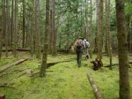
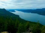
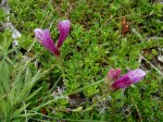
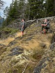
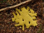
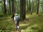
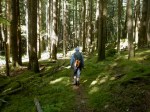
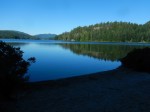
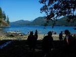
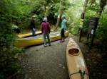
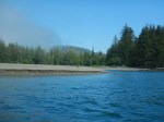
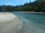
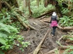
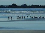
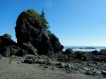
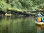
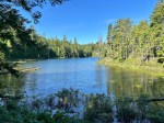
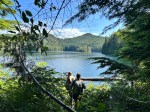
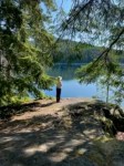
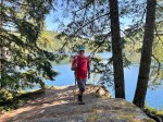
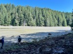
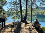
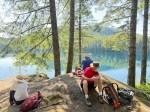
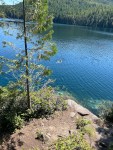
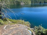
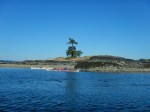
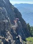
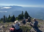
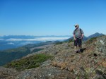
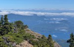
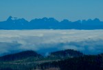
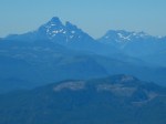
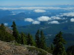
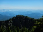
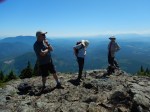
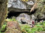
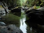
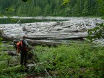
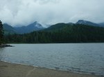
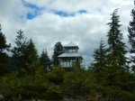
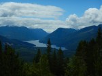
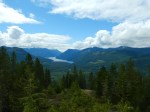
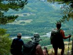
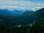
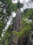
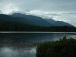
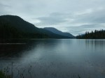
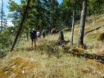
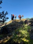
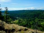
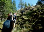
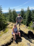
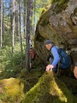
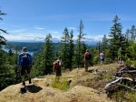
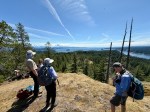
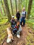
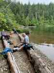
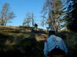
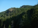
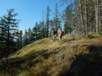
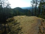
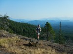
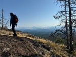
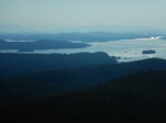
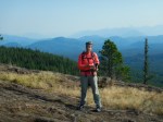
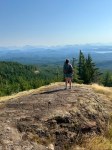
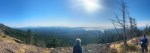
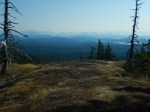
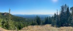
Instead of doing Campbell River Lookout, due to heat and unexpected circumstances, we decided to do a Beech’s Mountain Loop. This is a challenging hike, but not as much as Campbell River lookout. We had an early 8:15 start from South Chinese Mountain parking lot. It was a lovely 15° but with smoky skies. On the way up, Norris showed us a short alternate route instead of going up the washed out creek. When we got back on the main trail, we continued to the junction of Beech’s Mountain and South Chinese and had a short water break. This is a excellent spot to listen to frogs in the early spring. Once we got onto one of the open ridges we were surprised to find a big Canadian flag in one of the trees. There are great views on the open ridges to the west, but the smoke hampered some of the pictures. We continued the steep ascent and took a break on the large open rocks where you have great views to Rebecca Spit and the mainland mountains. After this, we had lunch on the top of Beech’s Mountain, where we enjoyed the views and shade after the steep climb.

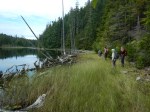
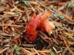
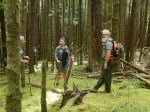
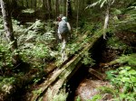
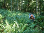
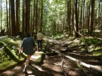
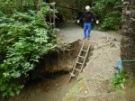
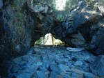
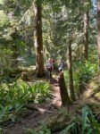
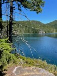
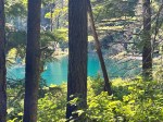
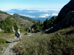
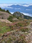
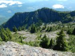
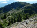
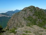
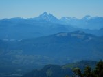
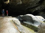
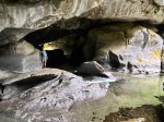
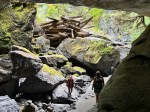
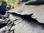
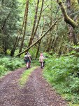
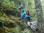
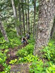
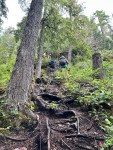
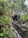
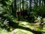
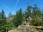
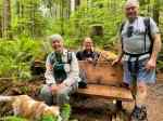
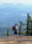
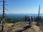
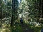
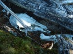
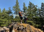
There was a steep descent then to the old road that comes up from the Nugetzi Lake turn off. This trail is not well used, but was flagged well. The old road is quite washed out with many loose rocks, but was a nice walk in the shade of the trees. We came to the turn off that goes to North Chinese Mountain and were surprised to find that it has hardly been used the last few years. I had an old track from 2014 that we followed. We came across a few old flags that marked the trail, but there is much blow down and salal and would not recommend it to anyone that does not like bush whacking. There are many large bluffs along the way that give great views. When we came to the last bluff before North Chinese Trail, we were surprised to find that someone had brought up a large, old fishnet and strung it between three large trees over the top of the bluff. I actually think this could be quite dangerous as it is 8′ above the rocks in some places.

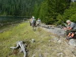
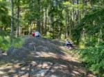
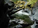
We continued on to North Chinese trail and descended back to the parking lot and our vehicles. It was starting to warm up now so we were quite pleased that we had left early.
(6.5 km, 3¾ hours, 420m ascent)

Les

Thanks to Jim, Carrie, Les and Norris for the photos

(Click on the photos to enlarge)

(click on photos to view larger)

Hike – Beech’s Mtn Loop – 27 Aug 2025

Trip Report – Manzanita Bluff – 8 Aug 2025

The Manzanita Bluff hike was postponed due to weather and it was worth the wait. Attending were six adventurous hikers that survived the long drive up the logging roads to the trailhead. We were surprised to find the first 100ft of the trail recently groomed with the blackberry and salmonberry branches removed. The route is now a well marked trail up to the Bluffs following the creek bed and eventually through an open forest with beautiful mature Douglas Fir trees.  By consensus, we decided that this trip was fairly challenging.

The group had a light snack surrounded by the Manzanita bushes and taking in the amazing views. The trail taken back was a loop back to Darkwater Lake where we all had a great lunch and a few took the opportunity for a cool swim before returning to the trailhead.  

Afterwards, most of the group went down to the bay on Discovery Passage for the view. 

Total distance of 5.1km, 340m ascent and total time of 4hrs 16 min.

Louise
 

(click on photos to enlarge)

Hiking – Manzanita Bluff – 8 Aug 2025

Trip Report – Main Lake and Yeatman Bay – 30 July 2025

It was a beautiful, but hot day for our hike into Main Lake Provincial Park and down to the Lake.  We started an hour earlier than originally scheduled due to the heat.  The eight of us hiked down through the beautiful forest, with green mossy understory in spite of the drought. The campground at East Beach was empty on arrival.  It was too early for lunch or even a swim, so we continued on, crossing the new skookum bridge over the creek, to admire the view from the swim rock, and then walk over to Yeatman Bay.  A large kayak group had pulled-up on shore just as we arrived.  After a short break we headed back to the campground for lunch.  The bay was very busy with three groups of visitors for the day.  About half of our group swam before heading back up the hill to Surge Narrow Rd and the cars.  It was a classic summer day for a wonderfully varied hike.  (9.7 km; 315m ascent; 4½ hours)  

Debbie
 

(click on photos to enlarge)

Hiking – Main Lake and Yeatman Bay – 30 July 2025

Reconnaissance Report – Raft Cove Provincial Park – 22-24 July 2025

We had wanted to visit Raft Cove by boat from the Mackjack River for at least a decade.  The combination of adequate information, timing and weather never worked out until July 2025.

The launch site is now well known and quite popular.  After the short, gravel path, access to the river is down a wooden ladder.  We thought the shore would be muddy, but it’s more like sand.  It works best to depart just as the tide in the river peaks and turns to ebb. This allows the boats to go with the current and float over the fallen trees.  The paddle down the river was lovely and makes clear that we are in a temperate rainforest.  It was mostly sunny and very quiet except for the Kingfisher.  The weather at the beach was “coastal” – warm with soft clouds and not too windy.  We set up our tents on the beach.  There were quite a few others camping in the park, but the area is large and absorbs many.  The park infrastructure of tent pads, outhouses and food caches was quite good for a remote park.

We had no particular agenda for our middle day.  The morning cloud/fog lifted to a brilliant, sunny day.  We relaxed in camp and walked a lot on the long, sandy beach, visiting the arch and sea stack.  We walked the hiking trail to the parking lot.  This was not exactly part of the plan, but the recent drought and the trail upgrade in 2009-2010 made this a reasonable walk instead of a gymnastic exercise climbing over fallen trees and through mud pits.

We packed up on the third morning and paddled across the river to briefly explore the south side of the park.  Although it was a bit early for the rising tide, we went with the flood tide back up the river returning to the launch site and the vehicles.  There were a few hurdles, but we arrived before two canoes launched and six paddle boards arrived after us.  This is a beautiful, wild area, but at least in the summer, it isn’t complete wilderness and solitude.

Debbie

(click on photos to enlarge)

Trip Report – Newton Lake and Small Inlet – 23 July 2025

A small group of four hikers undertook our “annual” midsummer trek to Newton Lake and Small Inlet. Being a hotter day we passed on the Waiatt Bay leg and allowed more swimming time.  It was shady and cool to start the hike so we arrived at Newton Lake in pretty good time. There was a solitary Common Loon to check on while we had a short drink break and then we headed to the Inlet.

Just under an hour later we were on the tidal flat of Small Inlet. The tide was flooding but still low enough to allow us to trek across to the spring and the trail to Waiatt Bay. The group decided to take the first turn off and headed back towards the lake. We crossed paths with a few boaters on their way to and/or from Newton Lake as we made the slow climb up the switchbacks with visions of lunch and a swim motivating a pretty steady pace.

We had the swim rock to ourselves and enjoyed a great swim on a beautiful summer day! The water was clear and not cold, the air warming towards mid-20s.  The shady trail down from the Lake made for an enjoyable walk out to the trailhead. (We were spared any attacks by wasps despite the warning sign posted by a hiker earlier this week).  (Length: 12.6 km, Time: 4 hrs 41 minutes)

Vic Gladish

Thanks to Jim, Louise and Vic for the photos

(Click to enlarge)

Hiking – Newton Lake and Small Inlet – 23 July 2025

Trip Report – Gowlland Harbour – 21 July 2025

Nine people gathered at my place for a easy paddle and social on a sunny summer day. Because of the driveway, launching from here is a challenge and the tide was very low. Once in the water we paddled north to check out all the new toys at Camp Homewood. It seems they have acquired many new and different types of boats. Then on to Seascape, now called Jade Resort, to find that the sunken barge had finally been cleaned up. Unfortunately, at the taxpayers cost. On past Gowlland Resort we turned and went to the Vigilant Islets for a quick stop and to stretch our legs. On our return, there was a colony of seals on Wren Islet that were enjoying the warm sunny day. We then paddled between Fawn Islet and Stag Island to return to my home for cold beverages and appetizers provided by everyone.  About 5 km and a 2 hour paddle. 

Les

(click on photos to enlarge)

Kayaking – Gowlland Harbour – 21 July 2025

Trip Report – Mt. Kitchener – 16 July 2025

Because of the hot weather, we decided on an early start.  We caught the 7am ferry and drove to the Big Tree turnoff, then up the logging road to the trailhead.  We started hiking at 9 am.  The first half hour is a well-worn trail up through the forest, with some blow-down at the edge of the clear cut.  Then there is a rock band, with a short scrambling section.  From then on, it’s all open terrain, alpine or sub-alpine with amazing views.  We decided to do Mt. Kitchener first.  We had an early lunch and lingered there.  Initially there were clouds in the valleys to the north, and it gradually cleared.  Other than that, clear and cloudless, with some haze to the south.  We were amazed that we could see whitecaps in Johnstone Strait, more than 1,400 metres below us. and Mt. Waddington, about 125 km to the north.  After that we visited Mt. McCreight, and then descended to the vehicles.

(4.3 km; 5 hours; 450 m elevation gain)

Norris 

Thanks to Les and Norris for the photos

(click on photos to view larger)

Hiking – Mt. Kitchener – 16 July 2025

Trip Report – Woss Lookout and Little Huson Caves – 9-11 July 2025

Five campers moved the trip dates forward one day due to rain forecast. This turned out to work very well as we only had showers one day and in the nighttime. We were going to camp at Woss Lake, but decided to check out Klaklakama Lake on the way and were very fortunate in getting the first place we stopped. After setting up camps, we had lunch and then proceeded to the Little Huson Caves. Atluck Creek has carved many sculpted images in complex shapes while running through Quatsino limestone. We first took a short walk and descended down the steep stairs to look at the River Cave from the north. The rocks were very slippery from the rain so we were not able to go below the platform and look into the cave. We then took the trail back up to the south opening where you could get down and look through the cave the opposite way. There are many places to explore here along the creek with beautifully shaped limestone. We also visited the Bridge Cave and then walked to Little Huson Lake. We then proceeded back to the campsite to have dinner and visit around the campfire.

(click on photos to view larger)

The next morning, we had a communal breakfast with blueberry pancakes, bacon, and devilled eggs. What a great way to start the day and fuel up for the hard hike up to Woss Lookout. From the parking area, we walked up the old logging road that is steep and has many loose rocks to the trailhead. This is a short steep hike with many ropes to help you up and over the rocks and roots. It was definitely a challenge to navigate up and even worse, coming back down due to the slick roots and rocks. At the summit, we enjoyed excellent views from the old restored lookout tower. You’re able to look up five different valleys from the top so you can see why this was such a good place for a fire tower. After descending, we drove back to camp to have another quiet evening by the lake.  (4.4 km, 3 hours, 375 m elevation gain, 35% in incline in the steep section)

Before heading home the next day, we visited the Upper Klaklakama rec site and walked the short nature loop with many fine old growth trees and some unusual trees like Pacific Yew and Amabilis fir.

Les

Thanks to Les, Jim and Norris for the photos

Multi-day Hiking – Woss Area – 8-10 July 2025

Trip Report – Heron Pt. and Mt. Sweat – 3 July 2025

Ten of us had a lovely day for this short hike with great views.  We started from Kolker Main and walked up an old logging spur.  We were amazed at how the brush had grown up this spring, obscuring fairly well used paths.  We quickly arrived at Heron Point for our first viewpoint extending from Hyacinthe Bay to the Chinese Mountains.  We continued on into Chauntaluf farm and followed  their trails up to the Mt. Sweat access.  We climbed steeply up to the first bluff and followed the cairns over the undulating bluffs and up to the Mt. Sweat viewpoint for lunch.  The 180° view takes in Quadra and the Salish Sea, with the mainland and Vancouver Island mountains.  We descended to the north, following flagging back to Kolker Main and from there to the vehicles.  Thanks to Heather Kellerhals for letting the Outdoor Club use the Chauntaluf farm trails to make this loop.  3.7 km, 2½ hours, 180m ascent.

Debbie
 
Thanks to Carrie and Norris for the photos
 

(click on photos to enlarge)

Hiking – Heron Point and Mt. Sweat – 3 July 2025

Trip Report – Morte Lake (Originally Plumber Bay) – 25 June 2025

The heavily loaded logging truck barrelling along the Walcan Road meant business as we manoeuvred our two cars, with four hikers and three dogs, as close to the road edge as possible. We soon realized that these trucks were coming from our eventual destination, the Maud Island / Plumper Bay trailhead. A quick but necessary change of plans and smart u-turn and we were back at our starting point, the Morte Lake parking lot. As this was billed as a low-key hike, we saw no reason to change that as well. We headed towards Morte Lake along the pleasant Deadfish trail, taking the bridge across the creek to connect to the main trail. We had a short, early lunch at the small north beach. It was still too chilly to swim, but at least no more rain after an earlier downpour. We took the main trail back to our cars, noting the improvements to divert runoff. Altogether a pleasant hike with a lake rather than ocean view for our break. (6.3 km 2.5 hours)

Valerie

(click on photos to enlarge)

Hiking – Plumper Bay – 25 June 2025