| Activity | Urban / Cultural Walk |
| Destination | Laichwiltach Family Life Society, Campbell River Museum, and Tyee Spit |
| Date | 20 Oct. 2021, Wednesday |
| Trip Coordinator | Vic Gladish |
| Contact Info | vicgladish@gmail.com; 250-285-2111; (cell 250-287-0459) |
| Description | In Honour of Truth and Reconciliation Day (September 30) this will be an urban walking experience from Q-Cove to the Laichwiltach Family Life Society to experience “The Witness Blanket” (http://www.lfls.ca/wp-content/uploads/2021/08/Witness-Blanket-Poster-LFLS-09.20.21.pdf ) and then to the Museum at Campbell River to see the Sacred Journey exhibit (https://crmuseum.ca/2021/01/04/sacred-journeys-exhibition/) to be immersed in the resurging Indigenous canoe culture. From the museum we will proceed to an optional lunch stop at Crooked Spoon Cafe OR bag lunch at Robert Ostler Park. Those that prefer a shorter day can take the next ferry home. Others are welcome to continue the urban experience and head out to the Tyee Spit trail (via the Wei Wai Kum gift shop/gallery, netloft and cemetery) and back to the ferry terminal. Distance/time from Museum to Tyee Spit to Ferry is approximately 6.5 km/ 1.75 hours. |
| Meeting Place | Quathiaski Cove Plaza Parking |
| Departure Time | 8:30 for the 9:00 ferry on foot |
| Difficulty |
Easy |
| Costs | Museum – $7 for senior; Laichwiltach Society – by donation?; |
| Trip limits | 12 |
| Dogs? | No |
| Notes: | 1. For more on the Witness Blanket and its creator, Carey Newman, visit https://humanrights.ca/story/picking-up-the-pieces-the-making-of-the-witness-blanket 2. QIOC is booked for 10:00 am with an Elder/Survivor to introduce us to the Witness Blanket. 3. To respect our hosts and because some of this activity is inside and discretionary, participants need to be fully vaccinated and use a mask when indoors. |
Category Archives: Vancouver Island
Hiking – Trout Creek Falls – 3 Nov 2021
This hike has been postponed due to weather.
| Activity | Hiking |
| Destination | Trout Creek Falls |
| Date | 3 Nov, Wednesday |
| Trip Coordinator | Debbie Quigg |
| Contact Info | debbie.quigg@ualberta.ca; 250-285-3710. Please contact the coordinator by Monday evening. |
| Description | We will drive out Menzies Main a short distance to the trailhead for Trout Creek. This undulating and varied trail passes by three falls, each very different and scenic. The trail is basic and it may be a bit muddy, rooty and rocky. There are a few steep sections, but it’s quite short overall. About 5km; 2½ hours. |
| Meeting Place | QCove ferry terminal |
| Departure Time | 10:00; drivers will need to be early to ensure that they can board |
| Difficulty |
Moderate |
| Costs | Ferry |
| Trip limits | 10 |
| Dogs? | |
| Notes: |
Hiking – Quinsam River Trails – 13 Oct 2021
| Activity | Hiking |
| Destination | Quinsam River Trails |
| Date | 13 Oct, Wednesday |
| Trip Coordinator | Debbie Quigg |
| Contact Info | debbie.quigg@ualberta.ca; 250-285-3710. Please contact the coordinator by Monday evening. |
| Description | We will hike along the west side of the Quinsam River, using hiking and mountain bike trails. This follows a variety of low and high bank along a picturesque river. There will be some muddy sections and possibly trail damage from dirt bikes. About 12.6km; 3½ hours. |
| Meeting Place | QCove ferry terminal |
| Departure Time | 9:00; drivers will need to be early to ensure that they can board |
| Difficulty |
Easy |
| Costs | Ferry |
| Trip limits | 10 |
| Dogs? | No |
| Notes: |
Hiking – Mt. Drabble, Strathcona Park – 6 Oct 2021
This hike has been postponed until Friday, 8 Oct. Stay in touch with the coordinator.
| Activity | Hiking |
| Destination | Mt. Drabble, Strathcona Park |
| Date | 8 Oct, Friday, |
| Trip Coordinator | Norris Weimer |
| Contact Info | norris.weimer@ualberta.ca; 250-285-3710. Please contact the coordinator by Monday evening. |
| Description | The approach to Mt. Drabble will be from a logging road off of Strathcona Parkway on the way to Mt. Washington. The logging road drive is fairly long and slightly deteriorated since the Club last drove it, but still possible without 4×4. We will walk the last steep part of the logging road and follow a cairned route up the mostly sub-alpine ridge to Mt. Drabble. There is one major dip in the ridge before the summit, which offers great views of the Forbidden Plateau in good weather. 12.5 km; 6+ hours; 650m elevation gain. |
| Meeting Place | QCove ferry terminal |
| Departure Time | 8:00 am ferry; drivers need to be early to ensure loading. |
| Difficulty |
Moderate to challenging for the length of the day, elevation and altitude gain. |
| Costs | Ferry |
| Trip limits | |
| Dogs? | No |
| Notes: | This is a long day, now that the days are shorter than the nights. Come prepared for mountain conditions. |
Hiking – Paradise Meadows, Strathcona Park – 26 Aug 2021
Postponed due to weather.
| Activity | Hiking |
| Destination | Paradise Meadows, Strathcona Park |
| Date | 26 Aug, Thursday |
| Trip Coordinator | Valerie van Veen |
| Contact Info | 250 285 2329 vvv@qisland.ca |
| Description | Anyone up for a hike in Strathcona Park this coming Thursday??? A moderate hike in Paradise Meadows , about 4-5 hours. |
| Meeting Place | QCove ferry terminal |
| Departure Time | 8:00 am ferry |
| Difficulty |
Moderate |
| Costs | Ferry |
| Trip limits | None, see Description above: must follow Club Covid rules while walking, must sit in groups of 6 max , distance as needed |
| Dogs? | Must be on leash in the Park |
| Notes: | A chance to get out in Strathcona. Leave on 8 am ferry, stop at Dave’s in Willow Point for a treat to take up the mountain. Bring Lunch, water. |
Hiking – Mt. Elma, Strathcona Park – 28 July 2021
This trip has been postponed
| Activity | Hiking |
| Destination | Mt. Elma, Strathcona Park |
| Date | |
| Trip Coordinator | Norris Weimer |
| Contact Info | norris.weimer@ualberta.ca or 3710; Please contact the coordinator by Monday evening. |
| Description | We will hike from Raven Lodge up to Battleship Lake and continue on the Forbidden Plateau trail, passing Lady Lake. The trail up Mt. Elma is not an official, maintained trail. The Mt. Elma summit is 1,420m and will have good views in all directions, weather permitting. Approximately 13 km and 420 m elevation gain. |
| Meeting Place | QCove ferry terminal |
| Departure Time | 8:00 ferry. |
| Difficulty |
Moderate to challenging |
| Costs | Ferry and fuel |
| Trip limits | 10 |
| Dogs? | No |
| Notes: | If you wish to car pool, please make your own arrangements in this COVID transition period. This trip will only proceed in reasonable weather. Rain or extreme heat will be avoided. Bring lunch and appropriate gear. |
Trip Report – Strathcona Park-Ralph River – 15-18 June 2021
When the kayak trip to Bligh Island unraveled, the remnants of that trip booked into the Ralph River campground at the last minute. This was not a carefully scripted trip; we mostly made it up as we went along.
Day 1 – After a late start and a ferry overload wait, we arrived at 3:00 at the campground, set up the tent amongst the amazing old growth trees in the Ralph River campground, and left to begin hiking at 4:00. Given the time available, we explored some of the trailheads in that area: the Auger Point Traverse (steep), Shepherd Creek route (impressive canyon), Flower Ridge, and Price Creek (river views, then follows an old level road for a while).
(click to enlarge photos)
- Ralph River campsite
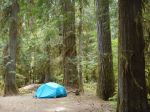
- Rain in the valley
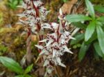
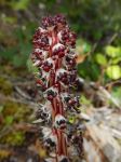
- Candy Stick (Allotropa)
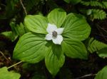
- Bunchberry
- Shepherd Creek Canyon
- Oyster mushroom
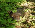
- Rugffled Grouse
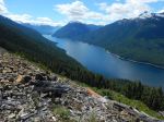
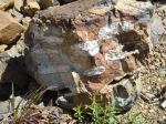
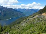
Day 2 – We hiked up the Buttle Bluffs and Park Main logging roads from the Western Mine road. These are steep, gated roads surrounded by clear-cuts, but they provide excellent views and a rapid approach to higher elevation destinations. The spring flowers were still quite good, the geology was fascinating, and there is an excellent water falls at 5 km. The views of the Buttle Lake valley are really exceptional. We continued about 7.5 km and 840 meters elevation gain, until we crossed a high point in the road and could see into the next valley surrounded by high mountains.
- Lupin
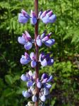
- Indian Paint Brush
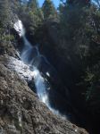
- 5 Km Falls
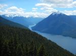
- Buttle Lake looking south
- Quartz intrusions
- Buttle Lake looking north
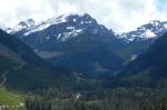
- Alexandra Peak
- Buttle Lake & Mt. Phillips
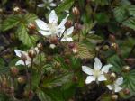
- Trailing blackberry
Day 3 – We planned to kayak on Jim Mitchell Lake, but that didn’t work out because the condition of the Jim Mitchell Road changes from 2-wheel drive to 4-wheel drive at the Bedwell trailhead. We didn’t have the right vehicles, so we walked up the road to see the Lake. We returned part way down the road and then followed the Bedwell Trail out through a beautiful old forest to Thelwood Creek and the suspension bridge for lunch. After lunch we drove just a bit further and walked the short approach to Lower Myra Falls. This is always a beautiful falls, with great rock ledges and pools. There was lots of water coming through the falls with the spring run-off. The final short hike of the day was the Shepherd Creek loop, which leaves from the Ralph River bridge. This short trail has a lot of variety with the river, some big trees, a mossy bluff, a wetland, and interesting saprophytes and fungus. We still had time to explore the campground which is nestled in a beautiful forest between the Ralph River and Buttle Lake with lots of shoreline and views. There were other folks from Quadra so the evenings were very social.
- South end of Buttle Lake
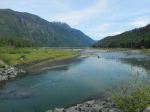
- Jim Mitchell Lake
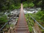
- Bridge over Thelwood Creek
- On the Bedwell Trail
- Bracket fungus
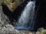
- Lower Myra Falls
- Lower Myra Falls
- Candy Stick (Allotropa)
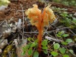
- Monotropa saprophyte
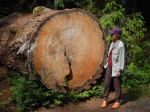
- Fallen old-growth danger tree
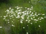
- Daisies on the shore
- Neville’s kite
- Mt. Myra at evening
Day 4 – We packed up the camping gear and drove to the Buttle Lake boat launch to kayak on the Lake. We crossed to Rainbow Island in a freshening breeze. At the moment it’s not an island because the water level in Buttle Lake is quite low. We paddled to the south, sheltered side, explored a bit and had lunch. There was a racing shell boat practicing in the lake. After lunch we poked around some cliffs and an island to the south before returning to the boat launch. Further exploration would be great, but more water and less wind would have been ideal.
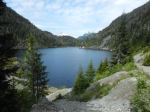
- Buttle Lake
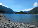
- Looking south in Buttle Lake
This is an exceptionally beautiful area with access to amazing hiking at the Lake level or in the surrounding mountains. The combination of the fjord-like lakes, the mature forests and the numerous mountains makes this a wonderful base for hiking and boating.
Debbie

Reconnaissance Report – Snowden Forest – 6 Nov 2020
Having now hiked the Lost Lake area three times, I was really keen to check out the trails further west, particularly “Lookout Loop” and “Enchanted Forest”. Armed with an old Ministry of Forests “Forest Recreation” map and the more recent coloured map, I headed out with my daughter and her dog on a lovely crisp fall day. We passed the Lost Lake parking lot, and the Riley Lake parking turn-off shortly after, and using the Ministry map (the coloured map has a logo right over the relevant section) we found the turn-off to the Elmer Lake parking lot, as marked on both maps. However, though marked as an almost straight north logging road, this quickly became a network of logging roads, with no signage anywhere. The northerly route eventually turned into a narrow, unmaintained quagmire, unnavigable if we hadn’t been in my daughter’s Honda Ridgeline. Obviously, this access route would be impossible for club members. We tried a few more logging roads that quickly opened out into recent clear-cuts with signs of active logging. Most regretfully, we turned around and headed back into more familiar territory.
We turned off at the sign to the Riley Lake parking lot, a bit further west of the more popular Lost Lake parking lot. Finally on foot, we headed up the Riley Lake trail. We soon came to a map which outlined the very area that we had been trying to access, now off-limits as active road construction and logging is presently underway there. So that explained the lack of any signage. To avoid the logging, the northern stretch of Riley Lake trail is being redeveloped, it is wide and with a good dirt base, easy walking. Eventually as Riley Lake trail turned west then SW, it became a narrow trail off the developed pathway, (not signed, used our compass and common sense). We followed the narrower trail to Pepper Spray (signed) to a T-junction with Cheshire Cat. Here the signage was very confusing. The right hand branch was signed “Out” but this would lead, eventually, to the very parking lot we had tried to find earlier, and would be in the closed area. Ignoring the “Out” sign, we went SE on Cheshire Cat, which came down to a clearing off the main road. We decided to follow Cheshire Cat back north, then took Oggies right back to our truck. Altogether about 2.5 hrs without a rest stop, easy to moderate hiking through beautiful woods. The short drive to the Riley Lake parking lot is a little rough, I think the Trimac trail links the Riley Lake trail to the Lost Lake parking lot, which would be more convenient. Definitely another hike to do in the beautiful Snowden Forest.
Valerie
Reconnaissance Report – Century Sam Lake – 7 Nov 2020
Another weekend was forecast to be fabulous, so we did another short-notice hike to check out a place we had never been to. It’s a difficult place to get to in part because the logging company keeps the access road closed most of the time. When it is open, the gate is locked promptly at 6:00 p.m. There is a long drive inside that gate, some of which has great views of Comox Lake and mountains along the way. Then there is a 2 km section which has water bars (cross ditches) making it accessible for 4×4 only and then there is the hike itself. The trail is well worn, but hardly improved, so it is slow. And this makes it harder to do as a day-hike. We parked before the water bars and hiked up the logging road to the trailhead.
The trail isn’t special. It’s often muddy, rooty and slippery, there is a lot of deadfall, there is a headwall below the Lake with a few places which require a bit of scrambling (and could use a rope). Also, for us the trail was frequently icy, and occasionally the rock had a thick coating of ice.
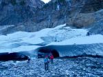
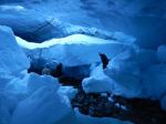
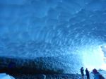
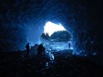
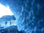
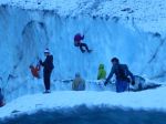
The destination is quite nice. Century Sam Lake is a glacial blue – it would be great with sunshine on it. We were too late in the season for that. The Lake lies in a hanging valley below Comox Glacier. A kilometre or so beyond the lake there is an ice patch with ice caves. Fantastic. For us, there was a strong, cold winter wind blowing across the lake, so we did not stay long.
This has become a very popular destination in the summer, when it is green, and you can see why. Even now, late in the season, there were lots of people there. Our whole hike was 13.6 km, 7 hours, 568m elevation gain to 1,000m at the ice caves. For just the trail portion, it was 8.3 km, 5¾ hours, 400m altitude gain.
Norris
Thanks to Norris, Stephen and Carrie for photos
(click on photos to enlarge)
- Comox Glacier
- Comox Lake
- Comox Lake
- Comox Lake
- Alone Mountain
- Crossing a water bar
- Bridge over Comox Creek
- Trail through avalanche path brush
- Ice-covered rock
- The ice-covered rock
- More ice on rock
- Comox Creek below the Lake
- Century Sam Lake
- The valley above Century Sam Lake
- Ice caves
- Sculpted ice caves
- Ice climbers & visitors
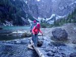
- Creek crossing
Reconnaissance Report – Mt. Drabble – 24 Oct 2020
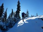
We had hoped to make an exploratory trip to Mt. Drabble before the snow came to Forbidden Plateau and didn’t quite make it, but we had a beautiful day. We approached it from the Strathcona Parkway and then logging roads. It had snowed a few inches about 24 hours before, but most of the logging roads were fine. However, we decided to walk rather than drive up the last steep section of road. From the the road it was easy to get onto the ridge which leads gradually up to the summit of Mt. Drabble. The ridge quickly becomes sub-alpine with great views and many tarns. The route was well marked so that we could follow it in the snow without being familiar with the trail. The snow made our time a bit slower as we checked frequently to make sure we were on track. There was one significant dip in the ridge, but mostly the walking was steady and gradual. From the end of the ridge there are great views of Forbidden Plateau, Georgia Strait and the mainland mountains. The reward for effort is very high on this trip. 11.8km (4 km on the road); 442m elevation gain to 1,353m; and 6 hours (1¼ hours on the road).
.Debbie
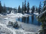
(click on photos to enlarge)
- View toward Mt. Albert Edward, Frink
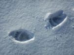
- Bear tracks on the road
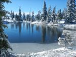
- Tarn on the ridge
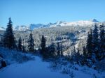
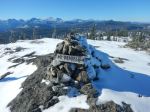
- Summit looking west
- Forbidden Plateau
- Comox Glacier