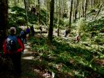
| Activity | Multi-day hiking and camping |
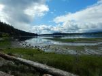
| Destination | Gold River area |
| Date | 15-17 July 2024, Monday to Wednesday |
| Trip Coordinator | Debbie Quigg |
| Contact Info | dmquigg@gmail.com or 3710; please contact the coordinator well in advance of the trip |
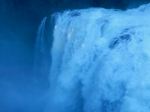
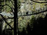
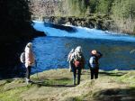
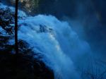
| Description | We plan to visit the Uphana Caves, hike the Antler Lake Loop, and possibly other local trails. Activities may depend on the group. We may camp at the Gold River Municipal campground or at Muchalat Lake Rec Site |
| Meeting Place | QCove ferry terminal |
| Departure Time | 9:00 ferry to Campbell River or by individual arrangement |
| Difficulty | Easy to moderate. |
| Cost | Ferry, fuel and camping costs. |
| Trip limits | 10 |
| Dogs? | No |
| Notes: | I have not personally visited the caves, so this will be an exploration. Please read the “comment” below for more information about the plans. |
Category Archives: Vancouver Island
Hiking – Century Sam – 13 July 2024
Updated!
| Activity | Hiking |
| Destination | Century Sam Lake |
| Date | 13 July Saturday; this date is still somewhat tentative for weather and for Mosaic’s announcement on Thursday about the gate opening. |
| Trip Coordinator | Norris Weimer |
| Contact Info | norris.weimer@ualberta.ca; 250-285-3710. Please let the coordinator know if you are interested by Wednesday, 10 July. |
| Description | This trip is hard to schedule because it needs good weather and the access is through a gate which is only unlocked for 12 hours on Saturday and on Sunday. Once passed the gate, the access is via a logging road which eventually has water bars. The hike itself is on a heavily used, but not really maintained trail. The creek crossings are on logs. To the lake is about 8.3 km (return) and 400m elevation gain; to the ice caves is about 13.6 km (return) and 570m elevation gain. The hiking time may be about 7 hours. The trail will likely be very busy. |
| Meeting Place | QCove ferry terminal |
| Departure Time | 7:00 am ferry |
| Difficulty |
Challenging for the length of the day, elevation and altitude gain. |
| Costs | Ferry, shared fuel costs. |
| Trip limits | Limits may depend on the vehicles going. |
| Dogs? | No |
| Notes: | We will not do this trip in poor weather. This is a long day. Come prepared for mountain conditions. |
Hiking – Mt. Kitchener – 3 July 2024
Due to some issues around this trip, please stay in touch with the coordinator.
| Activity | Hiking |
| Destination | Mt. Kitchener |
| Date | 3 July 2024, Wednesday |
| Trip Coordinator | Norris Weimer |
| Contact Info | 285-3710 or norris.weimer@ualberta.ca. Please contact the coordinator by Monday evening. |
| Description | Mt. Kitchener is located northeast of Campbell River and south of Sayward in the Prince of Wales Range. The summit is 1,457m, but fortunately the first 1,000 m can be driven up, leaving about 500 m elevation gain. The trail begins steeply through the forest and after a short scramble emerges onto a sub-alpine ridge. As the the ridge gains height, the views appear on all directions. We will visit Mt. McCreight (1,419 m) with some remembrances of the military plane crash from 1950. We will continue on to Mt. Kitchener, but not visit the crash site. |
| Meeting Place | Q Cove Ferry terminal. |
| Departure Time | 8:00 ferry. If the weather is very hot, we may go earlier. |
| Difficulty |
Challenging, but not very long |
| Costs | Shared ferry and fuel costs |
| Trip limits | 10 |
| Dogs? | No |
| Notes: | This trip will require 4-wheel drive vehicles with some clearance. We will not do this trip in poor weather. Bring lunch and water. |
Trip Report – Ripple Rock Trail – 29 May 2024
Three of us caught the 9:00 am ferry to Campbell River and when we reached the parking lot at the trailhead only one other car was there.The weather was typical west coast Spring with patchy clouds, sunshine and rain in the distance.
On the way to Seymour Narrows there are several viewpoints with excellent views of Menzies Bay with log booms and other watercraft. With the recent rain all the new growth was spectacular with thimbleberries in bloom, salmonberries ripening and all the variety of ferns and other plants we are learning to identify. There are several bridges over rushing creeks with many wire covered wooden structures over wet areas. The trail overall is easy walking with some uphill stretches that require careful stepping due to rock outcroppings. One set of stairs had a broken step, which hopefully will get repaired soon, as we did meet a maintenance crew trimming the new growth along sides of the trail.
The view at Seymour Narrows overlooking where Ripple Rock was blasted is striking as you can see up and down the Narrows for quite a distance with good views of Quadra Island. At the bluff viewpoint a large group of school age kids where just finishing their lunches before heading back on the trail before us. On the return hike it started to sprinkle so jackets went back on. With the rain and the group ahead of us the trail seemed more muddy from when we came out. By the time we reached the parking lot the sun came out with blue skies as we headed back and caught the 3:00 pm boat to Quadra. All and all a very enjoyable hike. (8.8 km 4 hours with lunch stop)
(click on photos to enlarge)
- The big Spruce
- Menzies Bay
- Penstemon
- Wild Rose
- Arnica
- South through Seymour Narrows
- Low tide
- Horsetail and fern
Hiking – Ripple Rock – 29 May 2024
| Activity | Hiking |
| Destinatio | Ripple Rock Trail, Campbell River |
| Date | 29 May, Wednesday |
| Trip Coordinator | Allan Liimatta |
| Contact Info | allanliimatta@gmail.com; 1 250 416 9338 |
| Description | Ripple Rock Trail starts 16 km north of Campbell River. It is a moderate hike through a lovely forest. The trail undulates over 9 km, taking 4 to 4.5 hours return. There are several metal bridges, and a 47-step staircase near the top. |
| Meeting Place | QCove ferry line up |
| Departure Time | 9:00 ferry |
| Difficulty |
Moderate |
| Costs | Ferry and gas |
| Trip limits | 10 |
| Dogs? | Bring a leash. |
| Notes: | Please arrange your own carpools. Bring a lunch and dress for the weather. |
Trip Report – Quinsam River Trails – 15 April 2024
Ten of us took the ferry to Vancouver Island to hike some of the trails on the east side of the Quinsam River. With recent commercial and industrial development, we had to park quite far from the the Boneyard Bypass trail head and walk some roads to start the hike. It was a great day, mostly sunny and a good hiking temperature. We followed the labyrinth of mountain bike trails through the forest and ravines. This is a lovely and varied walk, made more beautiful by the amazing display of spring flowers: trillium, pink fawn lilies, wild bleeding heart, wild current, and yellow violets. We stopped briefly at a viewpoint of some Strathcona Park mountains before descending to the river. We followed the river upstream to a bend with a view and a bench in the sunshine where we stopped for lunch. After the lunch break, we climbed back up to the high bank and meandered through the forest on bluffs and around ravines before completing the loop and heading back to the vehicles. It was a beautiful day and many on the trip had not explored this area before. (10.9 km; 4 hours)
(click on photos to enlarge)
- Crossing to Vancouver Island
- Spring catkins
- Through a ravine
- Pink Fawn Lily
- Mt. Alexandra and Adrian
- Trillium
- The Quinsam River
- Wild Bleeding Heart
- Trillium
- The lunch stop
- Wild Current
Hiking – Quinsam River Trails – 15 April 2024
| Activity | Hiking |
| Destination | Quinsam River Trails |
| Date | 15 Apr, Monday |
| Trip Coordinator | Debbie Quigg |
| Contact Info | dmquigg@gmail.com; 250-285-3710. Please contact the coordinator by Saturday evening. |
| Description | We will hike along the east side of the Quinsam River, using mountain bike trails and logging roads. This follows a variety of terrain down to the river and then follow the river upstream and loop back through the forest and ravines. There may be muddy sections. Ideally there would be spring flowers. About 11 km; 3.5 hours |
| Meeting Place | QCove ferry terminal; after exiting the ferry, we will drive to the parking area together. Parking is more limited than previously. |
| Departure Time | 9:30 ferry |
| Difficulty |
Moderate |
| Costs | Ferry |
| Trip limits | 10 |
| Dogs? | |
| Notes: |
Snow – Mt. Washington – 6 March 2024
| Activity | Snowshoeing |
| Destination | Mt. Washington |
| Date | 6 Mar, Wednesday |
| Trip Coordinator | Debbie Quigg |
| Contact Info | dmquigg@gmail.com or 3710. Please contact the coordinator by Monday night. |
| Description | We will follow some of the Mt. Washington snowshoe trails leaving from Raven Lodge. Participants without equipment can rent snowshoes from the resort. |
| Meeting Place | Quathiaski Cove Ferry terminal |
| Departure Time | 9:30 ferry; drivers need to be early enough to avoid overload. |
| Difficulty |
Easy to moderate. |
| Costs | Transportation costs and trail pass. Snow shoe passes are $14. |
| Trip limits | 12 |
| Dogs? | No |
| Notes: | Bring lunch as we may not eat at Raven lodge. Have reliable equipment and winter gear. |
Trip Report – Elk Falls Loop – 5 Feb 2024
Seven hikers set out on a frosty but bright and sunny day to see the massive amount of water that is coming over Elk Falls due to the atmospheric river and the huge snow melt last week. There is a lot of work still going on at the dam, upgrading it for the possibility of an earthquake. They are now filling in the old trench, where the three huge aqueducts were, with dirt and gravel from work on the dam.
After walking across this area, we turned right and hiked down the long hill to the old powerhouse. There is a nice viewing spot there with totem poles. This did make for quite a few stairs and a long hike back up the hill though. We then walked down the multiple stairs to the suspension bridge. The amount of water coming over Elk Falls is phenomenal. We were the only ones there so we ate lunch on the far side of the suspension bridge in the nice warm sunshine. Afterwards we went back across and down to the viewing platform right in front of the falls. There was a huge amount of mist being churned up by all the water coming over the falls.
We then proceeded to do a loop through Elk Falls park. We went through the old growth and then down to Moose Falls and followed the trail around to the old viewing platform. There were a few trees down on the trail that we had to crawl over and under. The view from this platform was very good as well. After this we proceeded back to the vehicles. 5.8 km; 2½ hours.
Les
Thanks to Les, Bonnie and Norris for the photos
(click on photos to view larger)
- View on the ferry
- The Campbell River
- Elk Falls from the bridge
- The river below
- Viewing platform
- Elk Falls from the platform
- The suspension bridge
- Moose Falls
- Elk Falls from the old viewpoint
- Spray from the falls
Hiking – Elk Falls Loop – 5 Feb 2024
| Activity | Hiking |
| Destination | Elk Falls Loop |
| Date | 5 Feb, Monday |
| Trip Coordinator | Les Hand |
| Contact Info | lhquadra@gmail.com or 285-2029 |
| Description | The water flow is exceptionally high at Elk Falls. So thought we all should take a look. We will go to the Hydro Visitor’s centre and start from there. Besides going to the Falls we will do the loop in the park and hike down to the viewpoint above the new power station. Probably 2 to 3 hours with lunch. |
| Meeting Place | Q Cove Ferry terminal |
| Departure Time | 10:00 ferry |
| Difficulty |
Easy |
| Costs | Ferry costs |
| Trip limits | 10 |
| Dogs? | No |
| Notes: | The heavy rain is supposed to be over by then but dress for the weather. Be sure to be at the Ferry early enough to make the 10. I will try to arrange carpooling and I’m driving myself so I can take one. Bring a snack or lunch, and a good camera as it should be something great to see. |


