Trip Report – Beech’s Mtn Loop – 30 Mar 2016

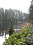
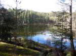
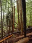
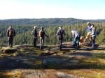
Eight hikers and one dog enjoyed a spectacular sunny day on this five hour hike, including guests Dina and Daryl from the Bulkley Valley. The maintained trail, which branches off South Chinese Mountain trail, was followed to the top of Beech’s Mountain, the second highest point on Quadra Island after Mt. Seymour. Our lunch break was spent overlooking an 180 degree panorama of the east side of Quadra and beyond to the mainland.

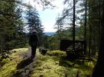
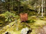
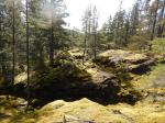
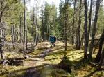
From the top of the mountain, we followed a flagged route down and around the mountain, and onto the North Chinese ridge at its north end. From there, the route over sunny mossy bluffs took us back to the North Chinese Mountain trail near the point where it heads up to North Chinese Mountain viewpoint. We headed down the steep rubbly trail/old logging road and back to the vehicles at the Chinese Mountain parking lot.   There were lots of stops to appreciate the views across to both the Vancouver Island and Coast Mountains, as well as views south down Georgia Strait.

I think this is one of the best hikes for stunning views on a clear day. Hiking level is moderate with sustained uphill and a few short difficult sections over bluffs on the way up the mountain. The route on the second half of the hike includes two long downhill sections of rock-strewn old logging roads which can be hard on tender knees. Walking sticks are recommended.

Janis

(click on photos to view larger)

Hike – Beech’s Mtn Loop – 30 Mar 2016

Snow – Mt Washington – 6 April 2016

 POSTPONED TO 7 APRIL

Activity Snow
Destination Mt. Washington
Date 7 6 April 2016, Thursday Wednesday
Trip Coordinator QIOC
Contact Info qioutdoorclub@gmail.com;  please e-mail by Sunday night
Description This is one last trip to Mt. Washington, with spring conditions.  Activities and destination will depend on the interests of the group.
Meeting Place Quadra ferry terminal to Campbell River.  Car pools should be arranged in advance.
Departure Time 9:00 ferry to Campbell River.  Those taking cars need to be early enough to get on the 9:00 ferry.
Difficulty
Up to the group.
Costs Ferry and shared fuel.  Snowshoe pass at Raven Lodge is $8, but we might not go there.
Trip limits Availability of cars going up to Mt. Washington
Dogs? No
Notes: Bring equipment, warm clothing and lunch.


Trip Report – Silk Stocking and Little Black Dress – 16 Mar 2016

Four hikers and one dog set off on the first sunny day we have had after weeks of heavy rain and gloomy skies. The trail was less sloppy than we had feared, which was welcome surprise. The sun filtered through the trees and the moss was a glowing neon green – almost too bright to look at! We made a loop down “Dick’s Ride” to check out the beaver pond with a collection of Mallard and Greater Scaup bobbing about on the calm water. Then we climbed back up the hill to get out on the mossy bluffs and into the glorious sunshine. Our lunch spot was a rocky outcrop with a view back toward Gowlland Harbour. As we ate, a group of wolves started to howl on the ridge to the south-west of us, and they continued their chorus for about twenty minutes as we started our descent – lovely!!

This section of Silk Stocking skirts the old copper mining area, now inactive for 60 to 70 years. There are bits of machinery still around and in some spots the rock has the classic bright green colour of copper ore. It is impressive how much the land has recovered from the scarring of mining activity – moss and young growth now covers the seams where ore had been taken out. It is a gorgeous section of the trail and hopefully will not be devastated by mining activity again.

Our last treat was a view of two Hooded Mergansers on the body of water at the base of the ridge. Then a twisty section of trail along Little Black Dress returned us to our starting point with almost dry feet.

Bird list for the day:
Harlequin Duck
Greater Scaup
Mallard
Hooded Merganser
Sooty Grouse
Bald Eagle
Pileated Woodpecker
Common Raven
Northwestern Crow
Golden-crowned Kinglet
Chestnut-sided Chickadee
Pacific Wren
American Robin
Spotted Towhee
Dark-eye Junco
Song Sparrow

Kathryn

(click on photos to view larger)

Hiking – Bike Trails – 17 Feb 2016

Trip Report – DW1 Copper Mine – 2 Mar 2016

It was a cloudy but mild day as four hikers set out to do some exploring. We drove to the summit of Deepwater Main and started from there.  There was lots of water in the creeks and on the trail from recent rain.

We first climbed a steep old road for 1.5 km to an old copper mine. It was once probably the largest mine on Quadra. There are many old remnants around the entrance. The main shaft has started falling in so if you go to the mine be very careful. Water has filled the shaft but there is an excellent view from a side shaft. We explored a bit more then returned to where we had parked.

Our next adventure was to explore an old logging road that veers south and up from the Deepwater Main. We climbed for 3.1 km this time until we met an old road that comes in from the Granite Bay gravel pit. We had hoped for this as the other road showed on an old topography map. At this point we decided to call it a day and returned via the same path.

The trip was 9.2 kilometers and 440 meters of vertical in 4 hours. This was a good workout as we had spent an hour looking around at the mine.

Les

(click on photos to view larger)

Hike – DW1 Copper Mine – 2 March 2016

Hiking – Beech’s Mtn Loop – 30 Mar 2016

Activity Hiking
Destination Beech’s Mtn Loop
Date 30 Mar 2016, Wednesday
Trip Coordinator Janis McLean
Contact Info 285-3614; please contact the coordinator in advance of the trip.
Description This hike will be on trails, logging roads and routes.  We will hike to the summit of Beech’s Mtn, then descend the backside  to the old Beaver Rd and then follow a flagged route down the parallel ridge to the Chinese Mtn parking lot.  About 4 hours, 7km.
Meeting Place Heriot Bay store parking lot for carpooling
Departure Time 9:00 am
Difficulty
moderate
Costs  none
Trip limits  8
Dogs? yes
Notes: Bring lunch and a walking pole if you like them.  If the weather is poor, we will hike to an alternative destination.


Hiking – Morte Lake Loop – 23 March 2016

 POSTPONED

Activity Hiking
Destination Morte Lake Loop
Date 23 Mar 2016, Wednesday
Trip Coordinator Julie Mellanby
Contact Info 285-3978.  Please contact the trip coordinator prior to the trip.
Description We will hike the classic loop on maintained trails.  This is a lovely walk through open forest around the lake on bluffs, old logging roads and trails.
Meeting Place Heriot Bay store parking lot, to arrange carpools
Departure Time 09:00
Difficulty
moderate
Costs none
Trip limits none
Dogs? yes
Notes: Bring lunch and water.

Hiking – DW1 Copper Mine – 2 March 2016

Activity Hiking
Destination DW1 Copper Mine
Date 2 Mar 2016, Wednesday
Trip Coordinator Les Hand
Contact Info 285-2029;  Please contact the trip coordinator prior to the trip.
Description We will walk up the Deepwater Bay Main road and then follow the old disused DW1 logging road up to an interesting copper mine.  This is a relatively short hike, about 4.2 km.
Meeting Place Heriot Bay store parking lot for car pooling
Departure Time  10:00
Difficulty
 easy
Costs  none
Trip limits  none
Dogs? Okay
Notes:

Hiking – Mt. Seymour – 9 March 2016

Re-Scheduled

Activity Hiking
Destination Mt. Seymour
Date 13 April 9 Mar 2016, Wednesday
Trip Coordinator Julie Mellanby
Contact Info 285-3978.  Please contact the trip coordinator prior to the trip.
Description We will hike up the old logging road and then follow the trail over rocky bluffs with great views of the Nugedzi Lakes and Discovery Passage.  From the summit there are views of Vancouver Island and mainland mountains.  Four to five hours, about 8 km and 425m elevation gain.
Meeting Place Heriot Bay store parking lot, to arrange carpools
Departure Time 09:00
Difficulty
moderate
Costs none
Trip limits none
Dogs? yes
Notes: Bring lunch and water.  If you use a walking stick, bring it. If the weather is poor, we will do an alternative hike.

Trip Report – Karst Formations – 24 Feb 2016

There were 12 for this walk to visit three sites of Quadra’s distinctive karst formations. It’s hard to believe that with all the rain this Winter there wasn’t quite enough water in the streams for ideal viewing, but the sinkholes, insurgents and resurgent creeks were impressive nonetheless.

Karst landscape is largely shaped by dissolving action of water on carbonate bedrock (usually limestone, dolomite, or marble). This geological process, occurring over many thousands of years, results in unusual surface and subsurface features ranging from sinkholes, vertical shafts, disappearing streams, and springs, to complex underground drainage systems and caves.

A narrow band of Quatsino Limestone on Quadra Island extends north from Open Bay and terminates near Luoma Creek. The most significant area north of Canyon Creek contains the largest number of caves and karst features. Although the cave sizes are very small, the impressive size of some of the karst features makes this an interesting area for recreational exploration and interpretation.

The Quadra Island Trails Committee has applied to Recreation Sites & Trails BC for two Forest Interpretative Sites to help protect some of the finest surface karst features on Quadra Island.

Richard Leicester


(click on photos to view larger)

Naturalist – Karst Formations – 24 February 2016

DSCN2558

Trip Report – Deepwater Bay – 17 Feb 2016

In spite of a rainy morning, six intrepid hikers set forth for Deepwater Bay. The route goes west from the Granite Bay Road, through a low section north of Mount Seymour. Given the brooding sky, we elected to attempt the drive up the logging road for the first part of the hike. This will not be possible for too much longer due to erosion and encroaching growth along the road. We stopped to view the remains of the old rail trestle which was once part of a logging railway from the north end of the island. There is quite a lot of evidence of the section bridging the canyon by the side of the road. Where the railbed ran before and after that is left to speculation.

After about 2.5 km we parked the cars and walked the last half of the road down to the shore. Beyond the logging, it’s a beautiful, steep valley with lots of water in the creeks. There are a number of buildings strewn around the shore site, in varying states of decay – remains of a fish hatchery that has been closed for over 20 years now. Previous to that, the site was a log dump. Sometimes the bay is busy with boats waiting for slack tide to go through Seymour Narrows, but there was not much action on the water other than a couple of seiners huddled against the shore. Once the herring start to run, sea lions are sometimes spotted here, and I have watched a huge school of dolphin cavorting off the point. But all was quiet today and it was a soggy, grey view across the water.

After a hurried lunch in the rain we trudged back up the hill to the vehicles, electing to save exploration of some of the tracks that ran off from the main logging road for a drier day. After less than three hours, we were back on the Granite Bay Road heading for dry clothes and a warm beverage. 4.4 km.

Kathryn

(click on photos to view larger)

Hiking – Deepwater Bay – 17 February 2016