Almost exactly one year to the day since our first Round the Cape paddle trip, four club members set out from Q-Cove to repeat the adventure. This report will therefore sound a lot like the one written last year (cut and paste…) The necessary shuttle was pretty simple with just four participants, one volunteer spouse and a two-car paddling couple! Two paddlers got to the put-in without motorized transport!
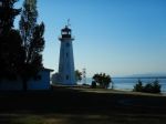
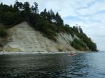
By 10:10 we were on the water just as the ferry was loading – two ferries to watch out for this time. Weather, (overcast and threatening drizzle, but no wind) tides and currents were all in our favour as we rounded Whiskey Point and headed south to Cape Mudge. We passed closely by the Village (accompanied briefly by a pair of harbour porpoises on our starboard), and then the lighthouse, working against the counter currents while the main tide continued to flood, and then rounded the Cape. One petroglyph barely revealed itself here, but one sharp-eyed paddler spotted it. These often treacherous waters were very calm, due to our timing, and we headed into the boulder strewn shallows of the south shoreline. It was interesting to be at the base of the sandy cliffs that we had hiked to the edge of last week for a view of the shoal at very low tide.
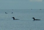
As we glided along a flock of a dozen or so Common Loons struck up a conversation about kayaking intruders, Harlequins scurried along the water’s edge to put distance between us, and the migrating coho were leaping about. Large schools of herring or sardines were seen in the shallow waters of Wilby Shoals.
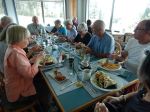
By this time we were looking for a reasonable place to pull out for a “rest” and stretch, but, once again a cobbly beach was the best we could do. As it was time for lunch, our rest stop lasted nearly an hour. Back on the water and heading for our final “turn around the corner”, a nice beach was spotted and perhaps will be remembered for next year’s lunch stop! We rounded Francisco Point and headed north on a somewhat brighter and milder afternoon without notable resistance from the ebbing tide. With our destination in sight for most of the 5 km, it did feel like a long stretch as we avoided rocks and watched for whales. (15.0 km; 4¼ hours.)
List of bird sightings – at least a dozen Common Loons (very vocal), many Harlequin ducks, a Common Merganser, numerous Bonaparte’s, Glaucous-winged, and Mew Gulls, Cormorants, a Great Blue Heron, Bald Eagles
Vic
Thanks to Vic and Norris for the photos
(click on photos to enlarge)
-

-
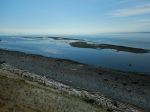
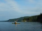
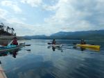
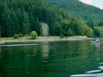
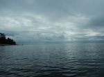
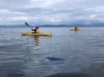
South in Discovery Passage
-
-
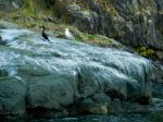
Bird rock with Gull and Cormorant
-
-
-
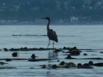
Great Blue Heron
-

-
At the Cape Mudge lighthouse
-
-

-
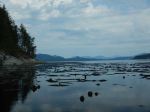
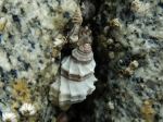
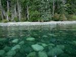
Petroglyph in the tide
-
-
-
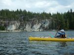
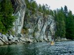
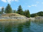
Bluff at Cape Mudge
-
-
-
Common Loons
-

-
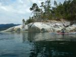
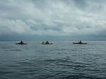
Approaching Francisco Point
-

-

-
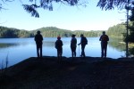
Arriving at Smiths Rd beach
Kayaking -Paddle around Cape Mudge – 6 Sept 2023