| Activity | Hiking |
| Destination | Thompson-B&B Trail Loop |
| Date | 22 May 2019, Wednesday |
| Trip Coordinator | Janis McLean |
| Contact Info | phone 3614 |
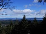
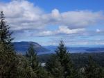
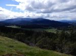
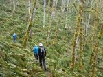
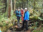
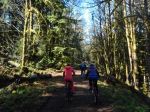
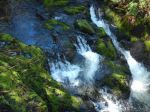
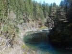
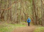
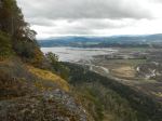
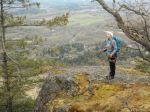
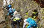
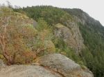
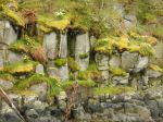
| Description | We hike up Thompson Trail, climb to the first viewpoint for views north and east, then descend the mossy bluffs of the open ridge in a northward direction. After the ridge peters out, we follow a deer route through the forest to the B&B Trail. After hiking this for a short distance, we take a side trip to Eileen’s Bluffs, with splendid views east and south from angles not normally see on the island. Backtracking to the B&B Trail, we carry on to Thompson Trail and east on Thompson to the trailhead. |
| Meeting Place | Thompson trailhead on Thompson Road. Carpool if you are able. |
| Departure Time | 9:30 am |
| Difficulty | Easy to moderate (on steep and potentially slippery bluffs) |
| Costs | none |
| Trip limits | 10 |
| Dogs? | Okay if under owner’s control |
| Notes: | Sturdy hiking shoes/boots required. Hiking poles may be helpful. Bring a lunch or snack. Estimated time 2½ to 3 hours. Please read the Outdoor Club Hiking Guidelines before the trip. If you leave a phone message, also leave your phone number in case trip plans change. Hikers who show up without pre-registering may not be allowed on the trip due to group size maximum. |
Kayaking Training – Main Lake Provincial Park – 26 June 2019
| Activity | Kayak training session |
| Destination | Main Lake Provincial Park |
| Date | 26 June 2019, Wednesday |
| Trip Coordinator | Darcy Mitchell; Instructor Monica Russell |
| Contact & Registration Info | mitchelldarcy51@gmail.com (preferred) or 250-923-5540. The registration deadline is May 26th. Payment must accompany the registration and is non-refundable. |
| Description | Led by trainer Monica Russell, this session will start at 10:30 and end about 3:30, with a half hour lunch break. Training will include: – the basics of kayak safety and necessary equipment; – strokes including forward, reverse, sweep, draw, stern rudder, bracing and edging; – controlled wet exit, assisted rescue and self-rescue. Rescue practice, when participants will be wet, will take place after lunch. |
| Meeting Place | Boat launch at Mine Lake |
| Departure Time | 10:00 meeting for 10:30 start of training session |
| Difficulty |
Moderate |
| Costs | $80; send your course fee to Julie at PO Box 397, QCove |
| Trip limits | 10 |
| Dogs? | No |
| Notes: | Participants will benefit most from the rescue training if they are able to stay in the water for some time – wet suits of any type, together with neoprene hoods or caps, will be very useful. Bring lunch and warm liquids. Participants provide their own kayak, paddle and all necessary equipment, including pump, paddle float, sponge, whistle. This session is the pre-requisite for participation in multi-day club kayaking trips and is an excellent refresher for all paddlers. |
Trip Report – Cowichan Valley – 7-11 Apr 2019
None of the 10 of us had spent much time in Cowichan Valley so this trip was exploratory. The weather was marginal, but we were lucky enough to never get wet. Some in the group had injuries, so not everyone was able to participate in the outings. We could see the evidence of the hugely destructive storm that hit the area in December 2018, but every trail we hiked had been well maintained. Spring was blooming out all over and the wildflowers were excellent.
Sunday – We met at the Duncan Market around noon before continuing to the vacation rental on Shawnigan Lake, where most of us were staying. After settling in, we went for a hike at Cobble Hill mountain. We hiked a loop (Squirrel, Frog, Buck, and Turtle) up to the summit ridge with great views in nearly all directions. It was a good introduction to the area with views of the Saanich Peninsula, Cowichan Bay, Mt. Tzouhalem, and the agricultural land in the Valley. 5.4 km; 2¼ hours. Back at the house, we had a great meal, celebrated a birthday, and sang to the accompaniment of guitars.
(click on photos to view larger)
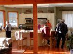
- Living room
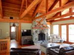
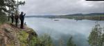
- Shawnigan Lake
- View east from Cobble Hill
- View toward Salt Spring Island
- View west from Cobble Hill
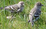
- Pine Siskins
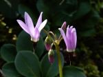
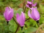
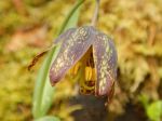
- Shooting Star
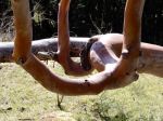
- Arbutus
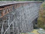
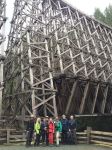
Monday – The weather was less promising as we set out from the rather obscure trailhead to Fern Grotto. We started on an old logging road that segued to a quite new trail through open forest with lots of maples, moss, and ferns. We reached the impressive Kinsol Trestle and had lunch before hiking out and back on the Jack Fleetwood trail. The Koksilah River and the fawn lilies were lovely. The group preferred to hike back to the house along the Cowichan Valley Trail, rather than retrace our route to the vehicles. We narrowly escaped heavy rain, returning to the vacation rental just in time. 14.7 km; 4¾ hours. We had another wonderful meal followed by games and reading.
- Shawnigan Lake
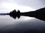
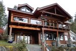
- The vacation rental house
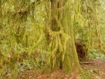
- Hanging moss
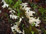
- Elkhorn Lichen
- Fern Grotto trail
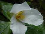
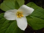
- Trillium
- Kinsol Trestle
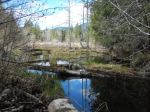
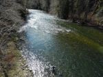
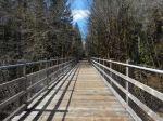
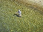
Tuesday – We had a sunny day for our bike trip on the Cowichan Valley Trail/Great Trail from Glenora to the end of the trail toward Cowichan Lake and back. Les opted to hike the Cowichan River Footpath nearby. Those who didn’t own bikes rented e-bikes, which was entertaining and easy. We later learned that this is the roughest section of the Cowichan Valley Trail, so we spent more time looking where the tire was headed than at the scenery. The forest was lovely and open, with creeks, wetlands (even a turtle) and, of course, trestles and the Cowichan River. 46.0 km; 5¼ hours. We had yet another great dinner and more music.
- Setting out from Glenora
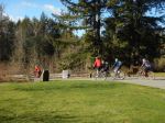
- Cowichan Valley Trail
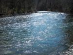
- Cowichan River
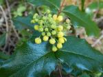
- Oregon Grape
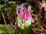
- Pink Fawn Lily
- Trestle bridge
- Fly fishing
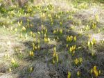
- Skunk Cabbage
Wednesday – The weather improved through the day. We hiked at Mt. Tzouhalem starting at the Kaspa parking lot and following the view trails at the edge of the escarpment. The meadows of shooting star wildflowers were a treat, as were the views of the Cowichan Valley. We stopped for lunch near the cross and then continued along the cliffs to the edge of the reserve before following logging roads, with a view of Salt Spring Island and Samson Narrows, back to the car. This area is a complex web of unmarked paths, and it’s good to go with a map, GPS or app to avoid getting lost. 9.9 km; 4¼ hours. Although rather late in the day, a few people opted to continue on to the Koksilah Ancient Forest Reserve. After a bit of trouble finding the trailhead, the blue flagging got us to the grove of fine old trees along the river. We would have liked to have spent more time there. 4.3 km; 1 hour. For our last night, we went out to dinner at the Village Chippery, which was very popular with locals and very good.
- Shooting Star
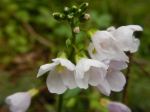
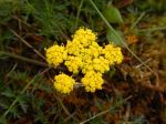
- Spring Gold, common lomatium
- Garry Oak
- Shooting Star
- Arbutus forest
- Cowichan Bay
- At the cross
- The cliffs at Mt. Tzouhalem
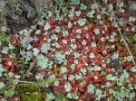
- Succulents in moss
- Samson Narrows
- Koksilah Ancient Forest Reserve
Thursday – The dark skies only produced drizzle on the hike near Cedar, taking the Cable Bay Trail to Joan Point and Dodd Narrows. This is a popular trail with locals. It’s wide and smooth and trends down to the ocean. The trail along the coast is lovely with great views of the sandstone shoreline typical of the southern Gulf Islands. The spring flowers were excellent with lots of fawn lilies. The current was not running strongly in Dodd Narrows, but the low tide provided inter-tidal viewing. 6.5 km; 1¾ hours.
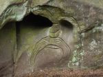
- Modern petroglyph
- Sea blush
- Sandstone shoreline
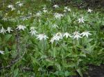
- Fawn lilies
- Creeping sedum
- Dodd Narrows
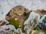
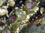
- Sea anemone
- Sea anemone
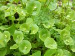
- Miner’s lettuce
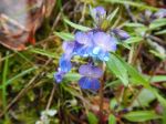
- Blue-eyed Mary
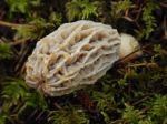
- Morel mushroom
- Calypso orchid
- Yellow-bellied Sap Sucker
Debbie
Trip Report – Deadfish-Tripod Loop – 10 April 2019
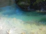
Four hikers enjoyed a three and a half hour hike on the bike trails south of Morte Lake. It was raining when we carpooled at the Heriot Bay store parking lot, less so at the Morte Lake parking area and had stopped within a half hour of leaving the trailhead. We began on the Deadfish Trail and stopped on Deadfish Summit to view Beech’s Mountain and watch wispy clouds rising from Morte Lake. Descending the Seven Deadly Sins switchback trail, the group turned north on Nirvana to connect with the South Morte Lake trail. We followed this east along the mirror-calm lake and stopped for a snack at the sandy beach at the southwest corner of the lake. Before reaching the beach, the view down into the water in the little bay revealed an exquisite turquoise colour – who needs to go to a tropical isle? We proceeded along Tripod Connector (the tripod is still there at the stream crossing) and uphill to Ridge trail, which skirts the base of Deadfish Summit ridge and connects to Lost Rider. At the Lost Rider-Morning Beer Trail junction we headed up onto the open ridge which parallels Deadfish Trail. Along this ridge we had grand views of Chinese Mountains, Hyacinthe Bay and beyond to Cortes Island. This rugged trail proceeds along the open moss-covered bluffs, eventually dropping steeply downhill to the Morte Lake parking lot. Due to the recent rains, the mosses and hanging lichens along the route vibrated with a brilliant green, even more so when the sun made an occasional appearance.
Janis
Trip Report – Stramberg Old Growth Grove – 2 April 2019
Nine of us hiked by Vic’s Marsh then on to the Stramberg big trees in Main Lakes Provincial Park. The weather was a perfect and the trail was in good condition and well flagged. The journey offers lots of variety including open marsh, a homestead site, old corrals and a barn, undulating forest trail with rocky bluffs and fern wetlands, and old logging roads. There has been some erosion this past year of dirt bridges over creeks, but conditions were very dry for early April. We ate lunch in the swale leading into the grove and then wandered among the trees. The trees are impressively big — and old. There was frequent wolf scat on the trail. 12 km; 5 hours.
Norris
Thanks to Norris, Les and Cyndy for the photos, and to Stephen and Carrie for the trail camera photo taken earlier.
(click on photos to view larger)
- Vic’s Marsh
- The Barn
- Lunch stop
- Hanging moss
- The teeter totter
- Turkey tail fungus
- Yellow wood violet
- Trail cam winter 2019
Hiking – Ripple Rock Trail – 17 April 2019
| Activity | Hiking |
| Destination | Ripple Rock Trail |
| Date | 17 April 2019, Wednesday |
| Trip Coordinator | Debbie Quigg |
| Contact Info | debbie.quigg@ualberta.ca or 3710. Please contact the coordinator about car pooling by Monday night |
| Description | 8 km round trip hike on Ripple Rock Trail, 16 km north of Campbell River. This is a classic hike through lovely mature forest, along bluffs and up stairs to the overlook of Seymour Narrows. It’s the other bookend to the Maud Island trail. Approximate time 4 hours. |
| Meeting Place | Q Cove ferry terminal |
| Departure Time | 9:00 am ferry. If you are driving, come early for this busy ferry. |
| Difficulty |
Moderate, with some steep sections |
| Costs | Ferry fare |
| Trip limits | None |
| Dogs? | Dogs must not run through the group |
| Notes: | Bring lunch. |
Kayaking – Gowlland Harbour – 24 April 2019
This trip description has been substantially revised.
| Activity | Kayaking |
| Destination | Gowlland Harbour |
| Date | 24 April 2019, Wednesday |
| Trip Coordinator | Norris Weimer |
| Contact Info | norris.weimer@ualberta.ca or 3710 |
| Description | The plan is to launch our kayaks at the April Point Marina and go around Gowlland Island. The exact details will depend on the weather and other conditions. The weather forecast is good and we are hoping the spring flower will be in bloom. We will check out the interesting islands, such as Doe, Stag, Fawn, Crow, Wren, Mouse, Vigilant. This trip is planned around the currents in Discovery Passage. We will go north on the end of the ebb and return south on the beginning of the flood. About 8 km; 4-5 hours. |
| Meeting Place | April Point Marina |
| Departure Time | 9:30 (arrive, unload and prepare) launch at 10:00 |
| Difficulty |
moderate |
| Costs | none |
| Trip limits | max 10 kayaks |
| Dogs? | no |
| Notes: | This trip is dependent on weather. Bring your kayak, paddle and all equipment required by the Coast Guard. Bring your own lunch and water. |
Trip Report – Maud Island – 27 Mar 2019
After cancelling this trip in February due to icy conditions, the weather could not have been better. Fifteen hikers, including five guests, enjoyed the cool of the forest and then the warmth of the sun at the lookouts. Some chose to go up and take in the views from Mt. Lolo, giving themselves a wonderful, varied hiking loop, and others chose to do the lower route to the lookout over Seymour Narrows both ways.
Sandra
(click on photos to view larger)
- Mt. McBride
- Elkhorn Mtn. & Kings Peak
- Looking toward Cape Mudge
- The causeway to Maud Island
- Bumble bee
- View north
- Looking toward Duncan Bay
- Looking north in Discovery Passage
- Steller sea lion
- The Saltwater Lagoon
Trip Report – Mt. Washington – 20 Mar 2019
This was our last scheduled trip to Mt. Washington for the season. On this first day of spring, the weather was very warm, up to 14°C on the hill. Five of us snowshoed under absolutely clear skies and the snow was better than expected considering the heat. Terry lead us up the Great Big View trail and on to Finger Glades, with wonderful views of the Vancouver Island mountains. We stopped for lunch near the high point of the trail before making our way back down to the vehicles. 184m elevation gain; 5.6 km; about 3½ hours.
Debbie
(click on photos to view larger)
- Mt. Albert Edward
- Great Big View trail
- Rees Ridge
- Albert Edward & Jutland
- Mt. Alexandra
- Still lots of snow
- Mt. Washington summit
- Steller Jay
- Gray Jay
Hiking – Stramberg Old Growth Grove – 2 April 2019
This hike has been re-scheduled to Tuesday
| Activity | Hiking |
| Destination | Stramberg Old Growth Grove |
| Date | 2 April 2019, Tuesday |
| Trip Coordinator | Norris Weimer |
| Contact Info | norris.weimer@ualberta.ca or 285-3710. Please contact the trip coordinator prior to the trip. |
| Description | This trail begins near Village Bay Lake and follows open meadows leading into and through the forest on old, unmaintained logging roads. The forest is varied with occasional old growth, creeks, and wetlands. This is not an official trail. Expect blow-down and brush. About 13 km; 5 hours or more. |
| Meeting Place | Heriot Bay store parking lot, to arrange carpools |
| Departure Time | 09:30 |
| Difficulty |
Moderate, due to unmaintained trail and quite long |
| Costs | None |
| Trip limits | None |
| Dogs? | Dogs must not run through the group |
| Notes: | Bring lunch and water. |