Trip Report – Coppermine and Deepwater Bay – 23 Nov 2016

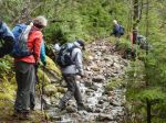
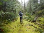
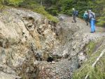
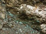
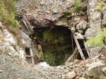
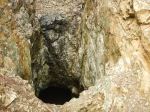
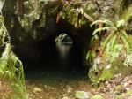
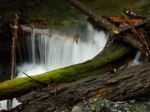
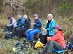
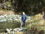
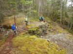
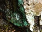
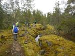
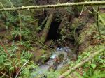
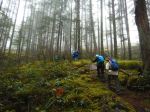
Seven of us hiked from Deepwater Main to the old copper-mine. There was water on the old road but not as much as expected considering the heavy rains Quadra has been experiencing. It is only about 1.5 km to the mine but the road is steep. The main shaft entrance has fallen in but there is a good view from the side shaft.

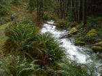
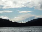
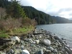
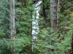
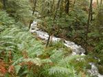
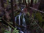
We then returned to the Deepwater Main and hiked down it to Deepwater Bay. The creek was running high and the two waterfalls were beautiful. We encountered our only shower of the day on the way down. At the beach we could not believe our good fortune as we ate our lunch in the sunshine before we returned to the vehicles. The whole trip was about 7 km with 335 vertical meters up and down in about 3 hours.

Les

(click on photos to view larger)
Hiking – Coppermine and Deepwater Bay – 23 Nov 2016

Trip Report – Bike Loop from WalCan Rd – 16 Nov 2016

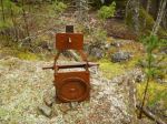
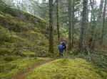
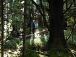
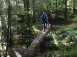
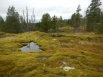
Seven of us started from the parking area where the WalCan Rd crosses Hyacinthe Creek at the end of Reed Lake. We followed Janis up Straight as a Dime in very light rain and low cloud, and continued until we joined Silk Stocking.  At the end of Silk Stocking we walked down the logging road to Bite the Bullet. We crossed the bridge and took Lady Lumps to Cash Only, and then Rick’s Ride to Yellow Mud, stopping at the beaver dam. This is a very lovely loop. There are great mossy bluffs, historical open copper mines with some old mining artifacts, open forest, and wet lands, complete with ducks. 10.9 km; 4 hours.

Debbie

(click on photos to view larger)

Hiking – Bike Loop from WalCan Rd – 16 Nov 2016

Multi-day Hiking – Salt Spring Island – 30 Jan-2 Feb 2017

 This trip is FULL.   You may call the coordinator to be put on the wait-list.

Activity Three days of hiking
Destination Salt Spring Island
Date 30 Jan – 2 Feb 2017, Monday to Thursday
Trip Coordinator Margot Wood
Contact Info margotw@gicable.com or phone 250.285.2393; please contact the coordinator as soon as possible; the deadline for committing to this trip is December 29.
Description Staying three nights at a rental property on Salt Spring Island, hiking each day.  We will check into the rental property & get settled. Off to hike. There are a number of hiking trails on Salt Spring Island, the most popular trails are in Maxwell Park. Maxwell Park is the second highest point on SSI. It rises about 595 metres, with a sheer drop on one side. the view can be quite spectacular. There is a network of trails within the park, one can drive into the park or walk up. Mt. Baker can be seen to the east, on a very clear day. There is also a network of hiking trails at Ruckle Park down in the southeast corner of SSI. A spectacular trail that goes to the shore at Yeo Point, lots of bird life on the water. There are some lovely hiking trails in Mouat Park, right in Ganges. Another addition is the Quarry Park Trail in Vesuvius, the trail takes you down to the waters edge. The Dunbabin Trail meanders through the forest in Dunbabin Park, an easy trail, a few stairs along the way. We will probably run out of days, not hiking trails.
We will divide the dinners amongst us and be responsible for our own breakfasts and lunches.
Car-pooling will be organized.
Salt Spring Island Hiking Trails: http://www.saltspringmarket.com Click on Hiking Trails & Map.
Meeting Place Quathiaski Cove, ferry line-up
Departure Time 9:00 am sailing, be early in case of overload.
Difficulty  Easy to Moderate.
Cost Accommodation approx. $65-$70 p. night, depending on number of persons attending. Ferry costs. Gas.
Trip limits Eight people.  Deadline booking is 29 Dec 2016. Full payment will be required on that date.
Dogs? No
Notes: Salt Spring Island Hiking Trails: http://www.saltspringmarket.com   Click on Hiking Trails & Map.

Hiking – Heriot Ridge Route – 30 Nov 2016

 Start time postponed to 12:00

Activity Hiking
Destination Heriot Ridge Route
Date 30 Nov 2016, Wednesday
Trip Coordinator Janis McLean
Contact Info 285-3614;  Please contact the coordinator prior to the trip
Description Rather than the official trail, we will follow routes and old trails on Heriot Ridge.
Meeting Place Thompson trailhead on Thompson Rd
Departure Time 9:00  12:00
Difficulty easy to moderate
Costs none
Trip limits none
Dogs? okay
Notes: Bring walking poles as the bluffs may be slippery.  Maybe a snack.

Trip Report – Karst Formations – 12 Nov 2016

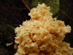
After yet another night of heavy rain, the weather improved and four of us went on an impromptu walk in the afternoon to see the karst features off the Granite Bay Rd.   We followed a sketchy route along the sinkholes, climbing down into the depressions and exploring the insurgences and resurgences.  There wasn’t as much water flowing as we had hoped, but we enjoyed the water disappearing and reappearing in the Quatsino limestone.  We then walked over to the falls into the really big sinkhole off of North Mtn Hookup. About 2 hours.  On the drive back we stopped to see the Chum spawning in Haycinthe Creek.  Though many were dead, some were still fighting their way upstream.

Debbie

(click on photos to view larger)

Naturalist – Karst Formations – 12 Nov 2016

Hiking – Coppermine & Deepwater Bay – 23 Nov 2016

 Change of meeting time to 9:00

Activity Hiking
Destination DW1 Copper Mine and then Deepwater Bay
Date 23 November, Wednesday
Trip Coordinator Les Hand
Contact Info 285-2029.  Please contact the coordinator in advance of the trip.
Description We will be able to take 4-wheel drive vehicles to DW1 Road. It is about 4 km round trip hiking. If you would like to see some pictures of the mine check out prior trip report of Mar. 2, 2016.
We will then hike to Deepwater Bay, about 5 km round trip. It will be good to see this before the new logging starts to the south of the road.
These are both old roads but may have lots of water on them.
Meeting Place Heriot Bay Store parking lot for car pooling
Departure Time 9:00 10:00
Difficulty
Moderate, but up and down
Costs none
Trip limits none
Dogs? O.K. Please keep them from running back and forth through the group.
Notes: Bring a lunch and hopefully we will eat by the ocean.
I will bring a rope for those who want to get down to the side shaft.

Hiking – Bike Loop from WalCan Rd- 16 Nov 2016

Activity Hiking
Destination Bike Loop from WalCan Rd
Date 16 Nov, Wednesday
Trip Coordinator Debbie Quigg
Contact Info 285-3710 or debbie.quigg@ualberta.ca.  Please contact the coordinator in advance of the trip.
Description We will start at the parking area on the WalCan Rd near Reed Lake.  Depending on the group’s interest, we will follow mountain bike trails, including Silk Stocking, Bite the Bullett, Lady Lumps, and Yellow Mud.  This will be a fairly long hike (4 to 5 hours), unless the weather is poor in which case we will do a shorter version.
Meeting Place Heriot Bay Store for car pooling
Departure Time 9:00
Difficulty
Moderate
Costs none
Trip limits none
Dogs?  yes
Notes: Bring lunch and gear for the weather.

Trip Report – Morte Lake-Mud Lake Loop – 9 Nov 2016

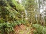
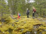
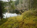
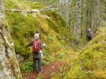
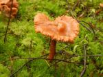
Wednesday was a beautiful, sunny morning and a great day for a hike.  Six of us  and a dog hiked from the WalCan Rd over to the southeast corner of Morte Lake on the new South Bluff mountain bike trail.  After a steep climb, this joins the hiking trail over lovely, mossy bluffs.  We descended to Morte Lake and took the side trip to the viewpoint.  The Lake was beautiful and Luna swam.  We walked the old logging road to the “tripod” and then decided to extend the hike by taking Ridge Trail to join the path along Reed and Mud Lake back to the vehicles.   6.5 km, 2¼ hours.

Norris

(click on photos to view larger)
Hike – Morte Lake-Mud Lake Loop – 9 Nov 2016

Naturalist – Karst Formations – 12 November 2016

Activity Naturalist outing
Destination Quadra’s karst formations
Date 12 November 2016
Trip Coordinator NA
Contact Info RSVP to qioutdoorclub@gmail.com
Description This will be a short walk to see the volume of water coming through some of Quadra’s Quatsino limestone formations.  There is no trail; we will be following a route which may be slippery.  Conditions may not be favourable to descend to the creeks.
Meeting Place Heriot Bay store parking lot for car pooling.
Departure Time 14:00
Difficulty
Easy to moderate
Costs none
Trip limits none
Dogs? no
Notes: Bring gear appropriate for the weather.  Poles and a flashlight to see into these geological formations may be useful.

Trip Report – North Gowlland Bike Loop – 2 Nov 2016

Since the forecast for Wednesday called for full-on monsoon weather, we moved the trip to Tuesday. We started at the logging bridge, which crosses the creek along North Gowlland road, and hiked up Marlow’s Climb. We followed a short, flagged route from the logging road to the official North Gowlland hiking trail and followed that down to the creek and the road. After walking up the Missing Link logging road we joined the Silk Stocking mountain bike trail to a small lake and from there we followed Little Black Dress. After a short dipsy-doodle on Back Door and other trails we took Cash Only and Lady Lumps to return to the vehicles.

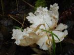
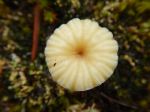
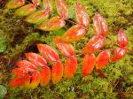
This walk combines a lot of trail sections into a very nice hiking loop. Although there are no big views along the way, the hike includes trails along and over mossy bluffs, an old open copper mine, wetlands and creeks, and always interesting trails. We had all the trails to ourselves with the moss and mushrooms. The rain held off until afternoon, so we had only a light sprinkle. 9.1km; 3 hours.

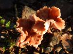
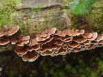
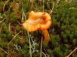
If you know what the mushrooms are, please let us know.

Debbie

(click on photos to view larger)
Hike – North Gowlland Bike Loop – 2 Nov 2016