| Activity | Backpacking |
| Destination | Baby Bedwell; Tom Taylor or Cream Lake day trip |
| Date | 25-27 August 2014, Monday to Wednesday |
| Trip Coordinator | Jill Sampson |
| Contact Info | 285-3202; please contact the coordinator well in advance of the trip. |
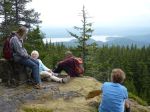
| Description | We will take the ferry and then drive to the south end of Buttle Lake. The access road from Highway 28 to the trailhead may be quite rough. The trail to Baby Bedwell climbs 600 metres over 6 kilometers to reach this beautiful sub-alpine area with lakes and tarns. On the second day, there are two options: an ascent of Mt. Tom Taylor (1,778 m) or a more gentle day exploring Bedwell and Cream Lakes. On the third day, the group will hike out and return to Quadra. |
| Meeting Place | Quadra ferry terminal to Campbell River |
| Departure Time | 10:55 ferry |
| Difficulty | Moderate to difficult |
| Costs | Ferry costs; fee for camping |
| Trip limits | 8 |
| Dogs? | no |
| Notes: | Carpooling and food arrangements will be made prior to the departure. |
Author Archives: qioutdoorclub
Trip Report – Mt. Seymour – 12 July 2014
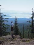
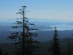
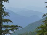
The seven hikers on the trip headed out early due to the early-July heat wave. We dropped vehicles off at the Nugedzi Lakes parking area, and headed up the trail to Mount Seymour from the Granite Bay Road departure point. The climb through the forest was not too hot yet, and we were pleased to find a breeze to help the over-heating issue once we moved onto the more open section of the trail to the summit. The views from the top were superb. A bit of summer heat haze, but still a lovely, clear panorama of peaks to the east, and the Vancouver Island coastline and more fine peaks to the west.
We descended to Nugedzi Lakes for lunch, and a refreshing dip in the lake for some of us. A couple of grouse flushed along the trail were our most exciting wildlife spotting for the day. We descended through the forest trail below Nugedzi, appreciative of at the work the Trails Committee did last year to reestablish this path after the damage from the previous winter. We were back at the cars around 2 pm and glad to be out of the most intense heat of the day.
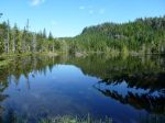
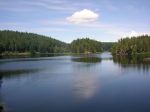
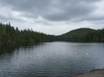
- Nugedzi Lake
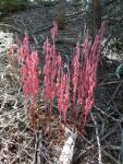
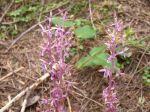
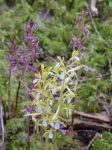
- Spotted Coralroot orchid
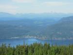
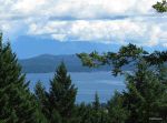
- Browns Bay to Mt. Victoria
- Lilies
- N Nugedzi Lake
- swimming in S Nugedzi Lake
(click on photos to view larger)
Trip Report – Desolation Sound 6-9 July 2014
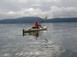
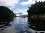
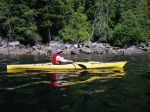
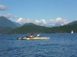
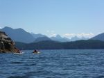
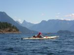
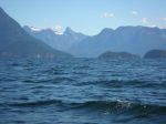
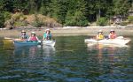
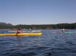
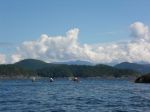
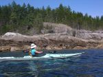
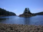
Thanks to the intervention of the weather gods, the Sutil Channel trip left a day later than planned and went to Desolation Sound instead, via Cortes Island. After Saturday’s rain, Sunday also started with a downpour which lightened to drizzle by the time Debbie, Norris and Darcy arrived in Whaletown with one vehicle and three kayaks. We intended to shuttle the third boat over to Squirrel Cove, but were saved the trip by a very nice woman who offered to take a kayak on her van. As a result, we were able to launch by 1 p.m., heading to the Martin Islands south of Refuge Cove (West Redonda). The 7 kilometre crossing took just over an hour and a half in calm conditions. The Islands (which are a single island except in high winter tides) offer a number of tent sites near the ‘waist’; we chose two sites with a stone fire ring and benches to the east of the main camping area. After setting up camp, we paddled out to visit Refuge Cove with its very well supplied store – and had sautéed mushrooms with our steaks as a result!
The following morning, we set out for Roscoe Bay on the east side of West Redonda, known among boaters for its drying bar and huge population of jellyfish. We trekked up to Black Lake for a swim, with a bit of bushwhacking until we found a good rocky ledge, then paddled back to camp against the wind. (Note to selves – plan itineraries so that return trips are downwind! And the northwest wind can come from the south here!) Twenty-three kilometres paddled for the day. After another excellent dinner, we settled down to a night of bright stars and loud winds.
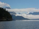
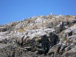
Next morning, rather than upping stakes and heading north to Teakerne Arm (in case the winds returned in force), we paddled toward Tenedos Bay with a light northwesterly behind us. We skirted a seagull rookery with chicks and seals, and stopped for lunch at the head of the Bay, where a short trail leads to Unwin Lake. Being a little nervous about the forecast, we skipped a swim, and paddled around the tidal island in Tenedos Bay, past rock ledge campsites (with kayaks resting precariously on very steep ledges) and through the popular Curmes Islands. We saw quite a few tents and campers, but no other kayaks actually on the water. Returning to the Martin Islands (25.5 kilometres for the day), we found seven kayaks on the beach and a large group of young people with their leaders from an outdoor education program in Victoria. Our little nook offered plenty of privacy, however, so we enjoyed another night of quiet except for the winds – again.
Next morning, we broke camp and hung about the beach for a while deciding when to leave. With whitecaps in Lewis Channel and forecast winds up to 30 knots in the afternoon, there weren’t many options other than taking advantage of the comparative lull (10-20 knots) expected to occur late morning. We set off at 11:15 and after battling our way through heavy gusts around the point south of Refuge Cove, things settled down a bit until we were about half way across. By the time we reached Squirrel Cove at 2 p.m., the wind was up to 15-20 knots, although the waves remained a short chop. Taking advantage of our Good Samaritan’s offer of a return trip to Whaletown, we made the 4:05 ferry with time to spare. The ferry crew estimated the winds at 25-30 knots, which made us very grateful that we were not paddling back to the Heriot Bay boat launch.
submitted by Darcy Mitchell, trip coordinator
- leaving Squirrel Cove
- arriving Martin Islands
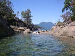
- Desolation Sound
- Roscoe Bay
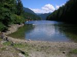
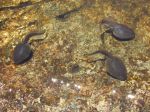
- tadpoles in Black Lake
- swimmer in Black Lake
- Mt. Baldy and Mt. Beartooth
- Mt. Aiken and Mt. Denman
- Ray Rock
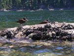
- Oyster Catchers
- Tenedos Bay
- Curme Islands
- Curme Islands
(click on photos to view larger)
Hike Mt. Seymour – 12 July 2014
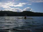
| Activity | Hiking |
| Destination | Mt. Seymour |
| Date | 12 July 2014, Saturday |
| Trip Coordinator | Mark Zimmerman / Kathryn Manry |
| Contact Info | 285-2103 or kamanry@gmail.com |
| Description | We will drop off some vehicles at the Nugedzi Lakes parking lot, then head on to the departure point on Granite Bay Road to hike up to Mount Seymour from that access point. The trail is a steady climb up for about 620 m to a 360 degree view point from the highest point on Quadra Island. We will then descend via Nugedzi Lakes, through some lovely forest and back to where the shuttle vehicles were parked. Then a bit of vehicle shuffling, and we will return to the HB Store by about 4 pm. Bring lots of water, a lunch and snacks. Hiking poles may be a good idea. We will be grateful to those who offer vehicles for the shuttle to accommodate the loop trip. |
| Meeting Place | Heriot Bay Tru Value parking lot |
| Departure Time | 9:00 |
| Difficulty | moderate to difficult (summit is 620 m) |
| Costs | none |
| Trip limits | 15 enthusiastic hikers |
| Dogs? | ok on leash |
| Notes: | We would like to make this a loop trip – leaving from the Granite Bay Road access point and returning via the Nugedzi Lakes trail. This will entail a bit of car shuffling, and a bit longer day to accommodate this, but should make for a more rewarding hike. |
Trip Report – Heriot Ridge Route – 29 June 2014
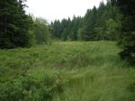
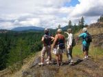
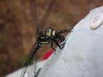
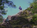
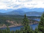
We had eight people on this short hike on short notice. Starting at the end of Hope Spring Road, we hiked up to the east and west viewpoints of Heriot Ridge on a warm, mostly sunny day. We continued north on the flagged route, which undulates through open forest and mossy bluffs. The most unusual naturalist event of the hike was a dragonfly with a bee in its mouth that landed on the trip coordinator’s shirt. The dragonfly did not leave until the bee was completely consumed, even during walking or close-up photography. The meal lasted at least 15 minutes. We returned by the Thompson Trail, with about half the group visiting the northern viewpoint over Hyacinthe Bay, and then following the road back to the cars.
- Heriot Ridge viewpoint
- Dragonfly eating a bee
- scramble up the northern viewpoint
- Hyacinthe Bay
(click on photos to view larger)
Trip Report – Village Bay 25 June 2014
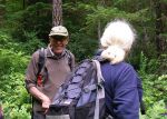
Wednesday morning came and the wind was blowing 15 knots at Chatham Point and a forecast of 25 by noon. We therefore decided to move the paddle from Chain Islets to the east side of Quadra. After many phone calls it was agreed to launch at Len Road into Hyacinthe Bay. Six people showed up and we had a great day on the water.
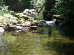
First we headed over to Hyacinthe Point and then on to Shellaligan Pass. The tide was out so we had to go around and then on to Village Bay. There were a few small white caps at the entrance but this was the most wind we had all day. The group stopped at the head of the bay for lunch. Afterwards we hiked up the old trail to Village Bay Lake. It is not maintained with a few logs over the trail but still very doable. It is a lovely walk along the creek. At this point half of the group needed to go back because it was already 2:30. The other three of us went on to Crescent Channel and around Bold Island. After this we took the most direct path back which was good as it still ended up 5:30 before we were off of the water. The total trip was about 11 nautical miles. The change of venue we made was for the best as we had not much wind and beautiful skies all day.
– Les Hand
- Sea Cucumber
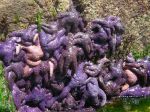
- Are the white dots the start of the wasting disease?
- Village Bay
- Village Bay Creek
- Village Bay Lake
(click on photos to view larger)
Hike Newton Lake – 13 August 2014
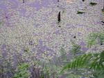
(postponed from 19 July 2014)
| Activity | Hiking |
| Destination | Newton Lake |
| Date | |
| Trip Coordinator | Syd Lapan |
| Contact Info | Syd 285-2999 or comoxsyd@gmail.com |
| Description | Lovely hike through the woods to a clear, sometimes cold, lake at the north end of the island |
| Meeting Place | Heriot Bay Store for car pooling |
| Departure Time | 9:00 |
| Difficulty | easy to moderate |
| Costs | none |
| Trip limits | none |
| Dogs? | no |
| Notes: | Bring lunch and snacks. Might want to bring a bathing suit. Small, extra walk could eliminate the need for that. |
Hike Heriot Ridge Route – 29 June 2014
| Activity | Hiking |
| Destination | Heriot Ridge Route |
| Date | 29 June 2014, Sunday |
| Trip Coordinator | Debbie Quigg |
| Contact Info | 285-3710; Please contact the coordinator prior to the trip |
| Description | This hike is a loop following the Heriot Ridge. It first follows the Heriot Ridge trail up to the ridge where there are excellent views to the east and west. The hike then continues on the ridge on a well-used flagged route, not a maintained trail, for about a third of the distance. The route undulates through open forest and bluffs until it joins the Thompson Trail and descends to Thompson Rd. About 2 hours. |
| Meeting Place | Heriot Bay Store for possible car pooling |
| Departure Time | 1:00 |
| Difficulty | easy |
| Costs | none |
| Trip limits | none |
| Dogs? | |
| Notes: |
Trip Report – Wood Duck Lake – 19 June 2014
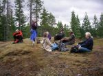
Despite the forecast for rain and gale force winds later in the day, the group of eight proceeded with this hike to an area not familiar to most of the participants. Taking the second logging road on the right after turning onto North Gowlland road, we parked about a half a kilometre down the road, just past a recently harvested area. The mountain bike trail known as Yellow Mud branched to the left and led to a series of meadows and to Wood Duck Lake. The beaver dam, which had failed a few years ago causing some down-stream damage, was in good repair. There were Mergansers with babies on the lake. We continued on and then up on Play Thing trail to an old copper mining site. Finding the Back Door trail we followed this through open forest until we reached a bluff with views of the Chinese Mountain – Beech’s Mountain ridge. We returned via Dick’s Ride trail, making a small loop. 7 kilometres. The rain and wind held off until we got home.
- beaver dam
- Wood Duck lake
- beaver dam
- Rolf
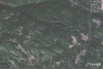
- track in Google Earth
(click on photos to view larger)
Trip Report – Nugedzi – 14 June 2014
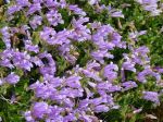
The group explored all of the Nugedzi highpoints: the old cedar grove, the lakes, the viewpoint over Discovery Passage, the lily pond and the viewpoint over Georgia Basin. The weather was overcast and hazy, even murky, and there were a few drops of rain at lunch, but the temperature was fine for the climb up the logging road. The wildflowers were excellent, though the forest is unusually dry for this time of year. (If the flowers are not all identified correctly, let us know). The pace was leisurely, with stops at all the beauty points for food and talk. 11.4 kilometres.
(click on photos to view larger)
- Coral Root
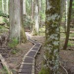
- the old forest
- Saprophytic Orchids
- Nugedzi Lake
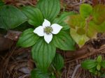
- Bunchberry/Dwarf Dogwood
- Sandwort
- Davidson’s Penstemon
- Death Camas
- Bonsai hemlock
- Labrador Tea in bloom
- Rebecca Spit