| Activity | Hiking |
| Destination | Bluffs West of North Gowlland Rd |
| Date | 22 Feb 2017, Wednesday |
| Trip Coordinator | Norris Weimer |
| Contact Info | 285-3710 or norris.weimer@ualberta.ca. Please contact the coordinator in advance of the trip. |
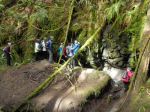
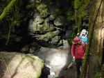
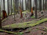
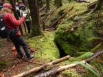
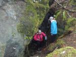
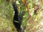
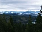
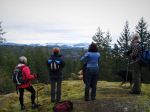
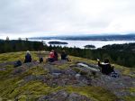
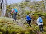
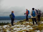
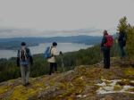
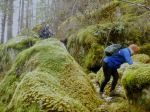
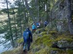
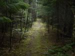
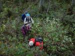
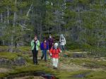
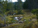
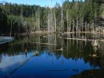
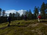
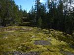
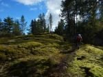
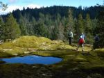
| Description | This hike starts up briefly on an active logging road and then climbs steeply up onto open bluffs. There is no trail or flagged route, but there are views to the south and west. The route continues through mostly open forest and mossy bluffs (only a bit of bushwhacking) to join the Little Black Dress trail. The trip is flexible in length by choosing the many mountain bike trail options. |
| Meeting Place | Heriot Bay store parking lot for car pooling. |
| Departure Time | 10:00 |
| Difficulty |
This trip includes industrial logging roads, steep mossy bluffs without trails and mountain bike trails. It will have a bit of everything. |
| Costs | none |
| Trip limits | none |
| Dogs? | Okay |
| Notes: | Bring lunch and gear for weather. |
Author Archives: qioutdoorclub
Bird Watching – Qualicum shoreline – 29 March 2017
Change of date from March 29 to April 12!
| Activity | Bird Watching |
| Destination | Qualicum area shoreline |
| Date | 12 April |
| Trip Coordinator | Mark Zimmerman |
| Contact | mz.markzimmerman@gmail.com or 285-2103; please contact the coordinator ten days to one week prior to the trip to ensure car pooling availability. |
| Description | The focus of the trip will be on local area birds and water birds, particularly brants. The group may visit more than one location depending on the cooperation of the birds. Actual destinations will be decided closer to the time of the trip and will remain flexible. |
| Meeting Place | Q Cove ferry terminal |
| Departure Time | Early ferry departure TBD |
| Difficulty |
Easy walking |
| Costs | Shared fuel and ferry costs |
| Trip limits | |
| Dogs? | no |
| Notes: | Bring lunch, gear for the weather and binoculars. |
Hike – Chinese Mountain – 22 Mar 2017
POSTPONED
| Activity | Hiking |
| Destination | South and North Chinese Mountain |
| Date | 22 March 2017 Wednesday |
| Trip Coordinator | Les Hand |
| Contact Info | 285-2029. Please contact the coordinator in advance of the trip. |
| Description | We will go up the south side to South Chinese Mtn. and have lunch while enjoying the view. Then down the north path and up North Chinese Mtn. and back to the vehicles. |
| Meeting Place | Heriot Bay Store parking lot for car pooling |
| Departure Time | 10:30 |
| Difficulty |
Moderate, but up and down |
| Costs | none |
| Trip limits | none |
| Dogs? | No, as trail is narrow in spots. |
| Notes: | It is only 3.4 km around South Chinese so we will go up north as well. Not everybody has to do both. |
Hiking – Thompson & B&B Trails Loop – 15 Mar 2017
| Activity | Hiking |
| Destination | Thompson & B&B Trails Loop |
| Date | 15 Mar 2017, Wednesday |
| Trip Coordinator | Janis McLean |
| Contact Info | 285-3614; please contact the coordinator in advance of the trip. |
| Description | This hike will include official trails, flagged routes and unofficial trails. The loop will pass over rocky bluffs with views, follow along creeks and travel through undulating forest. There are a variety of options depending on the interests of the group, including Rousseau Ridge. |
| Meeting Place | Trailhead for Thompson Trail on Thompson Rd. |
| Departure Time | 9:30 |
| Difficulty |
moderate |
| Costs | none |
| Trip limits | none |
| Dogs? | okay |
| Notes: | Bring lunch, a pole and gear for weather |
Hiking – Eagle Ridge Loop – 8 Mar 2017
| Activity | Hiking |
| Destination | Eagle Ridge Loop |
| Date | 8 March 2017, Wednesday |
| Trip Coordinator | Norris Weimer |
| Contact Info | 285-3710 or norris.weimer@ualberta.ca. Please contact the coordinator in advance of the trip. |
| Description | This hike will include the official trail to Eagle Ridge and an unmarked route descending the ridge and continuing on to the higher ridge to the north. From there we will descend to the logging road and return to the vehicles. The descent from Eagle Ridge is very steep on mossy rocks. There is no trail. |
| Meeting Place | Heriot Bay store parking lot for car pooling. |
| Departure Time | 10:00 |
| Difficulty |
The section up to Eagle Ridge is a maintained trail of moderate difficulty. The descent from Eagle Ridge is challenging. The segment to the next ridge and down to the logging road is on an unmarked route through mostly open forest. |
| Costs | none |
| Trip limits | none |
| Dogs? | Depends on the dog. Would need to be completely controlled during the descent. |
| Notes: | Bring lunch and gear for weather. |
Hiking – Kay Dubois & Fox Main Loop – 1 Mar 2017
| Activity | Hiking |
| Destination | Kay Dubois and Fox Main Loop |
| Date | 1 March 2017, Wednesday |
| Trip Coordinator | Julie Mellanby |
| Contact Info | 285-3978. Please contact the coordinator in advance of the trip. |
| Description | This hike will be a loop including the Kay Dubois trail and some of the logging roads in Dick Whittington’s woodlot. There are some hills and wet places, but mostly easy walking. |
| Meeting Place | Kay Dubois trail head at the south end of Wa Wa Kie Rd |
| Departure Time | 9:30 |
| Difficulty |
Easy |
| Costs | none |
| Trip limits | none |
| Dogs? | okay |
| Notes: | Bring gear for the weather and maybe a snack. |
Trip Report – Mt Washington – 8 Feb 2017
Three of us snow-shoed at Mt. Washington on Wednesday. The clouds were low, but the snow was excellent. It was absolutely a winter wonderland, with snow clinging to branches and bark in the forest. We crossed Paradise Meadows on the Old Cabin and Crooked Creek trails before taking the summer trail up to Battleship Lake. The trail had been well used, so it was easy to follow. It was completely quiet in the forest and we met very few people. We continued over the Lake and through the forest to Lake Helen Mackenzie. The steep descent was great in the deep powder. We crossed some of the Lake and then had lunch in a sheltered spot out of the wind. Around 1:00 it began to snow lightly. We returned to Paradise Meadows and completed the Old Cabin Loop. 8.1 km; 3 hours.
Debbie
(click on photos to view larger)
- Lake Helen Mackenzie
- Crossing the bridge!
- Winding creek
Trip Report – Salt Spring Island – 30 Jan – 2 Feb 2017
Such a wonderful time hiking the trails on Salt Spring Island, each day we experienced the gorgeous sunshine. Seven hikers from Quadra attended and all declared it was a lovely happening. We arrived on SSI just after noon on the 30th Jan, checked into the beautiful century home on the edge of Ganges. First hike, we drove to Ruckle Provincial Park down in the southeast corner of SSI. The trail took us along the rocky shore, bird life on the water, baby lambs in the field. We completed the trail loop of 6.8km; 2⅓ hours. We toured the heritage farm. This land was donated to the province by the Ruckle family, who still farm parts of the property. Returned to Ganges, some returned to the house and others looked into Ganges. A delicious dinner at night prepared by the first team of hikers.
Day two, started with a healthy breakfast and off to Mt Maxwell Provincial Park. We drove to top of Mt Maxwell; it rises about 595 metres. A spectacular view to Burgoyne Bay below, across to Vancouver Island, the beautiful Fulford Valley, Mt Baker and also Mt Rainier at 4,392 metres, both clothed in sparkling snow. The loop we hiked was again spectacular with lots of viewpoints, views over to Vancouver and beyond. (6.6 km; 3½ hours) We then hiked the trails at Burgoyne Bay to Daffodil Point, a few houseboats in the bay. (3.2 km; 1 hour) Returned to Ganges later in the afternoon in order to give us a little time to look at the shops in Ganges. Another delicious dinner at night prepared by the second team.
Day three, started with breakfast and then drove to the north picking up the Channel Ridge Trails. This 15km trail system with some challenging sections, beautiful arbutus groves that took our breath away. Some workouts that made us ready for our lunch on the trail. Some pretty view points, however, most were hidden by tree tops. (7.2 km; 3 hours) We then drove to the Andreas Vogt Nature Reserve, a beautiful experience with a number of glorious Garry Oak Groves, many younger Garry Oaks were protected from deer etc. This was truly one of our favourites. (2.6 km; 1½ hours) At night we decided to eat at Moby’s Pub, joining the locals in good food and music.
Day four, started with breakfast, packed up our belongings and cleaned. Most then drove to walk at Duck Creek Park, a shaded creek with a lovely open meadow providing a sweet 40 minute walk. Onto the ferry line-up at Vesuvius in order to take us across to Vancouver Island.
This was indeed a wonderful four days on Salt Spring Island. What made it so wonderful would be that each day was filled with sunshine, a great group of hikers, the beautiful heritage home on the beach, the delicious food and fantastic trails and views. Lets do it again!
Margot
See below the photos for the bird list. Note Peregrine Falcon!
(click on photos to view larger)
- The heritage home
- View of Ganges Harbour
- The historic Ruckle home
- Ruckle Park
- Ruckle Park
- Old farm buildings
- Friendly local chickens
- Views from Mt. Maxwell toward Vancouver Island
- Windy Burgoyne Bay
- View southeast
- Fulford Valley
- Mt. Baker
- Trail in Burgoyne Park
- Burgoyne Bay
- Garry Oak at Daffodil Point
- Mt. Maxwell
- An excellent dinner
- Dawn at Ganges Harbour
- Steep section of Channel Ridge
- Arbutus bark
- Arbutus tree
- Garry Oak leaves
- Garry Oaks
- Channel Ridge trail
- View toward Vancouver Island
- Garry Oak in Andreas Vogt Nature Reserve
- Lichen covered tree
| Song Sparrow | Chestnut-sided Chickadee |
| Common Merganser | Hooded Merganser |
| Trumpeter Swan | Golden-crowned Kinglet |
| Bufflehead | Common Goldeneye |
| Common Raven | Bald Eagle |
| Mew Gull | California Gull |
| Glaucous-winged Gull | American Wigeon |
| Dark-eyed Junco | Double Crested Cormorant |
| Northwest Crow | Pacific Wren |
| Black Oystercatcher | American Robin |
| Peregrine Falcon | Turkey Vulture |
| Red Crossbill | Spotted Towhee |
| Red Breasted Sapsucker | Red Breasted Nuthatch |
| Belted Kingfisher | European Starling |
| Northern Flicker | Hairy Woodpecker |
| Grouse | Varied Thrush |
Natural History – Karst Formations – 22 February 2017
Postponed to 5 April 2017
| Activity | Natural History |
| Destination | Quadra’s karst formations |
| Date | 5 April |
| Trip Coordinator | Norris Weimer |
| Contact Info | 285-3710 or norris.weimer@ualberta.ca; please contact the coordinator by Sunday if you are interested in going |
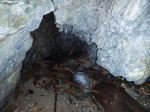
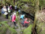
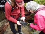
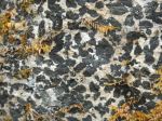
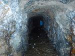
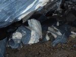
| Description | Visit some of Quadra’s Quatsino limestone formations, an area which contains karst sinkholes, intakes, resurgences and underground streams. We will visit two or three areas, which involves a bit of driving on logging roads and bush walking. We will not be walking in caves. |
| Meeting Place | Heriot Bay store parking lot for car pooling. High clearance vehicles will be preferable. |
| Departure Time | 9:30 |
| Difficulty |
Easy to moderate |
| Costs | none |
| Trip limits | none |
| Dogs? | no |
| Notes: | Bring lunch and gear appropriate for the weather. Also, bring a flashlight to see into these geological formations. |
Trip Report – Salmon Pt to Oyster River – 24 Jan 2017
Six of us met at Salmon Point Resort for lunch at noon. This is something we had not tried before but was a good social outing. If you have not tried this restaurant you should. It has a great view to Mitlenatch Island and the coastal mountains beyond. They have lunch specials. Their seafood chowder in a bread bowl as well as the calamari is delicious.
After lunch we walked from the resort to the Oyster River. This time of year the trail head can be covered with water but the resort lets the public go through the trailer park sites. Dogs must be leashed. The low land at the first of the walk is a great place to bird watch. We saw many birds, ducks and some trumpeter swans. Last summer much of the trail was moved closer to the ocean and covered with bark mulch. At the south end you go into the Oyster River Nature Park. It is only a 12 acre park but has many small trails. Be careful near the river as part of the path was eroded during the heavy rains. If it is a cold day or you want a break you can stop at the Fisherman’s Pub. We returned to the vehicles via the same route. It was about 6.5 km and took 2 hours.
Les
(click on photos to view larger)
- Marina at Salmon Pt
- Resaurant at Salmon Pt
- Swan and duck in the wetlands
- Shorebirds
- Erosion on the Oyster River
- Nurse log decomposed
- Oyster River delta