| Activity | Hiking |
| Destination | Noel’s Pizza Peak |
| Date | 3 July 2023, Monday |
| Trip Coordinator | Les Hand |
| Contact Info | 285-2029 or lhquadra@gmail.com |
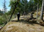
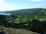
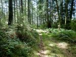
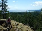
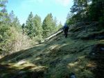
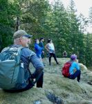
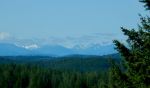
| Description | Noel’s Pizza peak is the informal name for the west ridge of Beech’s Mt. It is a flagged route, not an official trail. There may be some blow down and bushwhacking as it is not maintained. This is a view hike, so will be postponed if raining. About 4 hours. |
| Meeting Place | Heriot Bay Store for car pooling |
| Departure Time | 10:00 |
| Difficulty |
Moderate |
| Costs | No |
| Trip limits | 10 |
| Dogs? | No |
| Notes: | If you use hiking poles bring them. I would also recommend good hiking boots. Be sure and sign up a couple of days early so that I may contact you if there is a change in plans. |
Category Archives: day-trip
Trip Report – Heron Pt. and Mt. Sweat – 14 June 2023
Four of us enjoyed this great, short loop with wonderful views and lots of variety in terrain. It’s very quick up to Heron Point, with views from Chinese Mtn to Hyacinthe Bay. The weather was windy and “soft”. The sky was clear, but there was haze, perhaps from smoke. We continued on a gentle cairned trail to an old logging road and off on another marked trail which climbs and undulates through forest and mossy bluffs up to an intermediate viewpoint and then Mt. Sweat. We stopped for a very relaxing lunch at this viewpoint which covers more than 180°. From there we followed a recently flagged route down the north side back to Kolker Main and the short walk to the vehicles. Thanks to Heather Kellerhals for letting the Outdoor Club use the Chauntaluf farm trails to make this loop. 3.8 km, 2½ hours.
(click on photos to enlarge)
- Grouse
- Bluff to Heron Point
- View southwest
- View southeast
- Old logging road
- Climbing up the bluffs
- Views along the way
- View east from Mt. Sweat
Caving – Sayward Area – 28 June 2023
| Activity | Caving |
| Destination | Sayward area caves |
| Date | 28 June 2023, Wednesday |
| Trip Coordinator | Cyndy Chidley |
| Contact Info | Cyndy Chidley: 250-285-3575. Please let the coordinator know as soon as possible if you are interested. |
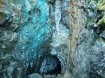
| Description | We will meet Bill north of Campbell River around 10:00 and drive to the cave area from there. We will try to car pool. Challenges may include bridging, climbing, stretching, wriggling, not to mention small, dark, wet places. Make sure you read the notes below on what to bring. |
| Meeting Place | Q Cove ferry terminal |
| Departure Time | 9:00 ferry to Campbell River. |
| Difficulty | Moderate |
| Costs | Ferry and shared gas |
| Trip limits | 10 |
| Dogs? | No |
| Notes: |
Bring;
Wear rubber boots, neoprene socks or booties, or wool socks with runners that you don’t mind getting wet. The water will be cold.
Gloves and coveralls for protection of hands, arms and legs.
A helmet that you are able to fit with head light, and a head light, if you have one.
Lunch and water.
A towel and change of shoes if you get wet.
Walkie-talkie or family radio (FSR), with charged batteries.
|
Hiking – Newton Lake-Small Inlet-Waiatt Bay – 26 July 2023
| Activity | Hiking with swimming |
| Destination | Newton Lake, Small Inlet and Waiatt Bay |
| Date | 26 July 2023, Wednesday |
| Trip Coordinator | Vic Gladish |
| Contact Info | vicgladish@gmail.com; 250-285-2111; text 250-287-0459 |
| Description | We will hike up to Newton Lake, down to the portage between Small Inlet and Waiatt Bay and back to the Newton Lake parking lot. Distance about 15 kilometres – will take approximately 6-7 hours (including lunch and short swim stops at Newton Lake) |
| Meeting Place | Heriot Bay Tru Value |
| Departure Time | 9:00 |
| Difficulty |
Moderate for distance and steep grades |
| Costs | Share fuel costs |
| Trip limits | 10 |
| Dogs? | No |
| Notes: | Bring plenty of water, lunch and snacks, and swimming stuff if you want to swim. |
Hiking – Plumper and Deepwater Bays – 19 June 2023
| Activity | Hiking |
| Destination | Plumper and Deepwater Bays |
| Date | 19 June, Monday |
| Trip Coordinator | Norris Weimer |
| Contact Info | norris.weimer@ualberta.ca or 3710. Please contact the coordinator in advance. |
| Description | A relatively flat and easy hike on old logging roads. The first part is the same as for going to Maud Island, then instead of turning left, we turn right. The trail is quite gradual down to the water. There has been some recent trail work. Plumper Bay has a nice grassy, sunny meadow on the waterfront and Deepwater has a gravel shore with a view north up Discovery Passage. Both have recently had a beach clean-up. About 8 km roundtrip. |
| Meeting Place | Heriot Bay Tru Value parking lot; we will convoy in our cars from there. |
| Departure Time | 10:00 |
| Difficulty | Easy, but roughly maintained |
| Costs | none |
| Trip limits | 10 |
| Dogs? | |
| Notes: | Bring lunch. |
Trip Report – Santana Mine – 29 May 2023
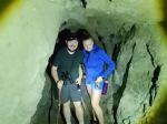
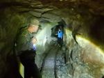
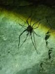
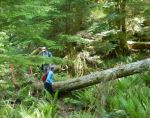
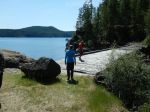
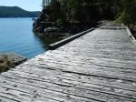
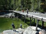
After we returned to the cars, doing a bit more trail work along the way, we drove to the old Bold Point trestle, where the Union Steamship used to dock. The planking is seriously deteriorating, but it’s a beautiful vista onto Hoskyn Channel.
Thanks for all the community support for our hike out to the mine. The mine trail was 3.3 km; 2¼ hours.
(click on photos to enlarge)
- View toward Vancouver Island
- Sanatana Mine entrance
- Cave cricket
- Still some deadfall
- The old trestle at Bold Point
- View of Hoskyn Channel
Hiking – Heron Point and Mt. Sweat – 14 June 2023
| Activity | Hiking |
| Destination | Heron Pt and Mt. Sweat loop |
| Date | 14 June, Wednesday |
| Trip Coordinator | Debbie Quigg |
| Contact Info | dmquigg@gmail.com or 3710 Please contact the coordinator by Monday night. |
| Description | This is a short hike starting on Kolker Main. We will briefly follow a logging road, a short connector and a mossy bluff to Heron Point for great views of Hyacinthe Bay and the Chinese Mtn area. From there we will take a cairned route through forest trails and rocky bluffs to Mt. Sweat. We descend to Kolker Main through open, forested slope and return to the vehicles on the logging road. This is a view hike and will not be done in poor weather. About 4 km; 2½ hours. |
| Meeting Place | Heriot Bay store parking lot. We will drive out in a group. |
| Departure Time | 10:00 or earlier if it’s hot |
| Difficulty |
Mostly easy, but some interesting places on Mt. Sweat. |
| Costs | None |
| Trip limits | 10 |
| Dogs? | No, some of this will be on private property. |
| Notes: | Some of this trip is on private property and we thank Heather Kellerhals for allowing our visit to Chauntaluf Farm. Bring gear appropriate for the weather and trail conditions, as well as lunch. |
Trip Report – Maud Island and Petroglyphs – 18 May 2023
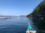
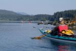
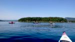
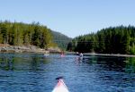
Five paddlers put in at Whalebone Cove and set off by 0900 on glassy seas, with bright sunshine, and warming temperatures. A beautiful summer day in the spring! And finally, after many attempts to undertake this trip, we were doing it.
Working with and against the ebbing current we made our way northward, close to shore and observing the life below. An hour’s paddling brought us to the fish farm near Maud Island and then we decided that our early lunch stop would be at the entrance to the saltwater lagoon which was at this point not navigable.
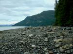
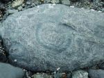
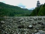
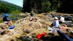
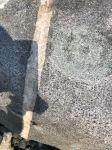
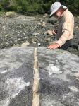
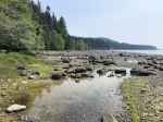
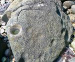
We then headed for “Kawston”, the ancient village site and its petroglyphs at the mouth of Morte Creek just east of Maud Island. Locating the flat-topped large rock with the quartz line was easy and on it was a fairly obvious petroglyph as indicated in Inglis’s little guide book. Over the next 45 minutes or so we searched for further examples and came up empty handed. However the many canoe pull outs were quite evident as we walked across the top of the beach.
As we paddled back, southward, with an increasingly strong flood current, we stayed close to shore and were passed by a solitary cetacean (porpoise?), spotted an otter, and a sea lion. We rode the fast current for several minutes, got pushed around by boils and whirlpools, and then cruised back into Whalebone Cove. 6½ hours and 17 km covered.
A fabulous outing!!
Vic
Thanks to Vic and Tak for the photos
(click on photos to enlarge)
- Paddling in Discovery Passage
- Approaching Saltwater Lagoon
- Lunch stop
- Petroglyph
Trip Report – Open Bay Beach Clean-Up – 15 May 2023
Five hardy club members started early Monday morning, May 15, braving the unseasonal extreme heat to show our community pride by participating in Quadra’s Beach Clean-Up. We began at Big Beach in Open Bay where Les and Neil hauled two heavy piles of already collected debris from the beach-side trailhead back up the steep trail to our large collection bag. This pile turned out to be the most garbage we would see for the entire clean-up. The three beaches (Big, Redonda, and Valdes beaches) have obviously been well cleaned in the last few weeks, by other Island teams and/or the geology students from VIU.
Kudos to Debbie and Norris who made a valiant effort at Big Beach to remove the tires/styrofoam/wood remains of an old dock. Too heavy and bulky to wangle up the steep hill, it was finally, regretfully, left at the beach above the high tide line.
Small amounts of debris were found at Redonda and Valdes beaches, dutifully packed into the big white bag for later disposal at the Beach Clean-Up event on May 27.
The heat on the exposed beaches precluded any socializing afterwards, so we all headed back to find our cool spots at home. (about 2.5 hours; about 27° C)
(click on photos to enlarge)
- Big Beach
- Open Bay Creek at Big Beach
- Working at Redonda Beach
- Redonda Beach
- Some of our finds…
Trip Report – Gowlland Harbour – 10 May 2023
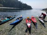
Ten kayakers met at Gowlland Harbour resort for our spring wildflower paddle. It was a beautiful sunny summer day with only light wind. Gowlland Harbour Resort was very gracious and allowed us to launch from their beautiful Resort. Les had hurt his shoulder earlier in the week, so was not able to join the group on the water. He showed up to help everyone get launched, but Debbie shepherded the group on the water.
After launching we paddled over to Vigilant Island, where about half the group went ashore to explore the wildflowers. There were Sea Blush, Monkeyflowers, Death Camas, tiny Blue Eyed Marys, and Chocolate Lilies, so it was a great show. From there we crossed the channel to Steep Island and chatted with the couple on the three-masted sailboat before crossing the Gowlland Harbour entrance. We skirted the outside of May Island and got a glimpse of the submerged wreck, which was less than a metre under the water. We headed east across North Gowlland Harbour checking out the old stone house and glimpsing large anemones around the islets. The cliffs along the Quadra shore were a perfect rock garden in places, with sedum and Monkeyflowers on dripping walls. We dipped into the bay and chatted with Jill and Vibeke before paddling east around the islets in Gowlland Harbour where the Harbour Seals were basking on the rocks in the sun. Passing by two large sailboats at anchor, we continued on by Fawn, Stag and Doe Islands with the Sea Blush coming out and the Canadian Geese nesting. As we landed at Les’ place, there were Geese with goslings making their way along the shore.
Les fixed appetizers for the group. We had Nan bread with cheese, ham and turkey, as well as rice crackers with cream cheese and crab, a mixed vegetable platter and cookies. After that the group paddle back to Gowlland Resort. Les met them there to load up. (11.2 km; 5 hours with all breaks)
Les and Debbie
(click on photos to enlarge)
- The launch
- Paddling in Gowlland Harbour
- Mt. Alexandra from Vigilant Island
- Sea Blush
- Monkeyflower
- Blue Eyed Mary
- Death Camas
- Chocolate Lily
- In the shallows around Vigilant Island
- Crossing to Steep Island
- In North Gowlland Harbour
- Old Stone House
- Garden on a wall
- Harbour Seal
- Sea Blush on the islet
- Monkeyflower on the islet
- Canada Gooss guarding the nest
- Harbour Seal
- Arriving at Les’
- Dogwood tree at Les’
- View from the balcony
- Lunch in the sun
- Heading back