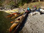
| Activity | Hiking |
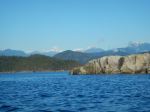
| Destination | Carrington Bay, Cortes Island |
| Date | 23 January 2019, Wednesday |
| Trip Coordinator | Margot Wood |
| Contact Info | tel 250.285.2393. Please contact the coordinator well in advance of the trip, so that car pools can be arranged. |
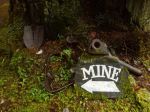
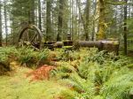
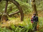
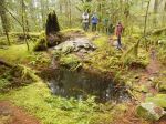
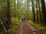
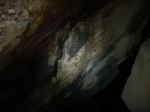
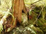
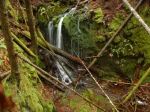
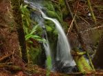
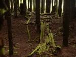
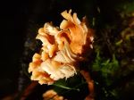
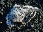
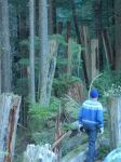
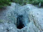
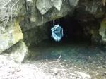
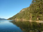
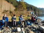
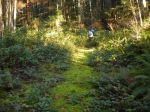
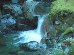
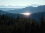
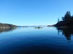
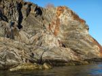
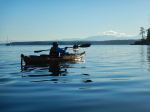
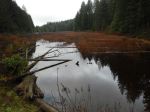
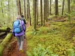
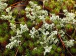
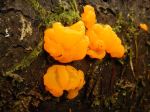
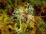
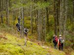
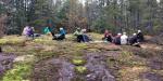
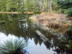
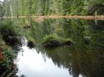
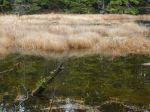
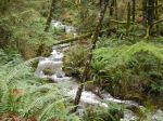
| Description | Sabina is going to join us to be our guide and naturalist. This will be a great treat; Sabina is always filled with marine and environmental knowledge. We will drive to Carrington trailhead and proceed on the trails to Carrington Bay. This deeply cut bay is magnificent with the adjoining lagoon. Glaciers receded over the shoreline of Carrington Bay 10,000 years ago; lots to see and learn. We will have lunch at Carrington Bay and continue on to Grandmother’s Grove following the stream. We plan to return on the 3:50 p.m ferry. |
| Meeting Place | Cortes ferry line-up. |
| Departure Time | 9:05 a.m ferry; vehicles need to be in the ferry line-up not later than 8:15 a.m as this is a busy sailing. |
| Difficulty |
Easy to moderate. |
| Costs | Ferry travel costs; bring your experience card and ID |
| Trip limits | |
| Dogs? | no |
| Notes: | Bring lunch and gear for weather. |
Category Archives: day-trip
Trip Report – Two Mines and Some Karst – 12 Dec 2018
Having decided that Mt. Washington needed more snow before we make that trip, we substituted this outing. Seven of us visited a number of caves and karst formations at the north end of Quadra Island. We started at the Lucky Jim mine, an historic gold, silver and copper mine, which is well signed and has been made safe with gratings over the vertical shafts. The steam donkey is huge and in good condition considering it was installed in about 1910. We next visited a mine off of Open Bay Main, which we know very little about. The horizontal shaft is in good condition. We continued to a karst cave with excellent marbling and were impressed by the risks inherent in the nearby grikes or eroded fissures in the limestone.
After lunch in the parking area we cut over to the Granite Bay Road and an area of sink holes. We started at a very large sinkhole with a lovely waterfall and then moved a short distance south for a walk following a creek which is insurgent and resurgent in the limestone. There are areas where the creek seems to have re-routed for it no longer emerges. The large sinkholes and walls are impressive. We didn’t walk very far, but took our time enjoying the sites and the incredible green forest at this time of year. A bit more than four hours, without the drive out.
Debbie
Photos by Norris
(click on photos to view larger)
- Steam Donkey
- Looking through the grate
- The Lucky Jim mine shaft
- The second mine
- Limestone marble
- Marble
- Waterfall into the sinkhole
- Emerging creek
- Shake cutter’s bridge
- Grike
- Mushroom
Exploring – Two Mines and Some Karst – 12 Dec 2018
| Activity | Exploring |
| Destination | Two Mines and Some Karst Formations |
| Date | 12 December 2018, Wednesday |
| Trip Coordinator | Debbie Quigg |
| Contact Info | 3710 or debbie.quigg@ualberta.ca; please contact the coordinator in advance of the trip |
| Description | We will visit an old mine off of Open Bay Main, a limestone cave and grikes in the limestone. We will also stop at the Lucky Jim mine before continuing on to some sinkhole formations. The weather is forecast to be very rainy in the afternoon. Having three sites gives us the flexibility to alter plans if necessary. |
| Meeting Place | Heriot Bay store parking lot for car pooling. This will involve some driving on logging roads. |
| Departure Time | 9:30 am |
| Difficulty |
easy; this will more a visit to multiple sites than a lot of exercise. |
| Costs | |
| Trip limits | none |
| Dogs? | No |
| Notes: | Be prepared for wet. Bring a good flashlight if you have one. |
Trip Report – Deepwater Mine and Bay – 5 Dec 2018
Deepwater Bay is on Discovery Passage, north of Seymour Narrows. Deepwater canyon or valley (for lack of a better name; it’s not quite a canyon and it’s more than a valley) is a big gap between Mt. Seymour and North Mountain, complete with a mountain stream which can be impressive.
Twelve of us set off on a clear, cold morning to explore it. It was a winter wonderland, even without snow, all white from hoarfrost. We stopped first on the Deepwater Main logging road to visit the old rail trestle, which is in ruins. Then we hiked up the old logging road to the copper mine on North Mountain. The horizontal shaft is full of water and fascinating, but no one was tempted to go swimming. We then hiked down the old road to the Bay, passed the abandoned fish hatchery, and had lunch in the beautiful warm sunshine, with great views of Deepwater Bay and Discovery Passage. A lone sea lion swam by close to shore. This area is full of the history of logging, mining and fishery on Quadra. 6.8 km; 3¼ hours.
Norris
Photos by Norris
(click on photos to view larger)
- View NE from Granite Bay Road
- Frosty leaf
- Old trestle posts
- Frosty needles
- Ice crystals
- Icicles
- Mining shaft and rails
- Mining shaft
- Horizontal shaft
- Frosty mushroom
- Angel hair
- Deepwater Bay
- Deepwater Bay
- Deepwater Creek
- View SW from new logging road
Trip Report – Open Bay and Breton Islands – 2 Dec 2018
It was a chilly day, as there had been frost, but sunny and calm. Five paddlers set out from Len Road access to enjoy the sun and an afternoon on the water. There were a large number of eagles and loons out enjoying the sun as well. We paddled out of Hyacinthe Bay and headed over to the North Breton Island. The tide was quite high, 15.7 feet, so we were able to cross the rocks near the south end. From there we traveled north and came back down through Shellalligan Pass. We stopped on a little stretch of sand in Moulds Bay for tea and cookies. It was quite warm in the sun for this time of year. Afterwards we made a circle into Open Bay before returning to the cars. 3 hours, 6.6 nautical miles
Les
Thanks to Norris and Les for the photos
(click on photos to view larger)
- Launch at Len Rd
- Folded rock
Hiking – Q Cove Trails – 2 Jan 2019
This hike has been re-scheduled to January 1st, Tuesday.
| Activity | Hiking |
| Destination | Q Cove Trails |
| Date | 1 |
| Trip Coordinator | Norris Weimer |
| Contact Info | 3710 or norris.weimer@ualberta.ca; please contact the coordinator in advance of the trip |
| Description | We will explore a network of forest trails on private, undeveloped land in what will eventually be downtown Q Cove, but which at present is a natural area surrounded by private homes. The trails are used by the locals from their backyards. The forest and streams are charming and the locals have added a bit of artwork to it. About 2 hours. |
| Meeting Place | Behind the Q Cove store |
| Departure Time | 10:00 am |
| Difficulty |
easy |
| Costs | none |
| Trip limits | none |
| Dogs? | Dogs must not run through the group |
| Notes: |
Snow – Mt Washington – 12 Dec 2018
Postponed!
| Activity | Snow |
| Destination | Mt. Washington |
| Date | 12 Dec 2018, Wednesday |
| Trip Coordinator | Debbie Quigg |
| Contact Info | debbie.quigg@ualberta.ca or 3710; please contact the coordinator by Sunday night. Please indicate whether you want to x-country ski or to snow shoe. |
| Description | Mt. Washington plans to open on Dec 7th, but as of Dec 1st there is very little snow, so this outing may need to be rescheduled. We can go the Rampart Hill area or to the prepared trails at Strathcona Park. This will depend on the weather, the snow and the group. |
| Meeting Place | Quadra ferry terminal to Campbell River. Car pools should be arranged in advance. |
| Departure Time | 9:00 ferry to Campbell River. Those taking cars need to be early enough to get on the 9:00 ferry. |
| Difficulty |
Depends |
| Costs | Ferry, shared fuel and the trail pass (If we go to Raven Lodge). The snowshoe day pass is $10 and the x-country day pass is $24 for adults and $20 for seniors.. |
| Trip limits | Availability of cars going up to Mt. Washington. |
| Dogs? | No |
| Notes: | Bring equipment, warm clothing and lunch. |
Hiking – Deadfish/Tripod Loop – 10 April 2019
This hike was originally scheduled for March 6th.
| Activity | Hiking |
| Destination | Deadfish/Tripod Loop |
| Date | 10 April 2019, Wednesday |
| Trip Coordinator | Janis McLean |
| Contact Info | 3614. Please contact the coordinator in advance of the trip. |
| Description | Starting at the Morte Lake parking lot, we make a big loop on biking/hiking trails south of Morte Lake. We follow Deadfish and Nirvana trails, then west along south Morte Lake. Turning back on Tripod, Ridge trail and Lost Rider, we finish off by going over a high bluff and steep descent back to the parking lot. Duration should be about 2 hours (3 hours max). |
| Meeting Place | Heriot Bay store parking lot for car pooling. |
| Departure Time | 9:30 |
| Difficulty |
Easy to moderate |
| Costs | none |
| Trip limits | none |
| Dogs? | Okay under owner’s control |
| Notes: | Bring a snack or lunch. Hiking pole(s) recommended (we will be crossing one stream). This trip was originally scheduled for January 9th and then February 6th. |
Trip Report – Backdoor-Yellow Mud Loop – 28 Nov 2018
Fifteen hikers, along with Kona and Joey, the dogs, enjoyed a three hour hike in the area south of Walcan Road, starting at the pullout at Reed Lake. The weather was great for November – cloudy but with no rain, no wind and a pleasant 8° C. We headed south on Straight-as-a-Dime Trail, following a combination of newer bike trail sections and old logging roads. Turning east onto Backdoor Trail, we hiked over vibrant green moss-covered rock bluffs, through pine forest and past a perfectly mirrored pond. Shortly after going past some old mining camp debris, we headed north and followed Dick’s Ride down to Nighthawk Lake (variously named Yellow Mud, Hilda’s, Wood Duck and Beaver Pond Lake). Walking alongside the large lake created by a 20-meter-long plus beaver dam, we spotted Bufflehead and other waterbirds, and an unidentified hawk. We continued northwest down Yellow Mud Trail through lush sword fern, hemlock and Doug fir forest, paralleling McKercher Creek before arriving back at Reed Lake. 8.1 km.
Janis McLean
Thanks to Norris and Les for the photos
(click on photos to enlarge)
- Reed Lake
- Turkey tail fungus
- Moss
- Orange Jelly Fungus
- Lichen
- Lunch stop
- Moss-covered truck
- Beaver dam at Nighthawk Lake
- Nighthawk Lake
- McKercher Creek
Kayaking – Open Bay and Breton Islands – 2 Dec 2018
| Activity | Kayaking |
| Destination | Open Bay and Breton Islands |
| Date | 2 Dec 2018, Sunday |
| Trip Coordinator | Les Hand |
| Contact Info | 285-2029 or leshand@gicable.com Be sure and sign up so I can call you if weather changes |
| .Description | The weather forecast is sunny but cold so dress accordingly. We are leaving as late as possible so it will warm up a bit. Have lunch before you come but we will stop for a snack so bring one and maybe something warm to drink. The exact course will be set by conditions and the people that go. |
| Meeting Place | Len Road public beach access |
| Departure Time | Meet at 12:30, launch at 1 P.M. |
| Difficulty |
Moderate |
| Costs | none |
| Trip limits | none |
| Dogs? | no |
| Notes: | All participants must conform to QIOC paddling guidelines. Participants must have all Coast Guard required equipment and spray skirts. The standard for participation in winter trips is higher than for summer outings. |


