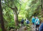
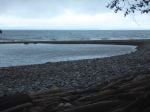
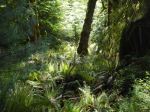
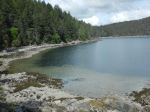
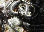
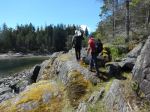
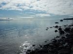
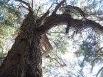
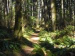
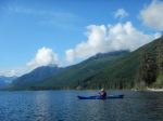
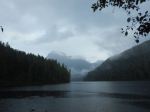
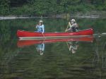
We camped at the Woss Lake Recreation Site, with the group arriving gradually over about 30 hours. Due to forecast rainy weather, many invested quite a lot of effort in setting up camp with tarps. Three of us kayaked on Woss Lake Monday morning in calm and increasingly sunny conditions. We paddled down the east side of the Lake exploring the cabins and boat launch. (about 7 km) Some also explored the Woss River Trail with some impressive old growth cedar and good views of the river from a bluff. This trail goes a long way, but we only went about 2.8km. In the afternoon, two more people arrived and the weather turned showery. We drove logging roads to check out Schoen Lake Provincial Park. We already knew that any possible interesting hiking would involve access by boat, but the deluge of rain when we arrived discouraged any enthusiasm for exploration. Back at camp, we enjoyed appies by Les’ campfire before dinner. By Monday night the final two people had arrived and enjoyed an evening canoe paddle, where they found some pictographs.
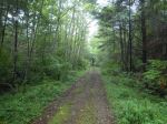
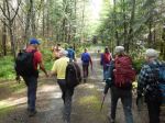
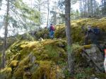
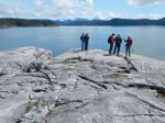
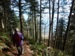
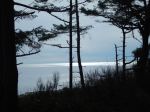
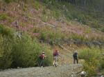
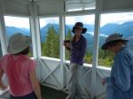
Tuesday morning: After Les’ delicious blueberry pancake breakfast, we departed for Woss Lookout. We parked at the trail sign and hiked up the steep logging road, through some clear cut and into the forested lookout hill. The steep trail is well equipped with rope aids and the distance is quite short, but a good test of fitness. We were soon rewarded with the restored fire lookout and excellent views, even with a bit of cloud around. The views of the Schoen, Vernon, Woss and Nimpkish Valleys are impressive, as well as the nearby mountains. We returned by the short loop and headed back down the steep trail, once again thankful for the ropes. (4.6km, 3½ hours; 400m elevation gain)
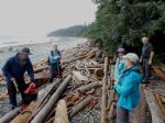
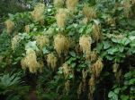
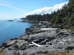
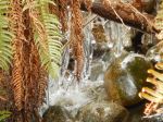
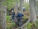
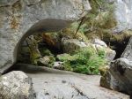
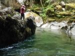
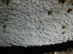
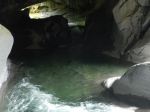
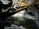
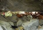
Tuesday afternoon: After lunch we continued on to the Little Huson Caves Regional Park. The short walk through the woods takes you to the sculpted rock of the Atluck Creek working its way though the limestone. The boardwalk and stairs are very helpful and some have been recently replaced. We enjoyed views of the Natural Bridge from both entrances, the River Cave, the Atluck Creek and the Bridge Cave. The green water, scalloped and sculpted rock were beautiful. (about 2.6km, 1½ hours) Back at camp, quite a few bathed in the Lake, which wasn’t too cold,
The forecast had consistently called for afternoon showers and we escaped until Tuesday evening, when the real weather was expected. The rain began lightly after 21:00 and increased and continued all night. Wednesday morning, five of us made a short paddle on Woss Lake in marginal weather, before taking down the sodden camp gear and heading home.
Thanks to everyone for the food sharing, logging road driving, and general good time. Having the only serious rain at night was a benefit for seeing this beautiful and not much visited area.
Debbie
(click on photos to view larger)
-

- Nimpkish River
-
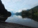
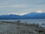
- Woss Lake
-
- Schoen Lake
-
- logging road to Woss Lookout
-
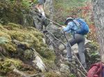
- the steep trail to the lookout
-
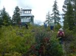
- Woss Fire Lookout
-
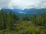
- Woss Valley and Lake
-
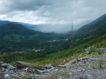
- Shower in the Nimpkish Valley
-

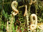
- Maidenhair Fern
-
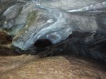
- part of the River Cave
-
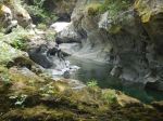
- Atluck Creek
-
- Scalloped limestone
-
- the Natural Bridge
-
- the River Bridge
-
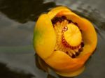
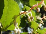
- Yellow Water Lily
-
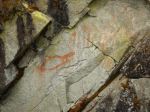
- Pictograph at Woss Lake
-
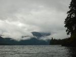
- Woss Lake
-
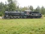
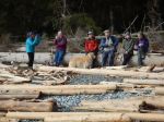
- the last logging steam engine, Woss town
Multi-day Hiking – Woss Lookout and Huson Caves – 15-17 July 2019