Re-scheduled due to weather
| Activity | Hiking |
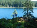
| Destination | Mt. Seymour |
| Date | 1 Oct, Friday |
| Trip Coordinator | Vic Gladish |
| Contact Info | vicgladish@gmail.com; 250-285-2111; (cell 250-287-0459) |
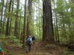
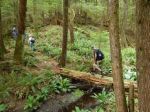
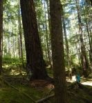
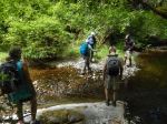
| Description | This is a strenuous hike with great views – best done in good weather. It’s a steady climb up old logging roads, until the trail branches off and follows open bluffs and forest to the summit at 620 m, the highest point on Quadra Island. We will then descend by the same route. Four to five hours. |
| Meeting Place | Mt. Seymour trailhead |
| Departure Time | 10:00 |
| Difficulty |
Moderate |
| Costs | none |
| Trip limits | 8 |
| Dogs? | No |
| Notes: | This hike will be cancelled if the weather is not favourable. Bring a lunch. COVID protocols in effect. |