Due to weather this is now a day trip on Thursday. There is a new trip description.
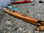
| Activity | Kayaking and camping |
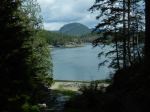
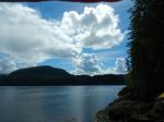
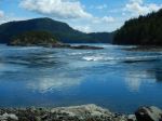
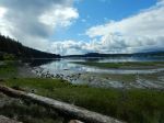
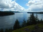
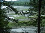
| Destination | Granite Bay and beyond |
| Date | 20-22 Aug 2024, Tuesday to Thursday |
| Trip Coordinator | Vic Gladish |
| Contact Info | vicgladish@gmail.com; 250-287-0459 |
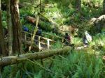
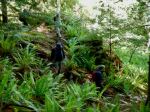
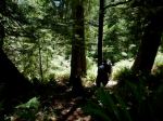
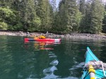
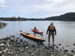
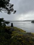
| Description | This will be a two night multi-day paddling trip out of Granite Bay. We will set up a base camp at Orchard Bay and explore the familiar haunts of Small Inlet and Kanish Bay. As well as doing lots of paddling we will do the hikes to Waiatt Bay and Newton Lake. Day 1: paddle to Chained Islets and Bodega Pt and finish at Orchard Bay on a rising tide. Day 2: paddle to east end of Small Inlet and hike to Waiatt Bay and/or Newton Lake (big tidal changes to deal with); camp at Orchard Bay Day 3: paddle to Granite Pt., Nixon Is, Ashlar Creek and return to Granite Bay and take out on a rising tide. WEATHER/WINDS will determine the final trip plan and itinerary. We will be very flexible. |
| Meeting Place | Granite Bay boat launch |
| Departure Time | Meet up 0830. On the water by 0915. |
| Difficulty | Moderate, but difficulty variable with the wind. |
| Cost | Fee for launching/parking and fuel |
| Trip limits | 8 |
| Dogs? | No |
| Notes: | Must have ocean kayaks with sealed hatches and sprayskirt with all Transport Canada required safety equipment. PLEASE REVIEW OUR PADDLING GUIDELINES. You will not put in unless fully equipped. (https://qioutdoorclub.org/wp-content/uploads/2023/07/paddling-guidelines-july2023.pdf ) Trip is weather and wind dependent. Only signed-up participants will be contacted of any changes in plans. MUST sign up by Sunday evening, August 18. You need drinking water for 3 days, your own camping gear and food. Be aware of the weather forecast when prepping your gear and clothing. There are no food caches or outhouses. We will hang our food and have a designated “outhouse” area. |