(scroll down for photos)
Access for kayakers wanting to paddle in the central coast has recently become more difficult. BC Ferries used to let kayakers wet launch at several places along its route on the central coast, but the new ferry is not equipped for that. However, BC Ferries still provides kayak transport to McLoughlin Bay near Bella Bella and there is a convenient beach launch site right at the ferry terminal.
For background information about kayaking in this region, see these articles:
http://www.wavelengthmagazine.com/1996/jj96ferry.html
http://www.wavelengthmagazine.com/PaddleBCCentralCoast.html
http://www.coastandkayak.com/2003/jj03central.html
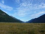
The target kayaking region is from Calvert Island to Bella Bella, with lots of little islands to explore. It is part of the Hakai Lúxvbálís Conservancy and the Great Bear Rainforest.
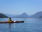
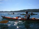
After looking into the region and the problems of getting there with all our gear, organizing the food, and general safety issues, we decided to go with a commercial kayak tour. There are very few of those to this region and one of them happens to be Quadra based. Spirit of the West (kayakingtours.com) ran two trips to Great-Bear-Rainforest-Outer-Islands this summer, and we went with their first one ever. Seven of us from the Quadra Outdoor Club, two excellent guides (Graham and Sam) and three other women, making 12 paddlers and 10 kayaks in total. The trip was eight days long and we paddled about 20 km each day.
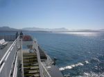
The new ferry is very upscale and provides great buffet meals in the restaurant. Two problems. One, the ferry leaves early in the morning and returns late at night, so it works best to overnight in Port Hardy at the beginning and the end, but every room in Port Hardy books way in advance. Solution: there are inexpensive hostels, but you still need to book in advance. Two, it leaves early in the morning and they want you at the ferry at 5 a.m. and it’s a half hour drive out of town. No solution; it takes them a long time to load.
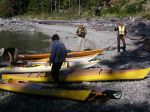
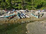
We loaded the gear into the kayaks at McLoughlin Bay and it was blazing hot with no breeze. By the time we got on the water it was after 16:00, we had a fair headwind and we were never too hot again. We didn’t paddle far before we stopped for the night at a small lagoon just north of the junction of Lama and Hunter Channel. Space was limited for the eight tents, but we were very protected.
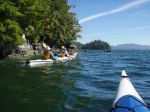
The next day was windy and rainy. We crossed Lama Passage and paddled southwest, against the wind, along the Campbell Island shore. We explored wonderful inlets and channels along the way. The weather had improved by the time we reached our campsite on island “49”, a cozy, protected midden beach.
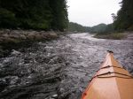
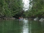
On day three we paddled through some amazing narrow channels and then on through the Admiral and Tribal group of islands to the McMullin Group. We meandered through the shallow waters between islets and then camped on a spectacular, white sandy beach with great views.
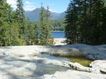
On day four we continued through the McMullin islands and then crossed to the north end of Goose Island. We were fortunate to have only a bit of wind and not a lot of swell for this 45-minute crossing. This area is both exposed and shallow and would not have been possible in many conditions. We had lunch and explored the long sandy beach with cabins once used by the Heiltsuk rediscovery camp. We continued to paddle along the east side of Goose Island, against some wind and current, to Gosling and Snipe Islands. This area also has extensive shallow sandy areas, which connect the islands at a low tide. We camped on Snipe, with beaches on both sides.
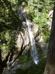
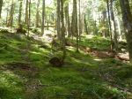
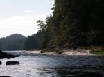
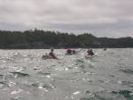
On day five, we made the big crossing over Queen Sound to the Simonds and McNaughton Group. We got an early start in order to reach protected waters before the forecast strong afternoon winds. In the McNaughton Group, we paddled along very narrow channels admiring the intertidal life and camped on another sandy beach on Hunter Island near Cultus Sound. This site had a short walk through very impressive old growth forest to another beach.
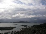
The following day, we continued south to Triquet Island. Although we were mostly protected from the fairly strong southwest winds by islets and channels, the crossing south of Superstition Point was quite bouncy with refracted waves. We paddled through Spitfire Channel and Spider Anchorage. We camped on Triquet for two nights, enjoying more leisurely day paddles, beach-time and walks on the seventh day.
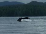
On the last day the water taxi picked us up, returning paddlers, kayaks and gear to the ferry dock. In the early evening we boarded the ferry back to Port Hardy. We saw humpback whales in Lama Passage and Fitz Hugh Sound.
We expected northwest winds; we got southeast and southwest winds. The unusually hot summer weather changed just before our trip. For a drought, we had quite a bit of rain. However, we cannot complain about the weather. This area is extremely exposed, so we were lucky we had good weather for the big crossings we made. We hoped to also cross notorious Hakai Passage to Calvert Island, but conditions were not favourable. Thanks to satellite technology, we were not forced to make that crossing. The guides used an inReach SE so that they could send text messages via satellite to the water taxi so they could pick us up wherever we happened to end up on the last day.
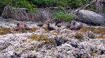
Other trips would have other weather and interests and take other routes. It’s a big area with lots to see. Incredible white sandy beaches, amazing sculptured granite cliffs along the shore, sea otters, sea lions, big trees, sand hill cranes and more than 20 other birds. Some sun, some rain, some wind, some calm, some swell, some waves, no fog. We saw a few fishing and cruising boats, but very few other kayakers. It’s a great place.
Thanks to the guides for all their hard work watching out for us, the great food, and arranging everything.
Photos by K. Manry, V. van Veen, M. Wood and N. Weimer.
-
-
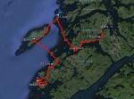
GPS track
-
-
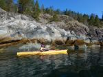
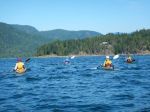
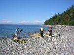
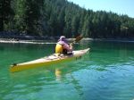
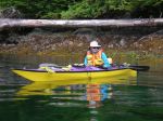
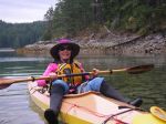
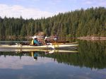
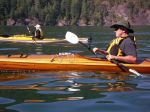
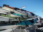
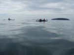
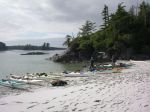
kayaks
-
-
-
-
-
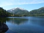
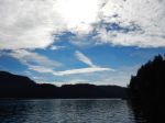
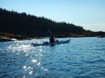
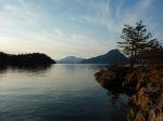
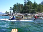
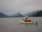
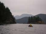
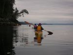
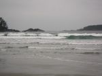
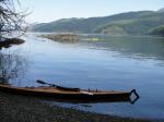
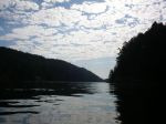
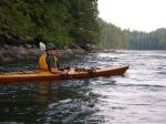
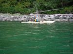
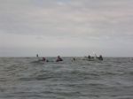
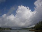
Lama Passage
-
-
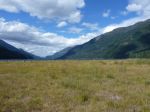
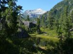
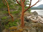
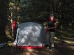
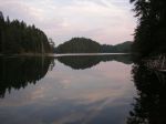
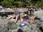
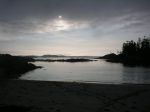
First night on Denny Island
-
-
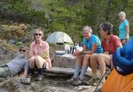
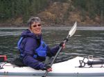
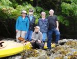
The guides: Graham & Sam
-
-
-
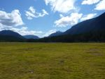
Campsite at Island 49
-
-
-

-
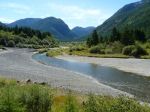
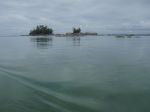
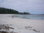
Beach at McMullins
-
-
-

-
-
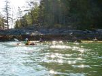
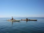
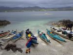
Crossing from McMullins to Goose
-
-
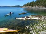
Beach at north Goose
-
-
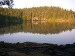
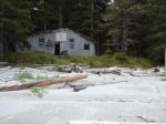
Heiltsuk cabin
-

-
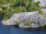
Goose shoreline
-
-
-
Campsite at Snipe
-
-
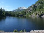
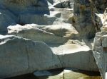
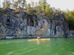
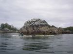
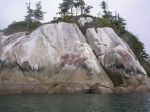
Rock Bluffs in the Simonds Group
-
-
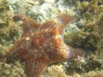
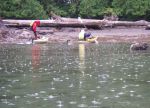
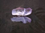
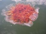
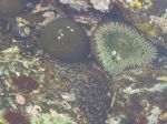
Anemone
-
-
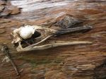
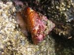
Turban snail
-
-
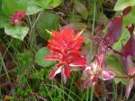
Paintbrush
-
-
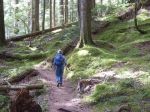
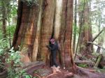
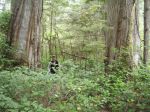
Old growth forest
-
-
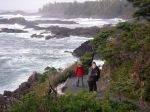
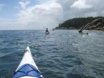
South of Superstition Pt
-

-
Kelp
-
-
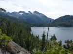
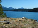
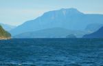
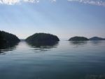
Looking SE from Triquet
-

-
Waterways near Triquet
-
-
-
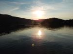
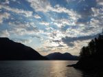
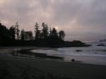
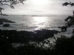
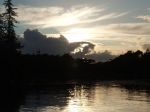
Sunset from Triquet
-
-
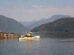
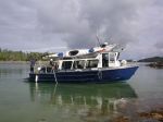
Water taxi
-
-
Humpback
(click on photos to view larger)