Trip Report – Cortes and beyond 15-17 Sept 2014

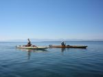
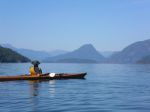
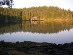
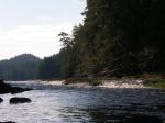
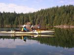
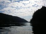
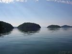
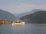
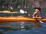
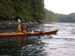
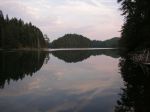
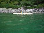
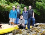
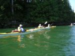
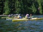
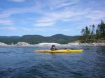
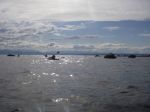
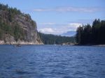
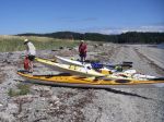
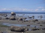
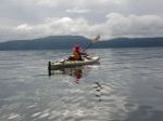
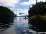
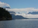
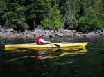
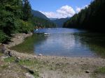
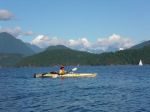
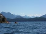
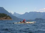
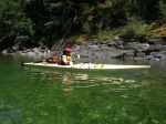
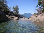
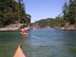
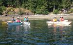
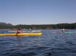
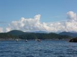
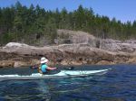
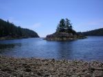
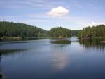
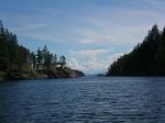
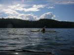
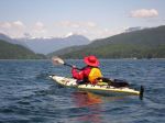
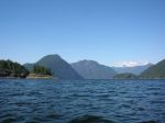
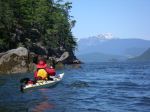
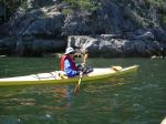
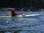
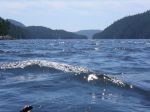
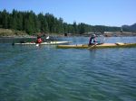
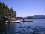
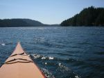
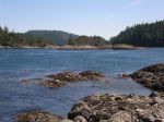
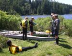
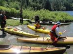
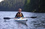
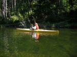
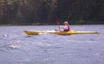
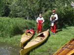
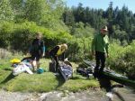
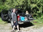
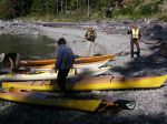
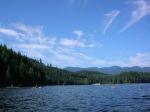
Debbie, Norris, Margot, Lonn and Darcy boarded the 9:05 ferry to Cortes on Monday morning and launched at the foot of Sea Vista road – a bit of a carry from the parking area made much easier by loading all the gear except boats on Lonn’s truck which he was able to drive to the beach. We left near high tide on a beautiful, sunny, windless day and paddled north through Plumper Passage and on to the entrance to Von Donop Inlet, with a short lunch break at Carrington Bay.

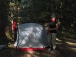
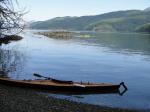
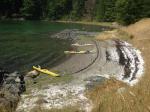
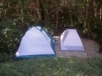
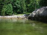
Our first plan for a campsite was to select one of the two reported on either side of Robertson Creek, about a kilometer northwest of Von Donop entrance. The first site showed a good beach, but tent sites appeared to be well back in the bush and rather dark. The second site would have been fine had it not been littered with derelict boats, floats, Styrofoam blocks and other detritus. So, following a futile hunt by Margot and Lonn to the north, we paddled back into Von Donop Inlet, to a beautiful, flat, open spacious site among huge cedars at the entrance to Von Donop lagoon. There’s even a picnic table!

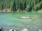
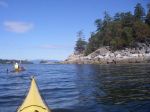
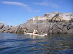
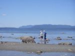
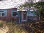
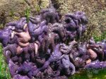
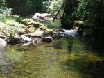
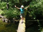
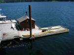
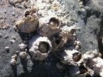
Following happy hour (with smoked salmon), dinner and a campfire, we crawled into our tents and woke next morning to another beautiful day. We first checked out the entrance to the lagoon to see whether it would be possible to paddle in (an exercise we repeated later in the day at a higher tide). The lagoon entrance is full of shellfish and sea stars that obviously relish the rushing water. We then paddled across Sutil Channel to the Penn Islands. We spotted one small group of kayakers (who turned out to also be from Quadra Island) and landed at a campsite on the east side of northernmost Island. The beach has excellent protection from all weathers and several tent sites (occupied by the tents of our Quadra neighbours). After paddling among the islands, accompanied by snorting, blowing and splashing seals, we returned to Von Donop and, starting at the north shore of the lagoon entrance, hiked up to Wiley Lake. On the way back, we stopped to investigate a small cabin, which has been built by local residents to provide emergency shelter for boaters and hikers. We again tried to enter the lagoon, but concluded that tides likely need to be higher than 14 or 15 feet to make entry possible.

After another quiet night (except for the odd owl and the rustle of curious rodents), we broke camp for the return trip. With impeccable timing, the weather started to change and we paddled back in a light headwind followed, as we drove onto the ferry, by the first drops of rain.

In all, we paddled about 60 kilometres over the three days.

submitted by Darcy Mitchell, trip coordinator
(click on photos to view larger)

Paddling/camping beyond Cortes 15-17 Sept 2014

Trip Report – Chain Islets & Orchard Bay 20 Aug 2014

Five members showed up for the trip and we were rewarded with an awesome paddle. The wind was blowing NW 15 and forecast was for 20 knots in the afternoon so we were hesitant to leave Granite Bay. After some discussion we decided to brave forward as this trip had already been canceled once due to winds. We stayed close together so if anyone felt the wind was too much we would just turn around and come back. It was challenging paddling into the wind, but not that bad and gave us a chance to practice some skills. As we turned the first point the water got a bit better as we had some protection from the Chain Islets. Some harbour porpoises were out playing and the sockeye were jumping to make things exciting.

The group stopped at a protected bay on the south side of Kanish Bay near the entrance. From here we could walk to the outside and see what the wind was doing on Johnstone Strait. The white caps were many so we decided to have lunch and hope that it calmed down. After lunch we rounded the west most island and out into the wind. It was a bit much so ducked back behind the next island and paddled on the lee side to the eastern most island. At this point the wind calmed some and it was decided to make a dash for Orchard Bay. The crossing was uneventful and not bad as we had a following wind.

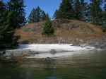
Orchard Bay is a very interesting place. The midden is enormous with a huge level meadow on top. There are many places to camp here. It is well worth the time to explore this old native site. After this we paddled across the entrance of Small Inlet and back to Granite Bay.

– Les Hand

(click on photos to view larger)

Kayak Chain Islets & Orchard Bay 20 August 2014

Paddling/camping beyond Cortes 15-17 Sept 2014

Activity Multi-day Paddle
Destination Flexible depending on weather, but most likely camping in the same place two nights with a day trip on the middle day.  (Von Donop area, Teakearne Arm are possibilities)
Date Sept 15 to 17 (two nights); Monday to Wednesday
Trip Coordinator Darcy Mitchell
Contact Info darcm@telus.net or 285 2739
Description Two night trip starting from Cortes island with destinations to be determined by weather. Estimated paddling from 15-20 km per day. Depending on weather, the destination may change, but we expect to launch from some point on Cortes Island to avoid long crossings from Quadra. We will plan to return on the 4:05 ferry from Cortes on Wednesday, September 17.
Meeting Place Heriot Bay ferry to Cortes
Departure Time 8:30 a.m. for 9:05 ferry, Monday, September 15
Difficulty
Moderate. All participants must be capable of self-rescue and able to paddle in moderate waves and wind. Appropriate equipment required.
Cost Ferry costs, possible launch and parking fees
Trip limits 6
Dogs? no
Notes: Please contact the trip coordinator no later than Monday, September 8 to confirm your interest in this trip.

Trip Report – Cortes 5-7 August 2014

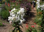
Seven enthusiastic ladies ventured on this trip. Sailed on the day’s first ferry for Cortes Island. We set-up camp at Smelt Bay Provincial Park. Later drove down to Smelt Bay Beach, & kayaked around the southern tip of Cortes Island, stopping along the way at Hollyhock. Some chose to swim & others toured the beautiful gardens at Hollyhock. We continued onto Hanks Beach. Beautiful rock formations & all took the time to explore. Return route we paddled past Manson’s Heritage Farm & also the Japanese Farm, learning a little about the history of these farms. A good hard paddle, watched a minke whale & arrived safely back to the camp site at Smelt Bay. This was certainly a good workout for us all.

Great pot-luck dinner at night & then down to watch the sunset.

The next day we set out for Manson’s Lagoon. Quite a breeze blowing, ventured out towards Shark Spit. Many lovely islands on route with lots of resident seals to watch. Put in at Shark Spit, viewed the camp site & the lovely tidal pools. Enjoyed our pot-luck lunch on the beach & took the time to rest. We then kayaked over to Gillean Douglas’s home. It was such a delight to visit her home & to learn more about this incredible author. Return paddle was at times challenging due to the boat traffic, however, a beautiful return trip into Manson’s Lagoon.

A quick change & out for dinner at ‘The Cove Restaurant’ in Squirrel Cove. After a delicious dinner we drove over to the Klahoose Long House. A most impressive building & grounds.

Final day, after we had packed up, we all drove to have a java at the Cooperative Café & local grocery store. Then onto Easter Bluff Trail. This bluff hike is part of Linnaea Farm & offers gorgeous views overlooking the south & west end of Cortes Island & the mountains beyond. Parts of this trail were steep but well worth the view from the top. After, we drove onto Hague Lake & most had a refreshing swim, plus time for lunch. Margot then took a few of the party to Whaletown to view the tiny library, Whaletown Church & the floating dentist. Onto the ferry terminal to be in line-up to catch the ferry for beloved Quadra Island.

The weather was superb, the camp site was clean & quiet, apart from the ‘boot sneak’. What an enjoyable trip & thanks to everyone for making it happen. There is still so much to explore on beautiful Cortes Island.

submitted by Margot Wood, trip coordinator


(click on photos to view larger)

Camp, Kayak, Hike Cortes 5-7 Aug 2014

Trip Report – Desolation Sound 6-9 July 2014

Thanks to the intervention of the weather gods, the Sutil Channel trip left a day later than planned and went to Desolation Sound instead, via Cortes Island. After Saturday’s rain, Sunday also started with a downpour which lightened to drizzle by the time Debbie, Norris and Darcy arrived in Whaletown with one vehicle and three kayaks. We intended to shuttle the third boat over to Squirrel Cove, but were saved the trip by a very nice woman who offered to take a kayak on her van. As a result, we were able to launch by 1 p.m., heading to the Martin Islands south of Refuge Cove (West Redonda). The 7 kilometre crossing took just over an hour and a half in calm conditions. The Islands (which are a single island except in high winter tides) offer a number of tent sites near the ‘waist’; we chose two sites with a stone fire ring and benches to the east of the main camping area. After setting up camp, we paddled out to visit Refuge Cove with its very well supplied store – and had sautéed mushrooms with our steaks as a result!

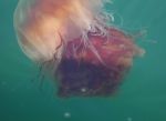
The following morning, we set out for Roscoe Bay on the east side of West Redonda, known among boaters for its drying bar and huge population of jellyfish. We trekked up to Black Lake for a swim, with a bit of bushwhacking until we found a good rocky ledge, then paddled back to camp against the wind. (Note to selves – plan itineraries so that return trips are downwind! And the northwest wind can come from the south here!) Twenty-three kilometres paddled for the day. After another excellent dinner, we settled down to a night of bright stars and loud winds.

Next morning, rather than upping stakes and heading north to Teakerne Arm (in case the winds returned in force), we paddled toward Tenedos Bay with a light northwesterly behind us. We skirted a seagull rookery with chicks and seals, and stopped for lunch at the head of the Bay, where a short trail leads to Unwin Lake. Being a little nervous about the forecast, we skipped a swim, and paddled around the tidal island in Tenedos Bay, past rock ledge campsites (with kayaks resting precariously on very steep ledges) and through the popular Curmes Islands. We saw quite a few tents and campers, but no other kayaks actually on the water. Returning to the Martin Islands (25.5 kilometres for the day), we found seven kayaks on the beach and a large group of young people with their leaders from an outdoor education program in Victoria. Our little nook offered plenty of privacy, however, so we enjoyed another night of quiet except for the winds – again.

Next morning, we broke camp and hung about the beach for a while deciding when to leave.   With whitecaps in Lewis Channel and forecast winds up to 30 knots in the afternoon, there weren’t many options other than taking advantage of the comparative lull (10-20 knots) expected to occur late morning. We set off at 11:15 and after battling our way through heavy gusts around the point south of Refuge Cove, things settled down a bit until we were about half way across. By the time we reached Squirrel Cove at 2 p.m., the wind was up to 15-20 knots, although the waves remained a short chop. Taking advantage of our Good Samaritan’s offer of a return trip to Whaletown, we made the 4:05 ferry with time to spare. The ferry crew estimated the winds at 25-30 knots, which made us very grateful that we were not paddling back to the Heriot Bay boat launch.

submitted by Darcy Mitchell, trip coordinator

(click on photos to view larger)
Paddling/camping Sutil Channel 5-9 July 2014

Trip Report – Village Bay 25 June 2014

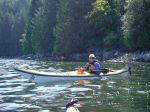
Wednesday morning came and the wind was blowing 15 knots at Chatham Point and a forecast of 25 by noon. We therefore decided to move the paddle from Chain Islets to the east side of Quadra. After many phone calls it was agreed to launch at Len Road into Hyacinthe Bay.  Six people showed up and we had a great day on the water.

First we headed over to Hyacinthe Point and then on to Shellaligan Pass. The tide was out so we had to go around and then on to Village Bay. There were a few small white caps at the entrance but this was the most wind we had all day. The group stopped at the head of the bay for lunch. Afterwards we hiked up the old trail to Village Bay Lake. It is not maintained with a few logs over the trail but still very doable. It is a lovely walk along the creek.  At this point half of the group needed to go back because it was already 2:30. The other three of us went on to Crescent Channel and around Bold Island. After this we took the most direct path back which was good as it still ended up 5:30 before we were off of the water. The total trip was about 11 nautical miles. The change of venue we made was for the best as we had not much wind and beautiful skies all day.

– Les Hand

(click on photos to view larger)
Kayak Chain Islets & Orchard Bay 25 June 2014

Paddling/camping Sutil Channel 5-9 July 2014

Activity Multi-day Paddle
Destination Flexible (Penn Islets/Rendezvous Islands/Cortes/West Redonda)
Date July 5 to July 8 or 9 (3-4 nights); Saturday to Tuesday/Wednesday
Trip Coordinator Darcy Mitchell
Contact Info darcm@telus.net or 285 2739
Description Depending on the interests of trip participants and weather conditions, we will plan to launch from the Heriot Bay public ramp, cross to Viner Point on Read Island and spend 3-4 nights camping on one or more of the Penn Islets, Rendezvous Islands, Teakerne Arm and the north side of Cortes.  We expect to paddle between 15 and 20 kilometres per day.
Meeting Place Heriot Bay public dock
Departure Time 9 a.m.
Difficulty
Moderate
Cost Launching fee and pay parking
Trip limits 6
Dogs? no
Notes: Please contact the coordinator no later than June 26.  Once we know who is planning to participate, we’ll discuss trip details including alternative itineraries.

Trip Report – Discovery Islands 2-4 June 2014

Trip Coordinator: Darcy Mitchell

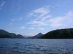
Following a quick pre-launch discussion, the planned trip to the Octopus Islands became a trip to the Rendezvous Islands instead. With strong to gale force winds forecast for the return date, we decided it was best not to be limited by slack water in Beazley Passage in the event that we needed to make a quick exit. We launched in 10-15 knot winds from the dock at Discovery Islands Lodge about 1:30 and paddled through White Rock Passage in sunny and calm conditions, although against increasing current, until we reached the eastern entrance where wind and current collided and it was a bit sloppy with steep waves close together. Heading downwind, we reached the north end of South Rendezvous and started hunting for a campsite reported to be on the northeast shore. Ducking around a point, we found a scrap of beach in a nook with little surf, and scrambled ashore. The campsite on a small peninsula (the handmade sign calls it “Cliffside Camp”) offers about three tent sites, has great views in nearly all directions and is very exposed in a northwest wind. The kayaks were hauled far up on logs, but Norris and Debbie moved them farther into the bush as the tide continued to rise late into the night. Next morning, we waited patiently for the beach to reappear, but finally launched from the seaweed-covered boulders with small waves.   This exercise had elements of the fox, geese and grain puzzle about it, as boats needed to be loaded at the water’s edge and launched one by one, a tricky task for the one person left on the beach. We resolved this problem by holding a loaded kayak offshore and floating it back in for the last paddler.

The morning was quite calm, so we headed south to check out a second reported campsite on South Rendezvous. This lovely site is more to the west than the south of the island, and appears to be an old homestead as there is a large meadow and the remains of a dock. The site offers a good beach for landing, and excellent protection from all directions except the southwest. Carrying on north, we crossed to paddle up the east side of Central Rendezvous, then back toward White Rock Passage to avoid fairly strong outflow winds, and to find a campsite within a short paddle back to the Lodge. There appears to be a camping area on the Read Island side of the passage, but it is fronted by active shellfish leases, and we felt that campers might not be welcome. We continued on to check out a campsite on the Maurelle shore north of the Settlers Group. Unfortunately, the outflow current from Beazley Passage was so strong we were unable to make much headway before being spit back out. We then paddled back toward White Rock Passage to a large beach in hopes of finding space there. After hunting about, we located a small site beside a creek, overhung with alders, and rather heavily infested with tent caterpillars. We spent the night about 15 feet from the high water mark.

Next morning, we explored along the south shores of the Settlers Groups and, just as the wind really started to blow, returned to the Lodge dock at noon. In all, we paddled 35 kilometres over about 10 hours. We had a great time, and learned a lot, including the fact that campsites are limited and it’s important to start looking fairly early and have several alternatives. As we paddle this summer, we intend to identify and visit as many potential campsites as possible in the Discovery Islands/Desolation Sound area to facilitate future trip planning. With the early return, there was an optional hike to Surge Narrows.

(click on photos to view larger)
Paddling/camping Octopus Islands 2-4 June 2014

Trip Report – Paddling practice strokes, bracing, rescues 28 May 2014

We had a sunny, breezy day for our paddling practice at Mine Lake.  Jill, with help from Charlie, led a great session.  After a short talk on the beach, the eight of us kayaked over to a more sheltered bay in the southwest corner of the lake.  On the way over we practiced strokes and bracing.  Everyone did at least one successful dump and re-entry, but each person chose what they wanted to do and how much.  The water temperature was fine. We paddled through the narrows to Village Bay, practicing rafting up and getting an unconscious person back into a kayak along the way.   Then we paddled back to the boat launch with the rising northwest wind at our back.  We had drinks and snack on Les’ tailgate before packing up and leaving.  Thanks very much to Jill and Charlie for their tremendous help on this.

Some take-away ideas:  Practice bracing so you don’t end up dumping.  Stay with the group, it’s easier to rescue if you have help.  Don’t let go of your paddle or your boat.

(click on photos to view larger)
Paddling practice strokes, bracing, rescues 28 May 2014

Camp, Kayak, Hike Cortes 5-7 Aug 2014

Activity Camp, Kayak, Hike.
Destination Cortes Island
Date 5-7 August 2013, Tuesday-Thursday
Trip Coordinator Margot Wood
Contact Info 285-2393, margotw@uniserve.com
Description Two nights stay at Smelt Bay Provincial Park. 1) Kayak Squirrel Cove to visit Ha’thayim Long House continue in bay & to Junction Point. 2) Smelt Bay to Hollyhock, beautiful tidal waters, visit Hollyhock garden, kayak to Hank’s Beach & North Twin Island. 3) Mansons Lagoon to Marina Island. 4) Hike Easter Bluff Trail. All these trips are dependent on weather/wind conditions.
Meeting Place Ferry Line Up for Cortes
Departure Time 09:05 Ferry
Difficulty
Moderate
Costs Camp site, ferry.
Trip limits none
Dogs? no
Notes: Smelt Bay Provincial Park is a beautiful camp site but fills up quickly. One camp site is booked. Each camp site will accommodate 4 adults.Need tent, kayak, food. Water available at the camp site.

Squirrel Cove has a general store & gas bar. Ha’thayim Lodge is in a gorgeous setting & a magnificent building overlooking the ocean. Lots of interesting shorelines in the bay & onto Junction Point.

Smelt Bay, Hollyhock, Hank’s Beach, North Twin Island, an interesting tidal water trip. Hollyhock has a beautiful garden that we can wander. Hank’s Beach is the newest park on Cortes with many intriguing rock formations. North Twin Island has many lovely tidal pools around its shoreline.

Manson’s Lagoon to Marina Island, interesting islands, Gorge Harbour plus Shark Spit, a lovely place to have lunch. Great returning at tide change.

Easter Bluff Trail – this trail is part of Linnaea Farm, parts are steep & rocky but worth the workout to see the gorgeous views at the top overlooking Cortes Bay.

The trips will be scheduled to meet weather conditions for safety & enjoyment.

Return on the afternoon of the 7th.