| Activity | Hiking |
| Destination | Shellaligan Pass Trail |
| Date | 8 July, Wednesday |
| Trip Coordinator | Valerie van Veen |
| Contact Info | vvv@qisland.ca; must contact the coordinator by 6:00 pm Tuesday night |
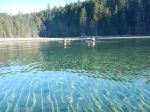
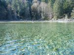
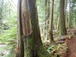
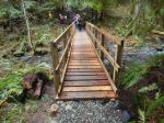
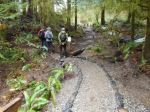
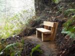
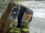
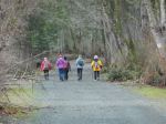
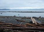
| Description | Shellaligan Trail is a lovely, moderate hike that takes us along a rocky shoreline, to a beach where we can stop for snacks/lunch, then up into the woods to follow trails and old logging roads back to our cars. About 2- 3 hours depending on route, pace (moderate), and breaks. To reach the trail, take the Hyacinthe Bay Road ( which, for unknown reasons, becomes Bold Point Road at the Granite Bay Road intersection) north to Valdes Road, turn right on Valdes, follow Valdes to the residential area, about one block past Marina look out for logging road access and trail signage on your left. IF you are carpooling from the South End, as per COVID restrictions as discussed at our organizational meeting July 6, (or phone me for details), meet at Heriot Bay Foods Parking Lot at 10 am. Otherwise, meet at the junction of the logging road (that accesses the Trailhead) and Valdes Road at 10:30 am. I will be at that junction in a green Toyota 4Runner. We will drive to one of the three trailheads, depending on the weather. If not raining we will do the complete Shellaligan Trail. If it is raining, then we will do only the land loop. As this is a “first of the year” hike for many of us, the pace will be very moderate. Speedy hikers who know the route are welcome to go on ahead. |
| Meeting Place | Logging road access to trailhead |
| Departure Time | 10:30 |
| Difficulty |
Moderate. |
| Costs | none |
| Trip limits | 8-9 max, in singles or “pods” as per our Club discussion |
| Dogs? | MUST be in full control, or on leash (deer and fawns) |
| Notes: | As per our Club discussions, we will walk either singly, or with your pod group of 2-3, separated by 6 ft. Our Club decided that: conversations while hiking would be kept to a minimum, even when possible; no sharing of food/snacks; (sorry Les, we will miss your treats!); we will keep distanced during breaks; no sign-up sheet, trip coordinator will keep a record of hikers for the Trip Report; hikers are expected to bring their own simple first aid kits to keep any emergency contact to a minimum; no non-members, family, friends, guests, or Woofers will be allowed to participate at this time; MUST pre-register with trip coordinator. Call or email by 6 pm TUESDAY NIGHT. |
Category Archives: Quadra Island
Trip Report – Breton Islands Spring Equinox Paddle – 20 Mar 2020
Six paddlers gathered (mindful of our interpersonal distance) at the Len Road access on a sunny, calm, 2° morning to start the season with our first paddle outing of the year. After refreshing each other on some basic paddle trip guidelines, a gear and flotation check, and COVID-19 protocols/discussion, we put in at 9:00 on a favourable tide and headed across Hyacinthe Bay. We cruised the shoreline through Open Bay, rounded the “Red Chair Point” and on into Moulds Bay. After a brief beach stop, we continued northeast through Shellalligan Pass into Hoskyn Channel to enjoy the view up the channel towards snow-capped Doogie Dowler and other mountains of the BC mainland. Turning south we paddled down the island chain on even calmer seas until we rounded the southern tip of Breton Island and our lunch stop destination on the cobble/gravel beach. After a leisurely, 90-minute lunch in the sun (physically distanced) we put in once again and headed west to Turtle Island and on to the take out, completing the circuit at about 3:00 pm. Although we saw no cetaceans or sea lions, and few harbour seals, we did enjoy the company of a large variety of sea birds, many of which were in breeding plumage. The trip coordinator will attempt to recall the identified birds and includes a list below. 15.0 km; 4 hour paddle without the lunch break
Varying numbers of: Common Mergansers, Harlequins, Barrow’s Goldeneye, Bufflehead, Loons (Common in transition to breeding plumage), Cormorants, Black Turnstones, Black Oystercatchers, Glaucous winged gulls, Canada geese, Surf scoters.
Vic
click to enlarge the photos
- Early morning launch in Hyacinthe Bay
- Approaching Big Beach
- Leaving Big Beach
- Doogie Dowler and mainland mountains
- Hoskyn Channel
- Vancouver Island mountains over Quadra
- North Breton Island
- Calm in Hoskyn Channel
- Lunch stop on South Breton Island
- Leaving S Breton
- Canada Geese
- View toward Sutil Channel
- Returning to Hyacinthe Bay take out
Kayaking – Hyacinthe and Open Bays to Breton Islands – 20 Mar 2020
Trip Report – Reed Lake Loop – 11 Mar 2020
Ten hikers enjoyed a three-hour hike on a series of biking trails south of Walcan Road. Beginning at the Reed Lake pullout on Walcan Road, we headed south on Straight-As-A-Dime. This is a winding uphill trail with intermittent sections of logging roads which are beginning to grow in. After a short time on Navel and Silk Stockings Trails, the group turned east onto Backdoor Trail which winds its way over an extensive rock bluff plateau covered with vibrant green moss and pine forest. We stopped at a warm sunny spot to have lunch and enjoy the rays. Continuing east to the junction of Cash Only, and through the Rose Garden, we took Dick’s Ride north to the Yellow Mud Trail. Here we found a few pink salmonberry buds about to burst open. It was a pleasant walk along Wood Duck Lake, created by the extensive beaver dam at the east end of the lake. There were ring-necked ducks and bufflehead on the lake. We continued northwest on Yellow Mud Trail through mature hemlock and Douglas fir forest and along McKercher Creek to arrive back at the vehicles. The weather was sunny with a cold north wind blowing. This loop should not be attempted without being familiar with the biking trail system and having a specialized bike trail map, since the trail names have worn off the flagging at main intersections and the trail system is extensive. 8.0 km; 3½ hours
Janis
- Reed Lake
- View of S Chinese Mtn
- On Copperhead Rd
- Catkins
- Salmonberry bud
- Beaver dam on Wood Duck Lake
Trip Report – Benn Mine and Deepwater Bay – 4 Mar 2020
Ten of us explored the Deepwater Main and Creek area to a variety of destinations. We first stopped at the old rail trestle. Only the posts remain, but some are impressively tall and it’s a reminder of Quadra’s history. We continued along the logging road and were surprised by the amount of snow on the road. We probably should have been expecting it, but the cloud on the Mt. Seymour Ridge had been so low we hadn’t noticed. We hiked up the old logging road to the Benn Mine, which was covered in enough snow to completely change the landscape. The sample cores and even the old car were not visible. After taking care around the open pits, we scrambled down to view the tunnel shaft. 2.5 km; 150m elevation; 1¼ hours.
We returned to the vehicles and continued further on the active logging road covered in some patches of snow. We hiked down the old logging road following Deepwater Creek. The creek was as beautiful as we have ever seen it, with plenty of water flowing and deep greens in the valley. The route is somewhat eroded, but the frequent winter deadfall had all been chain sawed, making our progress very easy.
We had not visited the old fish hatchery since it had been sold and rehabilitated by private owners. The area is much improved. We are very grateful that the new owners are permitting “leave-no-trace” visitors. It’s very generous of them. We stopped on the shore for lunch in the sun, with great views all around of Deepwater Bay, Discovery Passage and the mouth of Deepwater Creek. It was a lovely and varied hike. 4.8 km, 235 m elevation; 2 hours.
– Debbie
(click on photos to enlarge)
- Old trestle posts
- Benn mine in snow
- The tunnel shaft
- Deepwater Creek
- View of Discovery Passage
- Deepwater Bay
- Falls joining the creek
Hiking – Main Lake from Surge Narrows Rd – 8 Apr 2020
| Activity | Hiking |
| Destination | Main Lake from Surge Narrows Rd |
| Date | 8 April, Wednesday |
| Trip Coordinator | Norris Weimer |
| Contact Info | norris.weimer@ualberta.ca or 3710. Please contact the coordinator in advance. |
| Description | This is a flagged route from the Surge Narrows road, following old logging roads and paths through mature forest to the east end of Main Lake. The route is not far (about 7.0 km round trip), but quite slow due to rough conditions. Expect wet sections and significant climbing over deadfall. If the group wants more of a walk, we can continue on to Yeatman Bay, which would be about 10 km round trip. |
| Meeting Place | Heriot Bay Tru Value parking lot |
| Departure Time | 9:30 |
| Difficulty | Moderate due to the rough trail conditions. |
| Costs | none |
| Trip limits | none |
| Dogs? | |
| Notes: | Bring lunch. |
Hiking – Eagle Crag – 25 Mar 2020
| Activity | Hiking |
| Destination | Eagle Crag |
| Date | 25 Mar 2020, Wednesday |
| Trip Coordinator | Norris Weimer |
| Contact Info | 285-3710 or norris.weimer@ualberta.ca; please contact the coordinator in advance of the trip |
| Description | This hike begins on the south side of South Chinese Mountain. It then follows a flagged route to a climbing wall. The route goes around and up to the top of the climbing area. This involves some big steps and minor scrambling. The effort is rewarded with great views. About 3 hours. |
| Meeting Place | Heriot Bay Store for car pooling |
| Departure Time | 10:00 |
| Difficulty |
Moderate. This is a short hike (5km) mostly without a maintained trail and one very steep section which may feel exposed. |
| Costs | none |
| Trip limits | none |
| Dogs? | no |
| Notes: | Bring lunch. We will not do this trip in poor weather. |
Hiking in Silence – Hopespring-Thompson Trail Loop – 14 Apr 2020
| Activity | Hiking in silence |
| Destination | Hopespring-Thompson Trail Loop |
| Date | 14 Apr 2020, Tuesday |
| Trip Coordinator | Sandra Burns |
| Contact Info | sandraburns.ca@gmail.com or 3977. Please, no phone calls after 8 pm. |
| Description | On this silent walk, we will go down to the Old Growth section and do a loop, as long as the weather is a bit dry, coming back along Heriot Ridge, and planning to have lunch in the sun, on the ridge! We will then return to the vehicles, back down to the Hopespring trailhead. About 3 hours. |
| Meeting Place | Hopespring trailhead. Please note that there is limited parking here. |
| Departure Time | 9:30 |
| Difficulty | Moderate |
| Costs | |
| Trip limits | 6 |
| Dogs? | No |
| Notes: | Please bring a pole for any slippery spots. |
Trip Report – Drew Creek and Harbour – 26 Feb 2020
Nine of us took a stroll around the new Drew Creek loop on the We Wai Kai reserve starting at the stream renovation done by the Salmon Enhancement Society, then on to the new foot bridge put in by John Barclay and other volunteers. We continued through the campground, which is quiet in February, and on to the memorial and beachwood shack at Paddy’s Lagoon. There were lots of interesting things to explore along the way. We walked back along the shore and stopped to admire Alex Witcombe’s driftwood Sasquatch sculpture.
Five of the group continued into Rebecca Spit Marine Park, stopped for a snack and walked the trail to the end of the Spit. It was a cold, dark day with a bit of southeast breeze, but the rain held off. 11.1 km, 3½ hours.
– Norris
(click on photos to enlarge)
- Drew Creek
- Harvest cedar bark
- The new bridge on Drew Creek
- Trail improvements
- Drew Creek meets Drew Harbour
- Sculpture in the campground
- Paddy’s Lagoon
- Flowers in the memorial
- Art at the memorial
- The beachwood shack
- The Sasquatch
Trip Report – Open Bay and Crikey Creeks – 12 Feb 2020
Ten hikers attended the two short hikes. The weather was pleasant for early February, with cloud cover, mild temperatures and no rain. We walked south along the forestry road near the bottom of the big hill on Village Bay Lakes Road (opposite the Open Bay Main turnoff). After substantial snow the week before, the road still had a couple of inches of soft snow, but not deep enough to make walking difficult. After a half hour or so (and passing several clearcuts on the uphill side of the road), we took a trail into the woods towards Open Bay Creek, and followed this undulating trail through mossy open second growth Douglas fir and hemlock forest north along Open Bay Creek (upstream). This beautiful stream sustains salmon spawning in the fall, when chum and coho migrate up from Open Bay.
The second hike began on Open Bay Main which proceeds northwest from Village Bay Lakes Road, downhill from the large gravel pit. After a hundred meters are so, we turned west into the forest and proceeded at a steady uphill climb through lovely open Douglas fir and hemlock forest. The first part of this trail has been heavily eroded after the heavy winter rains, having been improperly constructed with no switchbacks or proper water management. We avoided the slippery-looking rough bridges by easily dipping down into the creek swales. Partway up this hill, we came across ‘Road Right-of-Way’ flagging tape, indicating that this area will be bisected by a forestry road and is slated for logging, presumably in the near future. We popped out onto a narrow logging road and could see Granite Bay Road a little further west uphill. A ten-minute walk south along the road took us to a good place for lunch, with old moss-covered logs to sit on. A short distance further, near the junction of this road and Granite Bay Road, our next trail headed downhill through the same forest, but closer to Crikey Creek which is situated in a deep gully. We came across forestry cruise plots used for timber volume estimates, another indication of imminent logging. The downhill trail ended on Open Bay Main just a short distance to the south of our uphill trail. Total time was three hours, from assembly at the Heriot Bay Store parking lot and back again.
Janis
Hiking – Deepwater Bay and Benn Copper Mine – 4 Mar 2020
| Activity | Hiking |
| Destination | Deepwater Bay and Benn Copper Mine |
| Date | 4 Mar 2020, Wednesday |
| Trip Coordinator | Debbie Quigg |
| Contact Info | 3710 or debbie.quigg@ualberta.ca; please contact the coordinator in advance of the trip |
| Description | We hope to be able to drive up the active logging road to begin the hike. We will follow old logging roads up to the copper mine and then return to follow the steep creek down to Deepwater Bay. The old fish hatchery has recently sold and is being upgraded by the new owner. About 7km, around 3 hours, and some noticeable elevation gain and loss. |
| Meeting Place | Heriot Bay store parking lot for car pooling |
| Departure Time | 10:00 am |
| Difficulty |
moderate |
| Costs | |
| Trip limits | We will need high clearance vehicles to avoid the long walk up the logging road |
| Dogs? | Dogs must not run through the group |
| Notes: | Bring lunch and gear for the weather. |