| Activity | Hiking |
| Destination | South and North Chinese Mountain |
| Date | 2 May 2017, Tuesday |
| Trip Coordinator | Les Hand |
| Contact Info | 285-2029. Please contact the coordinator in advance of the trip. |
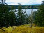
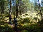
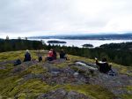
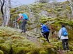
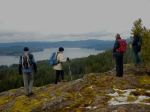
| Description | We will go up the south side to South Chinese Mtn. and have lunch while enjoying the view. Then down the north path and up North Chinese Mtn. and back to the vehicles. |
| Meeting Place | Heriot Bay Store parking lot for car pooling |
| Departure Time | 10:30 |
| Difficulty |
Moderate, but up and down |
| Costs | none |
| Trip limits | none |
| Dogs? | No, as trail is narrow in spots. |
| Notes: | It is only 3.4 km around South Chinese so we will go up north as well. Not everybody has to do both. |
Category Archives: Quadra Island
Trip Report – Morte Lake Loop – 20 Apr 2017
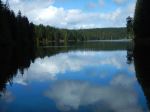
The Wednesday trip scheduled for snowshoes on Mt. Washington was cancelled because the rain was pretty thick. Instead five of us took advantage of a day off from the rain on Thursday and walked around Morte Lake. It was a lovely Spring day for a walk and Morte Lake did not disappoint. We had lunch at the far end at the sandy beach and returned via the Nirvana bike trail up to the viewpoint and back to the trailhead on Dead Fish. 11.4km; 4¼ hours.
Norris
(click on photos to view larger)
- Salmonberry bud
- Morte Lake
- the northwest beach
- Lunch break
- Water strider
- Swamp beacon (mitrula elegans)
- Morte Lake
- up the Nirvana trail
- tiny garter snake up close
Hiking – N Gowlland Hbr Bike Trail Loop – 5 July 2017
| Activity | Hiking |
| Destination | North Gowlland Harbour bike trail loop |
| Date | 5 July 2017, Wednesday |
| Trip Coordinator | Janis McLean |
| Contact Info | 285-3614; please contact the coordinator in advance of the trip. |
| Description | Carpool to North Gowlland Habour Road trailhead. We will traverse a large loop of mountain bike trails, passing by the old copper mining area on Silk Stocking trail, and returning to the vehicles via trails and old logging roads. 3 hours. Bring lunch or snack. |
| Meeting Place | Heriot Bay store parking lot |
| Departure Time | 9:00 |
| Difficulty |
easy to moderate |
| Costs | none |
| Trip limits | 10 |
| Dogs? | yes |
| Notes: |
Hiking – Beech’s Mtn Loop – 14 June 2017
Now scheduled for 21 June 2017
| Activity | Hiking |
| Destination | Beech’s Mountain Loop |
| Date | 21 |
| Trip Coordinator | Janis McLean |
| Contact Info | 285-3614; please contact the coordinator in advance of the trip. |
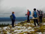
| Description | Carpool to Chinese Mountain parking lot. HIke up South Chinese Mountain trail and carry on to Beech’s Mountain summit. From there, we will drop down the far side of Beech’s and follow a route which will bring us to the North Chinese Mountain trail and back to the vehicles. Time – 3 hours. Bring a lunch or snack. |
| Meeting Place | Heriot Bay store parking lot |
| Departure Time | 9:00 |
| Difficulty |
moderate |
| Costs | none |
| Trip limits | 10 |
| Dogs? | yes |
| Notes: |
Kayaking – Gowlland Harbour – 4 May 2017
This trip was previously scheduled for Wednesday, May 3rd
| Activity | Kayaking |
| Destination | Gowlland Harbour |
| Date | 4 May 2017, Thursday |
| Trip Coordinator | Margot Wood |
| Contact Info | 250-285-2393 |
| Description | We will meet, help each other to launch from Gowlland Harbour Resort. We will kayak the islands to see the beautiful wild flowers. Kayak to May Island for our lunch. Visiting the islands in Gowlland Harbour. Returning to the launch area at approximately 2 p.m. |
| Meeting Place | Gowlland Harbour Resort boat launch, 823 Gowlland Harbour Rd. |
| Departure Time | 10:30 (unload and prepare at 10:00) |
| Difficulty |
easy |
| Costs | none |
| Trip limits | none |
| Dogs? | no |
| Notes: | This trip is dependent on weather. Bring your ocean kayak, paddle plus safety equipment. Bring your own lunch and water. I will meet you at the launch site at 10:00. We help each other with kayak launch. Gowlland Harbour Resort has kindly granted us permission to use their boat launch for this trip. This is not a public access. |
Hiking – Morte Lake Loop – 20 April 2017
| Activity | Hiking |
| Destination | Morte Lake Loop |
| Date | 20 April 2017, Thursday |
| Trip Coordinator | Norris Weimer |
| Contact Info | Please contact the coordinator at norris.weimer@ualberta.ca or 3710. |
| Description | This is a classic walk through forest and around the Lake. There are a number of variations depending on the access route used and the possibility of following unofficial trails on the south ridge. |
| Meeting Place | Heriot Bay Tru Value parking lot |
| Departure Time | 10:00 |
| Difficulty | moderate |
| Costs | none |
| Trip limits | none |
| Dogs? | |
| Notes: | This trip replaced the cancelled trip to Mt. Washington. Bring lunch and rain gear. This trail can be quite wet in places. |
Hiking – Hopespring/Homewood Loop – 24 May 2017
| Activity | Hiking |
| Destination | Hopespring/Homewood Loop |
| Date | 24 May 2017, Wednesday |
| Trip Coordinator | Janis McLean |
| Contact Info | 285-3614; please contact the coordinator in advance of the trip. |
| Description | Begins on Hopespring trail, then south on Heriot Ridge, stopping at the new communications tower and carrying on south to High Bluff. From there we follow east High Bluff trail to Homewood Bluff, then drop off the southwest side of the bluff to follow Gowlland trail back to the west High Bluff trail. Then north across a ridge route to Hopespring trail and back to the vehicles. About 2 1/2 to 3 hours. |
| Meeting Place | Hopespring Trailhead on Hopespring Rd. |
| Departure Time | 9:00 |
| Difficulty |
easy to moderate |
| Costs | none |
| Trip limits | 10 |
| Dogs? | yes |
| Notes: | Bring lunch and appropriate gear. |
Trip Report – Karst Formations – 5 April 2017
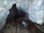
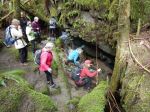
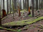
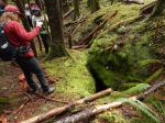
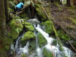
Eleven of us took advantage of a break in the rainy weather to visit some of the Karst features on Quadra Island: sink holes, insurgences, resurgences, caves, and grikes – holes in the limestone surface which connect to the underworld. Thanks to the recent rains there was plenty of water coming and going. We also visited a horizontal mine shaft. We don’t know what they were mining, but they made an impressive tunnel to explore. Thanks to James and Carley, young geologists, for their interpretation and commentary on what we were viewing.
Norris
(click on photos to view larger)
- Insurgence
- In the sink hole
- Maidenhair fern
- Shake-cutter’s bridge
- Sink hole
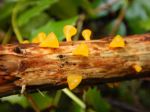
- Golden Jelly Fungus
- Resurgence
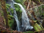
- Water falls
- Gabbro rock
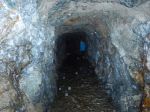
- The mine shaft
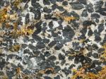
- Marbled limestone
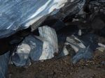
- Cave entrance
- Grike field
Trip Report – Thompson-B&B Trail Loop – 15 Mar 2017
Six hikers and two dogs, Joe and Luna, enjoyed a three and a half hour hike on a loop which was new to most of the group. The weather was cloudy and mild with no rain. Starting at the Thompson trailhead, we hiked to the first viewpoint and proceeded on a route north down the ridge, dropped off the ridge at the big moss-covered maple tree and continued on a route through the forest to the old B&B trail. We turned up the B&B trail, hiking along the pretty bedrock stream as far as the logging road crossing. The group walked down this road towards North Gowlland Harbour Road. We saw one rough-skinned newt on the road, and more in the water-filled quarry. Not far past the quarry we turned south on a fairly new bike trail leading towards Rousseau Ridge. After climbing the ridge, we took a break to enjoy the view and have lunch. Our return route followed the Gowlland Harbour trail, then the Thompson trail back to the vehicles.
Janis
(click on photos to view larger)
- View of mainland mountains
- Thompson Trail viewpoint
- Doogie Dowler & mainland mountains
- View of Sutil Channel
- View from Rousseau Ridge
Thanks to Stephen for the photos.
Trip Report – Eagle Ridge and Beyond – 8 Mar 2017
Despite the forecasts for bad weather Wednesday, the weather cleared just long enough for ten of us to do this hike. The sun even made a brief appearance. The slushy snow from Tuesday was still on the ground so the walking was a bit wet and a bit slippery. We hiked passed the wetland and up to the top of the Eagle Ridge trail with great views to the west. We took an alternate route down, using an unlikely easy route through an otherwise impossible and impressive cliff band. Then we switched to the next ridge to the north and followed mossy, open ridges up to a local summit for lunch. Then we gradually descended the ridge to the east to an overgrown logging road, which provided a good way down to the bigger logging road and easy walking for a loop back to the cars. 4.9km; 2¾ hours.
Norris
(click on photos to view larger)
- Ice on the wetlands
- The ascent
- The descent
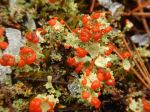
- British Soldier lichen