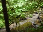
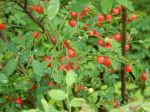
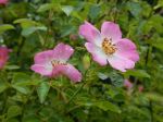
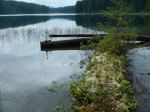
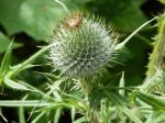
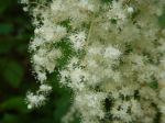
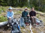
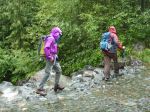
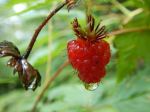
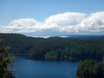
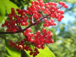
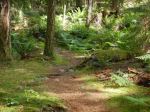
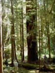
Ten hikers and one dog enjoyed the Morte Lake Loop. Most everyone swam from the sandy beach at the southwest corner and had lunch. The huckleberries were numerous and big. We had the trail and the lake to ourselves.
Julie

Ten hikers and one dog enjoyed the Morte Lake Loop. Most everyone swam from the sandy beach at the southwest corner and had lunch. The huckleberries were numerous and big. We had the trail and the lake to ourselves.
Julie
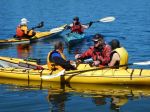
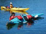
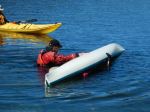
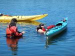
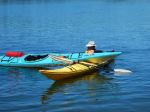
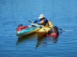
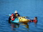
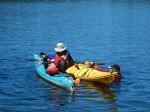
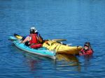
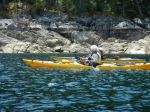
On June 29, nine club members fell out of their kayaks – repeatedly. But with demonstrations and coaching by trainer Douglas Taylor, assisted by his wife, Penny, everyone got back in – repeatedly.
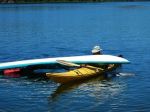
Organized through Coast Mountain Expeditions, the session provided an introduction to assisted kayak rescue and self-rescue for those without previous training, and a refresher and practice for more experienced paddlers. Participants took part in one of two 3-hour blocks, which included a review of kayak safety requirements, discussion of how to rig kayaks to facilitate rescue (e.g. good deck lines rigged loosely enough to grab easily), and a brief demonstration of bracing technique. Most time was spent, however, on the proper way to “wet exit” (after working up the nerve to voluntarily turn upside down….), and to safely and efficiently re-enter the boat either with the help of another kayaker, or with the use of a paddle and paddle float as an outrigger. Doug provided a handout on the steps in self- and assisted rescue which will soon be available in digital form for any club member who wishes one. Please contact Darcy at darcm@telus.net to request your copy.
The weather and water conditions at Mine Lake were perfect – warm air and water, sunny and a slight breeze – great for training, but probably not the most likely conditions for a real capsize. Doug emphasized the need to practice rescue techniques regularly so that the kayaker develops ‘muscle memory’ that will be there when needed for the real thing.
Participants agreed that annual training and practice are vital both for individual paddlers, and to build a cohort of club members with confidence in each other’s skills and knowledge.
Thanks to Lannie at Coast Mountain and trainers Doug and Penny for a very worthwhile day.
Darcy and Valerie
(click on photos to view larger)
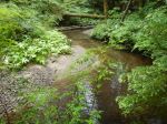
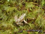
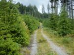
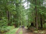
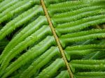
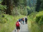
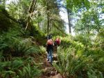
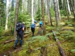
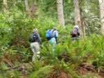
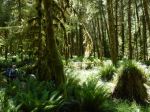
Despite the downpour the night before, 5 hikers accompanied by one friend of the canine persuasion braved the wet woods for a day of pleasant rambles. The original plans to explore down from Beaver Lake were altered to avoid much bushwhacking in the wet woods. The first ramble began from a logging road at the bottom of Gravel Pit Hill beside the full creek flowing south towards Open Bay. The area appears to be a second growth riparian zone, the rich forest included thick outcrops of Devil’s Club in bloom, all varieties of ferns and two frogs (Pacific Tree Frogs?) on the trail. The trail veered away from the creek up to one of the many logging roads in the area. We crossed the road and followed the flagged route up through a more recently logged second growth to a higher logging road which we followed back out to the junction where our cars were parked.
We opted to drive to the trailhead to Stramberg Lake, taking Open Bay Main just after a fully-loaded logging truck pulled out, heading towards Granite Bay. We parked at the orange gate and followed the logging road east for about 10 minutes, branching off onto an old logging road trail which we followed for about 15 minutes. We found the northerly trail down to Stramberg Lake, but it was quite overgrown with some deadfalls. The final few hundred meters required some bushwhacking (sorry, Emily and Jess) to reach the lakeshore. After a short break on the sandy beach enjoying the tranquil view, we retraced our path back to our cars. We had walked for almost 4 hours, enjoying the lush, damp woods so full of life after the early summer rains. 7.6 km
Valerie


(click on photos to view larger)
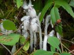
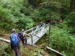
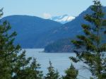
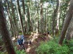
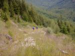
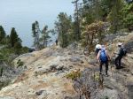
A beautiful day, perfect for hiking, 7 two-footed hikers and one very sanguine four-footed hiker took to the trail at 10 am. We stopped to admire the magnificent old-growth spruce at the start of the actual trail, certainly one of the largest, if not the largest, I have ever seen, even in Haida Gwaii. We encountered the first of the several metal bridges (and later, staircase) that have helped to change this trail designation from challenging to moderate. A pleasant walk through the lush forest, with one steep uphill, brought us to the first of several viewpoints. The view of the industry in Menzies Bay was not inspiring, but the exposed mud flats and eel grass were interesting, though we were too far away to see any particular wildlife. The trail continues around the bluff, offering occasional views south and east. A final stop at another viewpoint then the final staircase to the top of the bluff; the rock climb, up and down, pre-staircase, would have certainly been an interesting challenge. At the top we are treated to a perfect view of Seymour Narrows and the site of the former Ripple Rock. It was most interesting to see this historic site from the other side of the channel, most of us well familiar with the view from Maud Island on the Quadra side. We enjoyed almost an hour in the sunshine, having arrived at almost exactly slack, the Narrows were almost still. By the time we left, the boils and whirlpools of the rapidly increasing current were apparent, though only running then at about 4 knots, 1/3 of the way to the 12 knot max ebb that afternoon. On our return we passed several groups of hikers, presumably timing their hike to coincide with the max current. (I recommend we do the same for a return to Ripple Rock Trail, it would be well worth it.) We were back at the trailhead just after 2 pm. Flora of note were common camas still in flower at the first viewpoint and an earthstar beside the trail. An excellent hike, well worth repeating, even with the early morning start for some of us! 4 1/2 hours; 9.3 km.
Valerie


(click on photos to view larger)
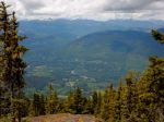
There was some interest in doing the Kuskam Klimb trail (Mt. Hkusam, near Sayward, http://www.kuskamklimb.com) but we couldn’t find a date to fit everyone’s schedule, so the trip was postponed to possibly late summer or fall.
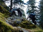
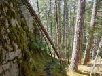
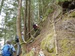
However the weather forecast and schedules aligned for four of us, so we made an impromptu decision to go check it out — just a reconnaissance, nothing serious — get to a viewpoint, check out the snow conditions, see what the trail is like. Well… they said it was steep, difficult, with some fixed ropes. It is that. Difficult on epic proportions. Bring your heart rate monitor! Poles help too, except they get in the way when using the ropes. Bring gloves for the ropes. There are a lot of ropes.
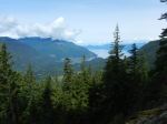
The trail starts very nicely, if it wasn’t steep it would be wheel chair accessible. That lasts about 2 km, up to 410 metre elevation. Then the trail divides. We took the shorter steeper trail. It’s more path than trail and it is steeper. Going up there are many short sections of fixed ropes, many more than we expected.
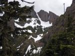
At 4.4 km, 970 m, the trail levels off very briefly and then it reverts to more climbing as it threads its way up what feels like must be a cliff. It’s all in the forest though, so except for a few peeks you don’t see how steep it is down to the valley. Oddly, there’s only one place on the trail where you feel any exposure. There were lots of alpine flowers and we watched a pair of woodpeckers feeding their noisy chicks in a hole in an old dead tree.
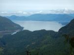
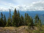
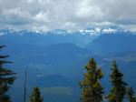
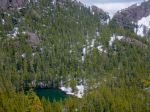
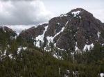
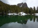
And on it goes, relentlessly up, until the Keta View Rock, at 5.8 km, 1270m, which has fabulous views. We took advantage of it for a lunch stop. This is where we thought about how slow it was coming up and how it might be even slower climbing back down and more dangerous. Since we were almost up to the elevation of the col we thought it might be faster and safer to continue up and over, since the south side had logging roads which would make it possible to go faster (although farther). Little did we know.
So, carrying on from there, the trail still goes up but at a reasonable trail grade. The forest opens up, almost sub-alpine, yellow cedars. All very nice. Except the recent days with thunderstorms dumped about 5 cm of hail above this elevation. We described it as white ball bearings. It made footing treacherous.
That section lasts until an excellent viewpoint of the mountain itself and the lake below at 6.8 km, 1435 m. Then we descended steeply in the slippery hail to a small lake which is a very nice green colour. 7.2 km, 1335 m.
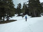
From the lake up to the col there is a snow patch and we kicked steps in the snow. Ours were the only tracks. The col is the high point on the trail, 7.9 km, 1469 m, with good views to the south.
From now on it’s all downhill. The first kilometre is very steep downhill, with long fixed ropes, still on slippery hail. Eventually the ropes and hail end. There is a wonderful lush green spring at 9.2 km, 1130 m, and we continued on a normal grade trail, winding down through old growth forest.
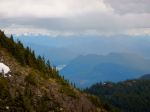
At 9.8 km, 1045 m, the trail crosses the stream on a log bridge and becomes an old logging road, wider and flatter, surrounded by young alders. Classic bear country. We didn’t see any bears but we saw lots of bear signs, some quite fresh. This is where it started to sprinkle and looking back the mountain was in the clouds. The weather forecast for good weather was right, but it did warn of showers developing late in the day.
The road down Stowe Creek Valley is a very pleasant walk, with nice view of the surrounding mountains and valleys. The only problem is that after a hard day it goes on forever. It feels endless.
After a couple hours (16.9 km, 380 m) we took the turnoff from this good logging road to a more ancient one which heads back to the start of the Klimb. The forest in this section isn’t so interesting, not if you’re tired. Eventually we made it back to the car. 24.4 km, 11 3/4 hours.
We did this hike two days before the real Kuskam Klimb event for 2016. We did not envy the runners who would be trying to go fast on this route! The runner times are online and simply amazing. They range from 2 hours (!!!!!) to 12 hours. As a hike, the Kusam Klimb trail is very interesting and certainly challenging, but it’s very long to do in one day.
Norris
trail guide
http://kusamklimb.com/trail-guide.php
trail map
http://saywardfutures.ca/wp-content/updloads/2015/11/MountHKusamTrail.pdf


(click on photos to view larger)
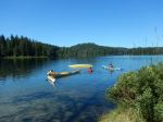
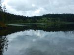
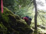
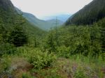
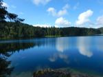
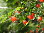
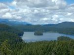
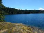
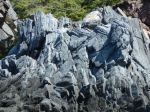
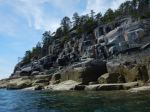
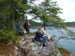
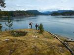
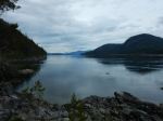
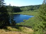
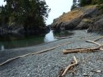
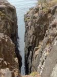
In spite of the downpour between 7:00 and 8:00, six of us decided to go on this hike and were rewarded by clearing skies. We hiked the trail from the Surge Narrows road into Homewood’s Woodsman camp, stopping along the way at viewpoints of Mine Lake and to sample the salmonberries and huckleberries. We followed the steep trail to the bluff and then out on to the somewhat exposed rock before arriving at great views at the top of the bluff. I highly recommend that this trip only be undertaken when the rock is dry, but I don’t always follow my own advice. We browsed around the bluff enjoying the views in different directions, sighting two fawns, a red-tailed hawk and a nighthawk, before stopping for lunch.
After lunch we descended by a less travelled route, down a gully to the north, which then traverses under the cliffs and circles back to the trail up to the bluff. We stopped by Mine Lake to enjoy the sun and the view of the quiet lake. 5.9 km; 3 1/2 hours.
Debbie


(click on photos to view larger)
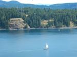
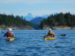
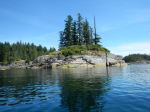
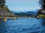
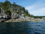
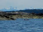
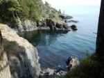
Our paddle on Monday, June 6, started from a new launch site for most of us, the end of Breton Road in Open Bay; a short downhill, a short walk avoiding the nettles, a few logs and the inevitable rocks though not as big nor as steep as at the more commonly used Valdez beach launch site. Five of us were on the water by 10:30 am. The overcast soon dissipated and the weather quickly turned from warm to hot, northwest winds gusted to about 20 knots throughout the day.
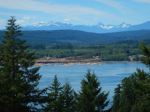
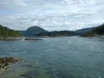
We paddled east along Open Bay shores, admiring the contorted and dramatic geology, peered into one cave, then turned north into Moulds’ Bay. The rapidly dropping tide prevented us from taking the shortcuts so we paddled through Shellaligan Pass into Hoskyn Channel, past the north Breton, then into Village Bay. The snow-dappled peaks of the Coast and Vancouver Island mountain ranges provided dramatic backdrops to the north and west.
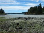
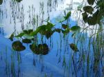
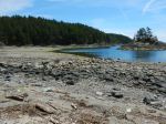
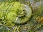
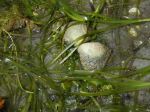
Our lunch stop, after one and a half hours of paddling was Village Bay beach where we noted the new signage posted by the We Wai Kai nation, as this is Reserve land. The very low tide revealed eel grass and its many inhabitants and the rich marine life in the intertidal zone.
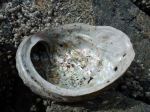
After a short lunch break we were boosted on our return by a following sea pushed by the north-west winds and the flooding tide. We stayed in Hoskyn due to the very low tide, and turned west to Open Bay on the north side of the southernmost Breton. Here we stopped to admire the seals laying on their backs on rocks just above the tideline, apparently sunning their bellies. We also saw many oystercatchers and a flock of wood ducks as well as several herons, gulls, and eagles.
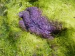
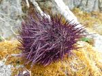
As we came into Breton Beach we could see sea urchins, pencil stars and bat stars on the rocks below. The very low tide meant a long haul up the rocky beach, the usual challenge of launching from Open Bay. We were off the water by about 2:45 pm after a hot but very pleasant paddle.
Valerie


(click on photos to view larger)
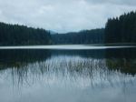
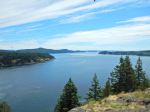
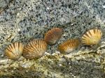
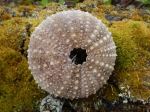
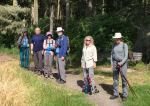
Six of us enjoyed our hike along the Surge Narrows trail. We stopped at the first viewpoint to watch the tidal rapids (8.8 knot flood tide at 11:00), then walked the route trail and shoreline through Raven Bay. We had good views of starfish and urchins. After lunch on the rocky point the tide was still low enough to go to a small island for views up Okisollo Channel.
Julie


(click on photos to view larger)
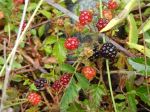
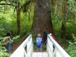
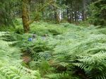
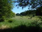
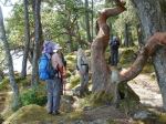
Four hikers and one dog enjoyed a lovely spring hike, beginning at the south end of Vic’s marsh where we were fortified by ripe salmonberries. We stopped for a look at the old barn built by Vic Balatti. The building is still sturdy but several square-timbered floor and ceiling joists have been removed. The trail winds along the marsh through open Douglas fir forest with occasional old growth fir. Past the end of the marsh the trail passes through stands of moss-covered alder, hemlock and back into mature fir. Several old growth cedar are lying on the ground where they were cut sometime in the past and left for some reason. One large solitary Western white pine was noted along the trail. We stopped for lunch in a grove of old growth fir, then proceeded on a short distance to the main stand of old fir trees. One giant clearly stood out in the crowd, a massive, stovepipe-straight beauty that was worth the hike all by itself.
The north half of the trail is less used but well-marked with flagging tape. Sections of the trail at this end could be improved by a chainsaw and clippers where downed trees make going slow. On the way back, we stopped off for a snack at the bluff overlooking the lake at the north end of the marsh. By mid-afternoon, the day was warming up so a cool Northwest breeze was welcome. Hiking time was a bit more than 5 hours moving at a good pace, and including lunch and a snack break (13.2 km). Highlights were the old fir trees, of course, but also the wide variety of plant communities we hiked through.
Janis


(click on photos to view larger)
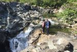
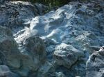
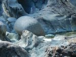
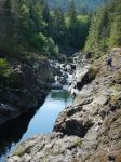
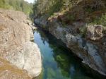
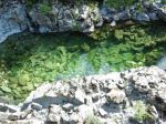
We began our trip to Sooke by visiting the Sooke Potholes. Eight of us drove up to the Regional Park and spent a few hours walking to the viewpoints and beaches, admiring the channels and sculpted rocks. 5.3 km.
We camped at the Sooke River Campground, which was well located for us and very quiet. We had wonderful appies and socializing each night. There were quite a lot of birds, including quail, rabbits and at least one bear in the area.
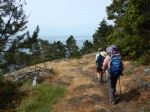
On Tuesday, seven of us hiked the Coast Trial in the East Sooke Regional Park. After the car shuffle, we started at Aylard Farm and hiked west to Pike Road Trail. The views along the rugged coast and across the Juan de Fuca to the Olympic Peninsula were spectacular. We really enjoyed the arbutus trees, which were continuous along the exposed bluffs and the excellent wildflowers in spite of the dry conditions. The route, undulating over the many rocky points and bluffs, was quite challenging. Just under 7 hours; 14.7 km.
On Wednesday, several people headed home, while four of us had an easy walk at Whiffen Spit and Sooke Harbour House. We then went separate ways, with some biking on the Galloping Goose trail to Matheson Lake; hiking up to Babbington Hill in East Sooke Regional Park; and visiting the Sooke Museum. It was too windy for kayaking. There were lots more destinations we couldn’t begin to visit in two and a half days.
Debbie
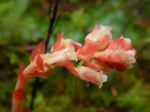
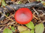
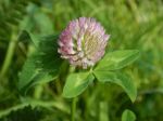
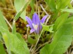
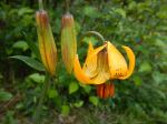
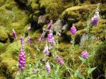
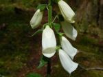
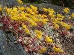
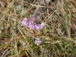
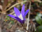
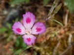
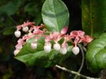
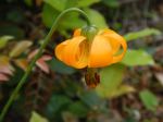
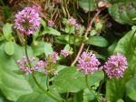
Here is a list of flowers:
harvest brodiaea
death camas
yarrow
smooth alumroot (heuchera)
white rhododendron
evergreen huckleberry
tiger lily
nootka rose
red paintbrush
sea blush
field chickweed
red columbine
nodding onion
fool’s onion (brodiaea)
fireweed
starflower
orange honeysuckle
farewell-to-spring
wild strawberry
broad-leaved stonecrop
false lily-of-the-valley
small-leaved montia
Siberian miner’s lettuce (candy flower)
white-flowered hawkweed
narrow-leaved hawkweed
arbutus
salal
manzanita


(click on photos to view larger)
