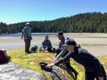
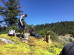
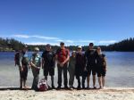
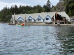
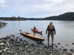
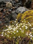
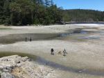
Eight of us gathered at Heriot Bay on a brilliant sunny day in May and carpooled to Manson’s Lagoon. Here a perfect low tide accommodated our trek across the sand to explore a couple of flower strewn islets in the middle of the lagoon where we sat and ate taking in the spectacular view surrounding us. After lunch we continued along a shoreline pathway and through the forest to the beautiful white sands of Hague Lake where the sun took it’s cue to warm us up enough to go wading in the clear, tepid water. Along the beach and through a forest to a roadway that curved uphill toward Manson’s Landing Coop Store. Here we took advantage of an opportunity to check out lovely local crafts, a great little book store, bakery, coffee shop and organic local grocery outlet. After coffee and yummy local chocolate we continued past Manson’s Community Centre, soccer field, Fire Hall, Museum, Senior’s Home & through the school yard onto a pathway leading through a delightful old growth forest hugging the west facing shoreline which eventually returned us to the Manson’s Dock, white sandy beach, carvings, Manson’s Spit and our vehicle.
Great day and memories.
Cyndy
Thanks to Cyndy for the photos.
(click on photos to view larger)
-
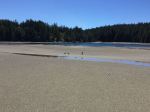
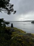
- Manson’s Lagoon at low tide