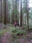
Day 1: Nine members left Quadra on a clear and sun-filled day, however, when we reached Courtenay we hit snow. On arrival at Hornby Island, the snow was quite deep, we drove to our guesthouse at Tribune Bay on unploughed roads. Unfortunately, the power was off and the four bedroom guesthouse was freezing. We soon got a fire going after chopping wood and finding kindling. A quick snack and all out for a hike at Helliwell Provincial Park. This is one of the finest walks on Hornby, through old-growth Douglas fir forest and along weather sculpted sandstone cliffs, glorious views of the mainland, Texada Island and Lasqueti. Another treat for us was watching listening to the sea lions, eagles etc….all waiting for the herring. It was such a lovely day and we soaked up the beauty of this trail. Returned to the guesthouse and all decided to keep our coats on, although it had warmed up a little. Dinner Team 1 soon got cooking in the kitchen before the darkness fell, the smells from the kitchen were divine. We ate a delicious meal in candle light, most still wearing our warm coats. After dinner we shared some of our favourite books and travel stories. The fire was kept going all night to keep us warm. Power back on at 11:30 p.m. but not the heat.
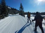
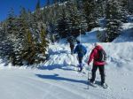
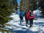
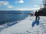
Day 2: A wonderful sunrise. After breakfast we met Joanne (our Hornby Island trail guide) and she took us onto the Mount Geoffrey Forest Trails. There are countless trails and we were pleased to have a wonderful guide to follow. We broke trail in the deep snow climbing quite steeply and eventually picked the Cliff Trail to hike along the bluff overlooking Denman Island. We also had spectacular views of snow-covered mountains on Vancouver Island. Worked our way back down and returned to the guesthouse for lunch. The afternoon trail that we chose was to explore Big Tribune Bay. It was low tide and we could walk out along the beach, scramble over rugged sandstone boulders and investigate the beautiful formations. Joanne was invited for appies and dinner. Dinner Team 2 prepared a fantastic dinner. Joanne shared many stories of Hornby and we learned a lot about the island and its residents. All to bed. It was starting to get warmer inside……yeah!
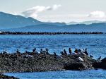
Day 3: The morning was overcast with light snow falling with sun in the afternoon. After breakfast, we headed to Shingle Spit near the ferry dock. This picturesque, mainly forested trail is sandwiched between a spectacular conglomerate rock face on one side and bluffs overlooking the water on the other. We walked to Ford’s Cove and all enjoyed looking at the boats before walking back. We stopped for a delicious lunch at the Community Hall, many residents come each Tuesday to enjoy the food and company. It was lovely to talk with the locals, most soon knew that Quadra people were visiting the island. The afternoon hike took us to Heron Rocks. We hiked down to the rocks that gave us spectacular sandstone formations and tidal pools. Best of all was watching and listening to the sea lions plus all the various waterfowl and numerous eagles, all waiting for their annual herring feast on Hornby. Dinner Team 3 prepared another delicious meal. After dinner some played a new game and others read/chatted.
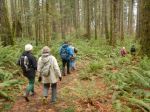
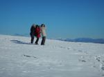
Day 4: Light snow fell most of the day. After breakfast we drove to the Bench Trail, part of the Mt Geoffrey Escarpment Provincial Park. The trail climbed steeply in places, but not difficult. Passing many arbutus, several large fir and a number of maple. The trail took us to the edge of the bluff with a couple of viewpoints, although unable to see far due to the light snow falling. This was a pretty trail enjoyed by all. On returning to the guesthouse some stopped at the Co-op store, what a lovely treat. Socks, scarves etc. were purchased, we all agreed the downstairs area of the store was like stepping back in time, plus the display of all the magnificent quilts created by the Islanders. Lunch back at the guesthouse and then some members went out to either Big Tribune Bay/Little Tribune Bay/Ford Cove and Heron Rocks. Dinner Team 4 prepared another delicious meal, followed by the sharing of stories along with lots of laughs around the table.
Day 5: A beautiful sunny day. Everyone up pretty early. Some of us actually ate quiche/chocolate cake for breakfast from the previous night’s dinner. Everyone packed and into our cars by 9 a.m. A final hike at Helliwell Park. We decided to turn left at the junction, giving us different view points. Walking through beautiful open forest containing enormous old-growth fir, cedar, large maple and alder. On emerging from the forest we found ourselves at the edge of the water. We were again entertained by the barking of the sea lions and waterfowl. We continued walking along the edge of the spectacular cliffs, fantastic views and many, many eagles. Creatures still waiting for the huge herring feast that happens in early March. We took our time because hikes come no better than this one. Caught the noon ferry to Denman Island, some continued onto the ferry and others hiked at Boyle Point Provincial Park. Took a short trail to Eagle Point and walked to the viewpoint of Chrome Island Light Station. The island was originally named Yellow Island because of its light colour. Chrome Island’s main claim to fame was a spectacular shipwreck, which took place during a gale on Dec 16th, 1900. Back on the road and caught the ferry to Vancouver Island, catching the 3:30 p.m ferry for home. What made this trip so enjoyable was the beautiful hikes on a lovely island, magnificent wildlife, delicious dinners and most of all a group of wonderful people. In every walk with nature, one receives far more than they seek.
Margot
The bird and mammal list follows the photos
(click on photos to view larger)
-
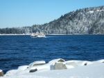
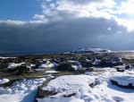
- Ferry to Hornby Island
-
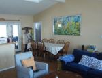
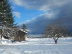
- The guesthouse
-

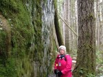
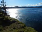
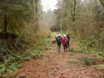
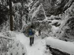
- Helliwell Prov Park
-
- Helliwell Prov Park
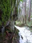
-
- Helliwell Prov Park
-

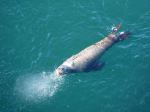
- California Sea Lion
-
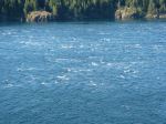
- Sea Gulls
-
- View from the guesthouse
-
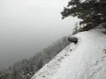
- Cliff Trail
-

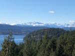
- Views from Cliff Trail
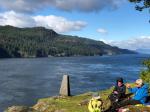
-
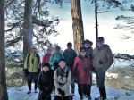
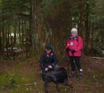
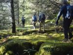
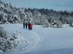
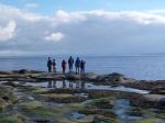
- The group
-
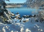
- Tribune Bay
-
- Tribune Bay
-
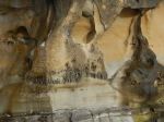
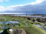
- Sandstone at Tribune
-

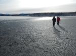
- On Shingle Spit Trail
-
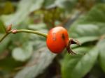
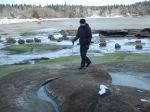
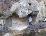
- Orchard near Heron Rock
-
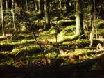
- Near Heron Rock
-
- Near Heron Rock
-
- Near Heron Rock
-

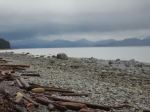
- Beach near Heron Rock


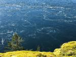
-
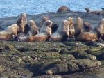
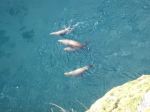
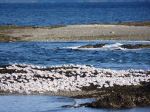
- Steller Sea Lions
-
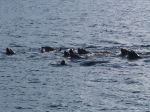
- Raft of Sea Lions
-
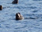
- California Sea Lions
-
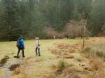
- On Bench Trail
-
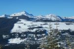
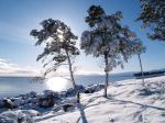
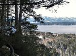
- Snowy view from Bench Trail
-
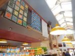
- Coop Store
-
- Sandstone at Tribune Bay
-

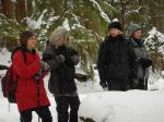
- Games
-
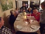
- Last night’s dinner
-
- Last day Hellliwell Prov Park
-
- Cormorants, gulls, sea lion from Helliwell

-
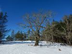
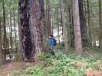
- Garry Oak
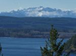
-

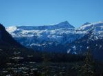
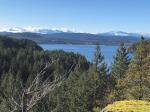
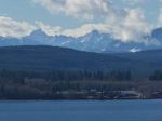
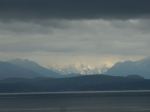
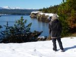
- View of mainland mountains
-
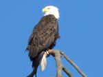
- Bald Eagle
-
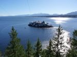
- Chrome Island Light Station
Thanks to Norris, Stephen and Diana for the photos
Bird List
| Common Loon | Bald Eagle |
| Horned Grebe | Black Osytercatcher |
| Pelagic Cormorant | Black Turnstone |
| Double-crested Cormorant | Mew Gull |
| Great Blue Heron | Glaucous-winged Gull |
| Canada Goose | Marbled Murrelet |
| Mallard | Northern Flicker |
| American Wigeon | Downy Woodpecker |
| Harlequin Duck | Pileated Woodpecker |
| Surf Scoter | Northwestern Crow |
| White-winged Scoter | Common Raven |
| Common Goldeneye | Chestnut-backed Chickadee |
| Barrow Goldeneye | Pacific Wren |
| Bufflehead | American Robin |
| Common Merganser | Varied Thrush |
| Red-breasted Merganser | Song Sparrow |
| Red-tailed Hawk | Red-winged Blackbird |
Mammal List
| Steller Sea Lion | River Otter |
| Californai Sea Lion | Deer Mouse |
| Harbour Seal | Mink |
| Black-tailed Deer |