| Activity | Kayaking |
| Destination | Open Bay |
| Date | 6 June 2016, Monday |
| Trip Coordinator | Valerie |
| Contact Info | 250-285-2329 or vvv@qisland.ca. Please contact the coordinator prior to the trip. |
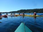
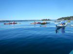
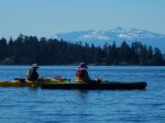
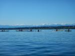
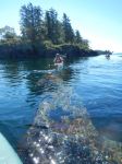
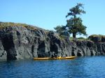
| Description | This will be an intermediate paddle. Depending on currents, weather, we could paddle to/around the Bretons, Moulds Bay, Village Bay, into Hoskyn Channel. Lunch stop to be determined enroute. |
| Meeting Place | Launch site, Breton Rd, Open Bay |
| Departure Time | 10:00 (arrive around 9:30 to prepare) |
| Difficulty |
intermediate, strong winds and currents possible |
| Costs | none |
| Trip limits | none |
| Dogs? | no |
| Notes: | Participants must be prepared for wind and strong currents; kayaks must be ocean kayaks equipped for ocean conditions. If access road is wet we will have to carry/trundle kayaks down a short hill to the beach. Meet at launch site (end of Breton Road) after 9:30 to be on water by 10 am. |
Author Archives: qioutdoorclub
Hiking – Surge Narrows – 1 June 2016
| Activity | Hiking |
| Destination | Surge Narrows |
| Date | 1 June 2016, Wednesday |
| Trip Coordinator | Julie Mellanby |
| Contact Info | 285-3978. Please contact the trip coordinator prior to the trip. |
| Description | We will hike the trail to the Surge Narrows viewpoint. There will be nearly a 9 knot flood current at 11:00. We will continue on the unmaintained route for additional views of the rapids. |
| Meeting Place | Heriot Bay store parking lot, to arrange carpools |
| Departure Time | 09:00 |
| Difficulty |
easy |
| Costs | none |
| Trip limits | none |
| Dogs? | yes |
| Notes: |
Hiking – Stramberg Old Growth – 25 May 2016
| Activity | Hiking |
| Destination | Stramberg Old Growth |
| Date | 25 May 2016, Wednesday |
| Trip Coordinator | Janis McLean |
| Contact Info | 285-3614. Please contact the trip coordinator prior to the trip. |
| Description | This trail begins near Village Bay Lake and follows open meadows leading into and through the forest on old, unmaintained logging roads. The reward at the end of the hike is a grove of old growth firs. This is not an official trail. Expect blow-down and brush. About 13 km; 5 hours or more. |
| Meeting Place | Heriot Bay store parking lot, to arrange carpools |
| Departure Time | 09:00 |
| Difficulty |
moderate, due to unmaintained trail and quite long |
| Costs | none |
| Trip limits | 10 |
| Dogs? | yes |
| Notes: | Bring lunch and water. |
Trip Report – Gowlland Harbour – 2 May 2016
Thirteen members left Gowlland Harbour Resort on a bright, sunny, calm day for a tour around North and South Gowlland Harbour. Many thanks to resort manager Carmen for allowing us to launch there. We paddled north first toward the log dump and sorting area. There was a lone buck on one of the islands and two otters playing on a dock for entertainment. Some members had not realized how much activity goes on in the log sort. We then paddled to the old shipwreck off May Island and had lunch on the island. The snow-capped peaks of Strathcona Park were stunning against the blue sky.
Next we went to Vigilant Island and watched many seals playing. From here we traveled down the east side of Gowlland Island to the narrow opening into April Point Bay. A few of us tried our skills in the current and found it can be hard in cross current. A word of caution to anyone that does not know this area, the current is not always running the same way as it is outside in Discovery Passage and can be quite fast.
We then paddled around the south end of Gowlland Harbour and up by Stag and Fawn Island. The Sea Blush bloom was early this year, but some flowers were still to be seen. We arrived back at launch site about four hours and 6.5 nautical miles after having left. All and all, it was a stunning day.
Les
Note: Special thanks from all of the participants to Les for the delicious prawns, smoked salmon, cheese and wine contribution to our picnic lunch.
Here is the bird list for the day:
Horned Grebe
Glaucous-winged Gull
Bonaparte’s Gull
California Gull
Double-crested Cormorant
Pelagic Cormorant
Great Blue Heron
Canada Goose
Mallard Duck
Bufflehead
Common Merganser
Pigeon Guillemot
Marbled Murrelet
Bald Eagle
Belted Kingfisher
Northwest Crow
Common Raven
Pacific Wren
American Robin
Spotted Towee
Townsend’s Warbler
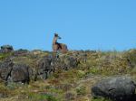
- Buck
- The wreck underwater
- Lunch on May Island
- Sea blush
- Vigilant Island
- Bay at the north of Gowlland Island
(click on photos to view larger)
Trip Report – Snowden Demonstration Forest – 27 Apr 2016
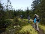
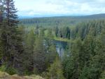
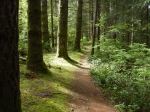
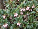
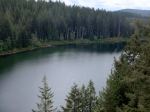
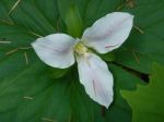
Five members explored the trails in the Snowden Demonstration Forest. Because the road over the dam is closed due to of construction, the access is via Duncan Bay Road (access map available at Outdoor Addictions), but the roads are good. We parked at the Lost Lake parking area and hiked around Lost Lake. We stopped for a snack on the eastern viewpoint and had lunch at the western viewpoint. The forest has quite an open understory, and there were trillium and other early wildflowers. The trails and routes we used were named Mudhoney Pass, Sanitarium, Scotty’s, T’aint, Riley Lake, and Tri Mac. The trail map is available at the Outdoor Addictions store or online at https://gocampbellriver.com/files/MapsForDownload/Snowden_Forest_Trail_Map.pdf
The trails range from flat grades that used to be logging railroad lines to walks along moss covered rocky ridges. We didn’t see anyone else while we walked. It was a very enjoyable walk, and it barely scratched the surface of what is available there. 7.6 km, 3.5 hours.
Norris
- Lost Lake
- Kinnikinnick
- Trillium
(click on photos to view larger)
Hiking – Mt. Seymour logging roads- 13 May 2016
| Activity | Hiking |
| Destination | Mt. Seymour logging roads |
| Date | 13 May 2016, Friday |
| Trip Coordinator | Norris Weimer |
| Contact Info | norris.weimer@ualberta.ca or 3710. Please contact the trip coordinator prior to the trip. |
| Description | We will hike around Mt. Seymour on old logging roads and flagged routes. There are several lovely small lakes along the way. The route goes up around the backside (west) of the mountain but does not go to the summit. There are some good viewpoints on the north side. A car shuffle will be done. |
| Meeting Place | Heriot Bay store parking lot, to arrange carpools |
| Departure Time | 09:00 |
| Difficulty |
moderate but long |
| Costs | none |
| Trip limits | none |
| Dogs? | |
| Notes: | 14.3 km. The logging road going up is very rough walking. Once we are high, the logging roads are mostly flat and easy, but not maintained. There may be wet places and bugs. |
Trip Report – Cortes, Linnaea Farm – 18-20 Apr 2016
Eight members met at Cortes Ferry line-up for our three day hiking trip to Cortes Island. A lovely cruise on the ferry and a time for details about the trip. We first took a quick visit to Whaletown, a sweet community, then onto Gorge Harbour; walked the property and the dock. On to Linnaea Farm to leave our baggage. We began the first hike and hiked up to Easter Bluff, gorgeous views overlooking the south and west ends end of Cortes, Quadra and the mountains beyond. In the afternoon we walked at Hank’s Beach Forest Conservation Park, spent time on the beach. The group enjoyed a delicious dinner around the big table at the farm.
Tuesday, Sabina, a marine biologist, took us on a walk from Smelt Bay to Manson’s Landing. This was a day filled with marine knowledge: identified wolf prints, sea-weeds, shells, grasses, birds, ducks, history of Cortes etc. It was a wonderful experience. Lunch near the beautiful maple trees and onto Manson’s Landing. Afternoon we walked Siskin Forest Park, one of the newer parks on Cortes. Again, a delicious dinner.
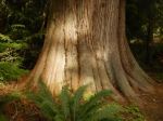
Final day we hiked in Kw’as Park. This is a large network of trails filled with old growth. We hugged the sides of Gunflint Lake and Hague Lake. Managed to climb up to the summit, a lovely display of wild flowers, arbutus and manzanita. We marveled at the huge red cedar trees and the dear survivor Douglas fir tree. We only managed to hike part of the park and certainly want to return.
Gunflint Lake was inviting and some chose to swim in order to cool down. Packed and onto the ferry, returning to Quadra.
I truly enjoyed this trip: the weather was a plus, the group was fantastic, the farm stay enjoyable and the hikes amazing. We all expressed what a gem Cortes Island is.
Margot
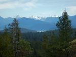
- Trail to Easter Bluff
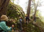
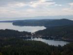
- Looking west
- Looking east
- Cortes Bay and beyond
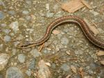
- Garter snake
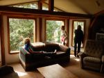
- Inside the farmhouse
- Meg on the balance beam
- Hank’s Beach
- The farmhouse
- sponge
- Sabina
- Moon snail egg case
- Alex’s meadow – lunch stop
- Petroglyph
- Mother Cedar – Siskin Forest
- Trail in Siskin Forest
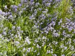
- Blue bells at the farm
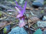
- Calypso orchid
- Trail to Kw’as Park
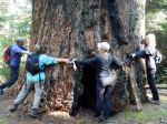
- Large Fir – Kw’as Park
- Bluff down from the Summit
(click on photos to view larger)
Kayaking – Gowlland Harbour – 2 May 2016
| Activity | Kayaking |
| Destination | Gowlland Harbour and small islands within |
| Date | 2 May 2016, Monday |
| Trip Coordinator | Les Hand |
| Contact Info | 250-202-4455 or leshand@gicable.com. Please contact the coordinator by April 29 |
| Description | We will circumnavigate Gowland Harbour exploring some of the small islands as we go. We will stop on May Island for lunch. There should be a beautiful display of flowers this time of year. |
| Meeting Place | Gowlland Harbour Resort parking lot, 823 Gowlland Harbour Rd. |
| Departure Time | 10:00 A.M. (unload and prepare at 9:30) |
| Difficulty |
easy to moderate |
| Costs | none |
| Trip limits | limited by parking to 10 vehicles |
| Dogs? | no |
| Notes: | Bring your kayak and all necessary safety equipment. If you have not completed your 2016-17 membership, please come prepared to sign papers and pay the membership fee. Only 2 vehicles can unload at beach at one time so please be on time. We will paddle South Gowlland and North Gowlland, about 4 hours weather permitting. Bring a lunch. If pouring rain or high wind, e-mail will be sent out by 8 am postponing trip. Gowlland Harbour Resort has kindly granted us permission to use their boat launch for this trip. This is not a public access. |
Hiking – Sooke – 16-18 May 2016
| Activity | Hiking |
| Destination | Sooke |
| Date | 16-18 May, Monday-Wednesday |
| Trip Coordinator | Debbie Quigg |
| Contact Info | debbie.quigg@ualberta.ca or 3710; please contact the coordinator by May 1. |
| Description | We will spend three days (two nights) in Sooke. The suggested accommodation will be camping at the Sooke River Campground. They also have three rustic cabins for rent. We have reserved three tent sites. Please contact the coordinator about these. If you want an RV site or a cabin, please make the arrangements yourself (250-642-6076).
The primary hiking destinations will be the Coast Trail in East Sooke Regional Park, the Sooke Potholes, or other trails in the area. There is also the opportunity to bike along the Galloping Goose trail, or kayak in the harbour. |
| Meeting Place | Sooke River Campground; 2259 Phillips Rd, Sooke |
| Departure Time | na |
| Difficulty | The Coast Trail is challenging. The walk along the Potholes is easy. |
| Cost | Transportation and camping ($25/night/tent or $40 or $60/night for the cabins) |
| Trip limits | none |
| Dogs? | Possible, but challenging |
| Notes: | This is a very historical area on Vancouver Island. Recommended reading: West Coast Pioneer – John Muir |
Trip Report – Mt. Seymour – 13 Apr 2016
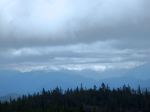
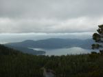
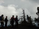
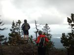
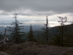
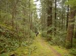
Ten people and two dogs climbed Mt. Seymour. We all stayed dry while watching rain clouds over Vancouver Island. We visited the east, north and west viewpoints and enjoyed a short lunch stop trying to huddle out of the wind (6° C). We hiked quickly and enjoyed the workout. 3½ hours, 8 km, 425m elevation gain.
Julie
- Discovery Passage
- At the summit
- Georgia Strait
(click on photos to view larger)